
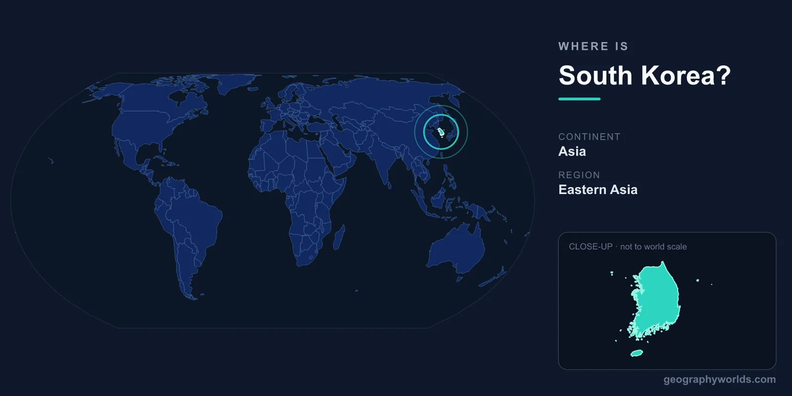
South Korea is located in East Asia, occupying the southern half of the Korean Peninsula, with the Yellow Sea to its west, the Sea of Japan (East Sea) to its east, and the Korea Strait separating it from Japan to the southeast. Its only land border runs along the Korean Demilitarized Zone with North Korea to the north. The country covers about 100,210 km² and its capital is Seoul.
Where Exactly Is South Korea on the Map?
South Korea sits in the Northern and Eastern Hemispheres, between roughly 33° and 39° North latitude and 124° and 132° East longitude. This places it at similar latitudes to the U.S. states of Tennessee and Virginia, or to the Mediterranean coast of Spain, though its climate is shaped far more by its peninsular setting and proximity to the Asian mainland than by latitude alone.
The Korean Peninsula juts southward from northeastern China and the Russian Far East, pointing toward the Japanese archipelago. South Korea claims the lower portion of this peninsula, while North Korea holds the upper half. Because it is bounded by sea on three sides, South Korea has a long, deeply indented coastline measuring more than 2,400 kilometres, fringed by thousands of islands of varying size.
Borders and Neighbours
South Korea shares a single land border, and it is one of the most heavily fortified frontiers on Earth: the boundary with North Korea, marked by the Korean Demilitarized Zone (DMZ). This roughly 4-kilometre-wide buffer strip runs near the 38th parallel and stretches about 250 kilometres across the waist of the peninsula, a legacy of the 1953 armistice that paused the Korean War.
By sea, South Korea's nearest neighbours are:
- North Korea – the only country sharing a land border, directly to the north across the DMZ.
- China – the nearest mainland neighbour, lying across the Yellow Sea to the west.
- Japan – lies across the Korea Strait and the Sea of Japan to the southeast.
This maritime position has made South Korea a natural hub for trade and shipping, with busy ports such as Busan serving as gateways between mainland Asia and the wider Pacific.
The Land and Its Geography
South Korea is a predominantly mountainous country. Roughly 70 percent of its territory is hilly or mountainous, with most of the population concentrated in the western and southern lowlands and coastal plains where farming and cities are possible. The Taebaek Mountains run down the eastern side of the peninsula, giving the east coast a steep, rugged profile, while the land slopes more gently toward the west and south.
The highest point in South Korea is Hallasan, a dormant volcano rising about 1,947 metres on the southern island of Jeju. Major rivers, including the Han, Geum, and Nakdong, flow westward or southward from the mountains, carving the valleys where cities and rice paddies have developed. Jeju Island, lying off the southern coast, is a popular volcanic, UNESCO-listed destination known for its lava tubes and crater landscapes.
Despite its modest size, comparable in area to Hungary or the U.S. state of Indiana, South Korea contains a striking variety of terrain, from forested peaks and national parks to the broad tidal flats along the Yellow Sea that are among the most extensive in the world.
Climate and Seasons
South Korea has a temperate climate with four distinct seasons. Summers are hot and humid, heavily influenced by the East Asian monsoon, which brings a concentrated rainy season in late June and July. Winters are cold and comparatively dry, with frigid winds sweeping in from the Siberian interior, so the north and the mountainous areas can see significant snowfall. Spring and autumn are mild and are widely considered the most pleasant times to visit, famous respectively for cherry blossoms and vivid autumn foliage.
Seoul and the Population
The capital, Seoul, lies in the northwest of the country along the Han River at about 37.5°N, 127°E, only around 50 kilometres from the border with North Korea. It anchors the Seoul Capital Area, one of the world's largest metropolitan regions, which together with Incheon and Gyeonggi Province is home to roughly half of South Korea's population of around 52 million people. Other major cities include Busan, a major port in the southeast; Incheon, the country's chief international gateway; and Daegu in the southeastern interior. Korean is the official language, the currency is the South Korean won (KRW), and the country is governed as a presidential republic. For more on the nation's people, history, and travel highlights, see the south korea country guide.
Frequently Asked Questions
What continent is South Korea on?
South Korea is on the continent of Asia, in the East Asia region. It occupies the southern portion of the Korean Peninsula, which extends from the northeastern edge of the Asian mainland toward the Pacific Ocean.
Which countries border South Korea?
South Korea has only one land border, with North Korea to the north, separated by the heavily guarded Demilitarized Zone. Its closest maritime neighbours are China to the west across the Yellow Sea and Japan to the southeast across the Korea Strait.
Is South Korea an island?
No. South Korea occupies the southern half of the Korean Peninsula, so it is connected to the Asian mainland through North Korea. However, it is surrounded by water on three sides and includes thousands of offshore islands, the largest of which is Jeju.
How far is South Korea from Japan?
At its closest, South Korea lies only about 200 kilometres from the Japanese islands across the Korea Strait. Historic ferry and shipping routes between Busan and Japanese ports cross this relatively narrow stretch of water.