
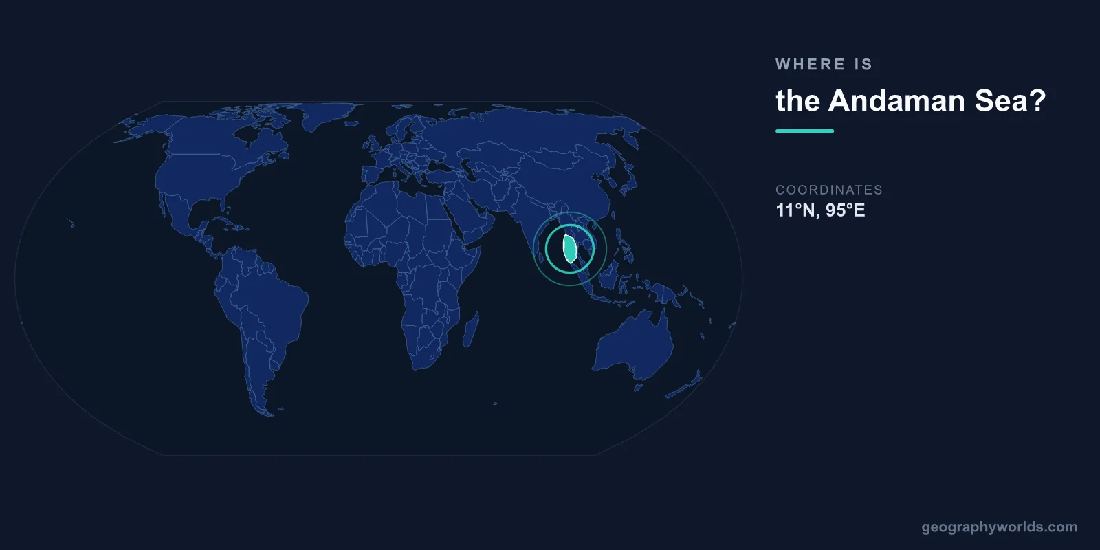
The Andaman Sea is located in the northeastern Indian Ocean, centered at approximately 10°N latitude and 96°E longitude. It is bounded by Myanmar (Burma) to the north and east, Thailand and the Malay Peninsula to the east and southeast, the Andaman and Nicobar Islands (India) to the west, and Sumatra (Indonesia) to the south.
Introduction
Covering approximately 797,700 square kilometers, the Andaman Sea is a relatively small but ecologically rich marginal sea. It is known for its coral reefs, tropical islands, and status as one of Southeast Asia's premier diving and beach tourism destinations.

Exact Location & Coordinates
- Center Coordinates: 10°N, 96°E
- Region: Northeastern Indian Ocean, Southeast Asia
- Connected To: Indian Ocean, Strait of Malacca
On a world map, the Andaman Sea is found between the western coast of Thailand and Myanmar and the Andaman Islands chain. It sits to the west of the Malay Peninsula, meaning if you find Thailand on a map, the Andaman Sea is the body of water along Thailand's western coastline — the side facing away from the Gulf of Thailand.
The sea opens to the Bay of Bengal and the broader Indian Ocean to the northwest and west. Its southern boundary merges with the Strait of Malacca between Malaysia and Sumatra, one of the world's busiest shipping channels.
Surrounding Countries & Borders
- Myanmar: Northern and northeastern shore
- Thailand: Eastern shore (Phuket, Krabi, Phang Nga)
- India: Western boundary (Andaman & Nicobar Islands)
- Indonesia: Southern boundary (northern Sumatra)
- Malaysia: Southeastern boundary (Langkawi)
Thailand's Andaman coast is the sea's most famous shoreline, including the tourist destinations of Phuket, Krabi, Phi Phi Islands, and Khao Lak. Myanmar's extensive western coastline and the Mergui Archipelago, a chain of over 800 islands, border the sea to the north and northeast.
The Andaman and Nicobar Islands, an Indian union territory, form a 700-kilometer archipelago that defines the sea's western boundary. These 572 islands separate the Andaman Sea from the Bay of Bengal. Northern Sumatra (Indonesia) and Langkawi (Malaysia) mark the sea's southern limits.
Geographic Context
- Part Of: Northeastern Indian Ocean
- Key Archipelagos: Andaman & Nicobar Islands, Mergui Archipelago
- Tectonic Setting: Near India-Burma tectonic plate boundary
The Andaman Sea sits above the boundary between the Indian tectonic plate and the Burma microplate. This active subduction zone was responsible for the devastating 2004 Indian Ocean earthquake and tsunami, which originated just west of the Andaman Islands and caused enormous destruction along the sea's shores.
The Andaman Basin, a back-arc basin in the sea's center, contains an active spreading center where new oceanic crust is being formed. This makes the Andaman Sea one of the few enclosed seas with active seafloor spreading, and explains the presence of submarine volcanoes and hydrothermal vents.
Physical Characteristics
- Area: 797,700 km²
- Maximum Depth: 4,198 m (Andaman Basin)
- Average Depth: 1,096 m
- Water Temperature: 26-29°C at surface
The Andaman Sea is deeper than its modest size might suggest, reaching 4,198 meters in the central Andaman Basin. The sea floor is geologically complex, with deep basins separated by ridges and dotted with submarine volcanoes. The continental shelf along the Thai and Myanmar coasts is relatively narrow.
The sea's warm tropical waters support extensive coral reef ecosystems. The Similan Islands and Surin Islands off Thailand's coast are considered among the world's top diving destinations. Visibility in the clearer waters can exceed 30 meters, revealing vibrant coral gardens and diverse marine life.
Why It Matters
- Tourism: World-class diving and beach destinations
- 2004 Tsunami: Epicenter region of Indian Ocean earthquake
- Biodiversity: Rich coral reefs, mangroves, seagrass beds
The Andaman Sea's coral reefs are among the most biodiverse in the Indian Ocean. The Mergui Archipelago, long closed to outsiders by Myanmar's military government, contains some of the most pristine marine environments in Southeast Asia. Thailand's Andaman coast supports a massive tourism industry centered on islands like Phuket and Phi Phi.
The 2004 Indian Ocean tsunami, generated by a magnitude 9.1 earthquake on the Andaman Sea's tectonic boundary, killed over 230,000 people across the Indian Ocean region. Thailand's Andaman coast was heavily impacted, as were the Andaman and Nicobar Islands. The event spurred the development of tsunami warning systems throughout the Indian Ocean.
Key Facts
- The Andaman Sea is centered at approximately 10°N, 96°E in the northeastern Indian Ocean.
- It covers about 797,700 km² between Myanmar, Thailand, and the Andaman Islands.
- Maximum depth reaches 4,198 m in the Andaman Basin.
- It sits above an active tectonic plate boundary, the source of the 2004 tsunami.
- The sea contains world-renowned diving sites including the Similan and Surin Islands.
Fun Facts
- The Mergui Archipelago off Myanmar contains over 800 largely unexplored islands.
- The Andaman Sea has an active undersea spreading center creating new ocean floor.
- The sea is home to the Moken people, nomadic "sea gypsies" who live on boats for most of the year.
- Phuket, in the Andaman Sea, is Thailand's largest island and most popular beach destination.
Final Thoughts
The Andaman Sea lies in the northeastern Indian Ocean at approximately 10°N, 96°E, between the coasts of Myanmar and Thailand and the Andaman Islands. Despite its modest size, it contains world-class coral reefs, dramatic underwater geology, and some of Southeast Asia's most beautiful islands. Its position on an active tectonic plate boundary adds both geological significance and natural hazard risk to this tropical sea on the world map.
Test Your Knowledge!
Think you know where things are on the map? Test your skills!
Play Geography Games →