
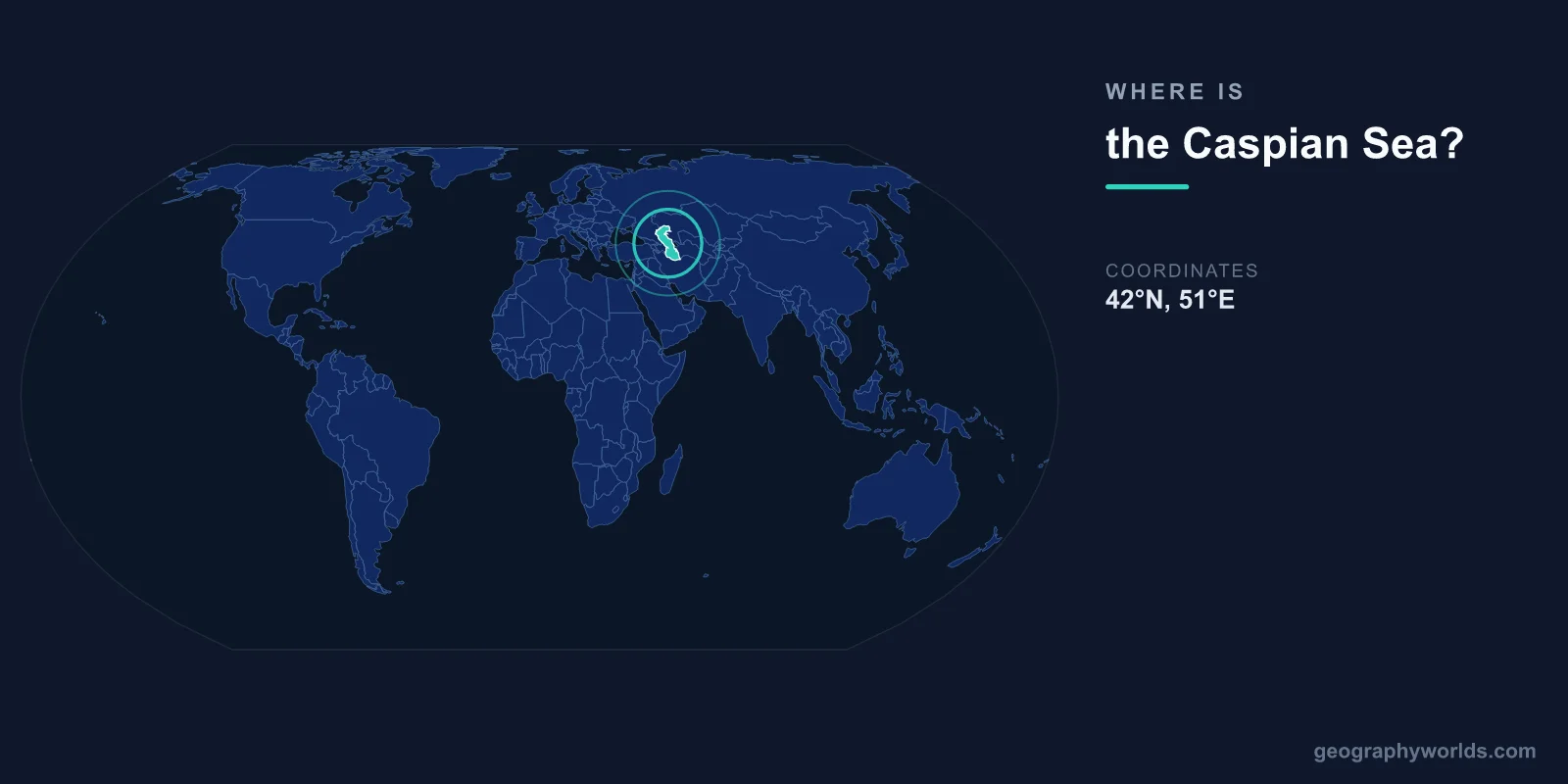
The Caspian Sea is located between Europe and Asia, centered at approximately 41°N latitude and 51°E longitude. Despite its name, it is technically the world's largest enclosed body of water — a landlocked sea with no natural outlet to any ocean. It is bordered by five countries: Russia, Kazakhstan, Turkmenistan, Iran, and Azerbaijan.
Introduction
Stretching roughly 1,200 kilometers from north to south and up to 320 kilometers wide, the Caspian Sea covers about 371,000 square kilometers. It sits approximately 27 meters below global sea level, making its surface one of the lowest points on Earth's continental surface.

Exact Location & Coordinates
- Center Coordinates: 41°N, 51°E
- Region: Between Eastern Europe and Central/Western Asia
- Elevation: ~27 m below sea level
On a world map, the Caspian Sea is found east of the Caucasus Mountains and west of the vast Central Asian steppe. It sits south of Russia's Volga River delta and north of Iran's Alborz Mountains. The sea is roughly equidistant between the Black Sea to the west and the Aral Sea to the east.
To locate it quickly on a map, find Iran and look at its northern border — the Caspian Sea forms Iran's entire northern coastline. Alternatively, trace the Volga River, Russia's longest, southward to its mouth: it empties into the northern Caspian.
Surrounding Countries & Borders
- Russia: Northern and northwestern shore
- Kazakhstan: Northern and eastern shore (longest coastline)
- Turkmenistan: Southeastern shore
- Iran: Southern shore
- Azerbaijan: Western shore, including Baku
Kazakhstan has the longest Caspian coastline at roughly 2,320 kilometers, though much of it is flat, desolate steppe. Russia's coast in the north includes the Volga delta, one of the largest river deltas in Europe. Azerbaijan's capital, Baku, is the largest city on the Caspian and sits on the Absheron Peninsula jutting into the sea.
Iran's southern shore is backed by the Alborz Mountains, creating a dramatic landscape where forested peaks rise steeply from the coast. Turkmenistan's coastline includes the port of Turkmenbashi and the Garabogaz Bay, a shallow inlet that acts as a massive evaporation basin.
Geographic Context
- Nearest Ocean: Indian Ocean (~1,500 km south)
- Major Inflows: Volga River (80% of inflow)
- Nearest Sea: Black Sea (~600 km west)
The Caspian Sea is completely landlocked, receiving no connection to any ocean. The Volga River provides roughly 80 percent of its freshwater inflow, with the Ural, Kura, and Terek rivers contributing most of the remainder. Because it has no outlet, the Caspian's water level fluctuates significantly over time, having dropped roughly 3 meters since 1995.
Geologically, the Caspian was once connected to the Black Sea and the Mediterranean through the Paratethys Sea. As tectonic activity raised the Caucasus Mountains and the land bridge between them, the Caspian became isolated roughly 5.5 million years ago. Ancient waterways once connected it to the Black Sea during ice age floods.
Physical Characteristics
- Area: 371,000 km²
- Maximum Depth: 1,025 m (in southern basin)
- Average Depth: 211 m
- Length: ~1,200 km north to south
The Caspian Sea is divided into three distinct basins. The shallow northern Caspian averages only about 5 meters deep and is heavily influenced by the Volga River. The middle Caspian reaches depths of about 788 meters, while the deep southern Caspian plunges to 1,025 meters near Iran's coast.
Its salinity varies dramatically: the northern section near the Volga delta is nearly fresh, while the central and southern sections average about 12 parts per thousand — roughly one-third the salinity of typical ocean water. The Garabogaz Bay in Turkmenistan has salinity levels exceeding 300 ppt due to intense evaporation.
Why It Matters
- Oil & Gas: Major Caspian basin reserves
- Caviar: 90% of world's wild sturgeon
- Geopolitics: Maritime boundary disputes among 5 nations
The Caspian Sea basin contains estimated oil reserves of up to 48 billion barrels and vast natural gas deposits, making it one of the world's most important energy regions. Azerbaijan's offshore fields near Baku have been producing oil since the 1870s, and Kazakhstan's massive Kashagan field is among the largest discoveries in decades.
The Caspian is also the last stronghold of wild sturgeon, the fish that produces caviar. The Caspian's beluga, osetra, and sevruga sturgeon once produced over 90 percent of the world's caviar, though overfishing and pollution have dramatically reduced stocks. International cooperation on fishing quotas and environmental protection remains a major diplomatic issue among the five bordering nations.
Key Facts
- The Caspian Sea is centered at approximately 41°N, 51°E, between Europe and Asia.
- It is the world's largest enclosed body of water at 371,000 km².
- Five countries border it: Russia, Kazakhstan, Turkmenistan, Iran, and Azerbaijan.
- Its surface sits about 27 meters below global sea level.
- The Volga River provides roughly 80% of its freshwater inflow.
Fun Facts
- Despite being called a "sea," the Caspian has no connection to any ocean.
- The Caspian Sea's water level has fluctuated by over 3 meters in just the past few decades.
- Baku, Azerbaijan's capital on the Caspian shore, is called the "City of Winds" due to fierce Caspian gales.
- The Caspian seal is one of the world's only freshwater seal species and is found nowhere else.
Final Thoughts
The Caspian Sea is a geographic anomaly — the world's largest enclosed body of water, sitting at the crossroads of Europe and Asia at approximately 41°N, 51°E. Bordered by five nations and sitting below sea level, it holds enormous energy reserves beneath its waters and serves as the last sanctuary for wild sturgeon. Its unique landlocked position and fluctuating water levels make it one of the most fascinating features on the world map.
Test Your Knowledge!
Think you know where things are on the map? Test your skills!
Play Geography Games →