
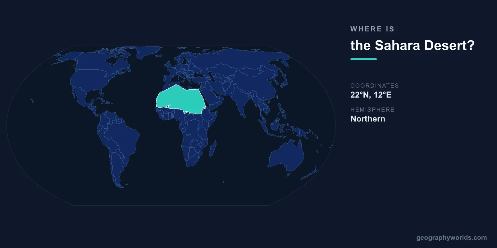
The Sahara Desert is located across northern Africa, centered at approximately 23°N latitude and 13°E longitude. It stretches from the Atlantic Ocean in the west to the Red Sea in the east, covering approximately 9.2 million square kilometers — roughly the size of the United States or China. It is the world's largest hot desert and the third-largest desert overall after Antarctica and the Arctic.
Introduction
The Sahara spans 11 countries: Algeria, Chad, Egypt, Libya, Mali, Mauritania, Morocco, Niger, Sudan, Tunisia, and Western Sahara. Its northern boundary roughly follows the Atlas Mountains and the Mediterranean coast, while its southern boundary transitions into the semi-arid Sahel zone.
Exact Location & Coordinates
- Center Coordinates: 23°N, 13°E
- Region: Northern Africa
- Extent: ~4,800 km east-west, ~1,800 km north-south
On a world map, the Sahara dominates the northern third of Africa. It is easily identified as the vast tan or yellow expanse between the Mediterranean coast to the north and the green vegetation of sub-Saharan Africa to the south. The desert stretches roughly 4,800 kilometers from the Atlantic coast of Mauritania to the Red Sea coast of Sudan.
The Tropic of Cancer runs through the Sahara's central portion, and the desert's core lies in eastern Libya and southwestern Egypt, where rainfall averages less than 1 millimeter per year. The eastern Sahara is the driest part, while the western Sahara receives slightly more moisture from Atlantic weather systems.
Surrounding Countries & Borders
- Algeria: Largest Saharan country by desert area
- Libya: Central Sahara, including the Fezzan region
- Egypt: Eastern Sahara (Western Desert)
- Mali: Southern Sahara, including Timbuktu
- Niger: Central-south Sahara, including Air Mountains
- Other Countries: Chad, Mauritania, Morocco, Tunisia, Sudan, Western Sahara
Algeria has the most Saharan territory, with the desert covering roughly 80 percent of the country. Libya's interior is almost entirely Saharan, including the vast sand seas of the Murzuq and Ubari. Egypt's Western Desert and Eastern Desert, separated by the Nile Valley, make up the Sahara's eastern extent.
The southern Saharan countries of Mali, Niger, Chad, and Sudan contain the Sahara's transition zone into the Sahel. Ancient caravan cities like Timbuktu (Mali) and Agadez (Niger) sit at this desert-savanna boundary and were historically vital stops on trans-Saharan trade routes.
Geographic Context
- World's Largest Hot Desert: 9.2 million km²
- Tropic of Cancer: Passes through the central Sahara
- Major Features: Ahaggar Mountains, Tibesti Mountains, Grand Erg sand seas
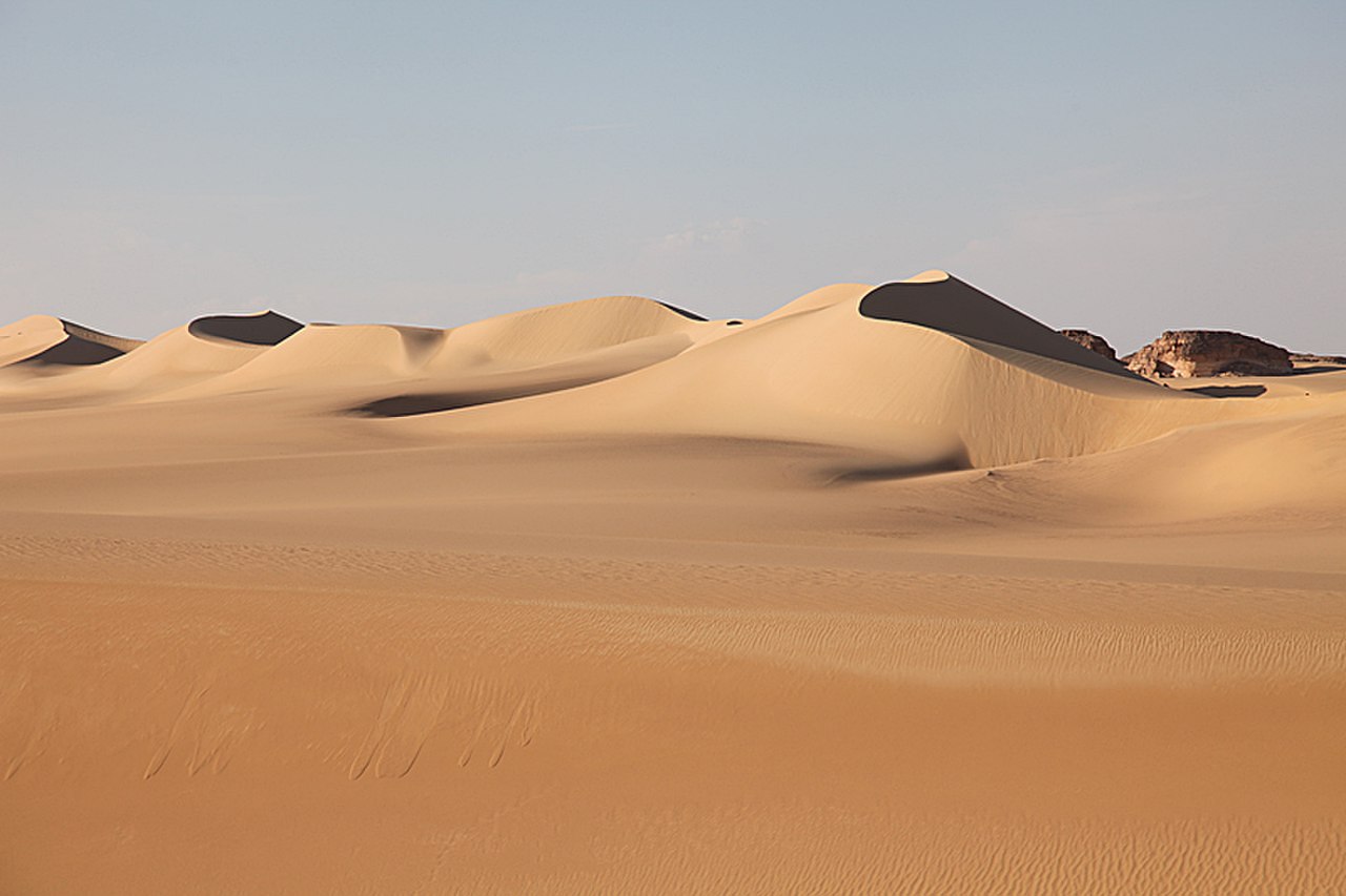
Despite popular imagination, the Sahara is not all sand dunes. Only about 25 percent is sandy desert (erg); the rest consists of rocky plateaus (hamada), gravel plains (reg), dry valleys (wadis), and mountain ranges. The Ahaggar Mountains in Algeria and the Tibesti Mountains in Chad rise above 3,000 meters and contain ancient rock art.
The Sahara was not always a desert. As recently as 5,000-10,000 years ago, during the "Green Sahara" period, it received much more rainfall and supported lakes, rivers, grasslands, and human settlements. Rock paintings in the Tassili n'Ajjer region of Algeria depict hippos, giraffes, and cattle herders in what is now barren desert.
Physical Characteristics
- Area: 9.2 million km²
- Highest Point: Emi Koussi, 3,445 m (Tibesti, Chad)
- Lowest Point: Qattara Depression, -133 m (Egypt)
- Record High Temperature: 58°C (disputed) in Libya
The Sahara experiences extreme temperature variations. Summer daytime temperatures routinely exceed 50°C, while winter nights in the interior can drop below freezing. The highest temperature reliably recorded in the Sahara is approximately 55°C at Kebili, Tunisia. The diurnal temperature swing can exceed 30°C in a single day.
Despite its aridity, the Sahara contains significant underground water reserves. The Nubian Sandstone Aquifer System beneath Libya, Egypt, Chad, and Sudan is one of the world's largest fossil water reserves, estimated to contain 150,000 cubic kilometers of ancient groundwater. Libya's Great Man-Made River project taps this aquifer to supply coastal cities.
Why It Matters
- Climate Influence: Saharan dust fertilizes the Amazon rainforest
- Energy Potential: Massive solar energy potential
- Migration Barrier: Historically separated Mediterranean and sub-Saharan Africa
The Sahara plays a significant role in global climate. Dust storms carry an estimated 182 million tons of Saharan dust westward across the Atlantic each year, with roughly 27 million tons landing in the Amazon basin, providing essential phosphorus that fertilizes the rainforest. Saharan dust also influences Atlantic hurricane formation.
The Sahara's flat terrain and intense solar radiation make it one of the most promising locations for large-scale solar energy production. Projects like the Desertec concept and Morocco's Noor-Ouarzazate solar complex aim to harness this potential. Morocco's solar farm is already one of the world's largest concentrated solar plants.
Key Facts
- The Sahara is centered at approximately 23°N, 13°E across northern Africa.
- It covers 9.2 million km², making it the world's largest hot desert.
- Eleven countries contain portions of the Sahara.
- Only about 25% is sandy desert; the rest is rock, gravel, and mountain.
- The Qattara Depression in Egypt drops to 133 m below sea level.
Fun Facts
- Saharan dust travels across the Atlantic to fertilize the Amazon rainforest.
- The Sahara was green with lakes and grasslands as recently as 5,000-10,000 years ago.
- The Sahara grows and shrinks seasonally, expanding southward in dry seasons by up to 10%.
- Snow occasionally falls in the Sahara — the town of Ain Sefra in Algeria has seen snowfall multiple times.
Final Thoughts
The Sahara Desert dominates northern Africa at approximately 23°N, 13°E, stretching 4,800 kilometers from the Atlantic to the Red Sea across 11 countries. As the world's largest hot desert at 9.2 million square kilometers, it is one of the most recognizable features on any world map. From ancient Green Sahara lake beds to modern solar farms, this vast landscape continues to shape global climate, migration patterns, and energy ambitions.
Test Your Knowledge!
Think you know where things are on the map? Test your skills!
Play Geography Games →