
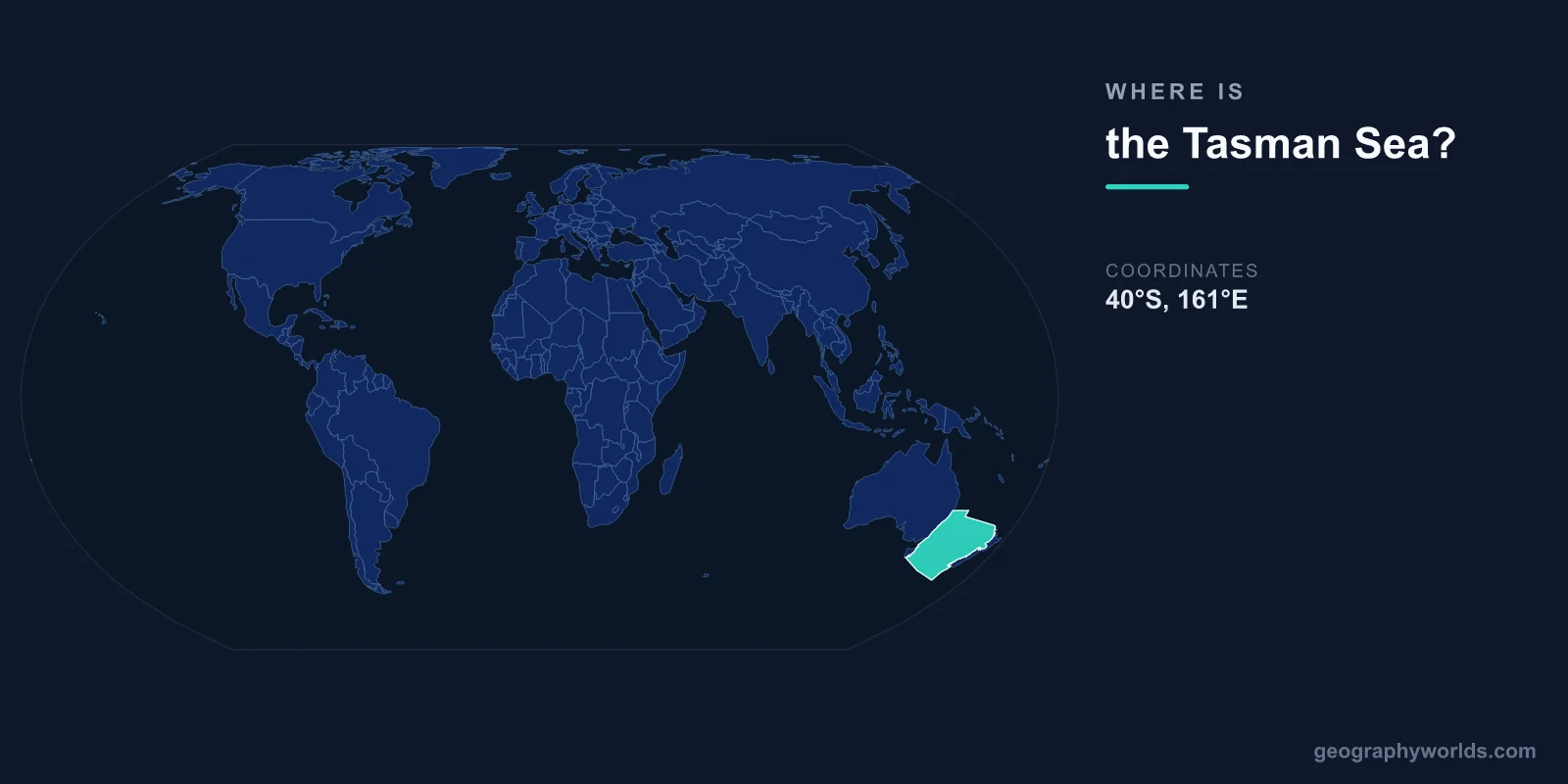
The Tasman Sea is located in the southwestern Pacific Ocean, centered at approximately 37°S latitude and 160°E longitude. It lies between the eastern coast of Australia (specifically New South Wales, Victoria, and Tasmania) to the west and the western coast of New Zealand to the east.
Introduction
Covering approximately 2,300,000 square kilometers, the Tasman Sea is a deep and often turbulent body of water roughly 2,000 kilometers wide. It is named after the Dutch explorer Abel Tasman, who crossed it in 1642, becoming the first European known to sight New Zealand and Tasmania.

Exact Location & Coordinates
- Center Coordinates: 37°S, 160°E
- Region: Southwestern Pacific Ocean
- Width: ~2,000 km between Australia and New Zealand
On a world map, the Tasman Sea is the body of water separating Australia from New Zealand. If you find Australia's eastern coast (Sydney, Melbourne) and look southeast toward New Zealand, the Tasman Sea fills the gap between them. It extends roughly from 28°S to 46°S latitude.
The sea's northern boundary merges with the Coral Sea near the Tropic of Capricorn, while its southern waters blend into the Southern Ocean. Tasmania, the Australian island state, sits at the sea's southwestern corner, giving the sea its name.
Surrounding Countries & Borders
- Australia: Western boundary (NSW, Victoria, Tasmania)
- New Zealand: Eastern boundary (North and South Islands)
- Norfolk Island (Australia): In the northern Tasman
- Lord Howe Island (Australia): In the western Tasman
Sydney, Australia's largest city, sits on the western shore of the Tasman Sea, as do Melbourne and Hobart. New Zealand's western coast, including the cities of Auckland and Wellington, faces the Tasman from the east. The sea thus separates two of the Southern Hemisphere's most developed nations.
Several isolated islands dot the Tasman Sea. Lord Howe Island, a UNESCO World Heritage Site roughly 600 kilometers east of Australia, rises from the Tasman's western portion. Norfolk Island lies further north. The Tasman is wide enough that its central waters are among the most remote open ocean areas in the Southern Hemisphere.
Geographic Context
- Part Of: Southwestern Pacific Ocean
- Key Currents: East Australian Current, Tasman Front
- Undersea Feature: Lord Howe Rise (submerged continental fragment)
The East Australian Current flows southward along Australia's eastern coast and then curves eastward across the northern Tasman Sea. This warm current, made famous in Finding Nemo, transports tropical waters into the temperate Tasman, significantly influencing the climate and marine ecology of both coastlines.
Beneath the Tasman Sea lies the Lord Howe Rise, a submerged continental fragment roughly 1,500 kilometers long. This underwater plateau, along with the Norfolk Ridge, is part of Zealandia — a mostly submerged continent that broke away from Australia roughly 85 million years ago. Some geologists consider Zealandia Earth's eighth continent.
Physical Characteristics
- Area: 2,300,000 km²
- Maximum Depth: ~5,200 m
- Average Depth: ~2,600 m
- Surface Temperature: 15-22°C (varies seasonally)
The Tasman Sea is a deep ocean basin, with most of its central floor lying between 4,000 and 5,200 meters below the surface. The Lord Howe Rise and other submarine ridges create significant bottom topography, with some areas rising to within 1,000 meters of the surface.
The Tasman is known for its rough seas, particularly in winter when storms from the Southern Ocean push through. Swells can reach 10 meters or more during storms. Despite this, the Tasman's waters support rich marine life, including humpback whales that migrate along Australia's east coast through the western Tasman each year.
Why It Matters
- Shipping Route: Major link between Australia and New Zealand
- Marine Science: Key area for studying ocean-climate interactions
- Zealandia: Sits above a mostly submerged continent
The Tasman Sea is the primary maritime link between Australia and New Zealand, with cargo ships and occasional passenger vessels crossing its 2,000-kilometer width. Flights between Sydney and Auckland cross the Tasman in about three hours, making "crossing the ditch" (as Australians and New Zealanders call it) a routine journey.
Scientifically, the Tasman Sea is an important region for understanding climate change. Its waters have warmed significantly in recent decades, with marine heatwaves becoming more frequent. This warming is shifting marine species southward and affecting fisheries, kelp forests, and coral communities in both Australian and New Zealand waters.
Key Facts
- The Tasman Sea is centered at approximately 37°S, 160°E between Australia and New Zealand.
- It covers about 2,300,000 km² and is roughly 2,000 km wide.
- Maximum depth reaches approximately 5,200 m in the central basin.
- The Lord Howe Rise beneath the sea is part of Zealandia, a mostly submerged continent.
- Named after Dutch explorer Abel Tasman, who crossed it in 1642.
Fun Facts
- Australians and New Zealanders refer to crossing the Tasman Sea as "crossing the ditch."
- The Tasman Sea sits above Zealandia, which some geologists consider Earth's eighth continent.
- Lord Howe Island in the Tasman has the world's most southerly coral reef.
- Abel Tasman never actually set foot on the Australian mainland despite crossing the sea named for him.
Final Thoughts
The Tasman Sea is a deep and often tempestuous body of water in the southwestern Pacific, centered at approximately 37°S, 160°E. Stretching 2,000 kilometers between Australia and New Zealand, it sits above the submerged continent of Zealandia and serves as the primary maritime link between two Southern Hemisphere nations. Its combination of oceanic depth, rough weather, and scientific significance makes it a notable feature on any world map.
Test Your Knowledge!
Think you know where things are on the map? Test your skills!
Play Geography Games →