
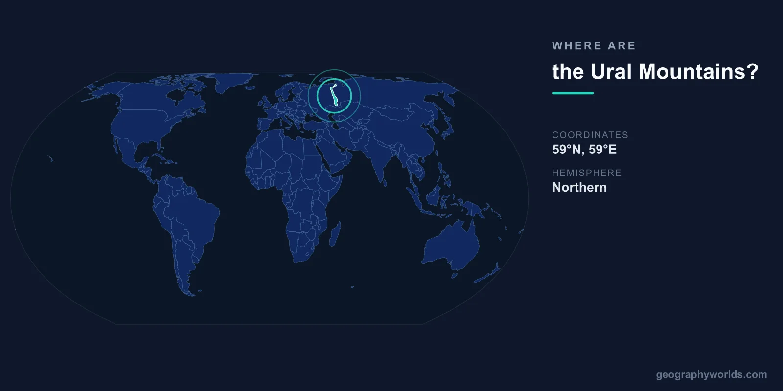
The Ural Mountains are located in western Russia, centered at approximately 60°N latitude and 59°E longitude. They run roughly 2,500 kilometers from the Arctic coast in the north to the steppes of Kazakhstan in the south, forming a long, narrow ridge that has traditionally been regarded as the boundary between Europe and Asia.
Introduction
Despite being one of the world's most famous mountain ranges due to their continental divide status, the Urals are actually quite modest in height. Their highest peak, Mount Narodnaya, reaches only 1,895 meters — lower than many European hill ranges. The Urals are among the oldest mountains on Earth, roughly 250-300 million years old.

Exact Location & Coordinates
- Center Coordinates: 60°N, 59°E
- Region: Western Russia, running north-south
- Extent: ~2,500 km from Arctic to Kazakhstan
- Mount Narodnaya: 65°02'N, 60°07'E, 1,895 m
On a world map, the Ural Mountains run as a roughly north-south line through Russia, dividing the European part of Russia from Siberia to the east. Find Russia on a map and look for the boundary line often drawn between Europe and Asia — the Urals form that line.
The range begins at Vaygach Island and Novaya Zemlya in the Arctic Ocean and extends southward through Russia to the Mugodzhar Hills in Kazakhstan. The city of Yekaterinburg, Russia's fourth-largest city, sits on the eastern slopes of the central Urals and is often cited as "the gateway to Asia."
Surrounding Countries & Borders
- Russia: The Urals lie entirely within Russia (plus northern Kazakhstan)
- Key Cities: Yekaterinburg, Chelyabinsk, Perm, Ufa, Magnitogorsk
The Ural Mountains lie almost entirely within Russia, with only their southernmost extension entering northwestern Kazakhstan. Major cities along the Urals include Yekaterinburg (1.5 million people) on the eastern slope, Chelyabinsk to the southeast, Perm on the western slope, and Ufa to the southwest.
The range divides Russia into two distinct regions: European Russia to the west (containing Moscow, St. Petersburg, and the majority of the population) and Siberia/Asian Russia to the east. This geographic division has significant cultural, economic, and climatic implications.
Geographic Context
- Continental Boundary: Traditional divide between Europe and Asia
- Age: 250-300 million years old (Permian)
- Parallel to: Roughly follows 60°E meridian
The Urals have been regarded as the boundary between Europe and Asia since the 18th century, when Russian geographer Vasily Tatischev proposed this definition. Before this, various boundaries had been suggested, including the Don River. The convention of using the Urals was adopted by most European geographers and remains the standard today.
The Urals are ancient mountains, formed during the Permian period roughly 250-300 million years ago when the ancient continents of Laurentia and Baltica collided. They were once as tall as the modern Himalayas, but hundreds of millions of years of erosion have worn them down to their current modest heights. The Permian geological period is named after the city of Perm, located on the western slopes.
Physical Characteristics
- Highest Peak: Mount Narodnaya, 1,895 m
- Length: ~2,500 km
- Average Width: ~150 km
- Average Elevation: ~1,000-1,200 m in central section
The Urals are divided into five sections from north to south: the Polar Urals (arctic tundra), the Sub-Polar Urals (containing Mount Narodnaya), the Northern Urals (taiga forest), the Central Urals (lowest, most accessible section), and the Southern Urals (broader, more rugged). The Central Urals near Yekaterinburg are so low that major highways and railways cross them with barely noticeable elevation changes.
The eastern slopes of the Urals contain vast mineral deposits that fueled Russia's industrialization. The region is rich in iron ore, copper, gold, platinum, emeralds, and numerous other minerals. The city of Magnitogorsk was built specifically to exploit enormous iron ore deposits and became one of the Soviet Union's largest steel-producing centers.
Why It Matters
- Continental Divide: The traditional boundary between Europe and Asia
- Mineral Wealth: Enormous deposits of iron, copper, gold, platinum, emeralds
- Industrial Heartland: Major center of Russian heavy industry
The Urals' role as the Europe-Asia boundary makes them one of the most symbolically important mountain ranges in the world. Obelisks and monuments mark the continental divide at various crossing points, and tourists photograph themselves straddling the line between two continents. This symbolic role gives the otherwise modest range outsized geographic importance.
Industrially, the Ural region has been crucial to Russia for centuries. Peter the Great established iron foundries in the Urals in the early 1700s. During World War II, Soviet factories were evacuated east of the Urals to protect them from German invasion, making the region a vital arsenal. Today, the Ural economic region remains one of Russia's most important industrial zones.
Key Facts
- The Ural Mountains are centered at approximately 60°N, 59°E in western Russia.
- They stretch ~2,500 km from the Arctic Ocean to Kazakhstan.
- They form the traditional boundary between Europe and Asia.
- Mount Narodnaya at 1,895 m is the highest peak — modest for such a famous range.
- The Urals are 250-300 million years old, among the world's oldest mountains.
Fun Facts
- The Permian geological period is named after the city of Perm on the western Urals.
- The Urals were once as tall as the Himalayas before hundreds of millions of years of erosion.
- Russia's emerald mines in the Urals produce some of the world's finest emeralds.
- The Central Urals near Yekaterinburg are so low that you can drive across Europe into Asia barely noticing.
Final Thoughts
The Ural Mountains run through western Russia at approximately 60°N, 59°E, stretching 2,500 kilometers from the Arctic to Kazakhstan. As the traditional boundary between Europe and Asia, they are one of the most symbolically important mountain ranges on the world map. Though modest in height at under 1,900 meters, their role as a continental divide, their enormous mineral wealth, and their 300-million-year geological history make them a landmark of global geographic significance.
Test Your Knowledge!
Think you know where things are on the map? Test your skills!
Play Geography Games →