
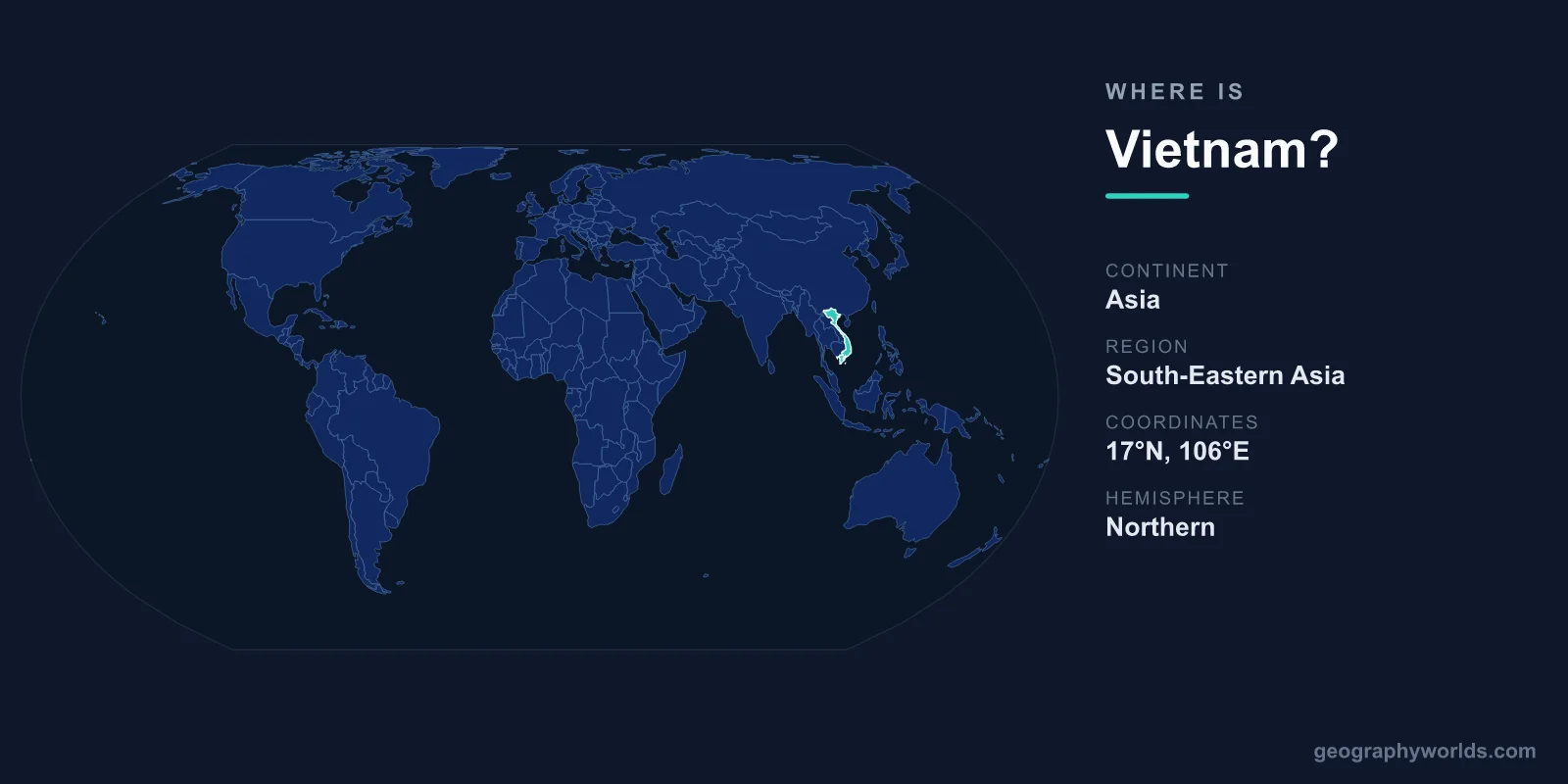
Vietnam is located in Southeast Asia, occupying the eastern edge of the Indochinese Peninsula along the South China Sea, with the capital at Hanoi and a total area of 331,212 km². The country forms a long, S-shaped strip down the eastern flank of mainland Southeast Asia, sharing land borders with China to the north and Laos and Cambodia to the west.
Where Exactly Is Vietnam on the Map?
Vietnam lies entirely within the Northern and Eastern Hemispheres, stretching roughly between 8°N and 23°N latitude and 102°E and 109°E longitude. It is one of the easternmost countries of mainland Southeast Asia, fronting the South China Sea (known locally as the East Sea) for more than 3,200 kilometres.
The nation's most striking feature is its shape. From north to south Vietnam measures about 1,650 kilometres, yet at its narrowest waist near the central province of Quang Binh it is barely 50 kilometres wide. Vietnamese often compare the outline of their country to a don ganh, the bamboo carrying pole with a rice basket at each end, the baskets being the two great deltas of the Red River in the north and the Mekong in the south. To find it quickly on a map, locate Thailand and the Gulf of Thailand, then look east past Cambodia and Laos to the curving coastline that frames the South China Sea.
Countries That Border Vietnam
Vietnam shares land borders with three neighbouring countries, while the entire eastern side is open ocean. These frontiers have shaped centuries of trade, migration, and conflict.
- China – to the north, along a mountainous border of roughly 1,280 kilometres facing Yunnan and Guangxi provinces.
- Laos – to the west, sharing the long, forested Annamite Range (Truong Son mountains).
- Cambodia – to the southwest, much of it crossing the flat, watery landscape near the Mekong Delta.
To the east and south stretches the South China Sea, with the Gulf of Tonkin in the north and the Gulf of Thailand off the southern tip. Vietnam's maritime territory includes the disputed Paracel and Spratly island groups. This position makes the country a key passage on shipping routes between the Strait of Malacca and East Asia.
Vietnam's Landscape From North to South
Despite its moderate size, roughly comparable to Germany or Japan, Vietnam packs in dramatic geographic variety. Mountains and hills cover about three-quarters of the territory, while the densely populated lowlands cluster around the two deltas and the narrow coastal plain.
In the far north rise the highlands of the Hoang Lien Son range, home to Fansipan at 3,143 metres, the tallest peak in Indochina. The Red River flows southeast from China through this region before fanning out into the fertile delta around Hanoi. The central spine of the country is dominated by the Annamite Range, which separates the slim coastal strip from the Central Highlands, a plateau region known for coffee plantations.
In the south, the mighty Mekong River completes its journey from the Tibetan Plateau, spreading into a vast network of channels and rice paddies that form one of the most productive agricultural regions on earth. Off the northeast coast lies Ha Long Bay, a UNESCO World Heritage Site famous for its thousands of limestone karst pillars rising from emerald water.
Climate, Time Zone and Coordinates
Because Vietnam stretches across some 15 degrees of latitude, it spans more than one climate band. The south enjoys a tropical climate with distinct wet and dry seasons, staying warm year-round. The north experiences a more subtropical pattern with a genuinely cool, sometimes misty winter, especially in the mountains around Sapa. Much of the central and northern coast is exposed to typhoons that sweep in from the South China Sea between roughly July and November.
The whole country observes a single time zone, Indochina Time (UTC+7), the same as Thailand, Cambodia, and Laos, and it does not use daylight saving. Hanoi sits at approximately 21.0°N, 105.8°E, while Ho Chi Minh City lies far to the south at around 10.8°N, 106.7°E, a spread that explains the noticeable difference in weather between the two cities.
People, Capital, and Major Cities
Vietnam is home to roughly 100 million people, making it one of the most populous nations in Southeast Asia. The official language is Vietnamese, and Buddhism alongside traditional folk religions remains the strongest cultural influence. The country is governed as a one-party socialist republic, and the official currency is the Vietnamese dong (VND).
Hanoi, in the north near the Red River Delta, is the political capital and second-largest city. The largest city is Ho Chi Minh City (formerly Saigon) in the south, the commercial heart of the nation. Other important urban centres include the port city of Da Nang in the centre and the historic town of Hue, a former imperial capital. To explore more about the nation's history, economy, and culture, see our vietnam country guide.
Frequently Asked Questions
What continent is Vietnam in?
Vietnam is in Asia, specifically the Southeast Asia region, on the eastern part of the Indochinese Peninsula bordering the South China Sea.
What countries border Vietnam?
Vietnam borders three countries by land: China to the north, and Laos and Cambodia to the west and southwest. Its entire eastern side faces the sea.
Is Vietnam part of China?
No. Vietnam is an independent, sovereign nation. It shares its northern border with China but has its own government, language, and currency, the Vietnamese dong.
What is the capital of Vietnam?
The capital is Hanoi, located in the north of the country. However, Ho Chi Minh City in the south is larger and serves as the main economic centre.