

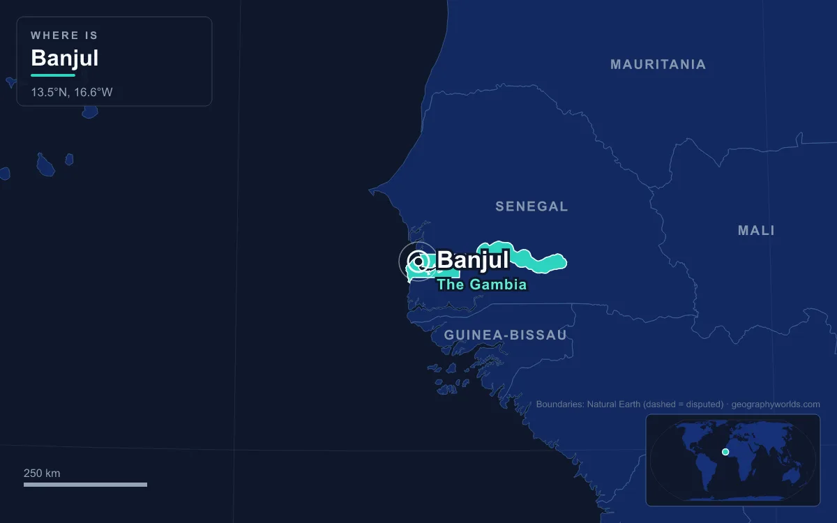
The capital of The Gambia is Banjul. The city covers St Mary's Island (Banjul Island), which sits in the mouth of the Gambia River where the river meets the Atlantic. It is one of Africa's smallest capitals. The 2024 census counted only 26,461 people in the city proper, although the Greater Banjul Area, which also takes in the Kanifing municipality and Serekunda, held 405,809. Britain founded the town in 1816 and called it Bathurst, the name it kept until 24 April 1973. Its colonial street grid is compact enough to walk across in a morning, and this guide follows that walk from the bridge to the ferry quay.
Over the Denton Bridge from Serekunda
Most visitors arrive the same way Banjul's commuters do, on the highway from Serekunda. The highway reaches the island over the Denton Bridge. Bridges are the island's only road links to the mainland. That explains a lot about the modern city. Banjul has no room to grow, so the population and much of the business activity have moved over the creek to Serekunda, now the country's largest urban area. Together the two form the Kombos, which hold about half of the Gambia's people.
The island had been part of the Kombo kingdom long before Britain arrived. In 1651 the Duke of Courland, ruler of a Baltic duchy with a small overseas trading venture, leased it from the King of Kombo. A century and a half later the British came for good. On 23 April 1816 Tumani Bojang, King of Kombo, ceded the island to Alexander Grant, the British commandant, in exchange for an annual payment of 103 iron bars. Grant had come with 75 men on the orders of Charles MacCarthy to build a garrison that could control the river mouth and suppress the slave trade. The British renamed the island St Mary's and the new town Bathurst, after the 3rd Earl Bathurst, then Secretary of State for War and the Colonies.
Arch 22 at the Box Bar Road Roundabout
The first landmark on the way in is a modern one. Arch 22 stands on the Banjul–Serrekunda Highway, beside the traffic island where Box Bar Road, Independence Drive and Marina Parade meet. It was built in 1996 to commemorate the coup of 22 July 1994, when Yahya Jammeh and his Armed Forces Provisional Ruling Council overthrew President Sir Dawda Jawara without bloodshed. Jawara had been prime minister since 1962, led the country to independence from Britain in 1965 and became its first president when it turned republic in 1970.
The arch was designed by the Senegalese architect Pierre Goudiaby, who also designed Banjul International Airport and Dakar's African Renaissance Monument. It is 35 metres tall, rests on eight columns and has three floors, which makes it one of the tallest structures in the country. It also appears on the back of the 100-dalasi banknote. A small textile museum occupies the top floor. The gallery on the second floor gives a panorama of the city, with views down to the seaport and the mangroves of the Tanbi Wetland Complex. Near the base, a statue of an "unknown soldier" has a rifle strapped to his back, carries a baby in one hand and makes a V-sign with the other.

Old Bathurst and the National Museum of The Gambia
From the arch, Independence Drive leads into the old town of Bathurst, where the first stop is the National Museum of The Gambia. The museum opened in 1985, fifteen years after a Friends of the National Museum association was formed and eleven years after the 1974 Monuments and Relics Act. Its three floors cover Gambian history and material culture, and the ground floor is about the capital itself. Walking in with that exhibition in mind helps, because the streets outside show the history it describes.
Bathurst drew migrants almost from its first years. The largest group was the Wolof, many of whom came from Gorée and Saint-Louis in what is now Senegal. They numbered 829 in 1881, 3,666 in 1901 and 10,130 by 1944. The Mandinka were the second-largest African group, followed by the Jola and the Fula. The town also had Lebanese and Syrian residents, English, French and Portuguese Europeans, and a Christian minority that included the Aku, a community with roots among the Creoles of Sierra Leone. Islamic schools, called dara, appeared early, and the colony set up its first Muslim court in 1905. In 1889 the town was formally made the capital of the Protectorate of the Gambia.
The Waterloo Grid Around State House
The administrative quarter holds State House, the Banjul Court House and the Central Bank of the Gambia. The layout goes back to 1816. The founders set the streets out in a modified grid and named them after Allied generals at the Battle of Waterloo, fought the year before. The city itself was renamed Banjul in 1973. Two stories are told about where the name comes from. One says it comes from Bandjougou, son of Barafin, who fled to the island from wars in the Manding country. The other traces it to bang julo, the Mandinka term for rope fibre that people gathered there.
These few blocks run the whole country. They also record its growth in the twentieth century. The Public Works Department was set up in 1922 and hired young men who came in from farming villages. Dock work, cinemas and colonial jobs pulled in more. During the Second World War, Bathurst was an Allied naval and air hub, and its population rose from 14,370 in 1931 to 21,154 in 1944. Growth continued after independence, but the island ran out of space. The city proper counted 31,301 people in 2013 and fewer than that in 2024. Some institutions stayed on the island. The Gambia Technical Training Institute is based in Banjul and has worked with the non-profit Power Up Gambia on a solar-energy training programme. The city also has about five senior secondary schools. The University of The Gambia, founded in 1999, is the country's first university.
Liberation Avenue, Albert Market and the King Fahad Mosque
Liberation Avenue is the city's main commercial street. The Albert Market, which was officially called the Royal Albert Market, stands on it. The market dates from the middle of the nineteenth century and is named after Prince Albert, Queen Victoria's husband.

Most of Banjul's places of worship are mosques. The largest is the King Fahad Mosque, and its minarets rise over the flat island. The city is also the seat of the Roman Catholic Diocese of Banjul and of an Anglican congregation of the Church of the Province of West Africa. Trade here still depends on the river and the port. Groundnut processing is the country's main industry, and the port also ships beeswax, palm oil, palm wood, and skins and hides.
The Barra Ferry Quay on the Gambia River
The walk ends at the water. Ferries leave Banjul for Barra on the north bank of the Gambia River. For most of the country's history, ferries like this one were how people crossed the river that cuts the country in two. At the main inland crossing near Farafenni, waits of 10 to 20 days for a ferry were not uncommon, and the alternative was a 400-kilometre detour east to the next crossing. The Gambia is the smallest country on mainland Africa. It is a strip less than 50 kilometres wide at its widest, laid along both banks of the river and bordered by Senegal on every side except the sea. A second option opened on 21 January 2019, when the Senegambia Bridge, about 1.9 kilometres long, carried its first light vehicles over the river near Farafenni. It was built mainly with a US$65 million loan from the African Development Bank. The bridge stands about 10 kilometres south of Farafenni, far upstream, so for travellers leaving the capital for the north bank the Barra ferry is still the direct route. Banjul is also on the Trans–West African Coastal Highway, the planned road link along the coast between Dakar, Bissau and other ECOWAS cities.
Tanbi's Mangroves on the Island's Western Shore
Behind the town, on the island's western side, the paved streets give way to swamp. The Tanbi Wetland Complex was established as a reserve in 2001 and designated a Ramsar site in February 2007. It covers about 6,000 hectares at the mouth of the river, 4,800 of them mangrove forest, and it reaches south-east towards Lamin and Mandinari. Tidal creeks, known locally as bolongs, run through it. Western red colobus monkeys, West African manatees and African clawless otters have been recorded there. The wetland also protects the capital. It stores incoming water and rainfall, holds the shoreline in place and acts as a flood buffer for the Banjul area.
Banjul needs that protection. It has a tropical wet and dry climate, with almost no rain from November to May and heavy downpours from June to October. August is the wettest month, with about 350 millimetres on average. A Gambian government minister has warned that a one-metre rise in sea level could put much of the island under water. A 2019 study projected that by 2050 Banjul's climate could most closely resemble today's climate in Bamako, Mali.
Crossing the island from Arch 22 to the ferry quay takes little more than an hour, and it passes almost every era of the country's history. For the wider picture, read our Gambia country guide. To see what Tanbi's forests have in common with others along the coast, look at our guide to mangrove forests around the world. The Senegalese capital just to the north, with its own island and colonial past, is covered in our piece on Dakar.
Quick Facts About Banjul
- Country: Gambia
- Continent: Africa (West Africa)
- Country population: approximately 2.9 million
- Capital city status: Banjul is the capital of Gambia, the seat of national government, and the location of foreign embassies, parliament, and the head of state's official residence.
Frequently Asked Questions
What is the capital of Gambia?
The capital of Gambia is Banjul. Banjul is the seat of national government, hosts most foreign embassies and consulates, and is typically where the head of state and parliament are located.
What continent is Banjul in?
Banjul, the capital of Gambia, is located in Africa, in the West Africa region. As Gambia's capital, Banjul serves as the country's primary connection to the broader African political, economic, and cultural sphere.
Why is Banjul the capital of Gambia?
Banjul was chosen as the capital of Gambia for reasons that typically combine geography, history, and politics. Capital city selections often reflect a desire for centrality (being accessible from across the country), historical importance (being a longstanding seat of government or culture), or neutrality (being acceptable to multiple regions or ethnic groups within the country). The specific reasons for Banjul's designation are detailed in the city's history above.
What is Banjul known for?
As the capital of Gambia, Banjul is best known for housing the country's central government institutions — parliament, presidential or royal residences, supreme court, and key ministries. It is also typically a major cultural and economic center within Gambia, hosting national museums, embassies, and signature monuments. The introduction and history sections above provide detailed coverage of the city's specific notable institutions and landmarks.
Related Pages
- Gambia Country Guide — full geography, climate, economy, and culture overview
- Flag of Gambia — meaning, history, and design of Gambia's national flag