
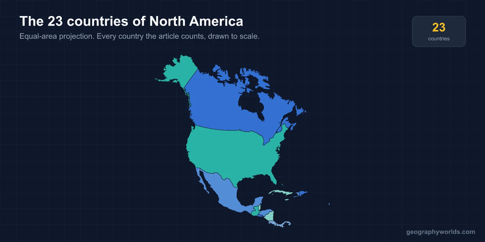
There are 23 countries in North America. There are three large mainland states (Canada, the United States and Mexico), seven countries on the Central American isthmus from Guatemala to Panama, and thirteen island nations in the Caribbean. Greenland, Puerto Rico and more than a dozen other islands are also geographically part of North America, but they are territories of Denmark, the United States, the United Kingdom, France or the Netherlands rather than independent countries.
All 23 Countries at a Glance
Populations are recent estimates, rounded.
| Country | Capital | Population |
|---|---|---|
| United States | Washington, D.C. | ~340 million |
| Mexico | Mexico City | ~131 million |
| Canada | Ottawa | ~41 million |
| Guatemala | Guatemala City | ~18 million |
| Haiti | Port-au-Prince | ~11.8 million |
| Dominican Republic | Santo Domingo | ~11.4 million |
| Honduras | Tegucigalpa | ~10.8 million |
| Cuba | Havana | ~10 million |
| Nicaragua | Managua | ~7 million |
| El Salvador | San Salvador | ~6.3 million |
| Costa Rica | San José | ~5.1 million |
| Panama | Panama City | ~4.5 million |
| Jamaica | Kingston | ~2.8 million |
| Trinidad and Tobago | Port of Spain | ~1.4 million |
| Belize | Belmopan | ~410,000 |
| Bahamas | Nassau | ~400,000 |
| Barbados | Bridgetown | ~280,000 |
| Saint Lucia | Castries | ~180,000 |
| Grenada | St. George's | ~120,000 |
| Saint Vincent and the Grenadines | Kingstown | ~100,000 |
| Antigua and Barbuda | St. John's | ~95,000 |
| Dominica | Roseau | ~70,000 |
| Saint Kitts and Nevis | Basseterre | ~50,000 |
Where North America Ends
The continent's southern limit on land is the border between Panama and Colombia, which runs through the Darién Gap. This roadless stretch of rainforest and swamp is the only break in the Pan-American Highway between Alaska and Argentina. The sea boundary is less tidy. Trinidad sits on the South American continental shelf, within sight of Venezuela, yet it is almost always counted with the Caribbean and therefore with North America. The Dutch islands of Aruba and Curaçao, just off the Venezuelan coast, are grouped the same way.
Some people, particularly in Latin America, use "North America" to mean only Canada, the United States and Mexico, and treat the Americas as one continent with North, Central and South as regions. Spanish-speaking schools often teach a single América. The count of 23 follows the seven-continent model that most English-language atlases use. The same boundary question comes up in our explainer on whether Mexico is in North or South America.
Three Giants and Twenty Small States
The continent is very lopsided. Canada and the United States together make up about 80 per cent of North America's land, and the three mainland countries hold about 85 per cent of its roughly 600 million people. Canada is the second-largest country in the world at 9.98 million km². Its border with the United States, 8,891 km including Alaska, is the longest international border anywhere. The United States is the world's third most populous country. Mexico has the largest Spanish-speaking population of any country, more than Spain and Colombia combined. At 1.96 million km² it is also among the fifteen largest countries in the world, though still smaller than Greenland, and greater Mexico City, with more than 21 million people, is one of the largest urban areas in the Western Hemisphere.
At the other end, Saint Kitts and Nevis covers only 261 km² and is the smallest country in the Americas by both area and population.
The Isthmus: Seven Countries in About 520,000 km²
Central America has seven countries in less area than France. Six are Spanish-speaking. The exception is Belize, the former British Honduras, where English is the official language. It became independent in 1981, and Guatemala still claims much of its territory. In 2018 and 2019 both countries held referendums that sent the dispute to the International Court of Justice.
Guatemala is the most populous of the seven and the heartland of the ancient Maya, whose cities included Tikal. Honduras, the second-largest, has a long Caribbean coast and a short Pacific one on the Gulf of Fonseca. Nicaragua is the largest by area and contains Lake Nicaragua, where bull sharks swim up from the Caribbean through the San Juan River. El Salvador is the smallest and most densely populated, and the only one with no Caribbean coast. It made bitcoin legal tender in 2021, then amended the law in 2025 so that businesses no longer have to accept it. Costa Rica abolished its army in 1948 and protects about a quarter of its land.
Panama was part of Colombia until 1903, when it separated with American backing in time for the United States to build the canal. The Panama Canal opened in 1914 and passed to Panamanian control at the end of 1999. It handles around 5 per cent of world seaborne trade. More detail on each country is in our guide to the countries of Central America.
Thirteen Island Nations
The Caribbean's sovereign states span more than two centuries of independence. Haiti was first, in 1804, after the only slave revolt in history to found an independent state. The Dominican Republic, which shares the island of Hispaniola with it, followed in 1844, and Cuba, the largest island, in 1902. The rest were British colonies that became independent between Jamaica and Trinidad and Tobago in 1962 and Saint Kitts and Nevis in 1983.
That history explains the languages. Ten of the thirteen are English-speaking, Cuba and the Dominican Republic speak Spanish, and Haiti speaks French and Haitian Creole. It also explains who is head of state. Jamaica, the Bahamas, Grenada, Saint Lucia, Saint Vincent and the Grenadines, Antigua and Barbuda, and Saint Kitts and Nevis still have King Charles III as monarch, as do Belize and Canada on the mainland. Barbados became a republic in November 2021. Trinidad and Tobago had done the same in 1976, and Dominica became independent as a republic in 1978. Our guide to the countries of the Caribbean covers the islands one by one.
From Arctic to Tropics
North America runs from Canada's Arctic islands and northern Greenland, well inside the Arctic Circle, to Panama at about 7 degrees north of the equator. Along the way it holds the continent's high point, Denali in Alaska at 6,190 m, and its low point, Badwater Basin in Death Valley at 86 m below sea level. Lake Superior is the largest freshwater lake in the world by surface area. The Mississippi–Missouri system, about 6,275 km long, is among the four longest river systems on Earth. Mexico's Pico de Orizaba, at 5,636 m, is the highest volcano on the continent and the highest point between the United States and the Andes. Our guide to the Great Lakes covers the continent's greatest body of fresh water.
Languages Across the Continent
English, Spanish and French are the main official languages, but the map is more complicated than that. French is the majority language of Quebec and an official language of Canada as a whole, as well as of Haiti. Dutch and Papiamento are spoken on Aruba and Curaçao. Mexico recognises 68 Indigenous languages, and the 2020 census counted about 1.7 million speakers of Nahuatl, the language of the Aztecs. Guatemala recognises 22 Mayan languages, which are the first language of a large share of its people. In the far north, Inuktitut is an official language of Nunavut, and Greenlandic is the sole official language of Greenland.
The Continent's Land Borders
North America has surprisingly few land borders for 23 countries, because most of them are islands. On the mainland, the United States–Mexico border runs about 3,145 km from the Pacific to the Gulf of Mexico. The seven Central American states share borders in a chain, with Belize and Guatemala's line still the subject of a claim at the International Court of Justice. In the Caribbean, only Haiti and the Dominican Republic share an island between two sovereign states. Their 376 km border across Hispaniola is sharply visible from the air, because far more of the forest cover survives on the Dominican side.
The newest land border on the continent is also the smallest. Hans Island, a 1.3 km² rock in the Nares Strait between Canada's Ellesmere Island and Greenland, was claimed by both Canada and Denmark for decades. The two governments exchanged bottles of whisky and schnapps on it as a joke before agreeing in June 2022 to split it down the middle. That gave Canada a land border with the Kingdom of Denmark, about 1.2 km long.
The Territories That Are Not Countries
More than a dozen inhabited places in North America are dependencies rather than countries. Greenland, the world's largest island, is a self-governing part of the Kingdom of Denmark. Puerto Rico, with about 3.2 million people, and the US Virgin Islands are United States territories. Bermuda, the Cayman Islands, the British Virgin Islands, Anguilla, Montserrat and the Turks and Caicos Islands are British Overseas Territories.
France's Guadeloupe and Martinique are full overseas departments, part of France and of the European Union, so they use the euro. France also holds Saint Martin, Saint Barthélemy and Saint Pierre and Miquelon off Newfoundland. Aruba, Curaçao and Sint Maarten are constituent countries within the Kingdom of the Netherlands, while Bonaire, Sint Eustatius and Saba are Dutch special municipalities. None of them has a UN seat, which is why the count stays at 23.