
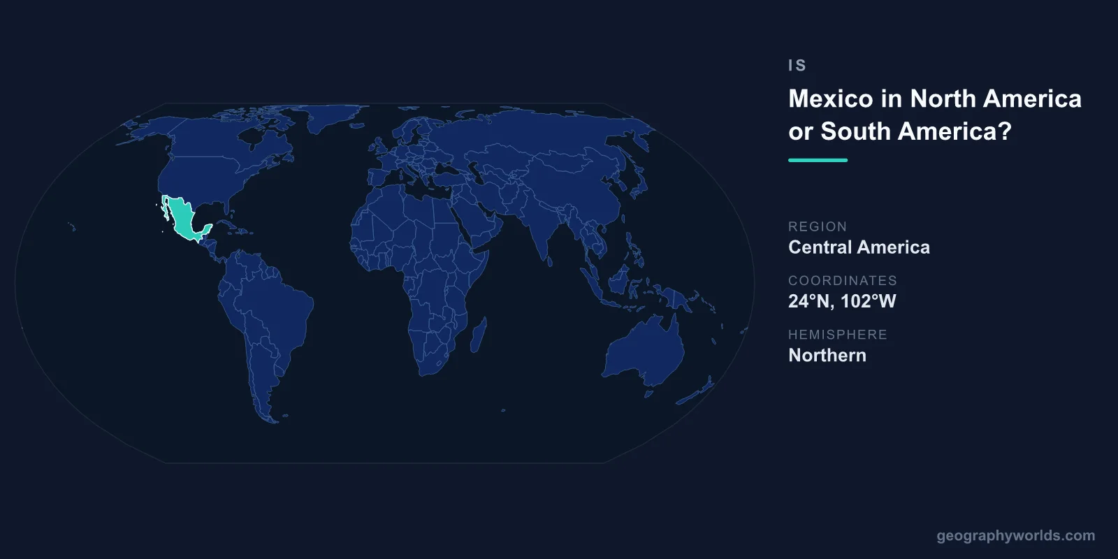
Mexico is in North America. It borders the United States to the north and Guatemala and Belize to the south, and every standard continent model places it in North America. South America starts much further south, at the border between Panama and Colombia, roughly 1,700 km from Mexico's southern border at the nearest. The confusion comes from "Latin America", a cultural and linguistic grouping that includes Mexico but is not a continent.
There is one real grey area. Some geographers and one major statistical scheme put Mexico, or its southern part, in Central America, which is itself part of North America. That question and the reasons behind it are covered below.
Where the Americas Actually Divide
The boundary between North and South America runs through the Darién, the roadless rainforest on the Panama–Colombia border. North of that line, the land narrows through the seven Central American countries, then widens again across Mexico into the main body of the continent. Mexico sits entirely on the northern side. Its southern borders with Guatemala and Belize, about 1,200 km long together, lie roughly 1,700 km from Colombia in a straight line, with Guatemala, Honduras or El Salvador, Nicaragua, Costa Rica and Panama in between.
Mexico is also joined physically to the rest of North America. The Sonoran and Chihuahuan deserts run straight across the border into Arizona, New Mexico and Texas, and the Sierra Madre ranges continue the mountain systems of the western United States. The Rio Grande, called the Río Bravo in Mexico, forms about two-thirds of the 3,145 km border. None of this changes at the border line; it is one continuous landscape, and it is crossed legally hundreds of millions of times a year, making it the most frequently crossed international border in the world. Our list of all 23 countries in North America shows where Mexico sits among its neighbours.
Why "Latin America" Causes the Confusion
"Latin America" means the countries of the Americas where Spanish, Portuguese or French, the languages descended from Latin, are dominant. The term came into use in the 1850s, when writers from Spanish-speaking America and France began using it to set the region apart from the English-speaking United States. It includes Mexico, the Central American republics, most of South America and the Spanish- and French-speaking Caribbean.
Because Mexico shares a language, a colonial history and a great deal of culture with Colombia, Peru and Argentina, it is easy to assume it shares a continent with them too. But Latin America spans two continents, just as the English-speaking world spans all of them. Mexico is the largest Latin American country in North America, and its capital is more than 2,500 km from the nearest part of South America. We list every member of that grouping in our guide to Latin American countries.
One Continent or Two? It Depends Where You Went to School
English-speaking countries usually teach seven continents, with North and South America separate. Much of Latin America, and Spain, teaches a single continent called América, divided into North, Central and South America as sub-regions. For a Mexican schoolchild, the natural answer to "which continent is Mexico in?" is simply America, and the question of North versus South does not arise in the same way. Both models agree on the point that matters here: Mexico is in the northern part, not the southern.
Is Mexico Part of Central America?
Usually not, but the answer depends on who is counting. In the common political definition, Central America means the seven countries from Guatemala to Panama, and Mexico is not one of them.
The United Nations Statistics Division is the main exception. Its M49 scheme, used for a great deal of international data, places Mexico in the "Central America" sub-region, alongside the seven isthmus countries, within the wider group "Latin America and the Caribbean". So if a UN table lists Mexico under Central America, it is not an error; it follows that scheme's convention.
Physical geographers make a different distinction. Many draw the geological boundary between the main body of North America and the Central American isthmus at the Isthmus of Tehuantepec, Mexico's narrowest point, where only about 200 km separate the Gulf of Mexico from the Pacific. By that definition, the Mexican states of Chiapas, Tabasco, Campeche, Yucatán and Quintana Roo, the Maya lands east of the isthmus, belong physically to Central America. Mexico has recently reopened a rail link across Tehuantepec as the Interoceanic Corridor, a land alternative to the Panama Canal. Our guide to the countries of Central America covers the isthmus itself.
The Plates Beneath Mexico
Mexico's position is written into its geology. Most of the country sits on the North American Plate, but the Baja California peninsula rides on the Pacific Plate, slowly moving north-west along the same fault system as California's San Andreas. The Gulf of California opened between them over roughly the last six million years. The far south of Chiapas touches the Caribbean Plate. Off the southern Pacific coast, the Cocos Plate and the small Rivera Plate are sliding beneath Mexico, and that subduction is what raises the Trans-Mexican Volcanic Belt, with Popocatépetl, Iztaccíhuatl and Pico de Orizaba, at 5,636 m the highest peak in Mexico and the third-highest in North America after Denali and Canada's Mount Logan.
Mexico even saw a new volcano form in living memory. In February 1943 Paricutín began erupting in a farmer's cornfield in Michoacán and, over nine years, built a cone about 424 m high. Under the Yucatán Peninsula lies the Chicxulub crater, about 180 km across, left by the asteroid impact 66 million years ago that is linked to the extinction of the dinosaurs. The same subduction that raised Paricutín causes Mexico's great earthquakes. On 19 September 1985, a magnitude 8.0 earthquake off the Michoacán coast killed thousands in Mexico City, 350 km away. The city stands at about 2,240 m on the soft clay bed of drained Lake Texcoco, and the clay amplified the shaking. The same clay is compacting as groundwater is pumped out, and parts of the city are sinking by up to tens of centimetres a year. By coincidence, another deadly earthquake struck on the same date in 2017.
The Mexico That Reached Further North
Mexico was once far larger, and in the north rather than the south. When it won independence from Spain in 1821, its territory ran north to the 42nd parallel, today the northern border of California, Nevada and Utah, and east into Texas. For a short time, its first government under Agustín de Iturbide also claimed the provinces of Central America, which broke away in 1823. Only Chiapas stayed, voting to join Mexico in 1824.
Most of the northern lands were lost within thirty years. Texas declared independence in 1836 and joined the United States in 1845. After the Mexican–American War, the Treaty of Guadalupe Hidalgo of 1848 gave the United States California, Nevada, Utah and most of Arizona and New Mexico. The Gadsden Purchase of 1853 added a strip of southern Arizona and New Mexico. In total Mexico lost about 55 per cent of its territory. The modern border is the result, and it is one reason Mexico's history is so closely tied to that of the United States rather than South America.
Mexico's Size in Context
Even after those losses, Mexico is large. It covers about 1.96 million km², about the combined area of France, Spain, Germany and Italy with room left over. From Tijuana in the north-west to Cancún in the south-east is more than 3,000 km in a straight line. Mexico has about 9,300 km of coastline on the Pacific, the Gulf of Mexico and the Caribbean, and it runs its clocks on four time zones. The Baja California peninsula alone is about 1,250 km long.
How Mexico Lines Up With Its Neighbours
In economics, trade and sport, Mexico is organised as a North American country. The North American Free Trade Agreement joined it with the United States and Canada in 1994, and its successor, the USMCA, took effect in 2020. Mexico has since become the United States' largest trading partner. In football, Mexico belongs to CONCACAF, the confederation for North America, Central America and the Caribbean, not CONMEBOL, which runs South American football. It took part in the South American Copa América only as an invited guest. In 2026 Mexico co-hosts the FIFA World Cup with the United States and Canada, and the opening match was played at Mexico City's Estadio Azteca.
At about 1.96 million km², Mexico is the third-largest country in North America after Canada and the United States, and one of the fifteen largest countries in the world. With around 130 million people it is the world's largest Spanish-speaking country, which is one reason it is so often grouped with South America. It has more than two and a half times as many Spanish speakers as Spain. The 2020 census also counted about 7.4 million speakers of Indigenous languages, led by Nahuatl and Yucatec Maya. Geographically, though, it has always been in North America.