
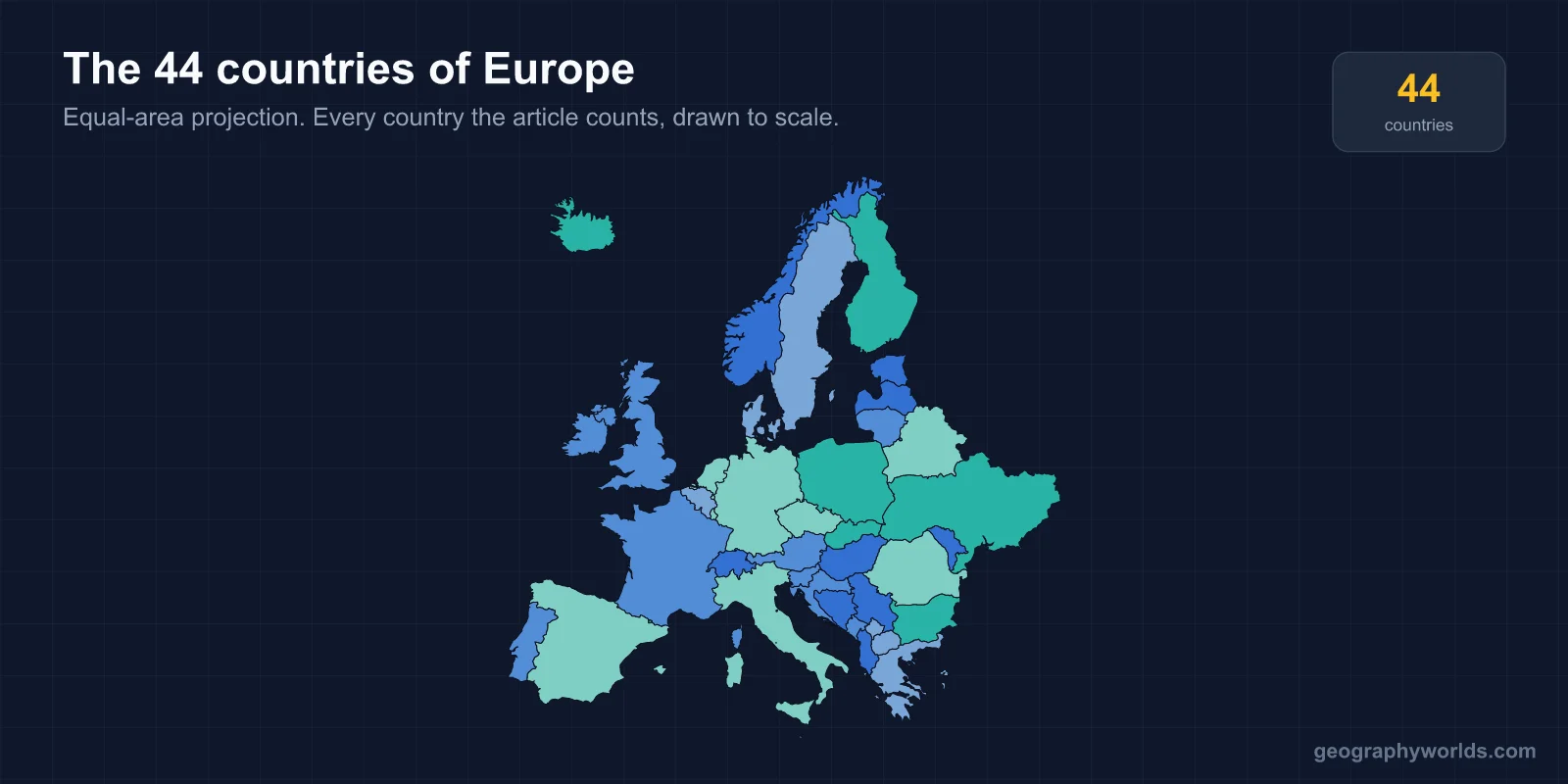
Europe has 44 countries that lie fully or primarily on the continent. Counts of 46, 49 or 50 are not errors — they are what happens when you fold in the transcontinental states that straddle the Urals and the Caucasus, and Europe is the only continent where that decision changes the answer by more than a rounding.
Why Forty-Four and Not Fifty
Europe's eastern edge is a line through the Ural Mountains, down the Ural River, across the Caspian and along the Caucasus watershed — a convention with no treaty behind it. Five countries sit across that line, and each is counted differently depending on the source.
Russia has about three-quarters of its territory in Asia and about three-quarters of its people in Europe. Turkey has roughly 3% of its land west of the Bosphorus and its largest city on both sides. Kazakhstan's western tip crosses the Ural River. Georgia and Azerbaijan sit on the Caucasus itself. Add all five and you reach 49; add Cyprus, geographically Asian but an EU member since 2004, and you reach 50. This list takes the narrower reading and counts 44, which is also why Asia's total of 49 includes Turkey, Georgia and Azerbaijan but not Russia. The two counts are answering the same question from opposite sides.
All 44, Grouped by Region
Grouped geographically rather than alphabetically, the list makes the continent's shape easier to hold:
- Southern Europe — 15. Albania, Bosnia and Herzegovina, Croatia, Greece, Italy, Kosovo, Malta, Montenegro, North Macedonia, Portugal, San Marino, Serbia, Slovenia, Spain and Vatican City. The largest group, and the one the Yugoslav breakup did most to enlarge.
- Northern Europe — 10. Denmark, Estonia, Finland, Iceland, Ireland, Latvia, Lithuania, Norway, Sweden and the United Kingdom.
- Western Europe — 10. Andorra, Austria, Belgium, France, Germany, Liechtenstein, Luxembourg, Monaco, the Netherlands and Switzerland. Three of the six microstates sit in this group alone.
- Eastern Europe — 9. Belarus, Bulgaria, the Czech Republic, Hungary, Moldova, Poland, Romania, Slovakia and Ukraine.
Fifteen plus ten plus ten plus nine is 44. The grouping is a convention rather than a rule — Austria and Slovenia in particular move between Western, Central and Southern depending on the scheme, and "Central Europe" appears in many sources as a fifth category carved out of the other four.
Six Microstates, and Why Europe Has Them All
No continent is so finely divided at the small end. Six sovereign states cover less than 500 km² each:
- Vatican City — 0.49 km², the smallest country in the world, with a resident population of a few hundred. It has existed in its current form only since the Lateran Treaty of 1929.
- Monaco — about 2.1 km², and the most densely populated country on earth.
- San Marino — about 61 km², which claims a continuous republican history since 301 and is plausibly the oldest surviving sovereign state.
- Liechtenstein — about 160 km², one of only two doubly landlocked countries anywhere.
- Malta — about 316 km², the smallest EU member.
- Andorra — about 468 km², still formally a co-principality headed jointly by the President of France and a Spanish bishop.
These are survivals rather than accidents. They are fragments of the medieval patchwork of duchies, bishoprics and free cities that covered Europe before the nineteenth-century consolidations, and they lasted because they were too small, too remote or too useful to be worth absorbing.
Kosovo, the Newest and Least Agreed
Kosovo declared independence from Serbia in February 2008 and is the most recent European state by some margin. It is recognised by around 100 UN members, including most of the EU, but not by Serbia, Russia, China, or by five EU members — Spain, Greece, Cyprus, Slovakia and Romania — several of which have separatist questions of their own.
Kosovo is therefore in this list of 44 but not in the UN's 193. Vatican City is in neither, being a permanent observer by choice rather than exclusion. Between them these two explain most of the small discrepancies between published European totals: a source counting UN members alone gets 43.
What 1991 to 2008 Added
More than a third of Europe's countries are younger than the personal computer, and almost all of them arrived in a single seventeen-year window.
The Soviet Union's dissolution in December 1991 produced six European states — Estonia, Latvia, Lithuania, Belarus, Ukraine and Moldova. Yugoslavia's breakup produced seven over nineteen years: Slovenia and Croatia in 1991, North Macedonia and Bosnia and Herzegovina in 1992, then Serbia and Montenegro separating in 2006 and Kosovo in 2008. Czechoslovakia divided into the Czech Republic and Slovakia on 1 January 1993, the only one of the three that was entirely peaceful and is still known as the Velvet Divorce.
That is fourteen countries in seventeen years, on a continent that had spent the previous four decades frozen. Nothing has changed since 2008 — the longest period of border stability in modern European history.
The Lines Still Being Argued Over
Europe's borders are stable but not uncontested. Cyprus has been partitioned since 1974, when Turkey invaded following a coup backed by the Greek military junta; the northern third is governed as the Turkish Republic of Northern Cyprus, recognised only by Turkey, and the UN buffer zone running through Nicosia makes it the last divided capital in Europe.
Transnistria broke from Moldova after a short war in 1992 and has functioned as an unrecognised state ever since, with Russian troops still stationed there. Gibraltar has been British since the Treaty of Utrecht in 1713 and is still claimed by Spain. Russia's annexation of Crimea in 2014 and the full-scale invasion of Ukraine in 2022 have made the continent's largest border dispute also its most consequential; almost no state recognises the annexation.
None of these change the count of 44 — an unrecognised breakaway is not a country on anyone's list except its own — but they are the reason Europe's map looks more settled on paper than it is on the ground.
The European Union Is Not Europe
The EU has 27 members, which is well under two-thirds of the continent. Norway, Switzerland, Iceland, the United Kingdom, Serbia, Ukraine, Moldova, Albania, Bosnia and Herzegovina, North Macedonia, Montenegro, Kosovo, Belarus and the microstates are all outside it, for reasons ranging from referendum results to accession queues to sanctions.
The Schengen Area is a different map again, and the eurozone a third: 20 of the 27 EU members use the euro, while Monaco, San Marino, Vatican City, Andorra, Montenegro and Kosovo use it without being in the EU at all. Four overlapping maps of the same continent, none of which is the answer to how many countries are in Europe.
Why So Many Countries in So Little Space
Europe fits 44 countries into about 10.2 million km². Africa fits 54 into three times that area, and Asia 49 into more than four times. By countries per unit of land, Europe is the most politically fragmented continent on earth, and the reason is physical as much as historical.
The continent is cut into pieces by mountain ranges and seas that are large enough to divide but small enough to cross. The Alps, the Pyrenees, the Carpathians and the Balkan ranges separate populations without isolating them; the Baltic, Adriatic, North Sea and Mediterranean do the same. Peninsulas do most of the work: Iberia, Italy, Scandinavia, the Balkans and Jutland are each effectively self-contained, and each ended up with distinct states on it. Europe has the longest coastline relative to area of any continent, which is another way of saying that almost nowhere in it is far from a natural boundary.
That fragmentation produced competing states of roughly comparable strength for most of the last thousand years — no single power ever absorbed the rest for long, unlike China in East Asia. The borders now on the map are the residue of that stalemate, redrawn after 1918, 1945 and 1991 but never consolidated.
Russia, and Where the Continent Actually Stops
The Urals convention dates to 1730, when the Swedish officer and geographer Philip Johan von Strahlenberg proposed the range as the divide, replacing the older use of the Don. It was adopted because it was convenient for Russian administration, and it has never been ratified by any body with the authority to do so.
It produces some odd results. Istanbul is a European city by most definitions and an Asian one by area. Yekaterinburg, a city of 1.5 million, sits just east of the line and is therefore in Asia while being culturally indistinguishable from cities 300 km west. The Caucasus section is vaguer still: whether Georgia is European depends on whether you follow the watershed or the political boundary, and the two do not agree.
From Russia to the Vatican
Even excluding its Asian territory, European Russia is about 3.9 million km² — larger than every other country on the continent combined, and roughly eight million times the area of Vatican City. Ukraine is the largest country lying entirely in Europe at about 604,000 km², a title it took from France when the Soviet Union dissolved.
Europe is the second-smallest continent by area and the third most populous, which is what produces the density of borders: about 44 countries in roughly 10.2 million km², where Africa fits 54 into three times the space. It is why a train from Brussels can cross three countries before lunch, and why France alone borders eight of them. If you want to see how many of the 44 you can actually place, the capitals reference lists every one with its capital city.