
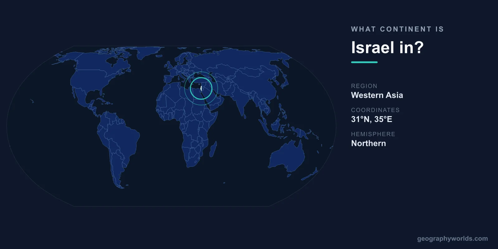
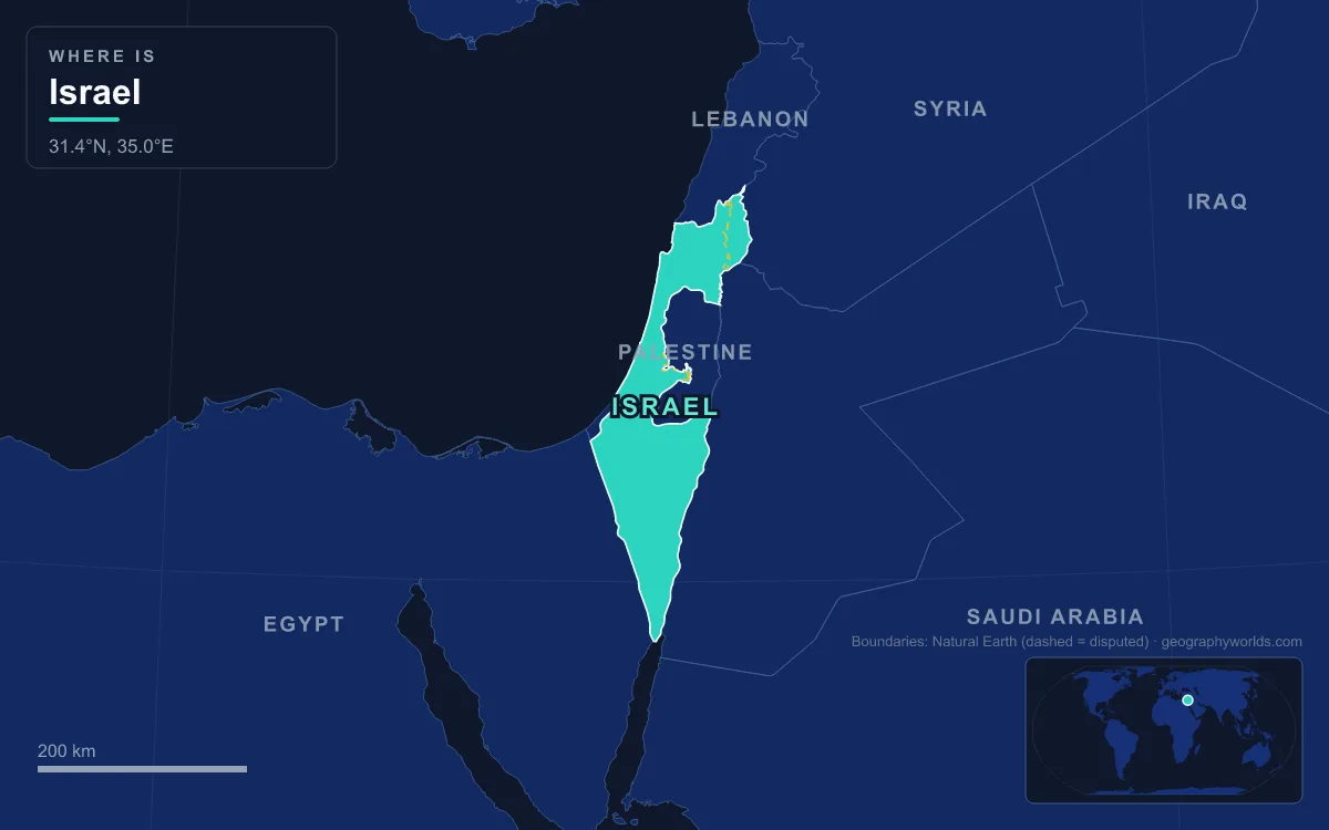
Israel is in Asia. It lies in Western Asia, in the part of the Middle East known as the Southern Levant, on the eastern shore of the Mediterranean Sea. Its land borders run to Lebanon in the north, Syria in the north-east, Jordan in the east and Egypt in the south-west, with the West Bank and the Gaza Strip also adjoining it. Within the 1949 armistice lines Israel covers about 20,770 km², and it stretches roughly 400 km from north to south but only about 100 km at its widest point. Africa begins just beyond its south-western border, across the Sinai Peninsula at the Isthmus of Suez, which is why Israel is often described as sitting where Asia meets Africa. Its membership of European football and its long history at the Eurovision Song Contest do not change the continent; they are the result of politics and broadcasting rules rather than geography.
Western Asia on the UN Map: Where Israel Sits
The United Nations statistical geoscheme, which most atlases and international databases follow, puts Israel in the subregion of Western Asia. That subregion stretches from Anatolia and the South Caucasus to the Arabian Peninsula, and it includes the Levant and the Sinai Peninsula. Twelve seas surround it, from the Aegean and the Black Sea to the Persian Gulf, the Gulf of Aqaba and the Mediterranean. Israel shares the subregion with every one of its land neighbours except Egypt, whose territory lies mostly in Africa.
The coordinates make the point plainly. Israel lies between latitudes 29° and 34° N and longitudes 34° and 36° E. Haifa and the Galilee in the north, Tel Aviv and the coastal plain in the centre, and the Negev desert and Eilat in the south all sit on the Asian landmass. Eilat, Israel's southernmost city, stands on the Gulf of Aqaba, an arm of the Red Sea whose coastline is divided among Egypt, Israel, Jordan and Saudi Arabia.
Area figures depend on what is being measured, and three are in common use. Within the 1949 armistice lines, known as the Green Line, Israel covers about 20,770 km² (8,019 sq mi), of which around 2 per cent is water. Including East Jerusalem and the Golan Heights, which Israel annexed after the 1967 Six-Day War in moves that are not internationally recognised, the area under Israeli law is 22,072 km². Adding the West Bank, which Israel occupies and parts of which are under Palestinian self-rule, the total under Israeli control is 27,799 km². Whichever figure is used, every square kilometre of it is in Asia. Israel's Central Bureau of Statistics put the population at about 9.7 million in April 2023.
The Isthmus of Suez Line Between Asia and Africa
Geographers draw the boundary between Africa and Asia at the Isthmus of Suez, the land bridge of roughly 125 km between the Mediterranean Sea and the Gulf of Suez. The Suez Canal, opened through the isthmus in 1869, now follows that line. Strictly, a canal is not what defines a continent; the boundary lies within the narrow land connection itself, and the canal simply happens to cut across it. Everything east of the line, including the whole Sinai Peninsula, counts as Asian. That makes Egypt a transcontinental country, even though less than 2 per cent of Egyptians live in Sinai and Egypt is usually treated as an African state.
For Israel, the consequence is that its south-western border with Egypt is not a continental boundary at all. The border was demarcated in 1906 between Britain and the Ottoman Empire and confirmed by the 1979 Egypt–Israel peace treaty. Running from the edge of the Gaza Strip to Taba on the Gulf of Aqaba, it separates two Asian landscapes: the Negev on one side and northern Sinai on the other. A traveller driving south-west from Beersheba would cross the Egyptian border and then the whole of Sinai before reaching the canal and Africa. You can read more about the peninsula that lies between them in our guide to the Sinai Peninsula.

Israel on the African Plate: The Dead Sea Transform
Beneath the surface, the continental boundary and the tectonic boundary do not match. The Dead Sea Transform is a fault system about 1,000 km long. It runs from the Marash triple junction in south-eastern Turkey, where it meets the East Anatolian Fault, south through the Beqaa Valley, the Hula basin, the Sea of Galilee, the Dead Sea and the Arabah to the northern end of the Red Sea Rift near the southern tip of Sinai. It forms the transform boundary between the African plate to the west and the Arabian plate to the east.
Both plates move roughly north-north-east, but the Arabian plate moves faster, so the two slide past each other in a left-lateral (sinistral) motion. Geologists estimate the total northward displacement of the Arabian plate along the fault at about 105 km, built up since faulting began in the Oligocene. Where the fault bends and pulls apart, it has opened a chain of deep basins: the Gulf of Aqaba, the Dead Sea, the Sea of Galilee and the Hula Valley.
Because the fault runs along Israel's eastern edge, most of the country, including the coastal plain, the Galilee hills and the Negev, sits west of it on the African plate, while Jordan lies on the Arabian plate. By the usual geological reckoning, the boundary between Africa and Asia lies along the Gulf of Aqaba and the Dead Sea Transform, which places Sinai, Israel, the Palestinian territories, much of Lebanon and coastal Syria on the African plate. This does not make Israel African. Continents are defined by convention around landmasses, and by that convention the line is at Suez. It does explain why the region is seismically active and why its lowest ground lies along a single valley.

The Dead Sea is the clearest product of that motion. As of 2025 its surface stood 439.78 m below sea level, making its shores the lowest land on Earth, and it is 304 m deep. Its salinity of about 34 per cent is nearly ten times that of the ocean. The lake is shrinking fast: its surface area was 1,050 km² in 1930 and is about 605 km² today. Our Dead Sea geography guide covers the basin in more detail.
Why Israel Has Played in UEFA Since 1994 and Sings at Eurovision
Sport causes most of the confusion. Israel's football association was founded in 1928 as the Palestine Football Association and joined FIFA in 1929. After 1948 it competed in Asia: it was a member of the Asian Football Confederation from 1954 until 1974, when it was expelled under pressure from Arab and Muslim members that refused to play against Israel. For almost two decades it belonged to no confederation at all, and its national teams played World Cup qualifiers in whichever zone FIFA placed them, at times in Oceania, Europe and South America.
In 1992 the Israel Football Association was admitted to UEFA as an associate member, and it became a full member in 1994. Since 1992 Israeli clubs have played in UEFA's club competitions and the national team has entered the European Championship qualifiers. The same pattern holds in multi-sport events. Israel took part in the Asian Games five times between 1954 and 1974, missing 1962 and 1978 for political reasons, and was excluded when the Olympic Council of Asia was formed in 1981. It has competed at the European Games since the first edition in 2015.
Eurovision follows a different logic. Eligibility depends on membership of the European Broadcasting Union, and that in turn depends largely on the European Broadcasting Area, a zone defined by the International Telecommunication Union that includes the southern and eastern shores of the Mediterranean while leaving out some parts of the European continent. The Israel Broadcasting Authority was an EBU member, a role its successor Kan took over in 2018, and Israel has competed 48 times since its debut in 1973. It has won four times, in 1978, 1979, 1998 and 2018, and hosted the contest in Jerusalem in 1979 and 1999 and in Tel Aviv in 2019. Algeria, Egypt and Tunisia sit inside the same broadcasting area. None of this places Israel in Europe; it reflects which organisations accepted it.
From Mount Meron to Eilat: Israel's Asian Landscapes
Israel's physical regions are all part of the wider Levant and share their character with neighbouring Asian lands. The Mediterranean coastal plain, home to most of the population, runs from the Lebanese border past Haifa and Tel Aviv towards Gaza. Inland rise the hill country and the mountains of the Galilee and Mount Carmel. Mount Meron in the Upper Galilee, at 1,204 m (3,950 ft), is the highest peak within the Green Line. Between the hills lies the fertile Jezreel Valley.
East of the central highlands, the Jordan Rift Valley carries the Jordan River from the slopes of Mount Hermon through the Hula Valley and the Sea of Galilee to the Dead Sea. The rift is a small part of the 6,500 km Great Rift Valley system. South of the Dead Sea the Arabah depression continues to the Gulf of Aqaba, where Israel's short Red Sea coastline at Eilat lies between Taba in Egypt and Aqaba in Jordan.
The southern half of the country is the Negev, a desert that continues into Sinai. Its signature landforms are the makhteshim, erosion cirques found only in the Negev and Sinai. The largest, Makhtesh Ramon, about 85 km south of Beersheba, is roughly 40 km long, 2 to 10 km wide and 500 m deep. It is neither an impact crater nor a volcanic crater: rivers draining towards the Arava rift, which formed about 5 million years ago, carved out softer rock beneath a harder cap, exposing layers up to 200 million years old. Mitzpe Ramon on its northern rim is the only town in the area, and the surrounding land forms Israel's largest national park.
Israel's ecology tells the same story of a meeting point. The country contains four terrestrial ecoregions, ranging from Eastern Mediterranean forests and Southern Anatolian montane forests to the Arabian Desert and the Mesopotamian shrub desert, and it has the largest number of plant species per square metre of any country in the Mediterranean Basin. Forest cover rose from 2 per cent in 1948 to 8.5 per cent in 2016.
So the short answer stands: Israel is an Asian country in the Middle East, with Africa beginning on the far side of Sinai and the African plate running beneath most of its land. If you want to follow the boundary line itself, start with where the Suez Canal runs, then compare it with the rest of the country in our overview of Israel's geography.