
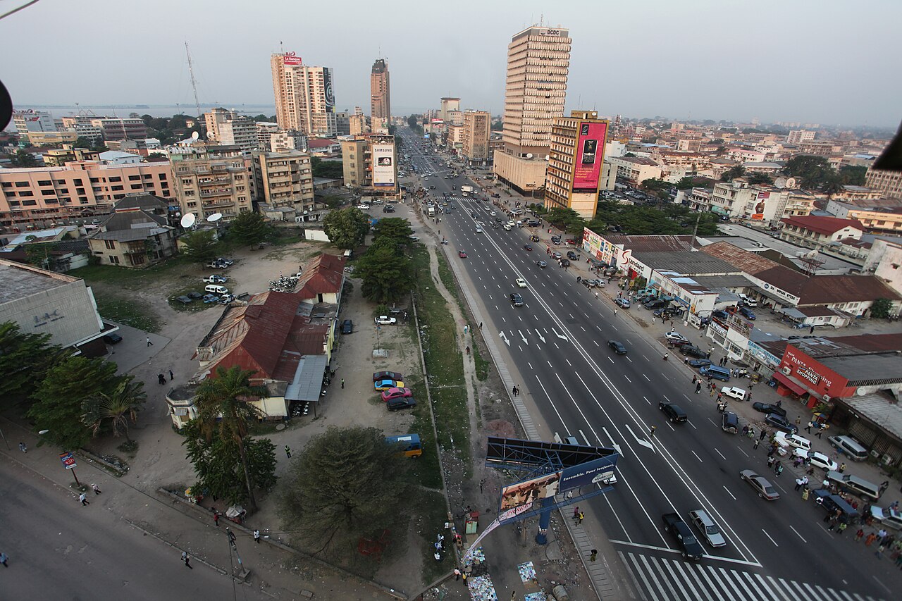
Where the Congo River spreads into a shallow lake called Pool Malebo, just before it drops into the Livingstone Falls, a city of roughly 18.5 million people (a 2026 estimate) lines the southern shore. That city is Kinshasa, capital and largest city of the Democratic Republic of the Congo, known as Léopoldville until 1966. It is the third-largest metropolitan area in Africa and faces Brazzaville, capital of the Republic of the Congo, across about four kilometres of unbridged water, the closest pair of national capitals in the world apart from Rome and Vatican City. Nearly everything about Kinshasa, from why it was founded to where its rich and poor live, follows from that stretch of river and the ground behind it.
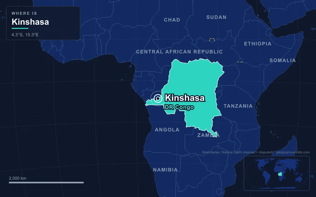
Pool Malebo: A Lake Inside the Congo River
Pool Malebo is where the lower Congo pauses. After flowing for well over a thousand kilometres through the central basin, the river widens into a basin about 35 kilometres long and 23 kilometres wide, covering roughly 500 square kilometres at an elevation of about 272 metres. It is shallow, mostly 3 to 10 metres deep, and its level can swing by up to 3 metres a year with the floods. Islands dot the surface; the largest, Mbamu, covers about 180 square kilometres at the centre of the pool and belongs to the Republic of the Congo.
The name is botanical. Malebo is the Lingala plural of lilebo, the Borassus palm that grows along the shores and islands, so Pool Malebo means roughly "lake of palms". Europeans called it Stanley Pool after Henry Morton Stanley, who reached it in March 1877 during his crossing of Africa, and the African name was restored in January 1972 as part of Mobutu's campaign to replace colonial place names. Before either name, local people knew the water as Ntamo, Nkunda, Mpumbu or Ngobila.

Livingstone Falls and the Break in the River Road
Just downstream of Ngaliema Bay, at the western end of the city, the calm water ends. The Congo plunges into the Livingstone Falls, a chain of rapids that drops about 270 metres over 350 kilometres to Matadi, through a channel often less than 800 metres wide and in places under 300. The river's flow usually exceeds 42,000 cubic metres per second, so no boat can pass. Upstream of the pool, by contrast, barges can travel all the way to Kisangani and up the Ubangi to Bangui.
That break made the site a market long before it made it a capital. Teke and Humbu people had lived on the site for centuries, and two trading centres, Ntamo and Ntsaasa (Nshasa), stood where the city now is, both part of the Tio kingdom. Traders from the Lower Congo brought salt, which they exchanged for iron, ivory and enslaved people brought down from the Upper Congo, and one theory derives the name Kinshasa from a Teke word for "place of exchange". Stanley recorded visiting "the king of Nshasa" on 14 March 1877.
Stanley returned in 1881 to build a trading post for King Leopold II of Belgium and named it Léopoldville. The land itself was contested from the start: the Teke chief Ngaliema ceded Humbu territory to Stanley without consulting the Humbu, who regarded themselves as its owners. It flourished as the first navigable port above the rapids, but at first every load had to be carried by porters to Matadi. The Matadi–Kinshasa railway, finished in 1898, bypassed the falls; a pipeline followed in 1914 to bring crude oil to the upriver steamers. By a royal decree of 1 July 1923 the town replaced Boma, down in the estuary, as capital of the Belgian Congo, a move completed on 31 October 1929.

Plain, Terrace and Hills: How the Ground Sorted Kinshasa
Behind the shore, Kinshasa's terrain falls into three bands, and each has shaped a different city. Closest to the water is the Kinshasa Plain, a banana-shaped stretch of sandy alluvium covering about 20,000 hectares at 275 to 300 metres above sea level. This is the old ville basse, where the colonial administrative centre was laid out at Kalina, now Gombe, between the commercial post of Kinshasa and Léopoldville-West. It is also where the most crowded older communes sit: Limete, Kalamu, Bandalungwa, Ngiri-Ngiri, Kinshasa, Barumbu and Lingwala. The plain is easy to build on but badly drained, and highly vulnerable to seasonal flooding and waterlogging.
The colonial authorities used that flat ground to separate people. From 1929 segregation became law, and in 1933 the Urban Committee created a "neutral zone" between the European town and the African cités indigènes. It was meant to be 800 metres wide but ended up at 250 to 300 metres, and it survives as the Kinshasa Botanical Garden and the zoo. After 1949 the Office des Cités Africaines built more than 40,000 homes, planning Matete, Bandalungwa and Lemba and the satellite town of Ndjili, while industry went to Limete.
West of the plain, between N'djili and Mont-Ngafula, runs a terrace of soft sandstone 10 to 25 metres high. Beyond it are the hills, rounded ridges that climb above 700 metres and are cut by deep valleys and horseshoe-shaped erosion cirques. Communes such as Mont-Ngafula, Selembao, Kisenso and Bumbu spread over these slopes, mostly on red soils that wash away easily. Since independence in 1960, much growth has happened here without a master plan; UN-Habitat estimates the city expands by about eight square kilometres a year, much of it in informal settlements.
Rain, Rivers and Erosion from the N'djili to the Funa
Kinshasa has a tropical wet and dry climate. The rainy season runs from October to May, and the short dry season from June to September begins around the southern winter solstice, the reverse of cities north of the equator. That rain drains toward the pool through two kinds of river. The N'djili and N'sele rise far beyond the southern hills and, with Pool Malebo, form the city's eastern and northern boundaries; the N'djili floods its lower reaches often enough to disrupt roads and other infrastructure. Smaller local rivers, the Funa, Lukunga, Bombo and Mbale, start inside the urban area and carve steep valleys through the southern hills.
Paving and building have changed how that water behaves. Studies put the city's runoff coefficient at about 13%, compared with near zero before urbanisation, which means more water reaching the rivers faster and more landslides on the hillsides. Tree cover has fallen too: forest covered about 46% of the area in 1960, 36% in 1982 and just 15% by 1987. The city-province is far larger than the built-up area. It covers 9,965 square kilometres, and the rural commune of Maluku alone makes up 79% of that, while the urban core occupies the western end.
A River Port for 18 Million on Pool Malebo's Shore
The river still carries the city's trade. The port, known as Le Beach Ngobila, stretches for about 7 kilometres along the shore, with dozens of quays and hundreds of boats and barges, and handles more than two million tonnes of freight a year. Because the road network is fractured and in poor condition, and the rail network limited, the rivers remain the main link to much of the country. The Matadi railway, the route around the falls, reopened to passengers in 2025 after five years of renovation, and N'djili International Airport handles long-haul flights.
The shape of the ground also explains the street plan. The main roads radiate from the centre toward the outer districts, so traffic from the hills and the eastern communes funnels toward Gombe. Boulevard du 30 Juin, named for independence day, runs about 5.5 kilometres through Gombe between the central station and the Socimat roundabout, with four lanes in each direction, and Lumumba Boulevard carries traffic about 25 kilometres from N'djili airport toward the centre. Of roughly 5,019 kilometres of urban roads, only 546 are paved. The city also holds the institutions of the state: the Palais du Peuple, seat of parliament, the Palace of the Nation, the Constitutional Court and the Court of Cassation. Beyond the centre are the Nsele Valley Park, the largest urban park in the city, and Lola ya Bonobo, the world's only sanctuary for orphaned bonobos.
The growth has been extraordinary. The town had about 5,000 people in 1889 and 39,530 in 1930. It reached 400,000 by independence on 30 June 1960, 2.6 million in 1984 and nearly 12 million by 2015. UN-Habitat reckons some 390,000 migrants arrive each year, many fleeing conflict or economic hardship. On 30 June 1966, the sixth anniversary of independence, Mobutu's government renamed Léopoldville as Kinshasa after the old riverside village. Today the Kinois speak Lingala on the street and French in offices, making Kinshasa the largest nominally French-speaking city in the world, and UNESCO named it a City of Music in 2015.
Across the pool, Brazzaville remains within sight but not within reach by road; ferries cover the four kilometres, and a long-planned road and rail bridge has yet to be built. Read about Brazzaville, Kinshasa's twin on the north shore, follow the Congo River from source to sea, or see how the capital fits into the wider Democratic Republic of the Congo.
Quick Facts About Kinshasa
- Country: Democratic Republic Of The Congo
- Continent: Africa (Central Africa)
- Country population: approximately 116.5 million
- Capital city status: Kinshasa is the capital of Democratic Republic Of The Congo, the seat of national government, and the location of foreign embassies, parliament, and the head of state's official residence.
Frequently Asked Questions
What is the capital of Democratic Republic Of The Congo?
The capital of Democratic Republic Of The Congo is Kinshasa. Kinshasa is the seat of national government, hosts most foreign embassies and consulates, and is typically where the head of state and parliament are located.
What continent is Kinshasa in?
Kinshasa, the capital of Democratic Republic Of The Congo, is located in Africa, in the Central Africa region. As Democratic Republic Of The Congo's capital, Kinshasa serves as the country's primary connection to the broader African political, economic, and cultural sphere.
Why is Kinshasa the capital of Democratic Republic Of The Congo?
Kinshasa was chosen as the capital of Democratic Republic Of The Congo for reasons that typically combine geography, history, and politics. Capital city selections often reflect a desire for centrality (being accessible from across the country), historical importance (being a longstanding seat of government or culture), or neutrality (being acceptable to multiple regions or ethnic groups within the country). The specific reasons for Kinshasa's designation are detailed in the city's history above.
What is Kinshasa known for?
As the capital of Democratic Republic Of The Congo, Kinshasa is best known for housing the country's central government institutions — parliament, presidential or royal residences, supreme court, and key ministries. It is also typically a major cultural and economic center within Democratic Republic Of The Congo, hosting national museums, embassies, and signature monuments. The introduction and history sections above provide detailed coverage of the city's specific notable institutions and landmarks.
Related Pages
- Democratic Republic of the Congo Country Guide — full geography, climate, economy, and culture overview
- Flag of Democratic Republic of the Congo — meaning, history, and design of Democratic Republic of the Congo's national flag