
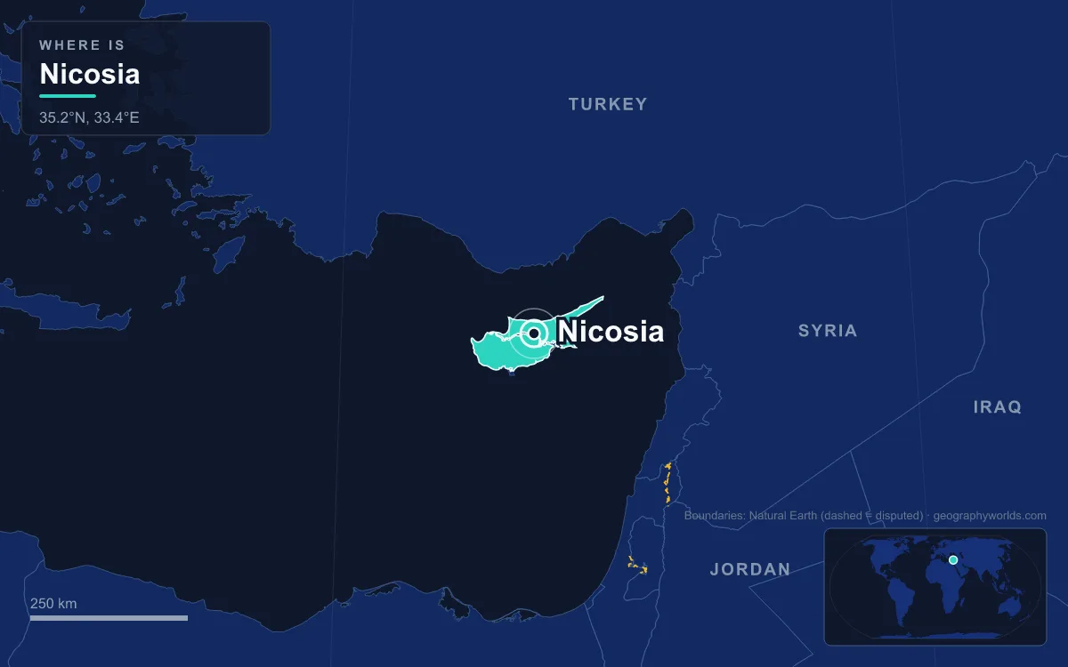
The capital of Cyprus is Nicosia, called Lefkosia in Greek and Lefkoşa in Turkish. It stands near the centre of the island on the Mesaoria plain and has been the capital since the Byzantines moved the seat of government there around 965. It is also the last divided capital in Europe. A United Nations buffer zone, the Green Line, runs through the old walled city. The south is the capital of the Republic of Cyprus, and the north serves as the capital of the self-declared Turkish Republic of Northern Cyprus, which only Turkey recognises. The 2021 census counted about 256,000 people in the southern urban area, and the 2011 count for the northern urban area was about 83,000. The old city is small enough to cross on foot in well under an hour, and walking it from south to north is the clearest way to see how the city got this way.
Eleftheria Square and the D'Avila Bastion
Start at Eleftheria (Liberty) Square, where the modern city meets the old. The square sits just below the Venetian walls. It was called Metaxas Square until 1974, and the Zaha Hadid Architects redesign opened to the public in 2021. Above it, the Nicosia town hall stands on the D'Avila Bastion, one of the eleven pentagonal bastions of the city walls.
The walls are the frame for everything that follows. Venice ruled Cyprus from 1489, and in 1567, worried about Ottoman expansion, it hired the military engineers Giulio Savorgnan and Francesco Barbaro to replace the medieval walls. They built a circle about 5 kilometres around with eleven bastions, each named after an Italian family that helped pay for the work. The engineers also knocked down the Lusignan royal palace and many churches, and diverted the Pedieos River outside a new moat. Three gates led out of the city: the Kyrenia Gate to the north, the Paphos Gate to the west and the Famagusta Gate to the east. All three survive, and the Famagusta Gate is now used for exhibitions and concerts.
Up Ledra Street, the Old "Murder Mile"
From the square, Ledra Street heads due north into the old city. It is about a kilometre long and was long the capital's main shopping street, named after Ledra, the ancient city-kingdom that stood here. An Assyrian inscription from about 672 BC records the name as Lidir. The street's more recent history is darker. During the EOKA campaign against British rule from 1955 to 1959, when Greek Cypriot fighters were pushing for union with Greece, British servicemen were targeted here so often that it became known as "the Murder Mile".
Faneromeni Square and the Archbishop's Quarter
Before going further north, take a detour. The side streets to the east of Ledra Street lead to Faneromeni Square, the centre of Nicosia before 1974. Faneromeni Church dates from 1872. In its courtyard, a mausoleum holds the remains of Archbishop Kyprianos and the bishops the Ottomans executed in 1821 during the Greek War of Independence. A few blocks further east are the Archbishop's Palace, built in 1956 in a Venetian revival style, and the late Gothic St John's Cathedral of 1665, known for its frescoes.
At the Green Line Checkpoint
Near its northern end Ledra Street runs into the buffer zone. The division began after independence. Cyprus became a republic in 1960 under a constitution shared between Greek Cypriots and Turkish Cypriots. In 1963 the Greek Cypriot leadership proposed constitutional amendments, which the Turkish Cypriot side rejected, and intercommunal fighting broke out on 21 December 1963. An officer drew the ceasefire line across a map of Nicosia in green ink, which is where the name Green Line comes from, and streets that crossed it, Ledra Street among them, were barricaded.

The line hardened in 1974. On 15 July a coup backed by the military government in Athens, aimed at uniting the island with Greece, removed President Makarios III. On 20 July Turkey launched a military operation, which it calls a peace operation and which the Republic of Cyprus and most other states call an invasion. By its second phase in August, Turkish forces held about 37 percent of the island, including northern Nicosia. The Turkish Cypriot side declared the Turkish Republic of Northern Cyprus on 15 November 1983. The UN buffer zone now runs about 180 kilometres across Cyprus. The first crossing in Nicosia opened at the Ledra Palace Hotel on 23 April 2003, and Ledra Street itself reopened on 3 April 2008. It became the sixth crossing point between the two parts of the island. More on the politics of the split is in why Cyprus is divided.
The Arasta and Büyük Han
Across the line the street continues into the Arasta, a network of old market lanes pedestrianised in 2013 and selling food and traditional goods. A short turn to the east brings you to Büyük Han, the "Great Inn", the largest caravanserai in Cyprus. The Ottomans built it in 1572, the year after they finished conquering the island, modelling it on the Koza Han in Bursa. Travelling merchants slept in rooms around a two-storey arcaded courtyard with a small mosque and ablution fountain at its centre.

The building has had several lives. Under British rule, which began on 5 July 1878 when the Ottoman Empire handed Cyprus to Britain to administer under the Cyprus Convention, it became the city's first prison. After restoration through most of the 1990s it reopened as an arts centre, with galleries, workshops and courtyard cafés.
Selimiye Mosque, the Cathedral of Saint Sophia
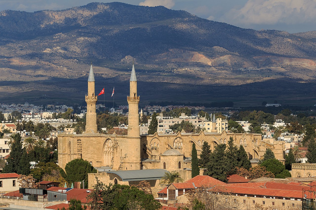
A few minutes further east, two minarets rise above the rooftops. They belong to the Selimiye Mosque, which is really the Gothic Cathedral of Saint Sophia. Its foundation stone was traditionally laid in 1209, early in the rule of the Lusignans, a French crusader dynasty that held Cyprus from 1192 until 1489 after Richard I of England seized the island in 1191 and sold it on. Earthquakes in 1267 and 1303 damaged the unfinished building, the first badly delaying work on the nave, and the cathedral was consecrated in 1326. It served as the coronation church of the kings of Cyprus. Inside it measures 66 by 21 metres, making it the largest and oldest surviving Gothic church on the island.
Its conversion marks the city's worst disaster. An Ottoman army under Piali Pasha besieged Nicosia from 22 July 1570. The city fell on 9 September, and about 20,000 residents are thought to have died. Nicosia had some 21,000 inhabitants before the siege; an Ottoman count in 1572 found between 1,100 and 1,200. The first Friday prayer was held in the cathedral on 15 September, attended by the commander Lala Mustafa Pasha, and the two minarets were added that year. In 1954 the Mufti of Cyprus renamed it the Selimiye Mosque after Sultan Selim II. Beside it stands the Bedesten, a former church that the Ottomans used as a covered market and that now hosts concerts and festivals.
Sarayönü and the Venetian Column
Walk west from the mosque to Sarayönü Square, the traditional heart of Turkish Cypriot Nicosia. The name means "in front of the saray". The Venetian Palazzo del Governo stood here and became the Ottoman governor's residence after 1570. The British demolished it in 1904 and put up the government offices that still stand on the site. In the centre stands the Venetian Column, known locally as the Dikiltaş ("the obelisk"). The Venetians brought it from the ancient city of Salamis around 1550, and the British re-erected it here in 1915. It was also near this square that the Ottomans executed Archbishop Kyprianos in 1821. From here Girne Avenue runs north past shops and restaurants to the Kyrenia Gate, beyond which the Kyrenia range rises on the horizon.
Outside the Walls: Two Municipalities and a Split Clock
Beyond the gates the two halves of the city have grown into ordinary modern cities, with wider roads, apartment blocks and suburban villas. The north's commercial centre is Dereboyu Avenue. The south's main shopping streets are Stasikratous Street and Makariou Avenue, and its suburbs are separate municipalities such as Strovolos, which had 70,823 residents in 2021, the largest single municipality in the urban area. Two city governments run the capital. The Nicosia Turkish Municipality, founded in 1958, administers the north, and Nicosia Municipality the south. A 2024 reform in the south merged Aglandjia, Engomi and Ayios Dhometios into Nicosia Municipality.
The split has reached as far as the clocks. On 30 October 2016 the northern administration followed Turkey and stayed on UTC+3 all year, so for a while Nicosia was the only capital in the world with two time zones. After public complaints in the north, it went back to matching the rest of Europe the following year. The two sides also share some infrastructure: the Mia Milia wastewater plant, opened in 2013, treats sewage from both communities.
The heat is shared as well. Sitting in the rain shadow of the Troodos Mountains, Nicosia has a hot semi-arid climate, and on 4 September 2020 it reached 46.2°C, the highest temperature ever recorded in Cyprus. For the northern side's own story, read what Northern Cyprus is. The closest parallel in living memory is the city whose wall came down in 1989, told in the history of the Berlin Wall.
Quick Facts About Nicosia
- Country: Cyprus
- Continent: Asia (Middle East)
- Country population: approximately 1.4 million
- Capital city status: Nicosia is the capital of Cyprus, the seat of national government, and the location of foreign embassies, parliament, and the head of state's official residence.
Frequently Asked Questions
What is the capital of Cyprus?
The capital of Cyprus is Nicosia. Nicosia is the seat of national government, hosts most foreign embassies and consulates, and is typically where the head of state and parliament are located.
What continent is Nicosia in?
Nicosia, the capital of Cyprus, is located in Asia, in the Middle East region. As Cyprus's capital, Nicosia serves as the country's primary connection to the broader Asian political, economic, and cultural sphere.
Why is Nicosia the capital of Cyprus?
Nicosia was chosen as the capital of Cyprus for reasons that typically combine geography, history, and politics. Capital city selections often reflect a desire for centrality (being accessible from across the country), historical importance (being a longstanding seat of government or culture), or neutrality (being acceptable to multiple regions or ethnic groups within the country). The specific reasons for Nicosia's designation are detailed in the city's history above.
What is Nicosia known for?
As the capital of Cyprus, Nicosia is best known for housing the country's central government institutions — parliament, presidential or royal residences, supreme court, and key ministries. It is also typically a major cultural and economic center within Cyprus, hosting national museums, embassies, and signature monuments. The introduction and history sections above provide detailed coverage of the city's specific notable institutions and landmarks.
Related Pages
- Cyprus Country Guide — full geography, climate, economy, and culture overview
- Flag of Cyprus — meaning, history, and design of Cyprus's national flag