
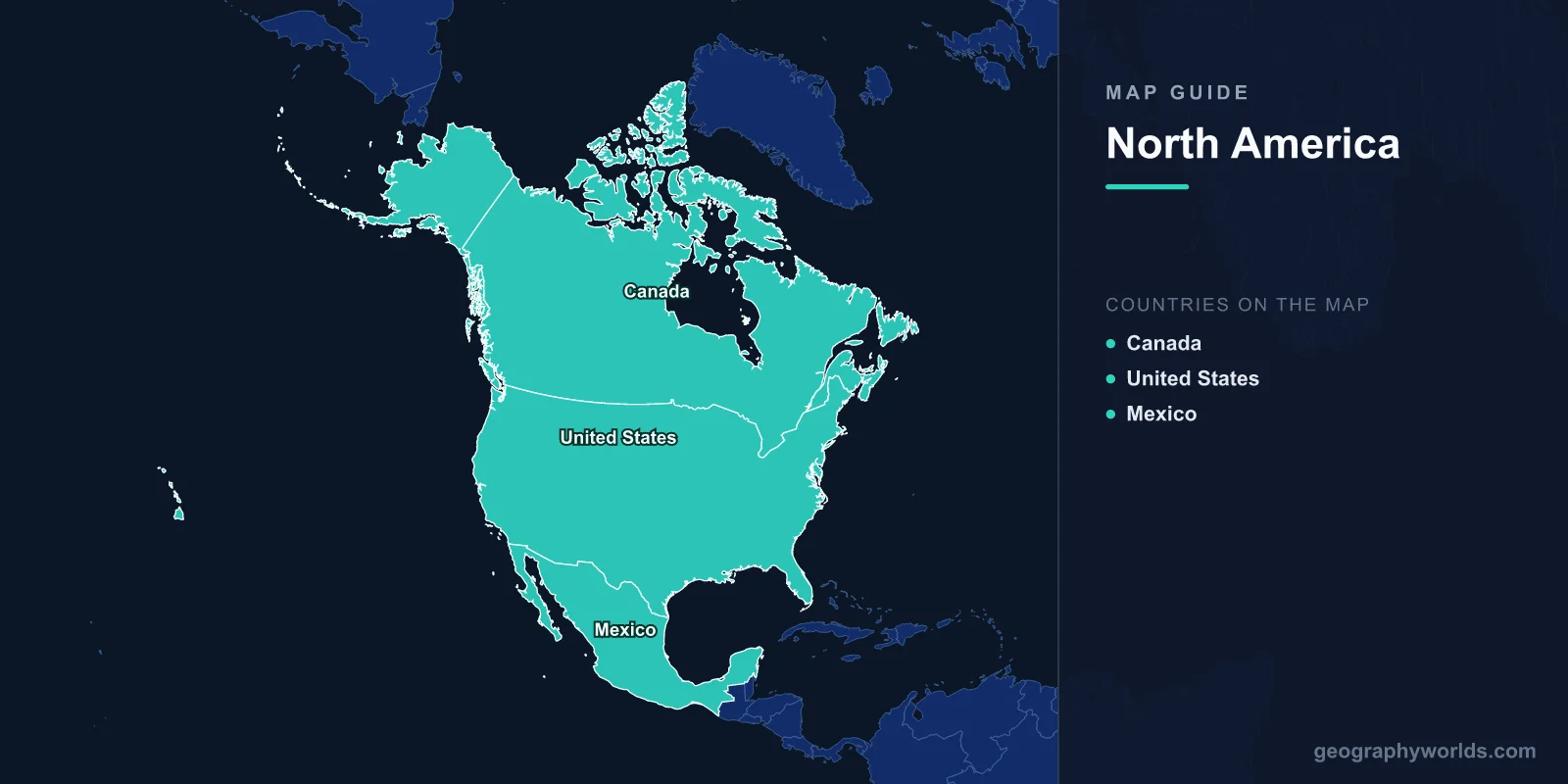
A map of North America shows the third-largest continent on Earth, covering 24.71 million km2 and home to approximately 579 million people across 23 sovereign nations. The continent stretches from the Arctic Circle in northern Canada and Alaska to the tropical isthmus of Panama, encompassing massive geographic features including the Rocky Mountains, the Great Plains, the Great Lakes, the Mississippi River system, and the Canadian Shield. North America's map reveals extraordinary geographic diversity spanning every major climate zone.
Geography of North America
North America extends from 83°N at Cape Columbia in Canada's Ellesmere Island to 7°N at the border of Panama and Colombia. The continent is bounded by the Arctic Ocean to the north, the Atlantic Ocean to the east, the Pacific Ocean to the west, and South America to the southeast.
The western spine of North America is defined by the Cordillera—a continuous system of mountain ranges stretching from Alaska to Central America. This includes the Brooks Range, Alaska Range (with Denali at 6,190 m, the continent's highest peak), the Coast Mountains of British Columbia, the Cascades, the Sierra Nevada, and the Rocky Mountains. The Rockies extend over 4,800 km from British Columbia to New Mexico.
East of the Rockies, the Great Plains stretch from Canada to Texas—a vast grassland region that serves as the continent's agricultural breadbasket. Further east, the Appalachian Mountains run 2,400 km from Alabama to Newfoundland, among the oldest mountains on Earth at over 480 million years old. Between the Appalachians and the Atlantic lies the Coastal Plain.
The Mississippi-Missouri river system, at 6,275 km, is the fourth-longest in the world and drains 3.2 million km2—roughly 40% of the contiguous United States. The Great Lakes (Superior, Michigan, Huron, Erie, Ontario) contain 21% of the world's surface fresh water and form the largest freshwater system on Earth.

Countries & Regions
North America contains 23 sovereign nations, ranging from Canada (the world's second-largest country) to tiny Caribbean and Central American states:
- Canada: 9.98 million km2; population 40 million; capital Ottawa. The world's second-largest country by area, spanning six time zones. Features the Canadian Shield, Rocky Mountains, prairies, and Arctic tundra.
- United States: 9.83 million km2; population 333 million; capital Washington, D.C. Third-largest country by area and population. Spans from tropical Hawaii to subarctic Alaska.
- Mexico: 1.97 million km2; population 129 million; capital Mexico City. Mountainous terrain with the Sierra Madre ranges, Yucatán Peninsula, and diverse ecosystems.
- Central American nations: Guatemala, Belize, Honduras, El Salvador, Nicaragua, Costa Rica, and Panama. This isthmus connects North and South America and features volcanic highlands, tropical forests, and both Caribbean and Pacific coastlines.
- Caribbean nations: Cuba, Jamaica, Haiti, Dominican Republic, Trinidad and Tobago, The Bahamas, Barbados, and several smaller island states.
Major Cities
- Mexico City: 21.8 million (metro); largest city in North America; sits at 2,240 m elevation in the Valley of Mexico.
- New York City: 20.1 million (metro); major Atlantic port and global financial center at the mouth of the Hudson River.
- Los Angeles: 13.2 million (metro); Pacific coast; sprawling basin between mountains and ocean.
- Chicago: 9.5 million (metro); southwestern shore of Lake Michigan; transportation hub of the Midwest.
- Toronto: 6.2 million (metro); Canada's largest city; northwestern shore of Lake Ontario.
- Houston: 7.1 million (metro); Gulf Coast; energy industry capital.
- Havana: 2.1 million; Cuba's capital; largest city in the Caribbean.
- Guatemala City: 3.0 million (metro); largest city in Central America.
Climate Zones
- Arctic/Subarctic: Northern Canada and Alaska; permafrost, tundra, extreme cold. Temperatures can reach -50°C in winter.
- Continental: Central Canada and northern US; hot summers, cold winters, significant snowfall. Large seasonal temperature swings.
- Maritime: Pacific Northwest and Atlantic Canada; mild, wet winters, cool summers.
- Mediterranean: California; dry summers, mild wet winters.
- Subtropical: Southeastern US; hot, humid summers, mild winters. Hurricane-prone from June to November.
- Arid/Semi-arid: Southwestern US and northern Mexico; the Sonoran, Mojave, and Chihuahuan deserts receive less than 250 mm annual rainfall.
- Tropical: Southern Mexico, Central America, Caribbean; warm year-round with distinct wet and dry seasons. Average temperatures 24–28°C.
Key Facts About the North America Map
- North America covers 24.71 million km2, about 16.5% of Earth's land area.
- Denali (6,190 m) in Alaska is the continent's highest point; Death Valley (-86 m) in California is the lowest in North America.
- The Great Lakes contain 21% of the world's surface fresh water.
- The Mississippi-Missouri system (6,275 km) drains 40% of the contiguous United States.
- The US-Canada border (8,891 km) is the world's longest international border.
- North America spans every climate zone from Arctic tundra to tropical rainforest.
- Greenland (2.17 million km2), an autonomous territory of Denmark, is the world's largest island and is geographically part of North America.
Final Thoughts
The map of North America reveals a continent of superlatives—the world's largest freshwater system, longest international border, highest peak in North America, and one of the greatest river systems on Earth. From the frozen tundra of the Canadian Arctic to the tropical rainforests of Costa Rica, and from the Rocky Mountains to the Caribbean archipelago, North America's 23 nations showcase remarkable geographic diversity that has shaped human settlement, agriculture, and culture for millennia.
Test Your Geography Knowledge!
Think you know your maps? Try our interactive geography games!
Play Geography Games →