

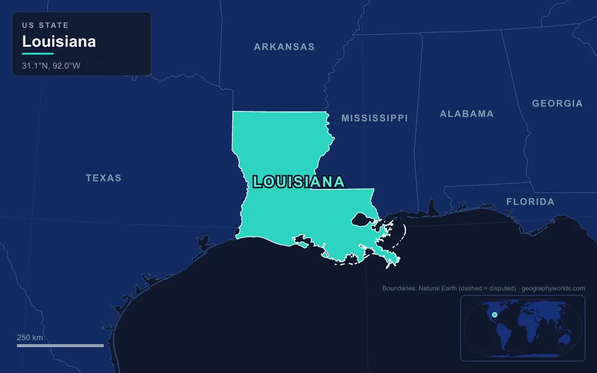
Louisiana’s main rivers are the Mississippi, which runs about 970 km (600 mi) through the state to the Gulf of Mexico; the Atchafalaya, its 220 km (137 mi) distributary, which takes 30% of the combined Mississippi and Red River flow; the Red River, which crosses the north-west from Shreveport; the Ouachita in the north-east; the Sabine and Pearl, which mark the western and eastern borders; the Calcasieu in the south-west; and a web of former Mississippi channels called bayous, led by Bayou Teche and Bayou Lafourche. Together they make up a natural network of navigable waterways more than 6,400 km (4,000 mi) long in a state of 135,382 km² (52,271 sq mi), about 15% of it water. River sediment built much of Louisiana, including all of its southern swamps and marshes, which is why the land is so low: the highest point, Driskill Mountain, reaches only 163 m (535 ft), while parts of New Orleans lie about 2.4 m (8 ft) below sea level. Where rivers flowed, people settled, farmed, fought over borders and built cities.
Settling on the natural levee: New Orleans, Baton Rouge and the Mississippi corridor
The Mississippi drains more than 3,220,000 km² (1,245,000 sq mi), all or part of 32 U.S. states and two Canadian provinces, and all of that water reaches the sea through Louisiana. Over thousands of years each flood dropped its coarsest sediment right beside the channel, so the river now flows along a ridge of its own making, a natural levee, from which finer silt settled on gentler slopes further out. In a region of swamp and marsh, that ridge was the highest, driest ground, and the French Mississippi Company chose it in the spring of 1718 when Jean-Baptiste Le Moyne de Bienville founded New Orleans on land traditionally inhabited by the Chitimacha.
The same pattern holds today. New Orleans’s oldest and densest neighbourhoods sit on the higher ground near the river; areas near the base of the river levee in Uptown stand about 6 m (20 ft) above sea level. As the city spread into drained backswamp, those newer districts subsided, and the city as a whole now averages 0.3 to 0.6 m (1 to 2 ft) below sea level, with some areas 2 m (7 ft) under.
The river has also shaped Louisiana’s economy. Between Baton Rouge, the state capital, and New Orleans, the navigation channel is at least 14 m (45 ft) deep, enough for container ships, cruise ships and bulk carriers. The ports of New Orleans, South Louisiana and Baton Rouge line the banks, and the Port of South Louisiana alone, centred on LaPlace, stretches 87 km (54 mi) and handles some 60% of raw grain exports shipped down from the Midwest. Protecting this corridor from floods has come at a price for others. During the Great Mississippi Flood of 1927, New Orleans bankers arranged for about 30 tons of dynamite to breach the levee at Caernarvon on 29 April, sending 7,000 m³/s (250,000 cu ft/s) of water across much of St. Bernard Parish and the east bank of Plaquemines Parish to spare the city. It proved unnecessary: major levee breaks upstream, one of them the very next day, relieved the pressure anyway. Afterwards the Bonnet Carré Spillway, built between 1929 and 1931 about 19 km (12 mi) west of New Orleans, gave the river a planned outlet into Lake Pontchartrain; it was first opened in the flood of 1937.
The Red River’s Great Raft, Natchitoches and Shreveport
The Red River, 2,190 km (1,360 mi) long and named for the reddish water it picks up from the red-bed country in its watershed, enters Louisiana from Arkansas and runs south-east across the state. For centuries it carried an obstruction unique in North America for its scale. The Great Raft was a tangle of logs, vegetation and sediment that may have begun forming in the 12th century or earlier, growing at its upper end while rotting away at its lower end. By the early 1830s it covered more than 260 km (160 mi) of river. The Caddo people, who lived in the valley for millennia, saw it as a protector, and the floods it caused enriched their fields. By raising the river’s banks it also backed water into tributaries, creating the Great Raft Lakes, among them Caddo Lake on the Texas line.
The raft decided where towns grew. At the start of the 19th century it reached down to Campti, which made Natchitoches the head of navigation. Natchitoches had been founded in 1714 by Louis Juchereau de St. Denis as a French post on the Red River for trade with Spanish Mexico, and it is the oldest permanent European settlement in the whole of the 1803 Louisiana Purchase.
In 1829 the U.S. Army Corps of Engineers hired Henry Miller Shreve, a steamboat builder who had invented the snag boat, to break the raft. He arrived in April 1833 with four snag boats and 159 men, and by the spring of 1838 had cleared a path through about 115 km of logs, opening the upper river to steamboats. The city of Shreveport was named after him. Downstream, the Red once flowed straight into the Mississippi; today it feeds the Atchafalaya, a change bound up with one more engineering project.
Old River, 1963: the Atchafalaya and the fight to keep the Mississippi in its bed
Before the 15th century the Red and Mississippi ran side by side. Then a westward loop of the Mississippi near present-day Angola, later called Turnbull’s Bend, cut into the Red, and the lower Red became a Mississippi distributary: the Atchafalaya, from the Choctaw for “long river”. In 1831 Shreve dug a canal across the neck of Turnbull’s Bend to save steamboats a 32 km (20 mi) detour, and between 1839 and 1840 locals removed a log raft on the Atchafalaya itself. With both obstacles gone, water flowed west into the Atchafalaya more and more often, and by 1880 the connecting channel, Old River, rarely flowed east at all.
The Atchafalaya offers the Mississippi a shorter, steeper route to the Gulf, and left alone it would capture the main flow, leaving Baton Rouge and New Orleans on a dwindling side channel. To stop that, the Corps of Engineers completed the Old River Control Structure near Simmesport in 1963. It holds the split at about 70% down the Mississippi and 30% down the Atchafalaya; after the 1973 flood damaged the original low-sill structure, an auxiliary structure was added, and in extreme floods the Morganza Spillway, at river mile 280 in Pointe Coupee Parish, can also send water into the basin.

That 30% has built a distinctive landscape. The Atchafalaya Basin between Simmesport and Morgan City is the largest swamp wetland in the United States, about 70% forest, and its 110,000 ha (260,000 acres) of cypress–tupelo swamp are the largest remaining tract of coastal cypress in the country. The river is the cultural heart of Cajun Country and a busy industrial shipping channel, and since 1942 part of its flow has been sent to the Gulf through the Wax Lake Outlet to protect Morgan City from floods. It is also building land. Since the late 20th century a new delta has been growing in Atchafalaya Bay, the only place on the Louisiana coast that is gaining ground. Elsewhere, levees that stop floods from spreading sediment, canals cut for logging and oil and gas, and rising seas have cost the state about 4,700 km² (1,800 sq mi) of land between 1932 and 2010.
Bayou Teche and Bayou Lafourche: old Mississippi channels that became Acadiana’s main streets
The youngest land in Louisiana is a patchwork of deltas the Mississippi has built and abandoned over the last 12,000 years: the Maringouin, Teche, St. Bernard, Lafourche and modern lobes, and now the Atchafalaya. Each time, the river left behind a slow, narrow channel on its own raised levees, and those ridges became the obvious places to live.
Bayou Teche, 201 km (125 mi) long, was the Mississippi’s main course when it built a delta about 2,800 to 4,500 years ago. It now begins at Port Barre, drawing water from Bayou Courtableau, and runs south past Breaux Bridge, St. Martinville, New Iberia and Franklin to meet the lower Atchafalaya at Patterson. When Acadians exiled from Canada arrived in the 18th century, in what was then the Attakapas region, the Teche was their main highway. Farming depended on its water: after levees went up along the Atchafalaya in the 1930s the bayou and its rice farms lost much of their fresh supply, so between 1976 and 1982 the Corps built a pumping station at Krotz Springs to feed it again.
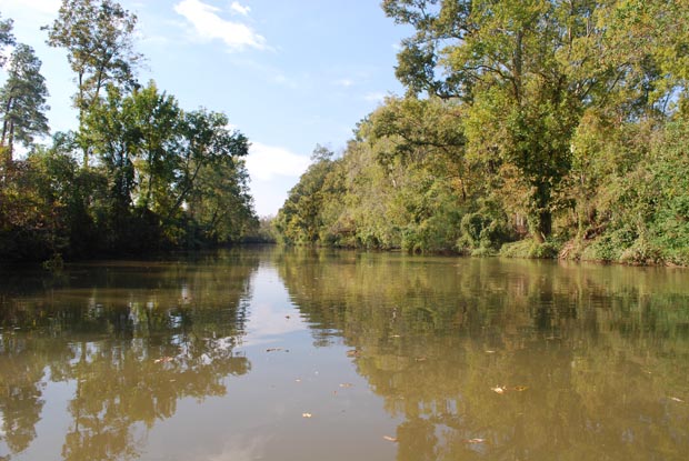
Bayou Lafourche, French for “the fork”, is 171 km (106 mi) long and was a working distributary of the Mississippi until 1904, when a dam at Donaldsonville sealed it off; since 1950 a pumping station has kept water flowing. The first Acadian settlements in southern Louisiana were near its banks, and houses and farms still line both levees so continuously, with Louisiana Highway 1 on one side and Highway 308 on the other, that it is known as “the longest Main Street in the world”. About 300,000 people drink water drawn from it.
The Sabine and the Pearl: rivers that drew Louisiana’s borders
Rivers also fixed where Louisiana ends. After the 1803 Louisiana Purchase, the United States and Spain disagreed over the western limit; the U.S. pressed hardest for the Sabine River, while Spain pointed to the Arroyo Hondo, a creek near Natchitoches. From 1806 to 1821 local officers left the land between them, the Neutral Ground, outside either country’s jurisdiction. The Sabine, 580 km (360 mi) long and named from the Spanish word for cypress, now forms the Texas–Louisiana boundary south of the 32nd parallel and empties into Sabine Lake; its lower course runs through one of the most industrialised stretches of the south-eastern United States.
On the east, the northern part of the boundary with Mississippi follows the Mississippi River, and after a straight stretch along the 31st parallel, the lower Pearl River, a blackwater stream 715 km (444 mi) long, forms the southern part. In the north-east, the Ouachita, 974 km (605 mi) from the Ouachita Mountains of Arkansas, joins the Tensas to form the Black River near Jonesville; the outpost of Fort Miro, now the Ouachita Parish seat, was renamed Monroe after the steamboat James Monroe first arrived there in the spring of 1820.
The deeper story of the bayous is told in our guide to Louisiana’s bayous, while the state’s uplands, coast and climate are covered in Louisiana geography, and the sediment the river still carries to the Gulf is the subject of our post on the Mississippi Delta.