
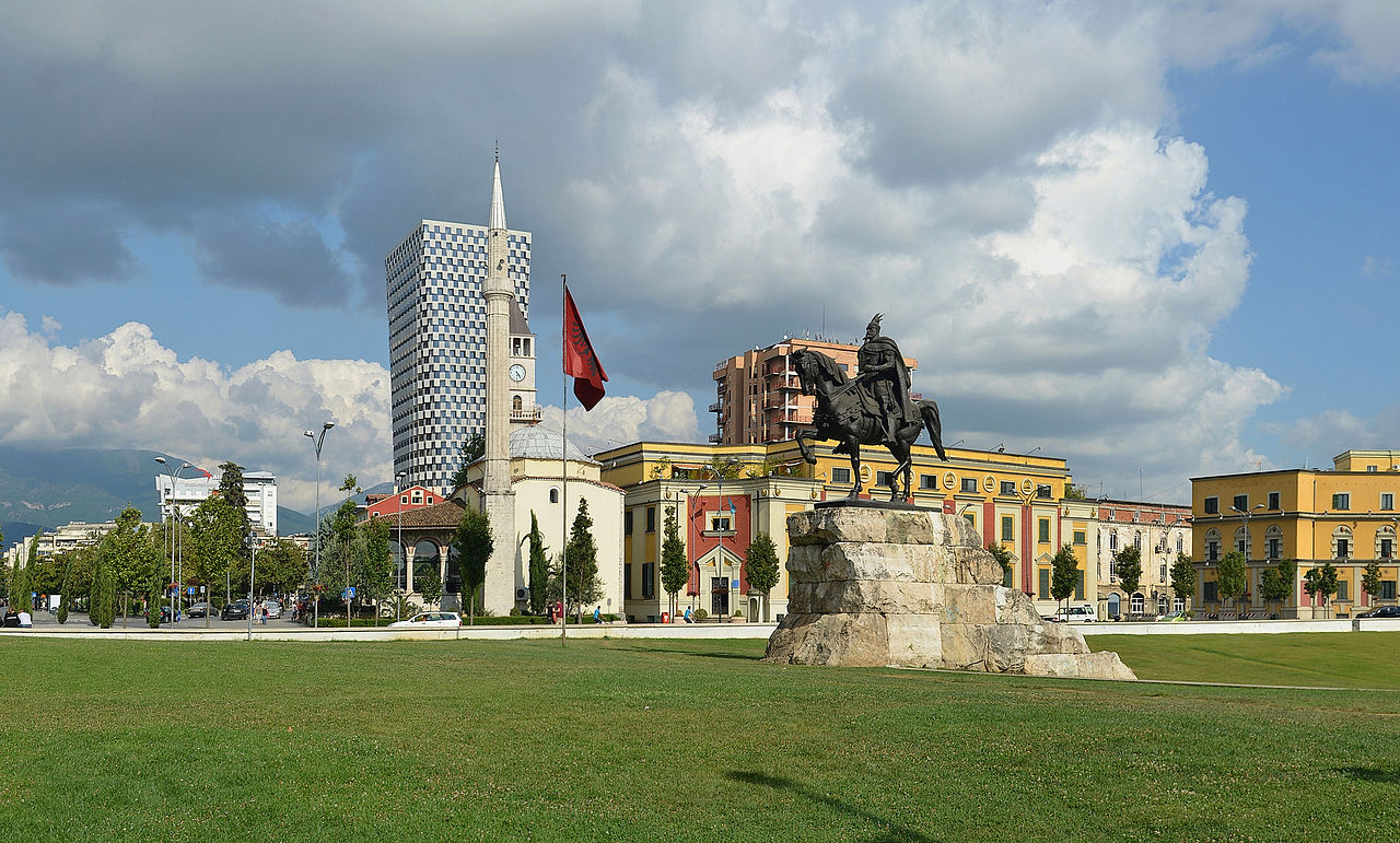
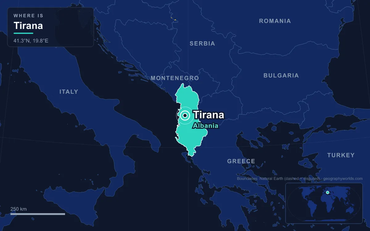
Tirana is the capital and largest city of Albania, with 598,176 residents in the municipality at the 2023 census and roughly a million people in the combined Tirana–Durrës metropolitan area, close to a third of the country. It lies in the centre of Albania on the Plain of Tirana, at an average height of about 110 metres, hemmed in by Mount Dajti to the east and low hills to the south, with a valley opening northwest toward the Adriatic Sea. That position, midway along the country and at the junction of its main roads, is why a small Ottoman bazaar town founded in 1614 was chosen as the capital in 1920.
The Plain of Tirana Beneath Mount Dajti
Stand anywhere in central Tirana and the eastern skyline is a single wall of mountain. Dajti, part of the Skanderbeg Mountains, runs for 8 kilometres from Shkalla e Tujanit in the northwest to the pass of Qafa e Priskës in the southeast, and its highest summit, Maja e Dajtit, reaches 1,613 metres. Its eastern face is steep, but the western slope descends gradually onto the plain, broken by Fusha e Dajtit, an ancient marine terrace formed in the Miocene. That terrace, reached by a narrow road, is the city's viewing balcony.
The mountain is layered by height. Up to about 600 metres the slope is flysch covered in Mediterranean scrub such as strawberry tree, juniper and heather; oak forest takes over between 600 and 1,000 metres, and beech and conifers grow above 1,400 metres, with limestone and karst near the top. South of the city the land rises into the hills of Kërrabe, Sauk and Vaqarr, and the municipality reaches its highest point, 1,828 metres, at Maja Mincekut on Mali me Gropa. Two protected areas frame the basin: Dajti National Park and the Mali me Gropa–Bizë–Martanesh Protected Landscape.
The basin shapes the weather. Tirana has a humid subtropical climate with about 1,266 millimetres of precipitation a year, most of it falling between November and March, enough to rank it among the wettest cities in Europe. It is also among the sunniest, with about 2,544 hours of sun a year. Average temperatures run from 6.7 °C in January to 24 °C in July, and snow is rare in the city even when Dajti is white. The flip side of an enclosed plain is trapped air: exhaust from ageing diesel cars and dust from construction make pollution a persistent problem, which led the government to ban imports of used vehicles made before 2005 from 1 January 2019.
The Lana River and the Crossroads at Justinian’s Fortress
Two small rivers cross the plain: the Tiranë and the Lana. The Lana is the one that runs through the city centre. It rises on the western slopes of Qafa e Priskës, drops through Dajti's foothills, and flows about 29 kilometres west across the plain to join the Tirana River near Bërxullë, draining a basin of about 67 square kilometres. In town it runs in a concrete-lined channel built for flood control.

Near the river, the flat plain and the routes across it produced a crossroads, and a crossroads produced a fortress. The Fortress of Justinian, also called Tirana Castle, stood where the main east–west and north–south roads met and formed the heart of the town. Its origins are Byzantine and it was restored by Ahmed Pasha Toptani in the 18th century. Today little survives above ground beyond a 6-metre Ottoman-era wall covered in vines, and the recently uncovered foundations are set into the pedestrian Murat Toptani Street; a traditional bazaar opened inside the walls in December 2018.
People had lived on the plain long before. The area was probably the core of the Illyrian kingdom of the Taulantii, and the oldest surviving find from the Roman period is a 3rd-century house later turned into a church with a mosaic floor. Ottoman land registers of 1431–1432 recorded 60 inhabited places in the Tirana area, with about 2,028 houses and 7,300 people. The settlement already had several watermills, and a bazaar had begun to grow before 1614, when the local ruler Sulejman Bargjini built the Old Mosque, a small commercial centre and a hammam. That date is taken as the city's founding. Two earlier mosques, the Mosque of Reç and the Mosque of Mujo, stood on the left bank of the Lana and were older still.
The finest survivor of Ottoman Tirana is the Et'hem Bey Mosque, begun in 1791 or 1794 by Molla Bey and finished in 1819 or 1821 by his son Haxhi Et'hem Bey, known for the frescoes of trees, waterfalls and bridges on its portico. Closed under communism, it was the scene on 18 January 1991 of a turning point in Albania's religious life, when 10,000 people entered it carrying flags despite official opposition.
Why a Plains Town Became the Capital in 1920
For three centuries Tirana was unimportant. It became a subprefecture in 1807, fell under the Toptani family of Krujë after 1816, and in the late Ottoman period belonged to the Sanjak of Durrës. Albania's independence was proclaimed at Vlorë on 28 November 1912, and Serbian troops occupied Tirana during the Balkan Wars until the Treaty of London forced them out in 1913. Then, on 8 February 1920, the Congress of Lushnjë named Tirana the temporary capital, and the choice was made permanent on 31 December 1925.
The geography made the case. Tirana lies in the middle of the country, a short distance inland from the port of Durrës and on the routes between the north and the south. Those routes are still its spokes: the SH1 runs north to Shkodër and Montenegro, the SH2 runs west to Durrës on the Adriatic, and the SH3, being rebuilt as the A3 motorway, follows the line of the ancient Via Egnatia east to Elbasan, Korçë and Greece. The A1 links the city with Kosovo through the Milot interchange.
A capital needed a centre, and the flat plain made it easy to draw one. The Austrians had laid out a public square in 1917 on the site of today's Skanderbeg Square, and in 1925 Armando Brasini drew a city plan, continued by Florestano Di Fausto, that set the ministries in a formal row. After the Italian invasion of 1939, Gherardo Bosio extended the plan south to the area now called Mother Teresa Square. It was in an officers' club, now the parliament building, that Zog was crowned King of the Albanians in September 1928.
The Artificial Lake and the Communist City of 1944–1991
The Communists took Tirana on 17 November 1944 after a fierce battle with German forces, and for the next half-century reshaped the plain around state needs. The Old Bazaar was razed for the Soviet-style Palace of Culture and the Orthodox Cathedral was demolished too, remaking Skanderbeg Square, a 40,000-square-metre plaza now dominated by the Skanderbeg Monument. The northern stretch of the main boulevard became Stalin Boulevard. Private cars were banned, so the flat streets carried bicycles, trucks and buses.
At the southern end of the main boulevard, the Grand Park at the Artificial Lake, built in 1955–1956 to a Bulgarian plan, covers 289 hectares, including a 55-hectare lake and a 14.5-hectare botanical garden. Nearby, the Blloku quarter was sealed off for members of the politburo and left unmarked on most maps; since 1991 it has become the city's upmarket bar and shopping district. The Pyramid of Tirana opened in 1988 as a museum to Enver Hoxha, three years after his death, and reopened in 2023 as a technology centre for young people. In 1991, student protests that began on the university campus ended in Skanderbeg Square with the toppling of Hoxha's statue.
A Basin Filling Up: 598,176 People and the Tirana Greenbelt
Since communism ended the plain has filled fast. Between 1989 and 2011 the city's population grew by about 2.7% a year, driven by migrants from across Albania, and the 2023 census counted 598,176 residents in the municipality, which at 502 people per square kilometre is the most densely populated in the country. A 2015 territorial reform merged the city with 13 surrounding communes, among them Dajt, Farkë, Kashar, Petrelë and Vaqarr, pushing the municipal boundary up the mountains.
Edi Rama, mayor from 2000 to 2011, bulldozed illegal buildings from the banks of the Lana and had facades painted in bright colours, though critics said the cosmetic changes left water and power shortages unsolved. The city also sits in an active seismic zone: a magnitude 5.6 earthquake centred near Durrës struck in September 2019, and a magnitude 6.4 shock hit the same region in November, though it did comparatively little damage in Tirana.

The plan now is to hold the edges. Four new parks were started in 2015 in Kashar, Farkë, Vaqarr and Dajt, and designated green areas around the city form the Tirana Greenbelt, where construction is banned or limited. The southern section of a ring road, first proposed in 1989, was begun in 2011, while the northern and eastern sections are still being planned. Tirana was European Youth Capital in 2022 and hosted the first EU–Western Balkans summit held outside the European Union in December of that year.
For the country the capital commands, see our Albania country guide, and for how Tirana's plain fits the mountains and seas of the wider region, the guide to the geography of the Balkan Peninsula.
Quick Facts About Tirana
- Country: Albania
- Continent: Europe (Southern Europe)
- Country population: approximately 2.8 million
- Capital city status: Tirana is the capital of Albania, the seat of national government, and the location of foreign embassies, parliament, and the head of state's official residence.
Frequently Asked Questions
What is the capital of Albania?
The capital of Albania is Tirana. Tirana is the seat of national government, hosts most foreign embassies and consulates, and is typically where the head of state and parliament are located.
What continent is Tirana in?
Tirana, the capital of Albania, is located in Europe, in the Southern Europe region. As Albania's capital, Tirana serves as the country's primary connection to the broader Europen political, economic, and cultural sphere.
Why is Tirana the capital of Albania?
Tirana was chosen as the capital of Albania for reasons that typically combine geography, history, and politics. Capital city selections often reflect a desire for centrality (being accessible from across the country), historical importance (being a longstanding seat of government or culture), or neutrality (being acceptable to multiple regions or ethnic groups within the country). The specific reasons for Tirana's designation are detailed in the city's history above.
What is Tirana known for?
As the capital of Albania, Tirana is best known for housing the country's central government institutions — parliament, presidential or royal residences, supreme court, and key ministries. It is also typically a major cultural and economic center within Albania, hosting national museums, embassies, and signature monuments. The introduction and history sections above provide detailed coverage of the city's specific notable institutions and landmarks.
Related Pages
- Albania Country Guide — full geography, climate, economy, and culture overview
- Flag of Albania — meaning, history, and design of Albania's national flag