
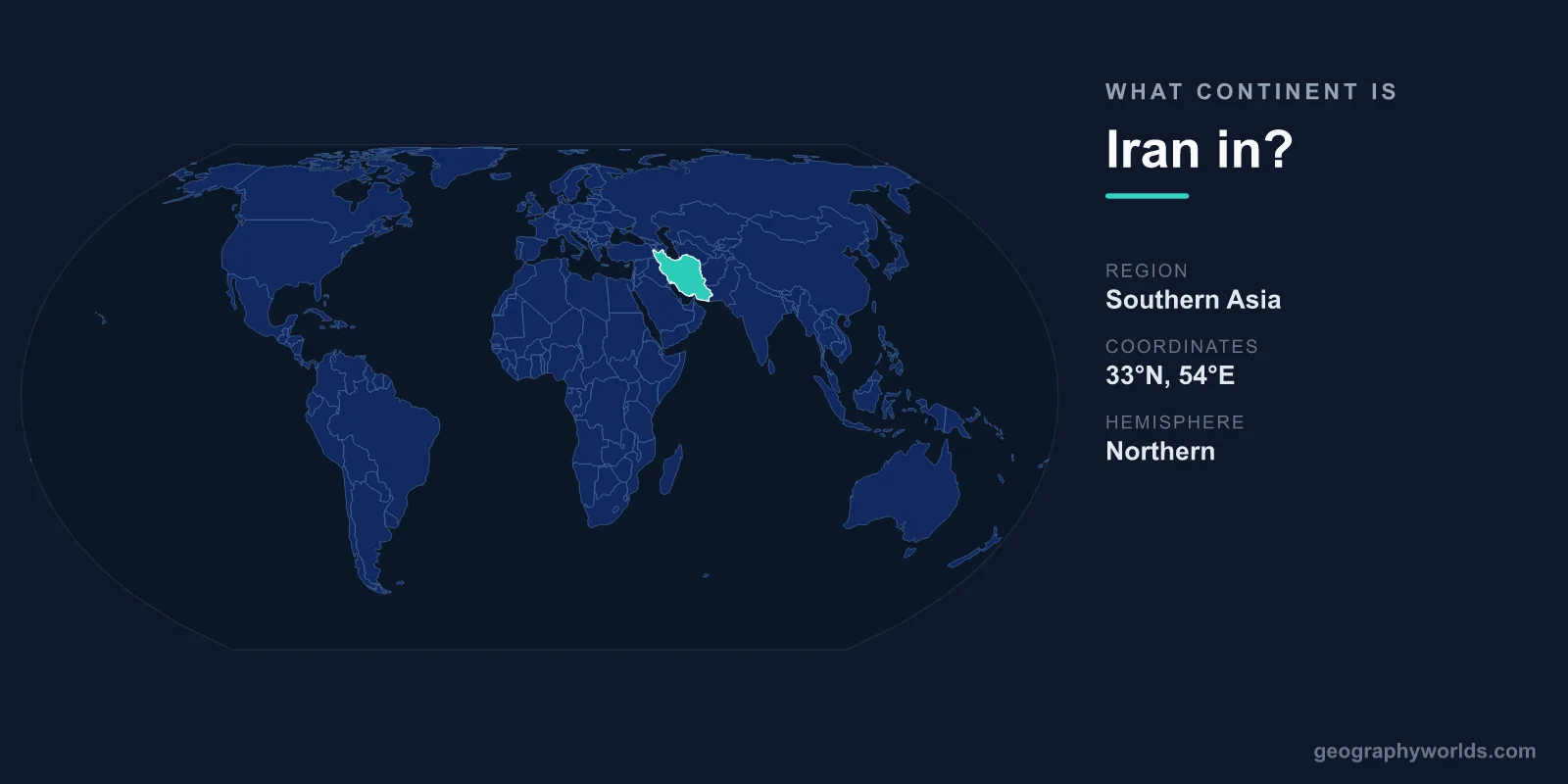
Iran is in Asia. Every common definition of the continents places the whole country on the Asian mainland, in the region usually called West Asia or the Middle East, between the Caspian Sea to the north and the Persian Gulf and Gulf of Oman to the south. It covers 1,648,195 km², ranks 17th in the world by area, and has a population of more than 92 million, which also ranks 17th. There is no serious case for putting Iran in Europe or Africa. The real argument is about which part of Asia it belongs to. Some schemes call it Western Asia, the United Nations statistics office files it under Southern Asia, and its history and trade also tie it to Central Asia.
The Caucasus Line and the Aras River: Iran’s Nearest Brush with Europe
The Europe–Asia boundary is a convention, not a coastline. It has been redrawn several times since Greek geographers first split the Old World into three parts in the 6th century BC. Anaximander and later Herodotus ran the line along the Phasis (the modern Rioni in Georgia) and then the Kura River to the Caspian. Ptolemy and the Roman-era authors used the Don. From the mid-19th century, three rival conventions were in use: the Don–Volga line, the Kuma–Manych Depression north of the Caucasus, and the watershed of the Greater Caucasus. The Caucasus crest became the standard choice in the later 20th century, and it is the line most atlases, including the National Geographic Society’s, still draw.
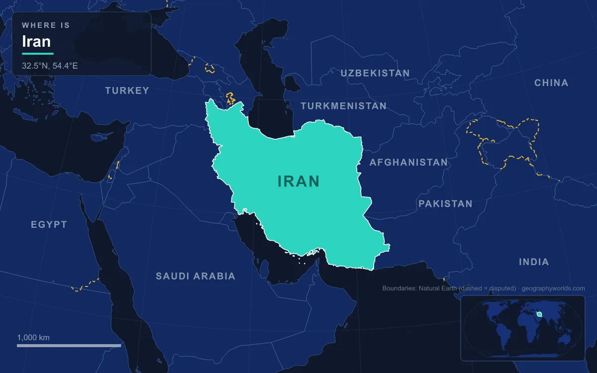
None of these lines comes near Iran. The closest any convention gets is a scheme described by Encyclopædia Britannica that uses the Aras River and the Turkish border as the continental divide, which would put Armenia, Azerbaijan and Georgia in Europe. The Aras is Iran’s own northern frontier. Rising in eastern Turkey, the 1,072 km river runs along Iran’s borders with Azerbaijan, including the exclave of Nakhchivan, and with Armenia. Under that reading the edge of Europe would run along the riverbank at towns such as Jolfa, but Iran would still lie entirely on the Asian side. Soviet usage had the same effect. For political, economic and historical reasons, the South Caucasus republics were often classed with the European part of the USSR, which treated the USSR’s southern border with Turkey and Iran as the edge of Europe, again leaving Iran just outside it.
Africa is even further from the question. The usual Africa–Asia line runs through the Isthmus of Suez, more than 1,000 km west of Iran’s border with Iraq. Geology adds one twist. Iran’s southwestern lowlands in Khuzestan sit on the Arabian plate, which was part of the African plate for most of Earth’s history until the Red Sea rift split them roughly 25 million years ago. That deep-time link has never been used to call any part of Iran African.
Iran on the Map: 24° to 40° North, 44° to 64° East
Iran lies between latitudes 24° and 40° N and longitudes 44° and 64° E. That is about 16 degrees from the Gulf of Oman coast up to the Aras valley, and 20 degrees from the Turkish frontier to the Afghan and Pakistani borders. Wikipedia’s figures make Iran the sixth-largest country lying wholly in Asia and the second-largest in West Asia after Saudi Arabia.
That box holds very different landscapes. Northern Iran faces the Caspian Sea with a humid lowland strip and the Hyrcanian forests, where summer temperatures rarely pass 29 °C. Directly behind the coast the Alborz range rises steeply. Its highest summit, Mount Damavand, reaches 5,610 m and is the highest volcano in Asia, 66 km northeast of Tehran. The east is a chain of desert basins. The Dasht-e Kavir is the largest, and in the Lut Desert satellites recorded a land-surface temperature of 70.7 °C in 2005, the highest ever measured. The south is a narrow coastal plain along the Persian Gulf and the Strait of Hormuz, which is about 39 km wide at its narrowest, with Oman’s Musandam Peninsula on the far shore.
Iran’s total coastline is about 2,440 km. Its Caspian shore makes it one of five countries around that inland sea, alongside Russia, Kazakhstan, Azerbaijan and Turkmenistan. Its Gulf shore faces the Arabian Peninsula. Both coasts sit squarely within Asia.
The Iranian Plateau and the Zagros: Where Arabia Pushes into Eurasia
Most of the country lies on the Iranian Plateau, a geological unit of about 3.7 million km². It stretches nearly 2,000 km from the Caspian to the Sulaiman Mountains and takes in most of Iran, all of Afghanistan and the parts of Pakistan west of the Indus. The plateau is part of the Eurasian plate and is squeezed between the Arabian plate to the southwest and the Indian plate to the east. It is far from flat. Its highest point is Noshaq in Afghanistan’s Hindu Kush at 7,492 m, and its lowest is the floor of the Lut Desert east of Kerman.
The plateau’s western wall is the Zagros, a range about 1,600 km long. It starts in northwestern Iran, follows the Iraqi and Turkish borders and ends at the Strait of Hormuz. The Zagros formed mainly in the Miocene, between about 25 and 5 million years ago, when the Arabian plate drove into Eurasia and folded the sediments on its margin into long parallel ridges. That collision is still going on. It is why Iran is so prone to earthquakes: one of magnitude 7.0 or more strikes on average once a decade, and the 2003 quake destroyed much of the city of Bam. The Zagros’s highest peak is Mount Dena, at 4,409 m.

In continental terms, the Zagros is where geology and the usual map labels line up. The Mesopotamian lowland of Iraq and Khuzestan lies on the Arabian plate, and the plateau beyond the range lies on the Eurasian plate. Both are counted as Asia. Iran therefore straddles a plate boundary but not a continental one.
Seven Land Neighbours from Iraq to Pakistan
Every country bordering Iran is Asian under the usual Caucasus-crest convention, or, in the case of Turkey and Azerbaijan, mostly Asian. Iran shares land borders with seven countries. Wikipedia’s border article gives a total of 5,894 km, and the seven segments it lists add up to about 5,840 km:
The longest frontier, with Iraq, runs from the Turkish tripoint down the Zagros foothills to the Persian Gulf. Its southern end follows the Shatt al-Arab, which Iranians call the Arvand Rud, to the sea. To the northeast, the 1,148 km Turkmenistan border follows the Kopet Dag, a range that runs about 650 km from near the Caspian to the Hari River. To the east, the Afghan and Pakistani borders cross the dry country of Khorasan and Sistan and Baluchistan. The 44 km strip shared with Armenia, along the Aras, is the shortest. The Azerbaijan border is split in two by Armenian territory: one stretch faces the Nakhchivan exclave and the other the main part of Azerbaijan, ending near the Caspian at Astara.
Across the water, Iran has maritime boundaries with six more states in the Persian Gulf and Gulf of Oman: Kuwait, Saudi Arabia, Bahrain, Qatar, the United Arab Emirates and Oman. Its neighbours on every side are therefore countries of West, Central or South Asia. A fuller country-by-country guide is in our article on the countries that border Iran.
Southern Asia or Western Asia? How the UN M49 Scheme Files Iran
Here is the one place where an honest answer gets complicated. The United Nations Statistics Division’s geoscheme, built on the M49 coding system, divides Asia into five subregions. It defines Western Asia as the Armenian Highlands, Anatolia, Arabia, the Levant, Mesopotamia and the South Caucasus. Southern Asia covers the Indian subcontinent and the Iranian Plateau. Iran sits on the plateau, so in UN statistical tables it appears in Southern Asia, alongside Afghanistan, Pakistan, India, Bangladesh, Sri Lanka, Nepal, Bhutan and the Maldives, not alongside Iraq and Turkey.
The UN says plainly that these groupings exist “for statistical convenience”. They do not imply any political or cultural affiliation, and other UN agencies use different regions. Everyday English usage, newspapers and most atlases still describe Iran as part of the Middle East or West Asia. Wikipedia’s opening line calls it “a country in West Asia”. Both labels are defensible because they answer different questions. The geoscheme groups countries by physical region, and the Iranian Plateau runs on into Afghanistan and Pakistan. The Middle East label reflects history, religion and politics, which tie Iran closely to Iraq, the Gulf states and the Levant. For how that region is usually counted, see our overview of the countries of the Middle East.
Middle East, Central Asia or South Asia: Iran in ECO, SAARC and the AFC
The organisations Iran has joined reflect the same three-way pull, and all of them are Asian or Eurasian. In 1985 Iran, Pakistan and Turkey founded the Economic Cooperation Organization in Tehran. In 1992, after the Soviet Union broke up, it expanded to take in Afghanistan, Azerbaijan, Kazakhstan, Kyrgyzstan, Tajikistan, Turkmenistan and Uzbekistan, making it in effect a club for the Iranian Plateau and Central Asia. Iran is also one of nine observers at the South Asian Association for Regional Cooperation, whose eight full members run from Afghanistan to the Maldives. It joined the Shanghai Cooperation Organisation, which grew out of the Shanghai Five, formed in 1996 by China, Russia, Kazakhstan, Kyrgyzstan and Tajikistan, in July 2023. It became a full member of BRICS on 1 January 2024.
Sport offers the most everyday proof of where Iran sits. Its national football team plays in the Asian Football Confederation, not UEFA or the Confederation of African Football. Iran won the AFC Asian Cup three times in a row, in 1968, 1972 and 1976, and the football tournament at the Asian Games in 1974, 1990 and 1998. Kazakhstan and Israel have both moved from Asian to European football at various times. Iran never has.
So the short answer stands: Iran is an Asian country. The longer answer is that it is the hinge of Asia, a high plateau where Mesopotamia, the Caucasus, Central Asia and the Indian subcontinent all meet. That is why one source calls it West Asian and another South Asian. If you want to go further into its mountains, deserts and coasts, our guide to Iran’s geography follows the Alborz, the Zagros and the great salt basins in more detail.