
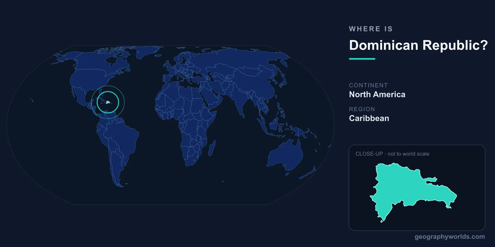
The Dominican Republic is located in the Caribbean, occupying the eastern two-thirds of the island of Hispaniola, which it shares with Haiti to the west. Geographically it belongs to North America and sits in the Greater Antilles, surrounded by the Atlantic Ocean to the north and the Caribbean Sea to the south. Its capital, Santo Domingo, lies on the southern coast, and the country covers roughly 48,671 km².
Where Exactly Is the Dominican Republic?
The Dominican Republic lies in the Northern and Western Hemispheres, between approximately 17 degrees and 20 degrees north latitude and around 68 to 72 degrees west longitude. It is part of the Greater Antilles, the chain of larger Caribbean islands that also includes Cuba, Jamaica, and Puerto Rico. Hispaniola, the island it occupies, is the second-largest island in the Caribbean after Cuba.
To picture its position, imagine flying southeast from Florida: after passing over Cuba you reach Hispaniola, with the Dominican Republic filling its eastern side. Puerto Rico lies just to the east across the Mona Passage, while the Turks and Caicos and the Bahamas sit to the north. This central location in the Caribbean has long made the country a crossroads for trade, migration, and tourism.
Sharing the Island of Hispaniola
The Dominican Republic is unusual in that it shares its island with only one other nation. Its single land border, running roughly 376 kilometres from north to south, separates it from Haiti, which occupies the western third of Hispaniola. The two countries have distinct languages, histories, and cultures despite sharing the same landmass.
- Haiti – the Dominican Republic's only neighbour by land, lying directly to the west.
Because the rest of the country is surrounded by water, the Dominican Republic also has an extensive coastline of around 1,288 kilometres, fronting both the Atlantic Ocean and the Caribbean Sea. This dual maritime exposure gives the nation a wide variety of beaches, bays, and coastal ecosystems.
The Landscape and Geography
Despite its modest size, the Dominican Republic is one of the most geographically varied countries in the Caribbean. Running through the centre of the country are the Cordillera Central mountains, home to Pico Duarte, which at roughly 3,098 metres is the highest peak in the entire Caribbean. The mountains feed numerous rivers and create cool, fertile valleys such as the Cibao, a major agricultural region.
The country also contains a striking geographic low point. Lake Enriquillo, a hypersaline lake in the southwest, sits about 46 metres below sea level, making it the lowest point in the Caribbean. Between the mountains and the coasts lie tropical lowlands, rainforests, mangroves, and the long sandy beaches that draw millions of visitors each year. This range of altitudes produces distinct microclimates, from humid coastal heat to noticeably cooler air in the highlands.
Cities, People, and How the Country Is Organised
Santo Domingo, the capital and largest city, sits on the southern coast at the mouth of the Ozama River. Founded by the Spanish in 1496, its Colonial Zone is recognised as the oldest permanent European settlement in the Americas and is a UNESCO World Heritage Site. Other important cities include Santiago de los Caballeros in the Cibao Valley and the tourism hub of Punta Cana in the far east.
The Dominican Republic is home to roughly 11 million people, the large majority of whom speak Spanish, the official language. The country is administratively divided into 31 provinces plus the National District around Santo Domingo. It operates as a presidential republic, and the national currency is the Dominican peso (DOP). If you want a fuller picture of the nation's history, economy, and culture, see our dominican republic country guide.
Frequently Asked Questions
What continent is the Dominican Republic on?
The Dominican Republic is part of North America, specifically the Caribbean region within the Greater Antilles. Although it is an island nation, geographers classify the Caribbean islands as part of the North American continent.
What country does the Dominican Republic share a border with?
It shares one land border, with Haiti, which occupies the western third of the island of Hispaniola. The rest of the Dominican Republic is bounded by the Atlantic Ocean and the Caribbean Sea.
Is the Dominican Republic the same as Dominica?
No. The Dominican Republic is a large Spanish-speaking nation on Hispaniola in the Greater Antilles. Dominica is a much smaller, separate island country in the Lesser Antilles where English is the official language. The two are often confused but are entirely different nations.
What is the capital of the Dominican Republic?
The capital is Santo Domingo, located on the country's southern Caribbean coast. It is the largest city and the political, economic, and cultural centre of the nation.