
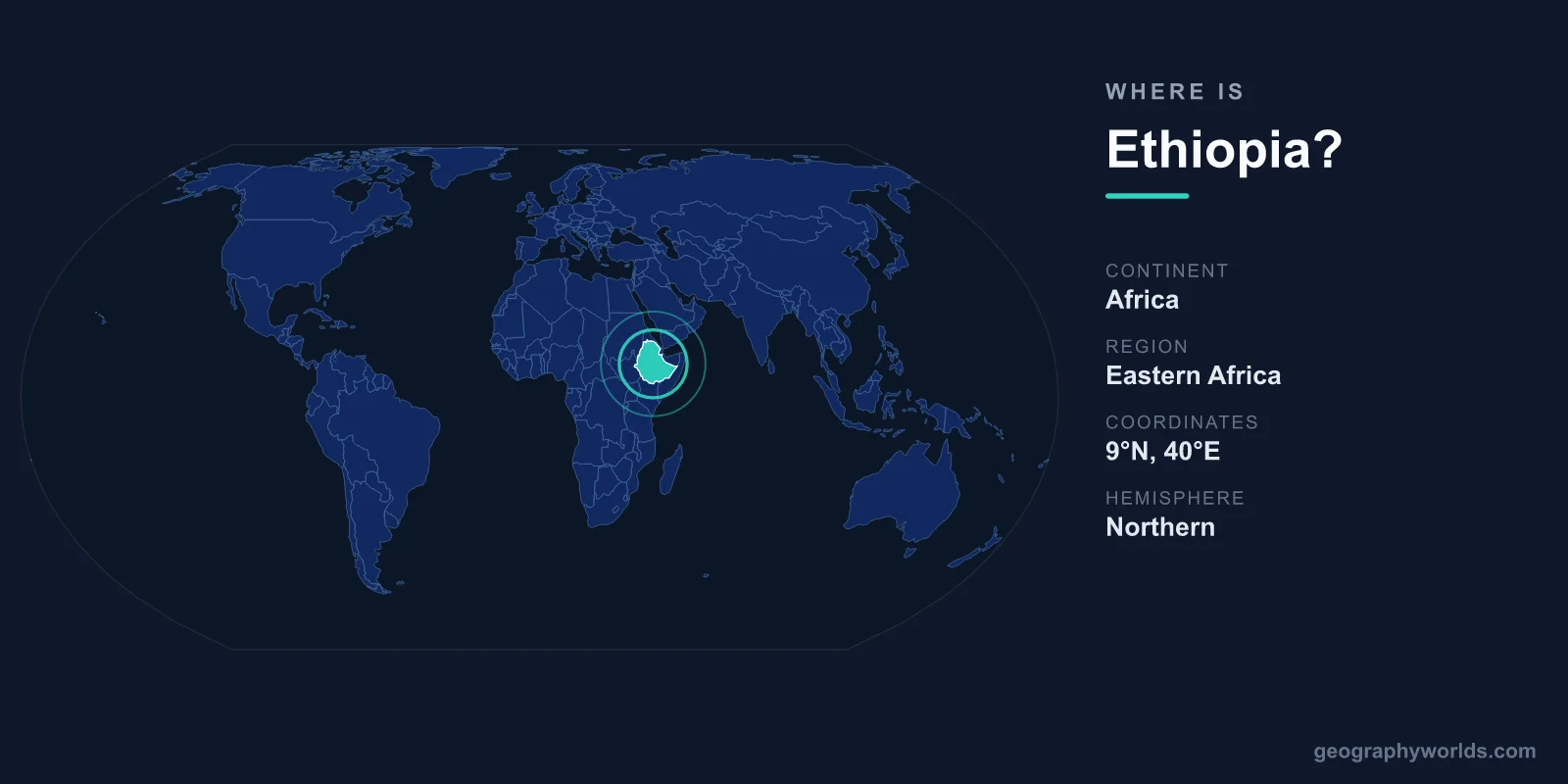
Ethiopia is a landlocked country in the Horn of Africa, in eastern Africa, bordered by Eritrea, Djibouti, Somalia, Kenya, South Sudan, and Sudan. Its capital, Addis Ababa, sits in the central highlands at roughly 9.03° N, 38.75° E. Ethiopia lies entirely in the Northern and Eastern Hemispheres and covers about 1,104,300 km² — close to twice the size of France and the tenth-largest country in Africa.
Ethiopia on the world map
Ethiopia occupies the heart of the Horn of Africa, the peninsula that juts eastward from the African mainland toward the Arabian Sea. Find it just south of the Red Sea, roughly between the Equator and the Tropic of Cancer. The country is large and roughly diamond-shaped, stretching from about 3.4° N near Lake Turkana in the south to about 14.9° N near the Eritrean border in the north. From east to west it spans roughly 33° E to 48° E, putting its eastern edge directly opposite Yemen across the narrow mouth of the Red Sea.
A quick orientation:
- Continent: Africa (eastern Africa)
- Region: Horn of Africa
- Hemispheres: Northern and Eastern
- Capital coordinates: 9.0250° N, 38.7469° E (Addis Ababa)
- Time zone: East Africa Time, UTC+3
Despite sitting in the tropics, much of Ethiopia is cool and temperate because of its elevation. Addis Ababa stands at about 2,355 m, making it one of the highest national capitals in the world — high enough that visitors sometimes feel the thin air on arrival.
How far is Ethiopia from the Equator and the sea?
Ethiopia's southern tip nearly touches the Equator at around 3.4° N, while its northern frontier reaches close to 15° N. That spread of roughly 1,200 km north to south, combined with elevations ranging from below sea level to over 4,500 m, gives the country an unusually wide range of climates packed into a single landmass. The lowlands of the Afar and Ogaden are searingly hot, while the highland plateaus enjoy spring-like weather year-round.
Although it has no coast of its own, Ethiopia is not far from the sea. The Red Sea lies just beyond Eritrea and Djibouti to the northeast, and the Gulf of Aden opens to the east beyond Somalia. The nearest major seaport, Djibouti City, sits only about 750 km by rail from Addis Ababa. This proximity to the world's busiest shipping lanes — the routes funneling through the Bab el-Mandeb strait toward the Suez Canal — gives Ethiopia's location real strategic weight despite its landlocked status.
Which countries border Ethiopia?
Ethiopia has six land neighbors and no coastline. Going clockwise:
- Eritrea — to the north
- Djibouti — to the northeast
- Somalia — to the east and southeast
- Kenya — to the south
- South Sudan — to the southwest
- Sudan — to the west
Together these borders run for well over 5,000 km. The Kenyan border passes through Lake Turkana, the world's largest permanent desert lake, while the South Sudan boundary is one of the newest, dating to South Sudan's 2011 independence. The longest of the six frontiers is with Somalia to the east and southeast, much of it crossing the arid Ogaden plateau. For more on the country itself, see our ethiopia country guide.
Why Ethiopia is landlocked
Ethiopia is one of the world's most populous landlocked countries — but it was not always landlocked. Until 1993, it controlled the Red Sea coast of what is now Eritrea, including the port of Massawa. When Eritrea won independence after a long war, Ethiopia lost its entire coastline, its ports, and its navy in one stroke.
Today the country depends heavily on the neighboring port of Djibouti, through which the large majority of its imports and exports flow. The electrified Addis Ababa–Djibouti Railway, reopened in 2018, is the main artery linking Ethiopia's highland economy to the sea. Smaller volumes move through ports in Eritrea and the breakaway region of Somaliland, and the search for additional, more secure maritime access remains a live regional issue.
The landscape that defines its location
Ethiopia's place on the map is shaped by dramatic geology. The Great Rift Valley slices diagonally across the country from the Afar region in the northeast toward Lake Turkana in the southwest, splitting it into western and eastern highlands. This is the same rift system that runs from Mozambique to the Middle East, and Ethiopia is slowly tearing apart along it.
Surrounding the rift are the Ethiopian Highlands, the largest continuous mountain range in Africa, sometimes called the "Roof of Africa." They rise to Ras Dashen at about 4,550 m. In stark contrast, the Danakil Depression in the northeast plunges to roughly 125 m below sea level and ranks among the hottest places on Earth. Northern Ethiopia is also the source of the Blue Nile, which rises at Lake Tana and supplies most of the water reaching the Nile downstream — a fact that ties Ethiopia's geography directly to the water security of Sudan and Egypt far to the north.
A crossroads location with deep roots
Ethiopia's position on the Horn has made it a meeting point for peoples, faiths, and trade routes for thousands of years. Its highland heartland kept it relatively isolated and defensible, which is one reason Ethiopia is the only African country never to have been formally colonized. The same elevation gave it a cool, fertile plateau ideal for early agriculture; the Ethiopian Highlands are widely regarded as the birthplace of the coffee plant. Sitting near the Red Sea trade corridor, the country has long connected the African interior with Arabia, the Mediterranean, and the Indian Ocean world — a strategic role that still shapes its diplomacy today, with Addis Ababa serving as the headquarters of the African Union.
Key Facts
- Continent: Africa (Horn of Africa, eastern Africa)
- Capital: Addis Ababa (9.03° N, 38.75° E), elevation ~2,355 m
- Area: ~1,104,300 km² (10th-largest in Africa)
- Coastline: None — landlocked since 1993
- Bordering countries: Eritrea, Djibouti, Somalia, Kenya, South Sudan, Sudan (six)
- Highest point: Ras Dashen (~4,550 m); lowest: Danakil Depression (~125 m below sea level)
- Time zone: East Africa Time (UTC+3)
Frequently Asked Questions
What continent is Ethiopia in?
Ethiopia is in Africa, specifically eastern Africa within the Horn of Africa region. It is not in the Middle East, although it lies just across the Red Sea from the Arabian Peninsula. Addis Ababa hosts the headquarters of the African Union.
Is Ethiopia landlocked?
Yes. Ethiopia has no coastline and relies mainly on the port of Djibouti for sea access. It became landlocked in 1993 when Eritrea gained independence and took the entire Red Sea coast with it.
What are the coordinates of Ethiopia?
Ethiopia spans roughly 3° N to 15° N latitude and 33° E to 48° E longitude. Its capital, Addis Ababa, sits at about 9.0250° N, 38.7469° E in the central highlands.
Which countries surround Ethiopia?
Six countries border Ethiopia: Eritrea to the north, Djibouti to the northeast, Somalia to the east and southeast, Kenya to the south, South Sudan to the southwest, and Sudan to the west. None of these borders includes a coastline, so Ethiopia depends on its neighbors for access to the ocean.