
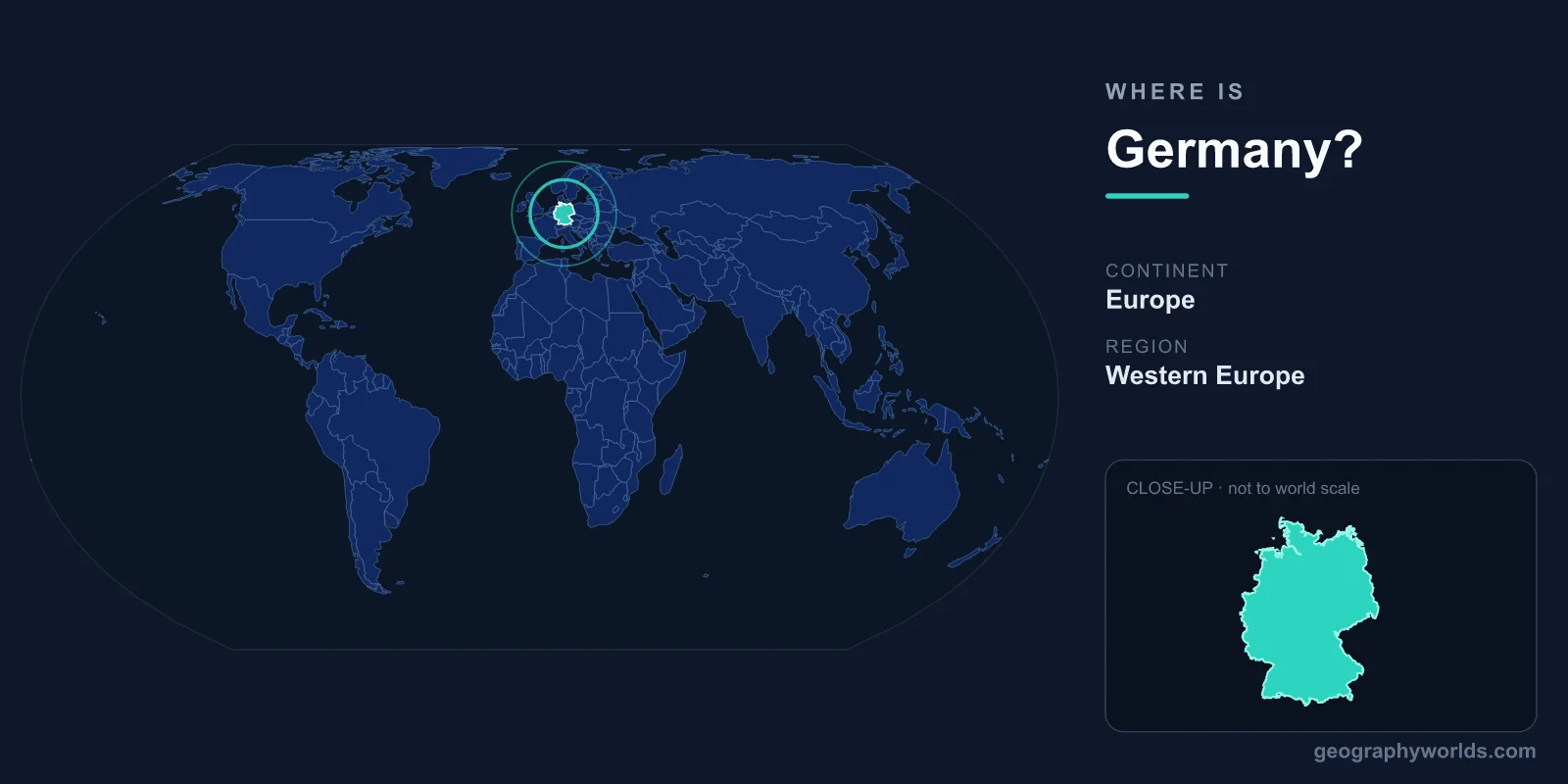
Germany is located in Central Europe, occupying the heart of the continent between the North Sea and Baltic Sea in the north and the Alps in the south. It sits in both the Northern and Eastern Hemispheres, shares land borders with nine countries, and covers about 357,000 km². Its capital, Berlin, lies in the country's northeast.
Where Exactly Is Germany on the Map?
Germany lies between roughly 47° and 55° north latitude and 6° and 15° east longitude, placing it squarely in the temperate zone of Central Europe. To picture it, find the broad band of land that connects Western Europe to the plains of Eastern Europe: Germany fills much of that gap. France and the Benelux nations sit to its west, Poland and the Czech Republic to its east, the Alpine states to the south, and Scandinavia just beyond its northern coast.
The country measures about 876 km from its northern tip at the Danish border to its southernmost point in Bavaria, and around 640 km from west to east. This central position has shaped German history for centuries, making the region a natural crossroads for trade routes, migrations, and the movement of ideas across the continent. Major cities reflect this spread: Hamburg sits on the northern rivers, Munich anchors the alpine south, and Cologne and Frankfurt cluster along the Rhine valley in the west.
Which Countries Border Germany?
Germany shares land borders with nine countries — more than almost any other nation in Europe — totalling roughly 3,700 km of frontier. Clockwise from the north, its neighbours are:
- Denmark to the north, across the narrow Jutland Peninsula
- Poland to the east, along the Oder and Neisse rivers
- Czech Republic to the southeast
- Austria to the south
- Switzerland to the south, near Lake Constance
- France to the southwest, along the Rhine
- Luxembourg to the west
- Belgium to the west
- Netherlands to the northwest
This dense web of neighbours places Germany at the centre of the European Union and helps explain why it has become the continent's largest economy and a key transit hub for goods, rail, and road traffic moving in every direction.
Germany's Coastlines and Seas
Although Germany can feel like an inland country, its northern edge meets two seas. The North Sea washes its northwest coast, while the Baltic Sea borders the northeast. Between them lies the Jutland Peninsula it shares with Denmark. These coastlines give Germany important ports such as Hamburg and Bremen, along with island chains like the North Frisian and East Frisian Islands and the resort island of Rügen in the Baltic.
The seas also moderate the climate of northern Germany, bringing cooler summers, milder winters, and frequent rainfall compared with the more continental conditions found further inland and to the east. Because the country lies well north of the Equator, it experiences clear seasonal swings, with long daylight hours in summer and short, dim days in winter.
From Lowland Plains to Alpine Peaks
Germany's terrain rises steadily from north to south, a pattern that defines its geography. The North German Plain stretches across the top of the country — flat, low-lying farmland and heath that connects to the great European plain reaching toward Russia. Moving south, the land gives way to the rolling hills and forested uplands of the Central German Highlands, including famous regions like the Black Forest, the Harz Mountains, and the terraced vineyards of the Rhine valley with its hilltop castles.
Further south still, the terrain climbs into the foothills of the Bavarian Alps. Here Germany reaches its highest point, the Zugspitze, at about 2,962 metres above sea level near the Austrian border. Major rivers such as the Rhine, Danube, Elbe, and Main thread through these landscapes, serving as vital transport arteries and shaping where Germany's great cities grew. The result is a compact country where a traveller can move from sea-level beaches to alpine summits in a single day's drive.
A Central Hub of the European Union
Germany's location at the core of Europe has made it indispensable to the continent's political and economic life. As the most populous member of the European Union, with roughly 84 million people, it borders more EU partners than any other state and forms a crucial bridge between Western and Eastern Europe. Berlin, the capital since reunification in 1990, sits surprisingly close to the eastern frontier with Poland — a legacy of the country's Cold War division. To learn more about the nation's regions, cities, and travel highlights, see our germany country guide.
Frequently Asked Questions
What continent is Germany on?
Germany is in Europe, specifically the Central Europe region. It lies in both the Northern and Eastern Hemispheres, north of the Alps and south of the Scandinavian Peninsula.
Is Germany in Eastern or Western Europe?
Germany is usually described as being in Central Europe rather than strictly east or west. It bridges the two, with western neighbours like France and the Netherlands and eastern neighbours like Poland and the Czech Republic.
How many countries border Germany?
Nine countries border Germany: Denmark, Poland, the Czech Republic, Austria, Switzerland, France, Luxembourg, Belgium, and the Netherlands. This is one of the highest numbers of land neighbours of any country in Europe.
What are the coordinates of Germany?
Germany's approximate geographic centre lies near 51° North latitude and 10° East longitude. Berlin, the capital, sits at roughly 52.5° North and 13.4° East in the northeastern part of the country.