
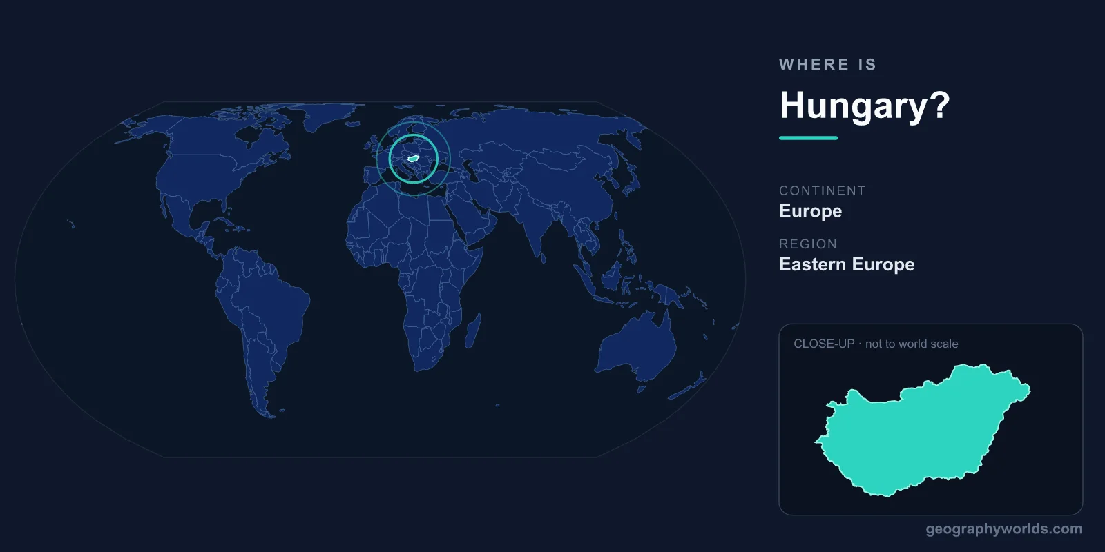
Hungary is a landlocked country in Central Europe, lying in the Carpathian Basin between roughly 45.7° and 48.6° North latitude and 16.1° and 22.9° East longitude. It is bordered by seven countries, sits squarely in the Northern and Eastern Hemispheres, and is dominated by the wide, flat expanse of the Great Hungarian Plain, with the Danube River flowing through its heart and through its capital, Budapest.
Where Exactly Is Hungary on the Map?
Hungary occupies a central position on the European continent, in the region commonly called Central Europe (sometimes grouped with Eastern Europe). It lies just east of the Alps and west of the Carpathian Mountains, nestled inside the natural bowl known as the Carpathian Basin or Pannonian Basin. This basin gives the country its characteristically gentle, lowland terrain.
To picture Hungary's position, find the Danube River as it bends southward through Europe. Budapest, the capital, sits on both banks of the Danube near the country's north. From there, Hungary spreads outward across an area of about 93,028 km² — making it a medium-small European nation, comparable in size to Portugal, or to the American state of Indiana. Despite its modest footprint, it is densely packed with rivers, plains, lakes, and historic towns.
Which Countries Border Hungary?
One of the clearest ways to locate Hungary is by its neighbors — it shares land borders with seven countries, more than most nations its size. Going roughly clockwise from the west, they are:
- Austria — to the west, linking Hungary to Western Europe
- Slovakia — to the north, across the Danube in places
- Ukraine — a short border to the northeast
- Romania — to the east, including the historic Transylvania region
- Serbia — to the south
- Croatia — to the southwest
- Slovenia — a small border to the west
This ring of neighbors places Hungary at a genuine crossroads of Europe. For centuries, trade routes, armies, and migrating peoples have passed through the Carpathian Basin, and Hungary's borders still reflect the major redrawing of Central European maps that followed the First World War.
Hungary's Landscape and Geographic Features
Hungary is famous above all for being flat and fertile. Roughly two-thirds of the country is lowland, dominated by the Great Hungarian Plain (the Alföld) east of the Danube — a vast stretch of grassland, farmland, and the unique puszta steppe. West of the Danube lies Transdanubia, a region of rolling hills and the country's most prominent highlands.
The country's defining waterway is the Danube, Europe's second-longest river, which enters from Slovakia in the north and flows south through Budapest before exiting toward Croatia and Serbia. The other great river, the Tisza, drains the eastern plains. Hungary is also home to Lake Balaton, the largest freshwater lake in Central Europe and a beloved summer destination. The highest point, Kékes in the Mátra mountains, reaches just 1,014 metres — a reminder that Hungary's terrain is more about open horizons than towering peaks.
The People, Capital, and How to Place Hungary
Hungary's capital and largest city, Budapest, is home to roughly one-fifth of the country's population of about 10 million. The official language is Hungarian (Magyar), which stands out in Europe as a Uralic language unrelated to the Germanic, Slavic, or Romance tongues of its neighbors — a linguistic clue to the Magyars' arrival in the basin over a thousand years ago. The dominant religious tradition is Christianity, with a strong Roman Catholic heritage.
Hungary is a parliamentary republic, a member of the European Union and NATO, and uses the Hungarian forint (HUF) rather than the euro. Its central time zone (CET) and landlocked position help fix it on any mental map of Europe: think of the heart of the continent, just downstream of Vienna along the Danube. For a deeper look at the country's regions, history, and culture, see our hungary country guide.
Frequently Asked Questions
Is Hungary in Eastern or Central Europe?
Hungary is most precisely described as being in Central Europe, occupying the Carpathian Basin. During the Cold War it was often grouped with Eastern Europe for political reasons, but geographically and culturally it belongs to the center of the continent, alongside Austria, Slovakia, and the Czech Republic.
Does Hungary have a coastline?
No. Hungary is completely landlocked, with no access to any sea. Its "inland sea," however, is Lake Balaton, which serves as the country's main summer beach destination. The nearest sea coast is on the Adriatic, reachable through neighboring Croatia or Slovenia.
What is the capital of Hungary and where is it located?
The capital is Budapest, located in the north-central part of the country on both banks of the Danube River. It was formed in 1873 by uniting the towns of Buda and Pest, and today it is the political, economic, and cultural center of Hungary.
How big is Hungary compared to other countries?
Hungary covers about 93,028 km², making it similar in size to Portugal or the U.S. state of Indiana. It is a medium-small country by European standards, ranking among the smaller nations of the continent but punching above its weight in cultural and historical influence.