
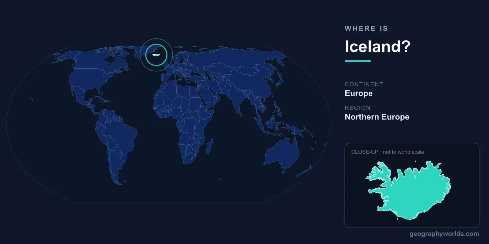
Iceland is a Nordic island nation in the North Atlantic Ocean, lying just south of the Arctic Circle between Greenland and mainland Europe. Geographically and politically it belongs to Northern Europe, sits in both the Northern and Western Hemispheres, and covers roughly 103,000 km². Its capital and largest city, Reykjavik, is the world's northernmost national capital. Because the island straddles the Mid-Atlantic Ridge, Iceland is one of the only places on Earth where two continental plates meet at the surface.
Where Exactly Is Iceland on the Map?
Iceland is centred at approximately 65° North latitude and 18° West longitude. That places it about 970 km west of Norway, 290 km east of Greenland, and 800 km northwest of Scotland. The island stretches across the open ocean between the European and North American landmasses, which is why it is sometimes described as a bridge between two continents.
Its northernmost point nearly touches the Arctic Circle, and the small island of Grímsey, just off the north coast, actually crosses it. This far-north position gives Iceland its dramatic seasonal light: near-endless daylight in June and only a few hours of sun in midwinter. Despite the latitude, the warm Gulf Stream (specifically its branch, the Irminger Current) keeps the climate far milder than other places this close to the Arctic. Average January temperatures in Reykjavik hover around freezing rather than the deep cold you might expect at 64° North.
To put the distances in perspective, Iceland is genuinely remote. There is no other country within a day's drive, and the only way in or out is by air or sea. Keflavík International Airport, near the southwestern tip, handles almost all international arrivals and sits roughly midway between North America and continental Europe, a position that has made Iceland a popular stopover hub for transatlantic flights.
Which Continent Does Iceland Belong To?
Politically and culturally, Iceland is part of Europe, and it is counted among the Nordic countries alongside Norway, Sweden, Denmark, and Finland. Geologically, however, Iceland is unique: it straddles the Mid-Atlantic Ridge, the boundary between the Eurasian and North American tectonic plates. The two plates are slowly pulling apart beneath the island at a rate of around 2 cm per year.
You can literally walk between continents at Thingvellir (Þingvellir) National Park, where the rift between the plates is visible at the surface as a dramatic series of fissures and walls of rock. This same geological setting is the engine behind Iceland's famous volcanoes, geysers, and geothermal energy. The island itself is essentially a volcanic hotspot that has built up above the ridge over millions of years, making it the largest landmass to sit directly astride a mid-ocean spreading boundary.
Iceland is also a young land in geological terms. Most of the surface rock is less than 20 million years old, and new ground is still being created during eruptions, such as the lava fields formed on the Reykjanes Peninsula during the eruptions that began in 2021.
Does Iceland Share Any Borders?
As an island, Iceland shares no land borders with any other country. Its entire boundary is coastline, totalling roughly 5,000 km of fjords, cliffs, black-sand beaches, and bays. The nearest inhabited neighbours are Greenland (a territory of Denmark) to the west and the Faroe Islands to the southeast.
This isolation shaped Iceland's history. Settled by Norse and Celtic people from around 874 AD, the island developed a distinct language and culture relatively insulated from continental Europe. Even today, modern Icelandic remains close enough to Old Norse that Icelanders can read medieval sagas with little difficulty. The country was united with Norway and later Denmark for centuries before gaining full independence as a republic in 1944.
Although it has no land neighbours, Iceland is well connected internationally. It is a founding member of NATO, belongs to the European Free Trade Association (EFTA) and the Schengen Area, and participates in the European single market through the European Economic Area, even though it is not a member of the European Union.
Key Geographic Features
Iceland's landscape is among the most geologically active and varied on Earth. Far from being a tropical isle, it is a sub-Arctic island of fire and ice. Notable features include:
- Volcanoes: Around 30 active volcanic systems, including Hekla, Katla, and Eyjafjallajökull, whose 2010 eruption grounded flights across Europe.
- Glaciers: Vatnajökull, the largest glacier in Europe by volume, covers roughly 8% of the country.
- Geothermal areas: Hot springs, mud pots, and geysers — the English word "geyser" comes from Iceland's Geysir.
- Waterfalls and highlands: A largely uninhabited interior plateau ringed by fertile coastal lowlands where most people live.
- Fjords and coastline: Deeply indented coasts, especially in the Westfjords and the east, carved by ancient glaciers.
Most of the population is concentrated in the southwest around Reykjavik, while the rugged interior — known as the Highlands — remains nearly empty and is impassable for much of the year. This contrast between a busy coastal capital region and a vast, almost lunar interior is one of the defining features of Iceland's geography.
Climate and Daylight
Iceland has a cool, maritime climate that is surprisingly mild for its latitude. Summers are short and cool, with temperatures usually ranging from 10 to 15 °C, while winters are relatively gentle near the coast but windy and stormy. The weather is famously changeable, and locals often joke that you can experience all four seasons in a single day.
The extreme daylight cycle is one of Iceland's most memorable characteristics. Around the summer solstice in late June, the sun barely sets, producing the "midnight sun" and weeks of near-continuous light. In contrast, the depths of December bring only four to five hours of low daylight. These long winter nights also make Iceland one of the best places in the world to see the aurora borealis, or northern lights.
Key Facts
- Region: Northern Europe, North Atlantic Ocean
- Continent: Europe (on the Mid-Atlantic Ridge)
- Capital: Reykjavik (world's northernmost capital)
- Area: approximately 103,000 km² (similar in size to Hungary or the U.S. state of Kentucky)
- Population: around 380,000
- Official language: Icelandic
- Currency: Icelandic Króna (ISK)
- Coordinates: roughly 65° N, 18° W
For a fuller picture of the country's people, history, and travel highlights, see our Iceland country guide.
Frequently Asked Questions
Is Iceland in Europe or North America?
Iceland is part of Europe politically and culturally, and it is a Nordic country. Geologically it spans the boundary between the Eurasian and North American tectonic plates, so it sits on both continental plates at once — but it is internationally regarded as a European nation.
Is Iceland close to Greenland?
Yes. Greenland is Iceland's nearest landmass, lying about 290 km to the west across the Denmark Strait. Despite the proximity, the two are very different: Greenland is largely ice-capped, while Iceland's warmer coastal climate supports towns, farms, and even small forests.
Is Iceland in the Arctic Circle?
Mainland Iceland lies just below the Arctic Circle, but it comes extremely close. The island of Grímsey, off the north coast, sits right on the line, making it the only part of Iceland that is genuinely within the Arctic Circle.
How big is Iceland?
Iceland covers about 103,000 km², making it the second-largest island in Europe after Great Britain. By area it is comparable to Hungary or the U.S. state of Kentucky, though its population is tiny by comparison.
How do you get to Iceland?
Because Iceland has no land borders, you can only reach it by air or sea. Most visitors fly into Keflavík International Airport near Reykjavik, while a smaller number arrive by ferry from Denmark via the Faroe Islands or aboard cruise ships during the summer months.