
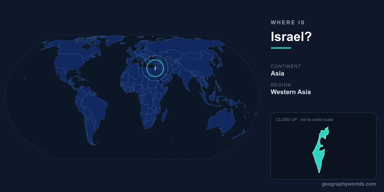
Israel is located in the Middle East, on the southeastern shore of the Mediterranean Sea, in the region of Western Asia. It sits between roughly 29.5°N and 33.3°N latitude and around 34.3°E to 35.9°E longitude, placing it firmly in the Northern and Eastern Hemispheres. This narrow strip of land bridges the Mediterranean world with the deserts of Arabia and connects the continents of Asia and Africa at one of history's most significant crossroads.
Where Exactly Is Israel on the Map?
Israel occupies a slender corridor along the eastern Mediterranean known historically as the Levant. To picture it, find the great curve of the Mediterranean's southeastern corner: Israel runs along that coastline, with the sea to the west and an arc of deserts and uplands to the east. The country is long and thin, stretching roughly 470 kilometres from north to south but measuring as little as 15 kilometres wide near the coast.
The country covers approximately 20,770 km² within its internationally recognised boundaries, making it one of the smaller nations in the world by area, comparable in size to Slovenia or the U.S. state of New Jersey. Despite this compact footprint, Israel spans a striking range of environments, from the snow-dusted slopes of Mount Hermon in the north to the searing Negev Desert in the south.
Bordering Countries and Coastlines
Israel shares land boundaries with several neighbours and is bounded by water on two sides. Its immediate neighbours are:
- Lebanon – to the north
- Syria – to the northeast, including the Golan Heights region
- Jordan – to the east, across the Jordan River and the Dead Sea
- Egypt – to the southwest, along the Sinai Peninsula
- The Palestinian territories – the West Bank to the east and the Gaza Strip to the southwest
To the west lies the Mediterranean Sea, giving Israel a coastline of about 270 kilometres dotted with cities such as Tel Aviv and Haifa. At its far southern tip, the resort city of Eilat opens onto the Gulf of Aqaba, a narrow arm of the Red Sea, providing Israel with a second, smaller maritime outlet. This position at the meeting point of seas and continents has made the region a hub for trade, migration, and cultural exchange for thousands of years.
A Land of Dramatic Contrasts
Few countries pack as much geographic variety into so small a space. Israel can be divided into four broad regions running roughly parallel from west to east. The Mediterranean coastal plain holds most of the population and the major coastal cities. Inland rise the central highlands, including the hills around Jerusalem and the green region of Galilee in the north, where Mount Meron reaches about 1,208 metres.
Further east lies one of the planet's most remarkable features: the Jordan Rift Valley, part of the Great Rift Valley system. Here sits the Dead Sea, whose shoreline at roughly 430 metres below sea level is the lowest point on any land surface on Earth. South of the highlands sprawls the Negev Desert, an arid triangle of rock, dune, and crater that makes up more than half of the country's land area yet holds only a fraction of its people.
Cities, Capital, and People
Jerusalem serves as Israel's seat of government and its largest city, a place of profound religious importance to Judaism, Christianity, and Islam. Tel Aviv, on the coast, is the country's economic and cultural engine, while Haifa is a major northern port. Around 9 million people live in Israel, and the country is highly urbanised, with most residents concentrated along the coastal plain and in the Jerusalem corridor.
Hebrew is the primary official language, and Arabic is widely spoken and holds special status. The national currency is the Israeli New Shekel (ILS). This blend of geography, history, and faith makes Israel one of the most studied and visited regions in the world relative to its size. For a deeper look at the country's history, economy, and travel highlights, see our israel country guide.
Climate and Time Zone
Israel has a Mediterranean climate along the coast and in the north, marked by hot, dry summers and mild, wet winters. Rainfall decreases sharply moving south and inland, fading into true desert conditions in the Negev and around the Dead Sea, where some areas receive only a few millimetres of rain a year. The country runs on Israel Standard Time (UTC+2), shifting to UTC+3 during daylight saving in the warmer months. Ben Gurion Airport, near Tel Aviv, is the main international gateway.
Frequently Asked Questions
What continent is Israel in?
Israel is located in Asia, specifically in the region of Western Asia known as the Middle East or the Levant. It lies very close to the boundary with Africa, separated from Egypt's African mainland only by the Sinai Peninsula.
What is the capital of Israel?
Jerusalem functions as Israel's capital and seat of government. It is also the largest city in the country and one of the oldest continuously inhabited cities in the world.
Is Israel a big country?
No. At around 20,770 km², Israel is a small country, similar in area to Slovenia or New Jersey. You can drive its full length in roughly six to seven hours, yet that short journey passes through coastal cities, green hills, and barren desert.
What body of water borders Israel?
The Mediterranean Sea forms Israel's western edge, while the Gulf of Aqaba on the Red Sea touches its southern tip at Eilat. Inland, the Dead Sea and the Sea of Galilee are two famous bodies of water along the eastern boundary.