
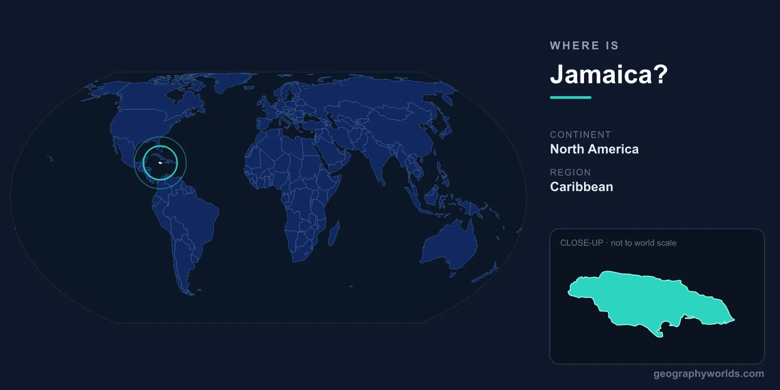
Jamaica is an island nation in the Caribbean Sea, located about 145 kilometres south of Cuba and roughly 190 kilometres west of the island of Hispaniola (Haiti and the Dominican Republic). It is the third-largest island in the Greater Antilles, covering an area of 10,991 km², with its capital and largest city, Kingston, on the southeastern coast.
Where Exactly Is Jamaica?
Jamaica lies in the northern Caribbean, between approximately 17° and 18° north latitude and 76° and 78° west longitude. This places it firmly within both the Northern and Western Hemispheres. Geographers classify the island as part of North America, sitting within the broad Caribbean sub-region rather than the South or Central American mainland.
The island stretches about 235 kilometres from east to west and ranges between 35 and 82 kilometres from north to south, giving it a long, narrow shape. Its position just south of the Tropic of Cancer means Jamaica has a warm tropical climate year-round, moderated along the coast by trade winds blowing in from the Atlantic and Caribbean Sea.
Jamaica's Neighbours and Surrounding Waters
As an island, Jamaica shares no land borders with any country. Instead, it is surrounded entirely by water, which makes the sea central to its identity, trade, and culture. Its nearest neighbours are:
- Cuba to the north, separated by the Cayman Trench and the open Caribbean.
- Haiti to the east, across the Jamaica Channel.
- The Cayman Islands to the northwest, a British Overseas Territory.
- Colombia, Honduras, and Nicaragua to the south and southwest, though these lie hundreds of kilometres away.
The Caribbean Sea borders the island on the south and west, while the wider Atlantic influences its northern shores. These warm waters host coral reefs, seagrass beds, and rich marine life that support both fishing and a thriving tourism industry.
The Landscape: Mountains, Coast, and Coves
Although Jamaica is compact, its terrain is strikingly varied. A mountainous spine runs through the interior, dominated by the Blue Mountains in the east. Their highest point, Blue Mountain Peak, rises to roughly 2,256 metres, making it the tallest summit on the island and a renowned source of premium coffee grown on its misty slopes.
To the west lies the Cockpit Country, a rugged limestone karst region riddled with sinkholes, caves, and steep conical hills. Around the edges of the island, narrow coastal plains give way to white-sand beaches, sheltered bays, and resort towns such as Montego Bay, Negril, and Ocho Rios on the north coast. Rivers like the Black River and the Rio Grande cut down from the highlands toward the sea, while limestone geology gives rise to dramatic features such as the cascading Dunn's River Falls.
People, Capital, and Way of Life
Jamaica is home to a population of around 3 million people, the majority of whom live in and around urban centres on the southern and northern coasts. Kingston, the capital, anchors the country's politics, business, and culture, and sits beside one of the largest natural harbours in the world.
English is the official language, used in government, schools, and business, while Jamaican Patois, an English-based creole, is widely spoken in everyday life. Christianity, especially Protestant denominations, is the dominant faith. Jamaica is a parliamentary constitutional monarchy and a member of the Commonwealth, and its national currency is the Jamaican Dollar (JMD). To dig deeper into the island's history, economy, and culture, see our jamaica country guide.
Why Jamaica's Location Matters
Jamaica's central position in the Caribbean has long made it a strategic crossroads. For centuries it lay along important shipping routes linking Europe, Africa, and the Americas, a history reflected in its diverse population and creole culture. Today, that same location keeps the island within easy reach of North American travellers, fuelling a tourism sector built around its beaches, music, and mountain scenery. Its tropical setting also exposes Jamaica to the Atlantic hurricane season, which runs from June through November and shapes how communities build and prepare each year.
Frequently Asked Questions
What continent is Jamaica on?
Jamaica is part of North America, situated within the Caribbean region. It is not part of South or Central America, though it lies relatively close to the Central American mainland.
What is Jamaica closest to?
Jamaica's nearest large neighbour is Cuba, around 145 kilometres to the north. Haiti lies to the east across the Jamaica Channel, and the Cayman Islands sit to the northwest.
Is Jamaica an island or a country?
It is both. Jamaica is a single main island (plus a few small surrounding cays) and an independent sovereign nation, having gained independence from the United Kingdom in 1962.
What ocean or sea surrounds Jamaica?
Jamaica is surrounded by the Caribbean Sea, which lies to its south and west, with the broader influence of the Atlantic Ocean to the north.