
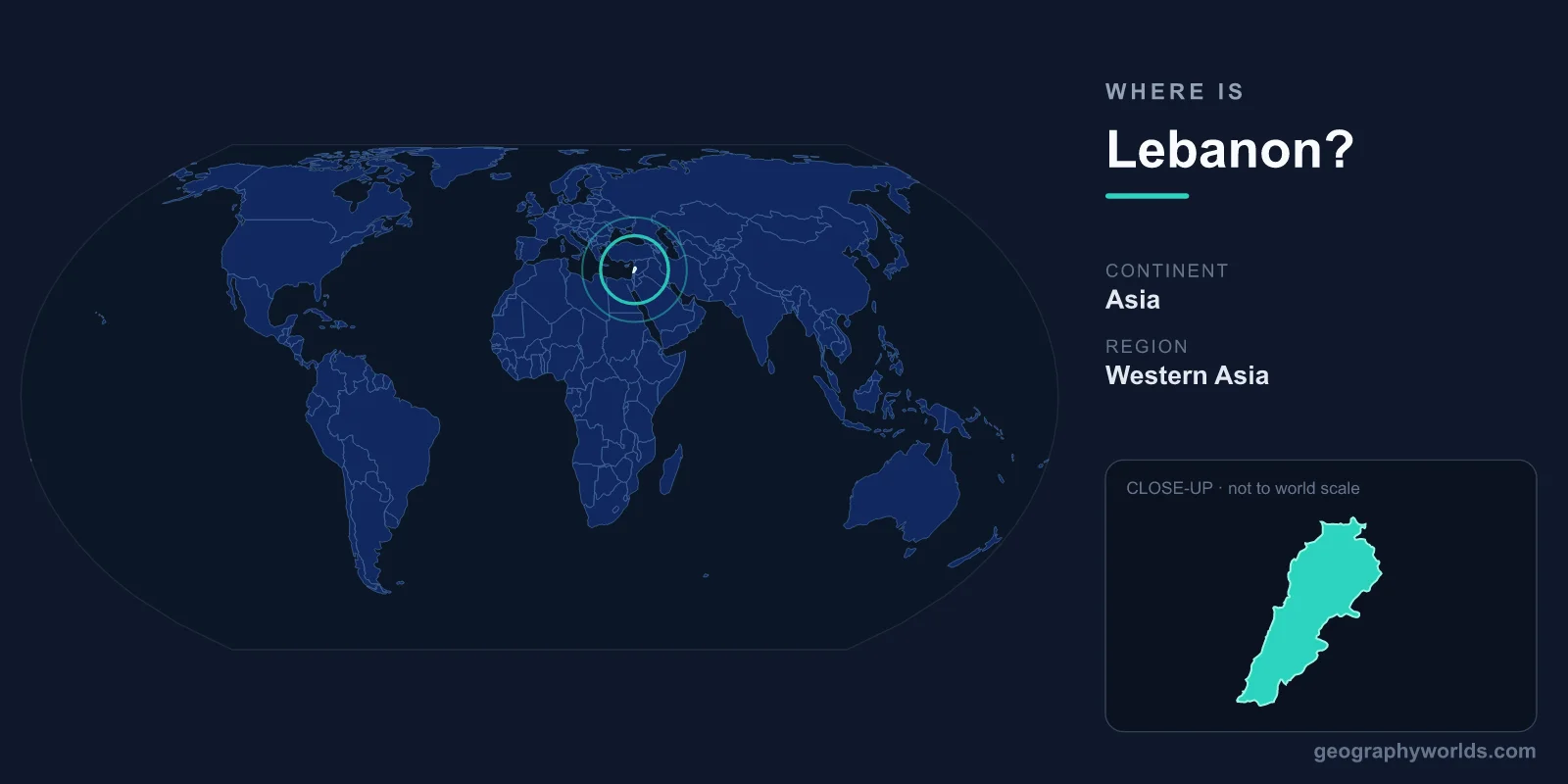
Lebanon is a small country in the Middle East, located on the eastern shore of the Mediterranean Sea in the region known as the Levant. It lies on the continent of Asia, bordered by Syria to the north and east and Israel to the south, with its western edge meeting the sea. The capital is Beirut, and Lebanon covers roughly 10,452 km², making it one of the smallest countries on the Asian mainland.
Where Lebanon Sits on the Map
Lebanon occupies a sliver of land along the easternmost curve of the Mediterranean coast. It is positioned in both the Northern and Eastern Hemispheres, sitting at roughly 33 to 34 degrees north latitude and 35 to 36 degrees east longitude. For comparison, that places Beirut at a latitude similar to parts of the southern United States and North Africa.
The country stretches only about 210 kilometers from north to south, and at its widest is barely 90 kilometers across. Despite this compact footprint, Lebanon packs in a remarkable variety of landscapes. You can stand on a Mediterranean beach in the morning and reach snow-covered mountains within a couple of hours, a contrast few places of its size can match. To learn more, see our lebanon country guide.
Countries That Border Lebanon
Lebanon shares land borders with only two countries, which strongly shapes its geography and history:
- Syria – borders Lebanon along the north and east, accounting for the great majority of its land frontier.
- Israel – borders Lebanon to the south along a much shorter boundary.
To the west, Lebanon's entire flank is open to the Mediterranean Sea, giving it about 225 kilometers of coastline. This maritime access has made the country a trading and seafaring hub since antiquity, when the ancient Phoenicians launched ships from ports such as Tyre, Sidon, and Byblos.
The Landscape: Mountains, Coast, and Valley
Lebanon's terrain is defined by four roughly parallel bands running north to south. From west to east, these are:
- A narrow coastal plain along the Mediterranean, where most of the population and major cities are concentrated.
- The Mount Lebanon range, the country's rugged backbone, whose highest peak, Qurnat as Sawda, rises to about 3,088 meters.
- The fertile Beqaa Valley, a high inland plateau that is the agricultural heart of the nation and home to the famous Roman temples at Baalbek.
- The Anti-Lebanon mountains, which form much of the natural border with Syria.
The name "Lebanon" itself is thought to derive from a Semitic root meaning "white," a reference to the snow that caps its peaks for much of the year. This combination of high mountains and Mediterranean coast gives the country its distinctive climate and scenery.
Climate and Natural Setting
Lebanon has a Mediterranean climate, with hot, dry summers and mild, wet winters along the coast. The mountains, however, create dramatic regional differences: higher elevations receive heavy snowfall in winter, supporting ski resorts within a short drive of the warm shoreline. This climatic range allows Lebanon to grow everything from olives and citrus near the sea to apples and grapes in the cooler highlands.
The country was historically famed for its cedar forests, and the cedar of Lebanon remains the national symbol, featured at the center of the national flag. While only scattered ancient groves survive today, they remain a powerful emblem of the country's natural heritage.
People and Culture in Their Geographic Context
Lebanon is home to roughly 5 to 6 million people, with a large share living in and around Beirut on the coastal plain. Arabic is the official language, though French and English are widely spoken, a legacy of trade, education, and a period of French administration in the twentieth century.
Lebanon is notable for its religious diversity, with significant Muslim and Christian communities living side by side, a balance reflected in its distinctive power-sharing system of government. The national currency is the Lebanese pound. The country's coastal position at the crossroads of Europe, Asia, and Africa has, for thousands of years, made it a meeting point of cultures, cuisines, and ideas.
Frequently Asked Questions
What continent is Lebanon on?
Lebanon is located on the continent of Asia, specifically in the Middle Eastern region known as the Levant, on the eastern shore of the Mediterranean Sea.
What countries border Lebanon?
Lebanon shares land borders with just two countries: Syria to the north and east, and Israel to the south. Its western boundary is the Mediterranean Sea.
What is the capital of Lebanon?
The capital and largest city of Lebanon is Beirut, a major Mediterranean port located on the coastal plain. It serves as the country's political, financial, and cultural center.
Is Lebanon a big country?
No, Lebanon is quite small, covering about 10,452 km². It is one of the smallest countries in mainland Asia, roughly comparable in size to the island of Cyprus or the US state of Connecticut.