
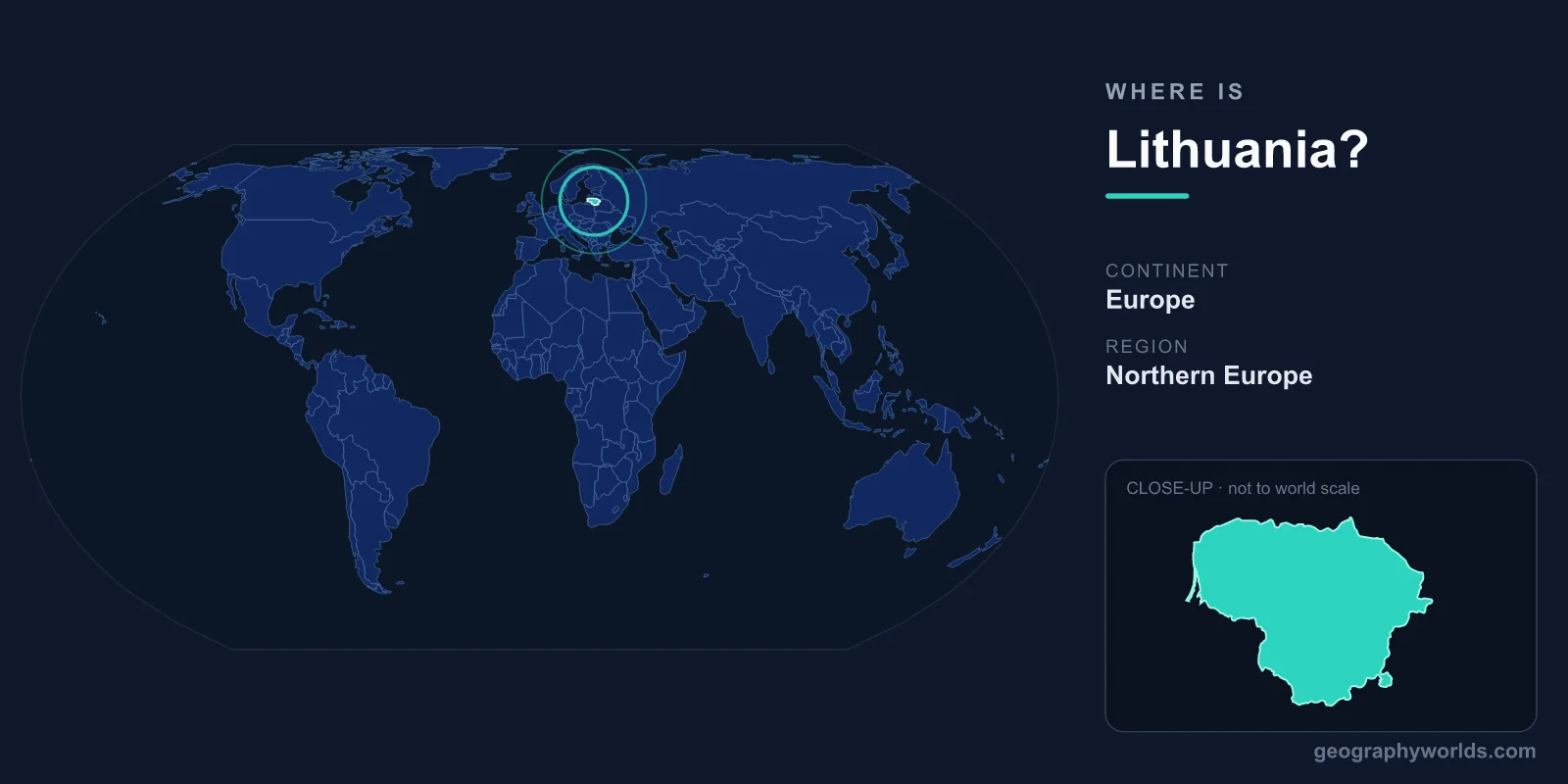
Lithuania is located in northeastern Europe, the southernmost and largest of the three Baltic states, sitting along the southeastern shore of the Baltic Sea between roughly 53.9°N and 56.4°N latitude and 21°E and 26.8°E longitude. Its capital, Vilnius, lies in the southeast of the country, and Lithuania covers about 65,300 km² in the Northern and Eastern Hemispheres.
Where Exactly Is Lithuania on the Map?
Lithuania occupies a strip of the European mainland that opens westward onto the Baltic Sea. To its north is Latvia, to the east and southeast is Belarus, to the south is Poland, and to the southwest is Russia's detached Kaliningrad Oblast. This places Lithuania at the meeting point of the Nordic-Baltic world and continental Eastern Europe, a crossroads it has occupied for centuries.
The country is part of the geographic region often called the Baltics, alongside Latvia and Estonia. Despite the shared label, Lithuania has its own distinct language and history. It is the most southerly of the three and, with a population of roughly 2.8 million, slightly the most populous as well. In land area it is comparable to Croatia, Costa Rica, or the U.S. state of West Virginia.
Which Countries Border Lithuania?
Lithuania shares land borders with four neighbors, plus a coastline on the Baltic Sea:
- Latvia — to the north, a fellow Baltic state and EU member.
- Belarus — to the east and southeast, the longest of Lithuania's land borders.
- Poland — to the south, Lithuania's main land link to the rest of the European Union.
- Russia (Kaliningrad Oblast) — to the southwest, an exclave separated from the Russian mainland.
The narrow strip of land between Poland and Belarus where Lithuania connects to Poland is known as the Suwałki Gap, a corridor that has drawn particular strategic attention because it is the only land bridge between the Baltic states and the rest of NATO and EU territory.
Lithuania's Coast and Physical Landscape
Lithuania's Baltic coastline stretches for about 90 kilometers, a modest but cherished frontage that includes one of Europe's most unusual landforms: the Curonian Spit, a long, thin sand-dune peninsula shared with Russia and recognized as a UNESCO World Heritage Site. The port city of Klaipėda anchors this western edge and is the country's only deep-water harbor.
Inland, the terrain is mostly flat to gently rolling lowland, shaped by glaciers during the last Ice Age. The highest point, Aukštojas Hill, reaches only about 294 meters. Forests cover roughly a third of the country, and Lithuania is dotted with thousands of lakes, especially in the highlands of the east. The Nemunas River is the principal waterway, draining much of the country before reaching the Baltic. Lithuania even contains a much-cited geographic curiosity: a point near Purnuškės, just north of Vilnius, that has been calculated as the geographic center of the entire European continent.
How Lithuania's Location Shapes Its Identity
Sitting where Northern, Eastern, and Central Europe overlap has defined Lithuania's story. In the late Middle Ages the Grand Duchy of Lithuania grew into one of the largest states in Europe, at its height stretching from the Baltic toward the Black Sea. Centuries later, its location between larger powers led to occupation and shifting borders, and in 1990 Lithuania became the first Soviet republic to declare independence.
Today that crossroads position is an asset. Lithuania is a member of the European Union, NATO, and the Eurozone, using the Euro (EUR) as its currency. The official language is Lithuanian, one of the oldest living Indo-European languages, and the dominant religion is Roman Catholic Christianity. The country operates as a semi-presidential republic with Vilnius as its political center. To explore more about the nation's history, regions, and travel highlights, see our lithuania country guide.
Frequently Asked Questions
What continent is Lithuania on?
Lithuania is on the continent of Europe, in its northeastern Baltic region. It lies entirely within the Northern and Eastern Hemispheres.
Is Lithuania part of Eastern Europe or Northern Europe?
It is classified both ways. Geographically it is often grouped with Northern Europe as one of the Baltic states, but historically and politically it is frequently described as part of Eastern or Central Europe, reflecting its position at the meeting point of these regions.
What is the capital of Lithuania and where is it?
The capital is Vilnius, located in the southeastern part of the country relatively close to the Belarusian border. It is Lithuania's largest city and its cultural and administrative heart.
Does Lithuania have a coastline?
Yes. Lithuania has roughly 90 kilometers of coastline on the Baltic Sea to its west, including the famous Curonian Spit and the port city of Klaipėda.