
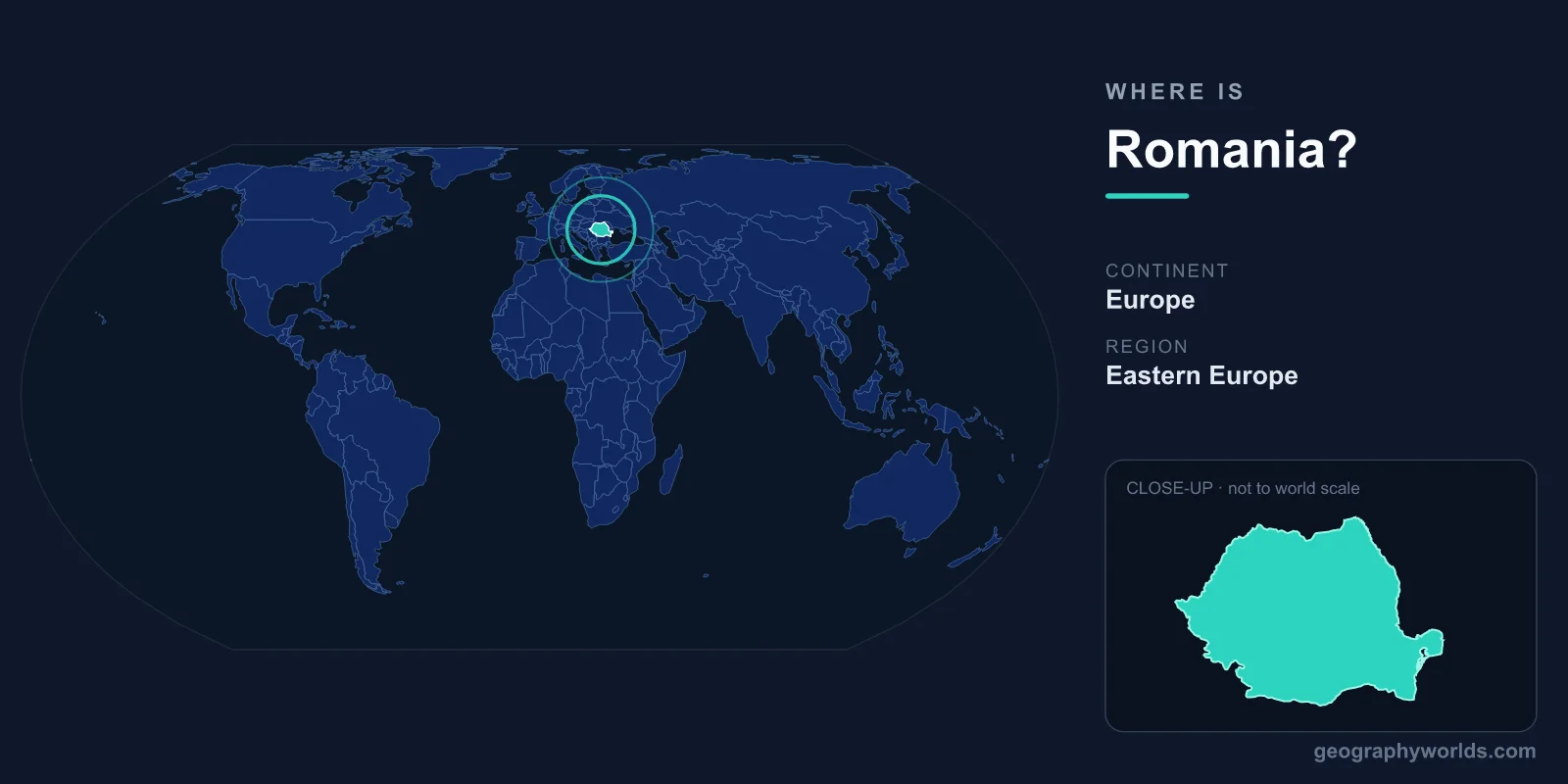
Romania is in southeastern Europe, on the western shore of the Black Sea, bordered by Ukraine to the north, Moldova to the east, Bulgaria to the south, Serbia to the southwest, and Hungary to the west. Its capital, Bucharest, sits at 44.43°N, 26.10°E. Covering 238,397 km² — roughly the size of the United Kingdom — Romania is the 12th-largest country in Europe and the 6th-largest member of the European Union.
The short version: continent, region, coordinates
Romania lies entirely in the Northern and Eastern hemispheres, anchored where Central Europe blends into the Balkans and the lower Danube basin opens onto the Black Sea. The country stretches from about 43.6°N at Zimnicea on the Danube up to roughly 48.3°N near the Ukrainian frontier, and from the Tisza lowlands in the west to the Black Sea coast in the east. Its rough geographic center falls near 46°N, 25°E, deep in the Carpathian heartland.
Romania keeps Eastern European Time (UTC+2), shifting to UTC+3 in summer. With a population of around 19 million, it is one of the larger nations in the region, and Bucharest — its political, financial, and cultural hub — lies in the southern lowlands about 60 km north of the Danube and some 220 km inland from the sea. For more on the country as a whole, see our romania country guide.
Which continent — and is it Eastern Europe or the Balkans?
Romania is firmly in Europe, and most modern atlases file it under southeastern Europe. Where things get interesting is the finer label. Politically, Romania spent 1947 to 1989 inside the Soviet sphere, which cemented its "Eastern European" reputation throughout the Cold War. Yet culturally it leans westward: Romanian is a Romance language descended from Latin — the only one spoken in this corner of the continent — and the country has been a NATO member since 2004 and an EU member since 2007.
As for the Balkans, only the sliver of land south of the Danube, the region of Dobruja, sits squarely on the Balkan Peninsula. The bulk of Romania — Wallachia, Transylvania, Moldavia, and the Banat — lies north of the river and therefore off the peninsula proper. Romanians themselves tend to prefer "southeastern European" or "Carpatho-Danubian" over "Balkan," even though international classifications often lump them together for historical convenience.
Romania's borders, neighbor by neighbor
Romania has five land neighbors plus a coastline, and several of those borders follow major rivers:
- Ukraine (north and northeast) — about 649 km of land border, tracing the upper Tisza, Suceava, and Siret rivers, with an additional maritime boundary in the Black Sea.
- Moldova (east) — roughly 681 km running entirely along the Prut River. Moldova was the Romanian region of Bessarabia until 1940, and Romanian and Moldovan are essentially the same language.
- Bulgaria (south) — about 605 km, following the Danube for most of its course before turning west across northern Dobruja.
- Serbia (southwest) — roughly 531 km, including the dramatic Iron Gates gorge where the Danube slices through the Carpathians.
- Hungary (west) — about 448 km across the flat Banat and Crișana plains.
- Black Sea (east) — 245 km of coastline, including the resorts near Mamaia and the major port of Constanța.
The lay of the land: mountains, plains, and the Danube
Romania has one of Europe's most evenly balanced terrains — almost exactly one-third mountains, one-third hills and tablelands, and one-third plains. The defining feature is the Carpathian Mountains, which curve through the country in a great arc; Romania holds roughly half the entire range. Its highest summit, Moldoveanu, reaches 2,544 m in the Făgăraș massif. Inside the mountain ring sits the Transylvanian Plateau, a high, fertile tableland that is geologically distinctive within Europe.
The other great organizing force is the Danube, Europe's second-longest river. It enters Romania from Serbia at the Iron Gates, forms most of the Bulgarian border, then swings north and east to empty into the Black Sea through the Danube Delta — Europe's largest wetland, a UNESCO World Heritage Site, and a refuge for more than 300 bird species. Together, the Carpathian arc, the Danube basin, and the coastal strip frame Romania's place on the map.
Cities and historic regions that pin Romania down
Romania is traditionally divided into five historic regions that map neatly onto its geography: Wallachia in the southern lowlands (home to Bucharest), Moldavia in the hilly northeast near the Moldovan border, Transylvania on the central plateau, Banat and Crișana on the western plains, and Dobruja between the Danube and the sea.
The largest cities anchor these regions. Bucharest, with about 1.7 million people in its metro area, dominates the south. Cluj-Napoca and Brașov sit in Transylvania, Timișoara in the Banat near the Hungarian and Serbian borders, Iași in Moldavia close to Moldova, and Constanța on the Black Sea as the country's biggest port. Knowing where these cities fall makes it easy to picture Romania's shape: a roughly oval country tilted between the Carpathians and the coast.
Frequently Asked Questions
Where is Romania located on the map?
Romania is in southeastern Europe on the western shore of the Black Sea, bordered by Ukraine, Moldova, Bulgaria, Serbia, and Hungary. Its capital, Bucharest, sits at 44.43°N, 26.10°E in the southern lowlands.
What countries border Romania?
Five countries: Ukraine to the north, Moldova to the east (along the Prut River), Bulgaria to the south (along the Danube), Serbia to the southwest, and Hungary to the west. Its sixth boundary is the Black Sea coastline.
Is Romania near Russia?
No. Russia lies roughly 800 km away at the nearest point, with Ukraine and Moldova in between. Despite the similar-sounding names, Romania and Russia share no land border and have very different histories and languages.
Is Romania in the European Union?
Yes. Romania joined the EU on 1 January 2007 and has been a NATO member since 2004. It entered the Schengen Area for air and sea travel in March 2024 and for land borders in 2025.