
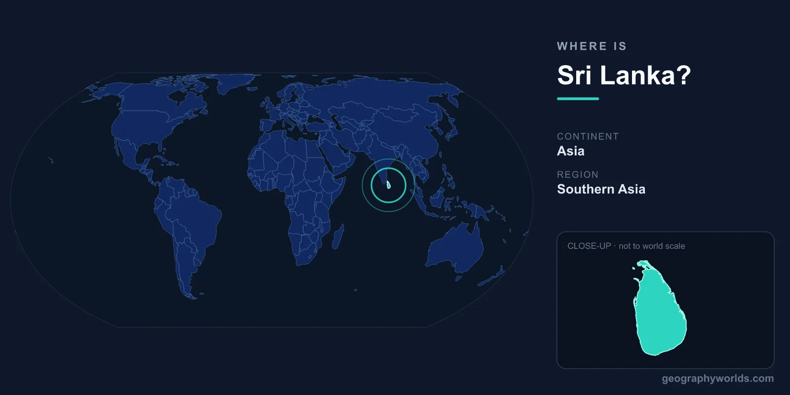
Sri Lanka is an island nation in South Asia, located in the Indian Ocean just off the southeastern coast of India at roughly 7.87°N latitude and 80.77°E longitude. Separated from the Indian mainland only by the narrow Palk Strait and the Gulf of Mannar, this teardrop-shaped island covers about 65,610 square kilometers — close to the size of Ireland. Its legislative capital is Sri Jayawardenepura Kotte, while Colombo serves as the commercial hub and largest city.
Where Exactly Is Sri Lanka on the Map?
Sri Lanka sits in the Northern and Eastern Hemispheres, stretching between about 5°55' and 9°51' north latitude and 79°41' and 81°53' east longitude. It lies just north of the equator, which is why its climate stays warm and tropical year-round. On a world map, look for the small, pear- or teardrop-shaped island dangling beneath the southern tip of the Indian subcontinent — it is sometimes called the "Pearl of the Indian Ocean" because of this shape and its position.
The island's location is far more strategic than its modest size suggests. It sits at the crossroads of some of the world's busiest maritime trade routes, with shipping lanes connecting East Asia and Southeast Asia to the Middle East, Africa, and Europe passing directly to its south. This has made Sri Lanka a vital trading post for more than two thousand years, visited by Arab, Chinese, Persian, and later Portuguese, Dutch, and British seafarers.
How Close Is Sri Lanka to India?
Sri Lanka is remarkably close to India. At its narrowest point, the Palk Strait separating the two countries is only about 53 kilometers wide. Connecting them is Adam's Bridge — also known as Rama's Bridge — a 48-kilometer chain of limestone shoals, sandbanks, and shallow reefs running between Mannar Island in northwestern Sri Lanka and Rameswaram on India's southeastern coast.
These shoals are mostly only 1 to 10 meters deep and are clearly visible in satellite imagery. Geologists believe the chain is evidence that Sri Lanka was once physically linked to the Indian mainland. The bridge also features prominently in the Hindu epic Ramayana, which describes it as a causeway built by an army led by the monkey god Hanuman. Despite the closeness, there is currently no passenger ferry running between the two nations, though such a service has been proposed many times.
What Surrounds Sri Lanka?
As an island, Sri Lanka shares no land borders with any country. It is surrounded entirely by water, with the following maritime neighbors and bodies of water:
- India — about 53 km to the northwest across the Palk Strait, its nearest neighbor
- Maldives — roughly 650 km to the southwest in the Indian Ocean
- Indian Ocean — bordering the island to the south and west
- Bay of Bengal — to the northeast
- Gulf of Mannar and Palk Strait — to the northwest, between Sri Lanka and India
The country's coastline runs approximately 1,340 kilometers and is dotted with natural harbors, lagoons, mangrove forests, coral reefs, and long sandy beaches that have made it a popular destination for travelers.
The Island's Geography and Landscape
For such a compact country, Sri Lanka packs in extraordinary geographic variety. The south-central interior is dominated by the Central Highlands, a rugged, misty mountain region where Pidurutalagala rises to 2,524 meters as the island's highest peak. These cool uplands are home to the famous tea plantations — rolling hills carpeted in neatly clipped tea bushes — that gave the country its global reputation for "Ceylon tea." Around the highlands stretches a broad coastal plain that wraps almost the entire island.
More than 100 rivers radiate outward from the central mountains. The longest is the Mahaweli River at about 335 kilometers. Sri Lanka is also one of the planet's 36 biodiversity hotspots, supporting thousands of plant species and endemic wildlife such as the Sri Lankan leopard and the purple-faced langur. Despite measuring smaller than Ireland, the island holds eight UNESCO World Heritage Sites, including the ancient cities of Anuradhapura and Polonnaruwa and the dramatic Sigiriya rock fortress.
Climate and Time Zone
Sri Lanka has a tropical climate shaped by two monsoon seasons. The southwest monsoon (Yala) brings rain to the western and southern coasts from May to September, while the northeast monsoon (Maha) drenches the north and east from December to February. Coastal temperatures hover between 26°C and 30°C year-round, while highland towns like Nuwara Eliya can drop to a crisp 10–16°C. Because the wet and dry zones experience rain at different times, some part of the island is almost always enjoying sunny weather. The country runs on Sri Lanka Standard Time (UTC+5:30), the same offset as India. For more travel and cultural context, see our sri lanka country guide.
Frequently Asked Questions
What continent is Sri Lanka on?
Sri Lanka is part of Asia, specifically the South Asian region. It lies in the Indian Ocean off the southeastern coast of the Indian subcontinent and is sometimes grouped with the wider Indian Ocean island nations.
Is Sri Lanka part of India?
No. Sri Lanka is a fully independent, sovereign country. Although it sits close to India and was administered separately under British rule as Ceylon, it has never been part of India. It gained independence in 1948 and changed its name from Ceylon to Sri Lanka in 1972.
What is the capital of Sri Lanka?
Sri Lanka has two capitals. Sri Jayawardenepura Kotte, a suburb just east of Colombo, is the official legislative capital and home to parliament, while Colombo remains the largest city and the commercial and economic center.
How big is Sri Lanka?
Sri Lanka covers about 65,610 square kilometers, making it roughly comparable in size to Ireland or the U.S. state of West Virginia. It is home to a population of around 22 million people.