

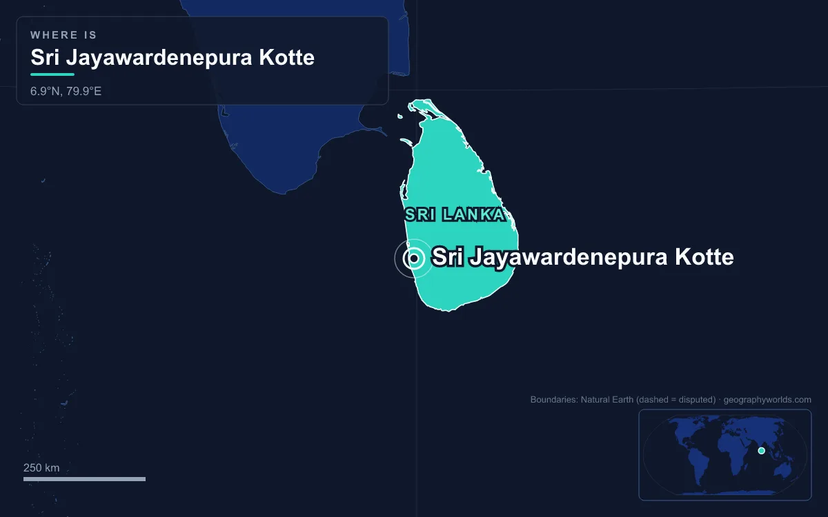
Sri Jayawardenepura Kotte is the legislative capital of Sri Lanka: the seat of the national Parliament, set on a small island in the Diyawanna Lake on the eastern edge of Colombo, in the country’s Western Province. It is a compact municipality of about 17 square kilometres that counted 107,925 residents in the 2012 census, far smaller than the neighbouring commercial capital. What defines Kotte is that pairing. Colombo holds the money, the port, the President’s office and the Supreme Court, while Kotte, a medieval royal city that was abandoned in 1565, got the lawmakers back when the new Parliament opened on 29 April 1982.
Kotte Against Colombo: 17 Square Kilometres Versus 37
The easiest way to understand Kotte is to set it next to Colombo, because the two touch. The Sri Jayawardenepura Kotte Municipal Council area is bounded on the west by the Colombo Municipal Council, on the south-west by Dehiwala-Mount Lavinia, on the south-east by Maharagama, on the east by Kaduwela and on the north by Kolonnawa. Walk east from Borella in Colombo and you cross into Kotte without any sign that you have changed capitals.
The numbers show the gap. Colombo’s municipal area covers about 37.3 square kilometres and holds roughly 750,000 people, a density above 20,000 per square kilometre, and its metropolitan area is put at about 5.6 million. Kotte covers about 17 square kilometres, less than half as much, with around 108,000 residents in 2012. Colombo sits on the coast at an elevation of about 1 metre. Kotte lies inland among marshes and streams that once made it hard to attack. Colombo has been the main city since the British took over the island in 1815. Kotte had to wait until 1982 to regain any national role.
The split of functions is just as uneven. Wikipedia describes Colombo as the executive and judicial capital and the commercial capital, while Kotte is the legislative capital. The Old Parliament Building on Galle Face in Colombo now houses the Presidential Secretariat, and the courts stayed in Colombo. The plan to move government offices out of Colombo is still unfinished more than four decades later, so the phrase “capital of Sri Lanka” still points to two places. For how Kotte ranks against Kandy, Negombo and Jaffna, see the largest cities in Sri Lanka.
108,000 Residents Hosting a Parliament for 21.8 Million
Kotte is tiny next to the country it serves. Sri Lanka’s 2024 census counted 21,781,800 people, so the municipality that hosts its 225-seat Parliament holds about half of one per cent of the national population. The mismatch is intentional. When J. R. Jayewardene’s government designated Kotte as the new capital in 1977, the stated aim was to take pressure off a congested Colombo, not to build a large new city from scratch as Brazil did with Brasília or Nigeria with Abuja.
By ethnicity and religion the city closely matches the country’s western lowlands. In the 2012 census, 84.9 per cent of residents were Sinhalese, 7.0 per cent Sri Lankan Tamil, 4.8 per cent Sri Lankan Moor and 0.75 per cent Indian Tamil. By religion, 77.1 per cent were Buddhist, 6.3 per cent Muslim, 4.5 per cent Hindu, and the rest were Roman Catholic or other Christian. The local council is small too. Since the Kotte Urban Council was upgraded to the Sri Jayawardenepura Kotte Municipal Council in 1997, with Chandra Silva as first mayor, it has had 20 members elected by proportional representation. Its zones are Pita Kotte, Ethul Kotte, Nawala, Nugegoda and Rajagiriya. For national figures behind these shares, see our guide to the population of Sri Lanka.
A Moated Royal Capital of 1415 Against a Colonial Port
Colombo’s past is maritime. Arab traders settled around its harbour from about the eighth century, the Portuguese began a fort there in 1517, the Dutch took it after a siege in 1656, and the British made it the island’s capital in 1815. Kotte’s past is royal and inland. In the late fourteenth century Nissanka Alakesvara, a minister of the Gampola kingdom, built a fortress (a kotte) at the village of Darugama, where the Diyawanna Oya and Kolonnawa Oya meet. It was a jala durga, a water fortress. The marshes formed two sides of a triangle and a dug moat closed the third, enclosing about 2.5 square kilometres behind laterite ramparts 2.5 metres high and 10.7 metres wide.
Parakramabahu VI made it his capital in 1415 and extended the citadel with a new palace. The name Sri Jayawardenepura means “resplendent city of growing victory”. After his armies took the Jaffna kingdom in about 1450, Kotte ruled the whole island under one king. Its royal quarter held a three-storey temple for the Tooth Relic, a five-storey monastery housing sixty monks, a treasury and a parade ground inside the inner moat.
The coast eventually won. When the Portuguese landed in 1505, their envoys were reportedly led to Kotte by a deliberately long, winding route so the capital would seem far inland. Sinhala speakers still describe a roundabout approach as “like the Portuguese going to Kotte”. The kingdom split after the Vijayaba Kollaya of 1521. Sitawaka’s repeated attacks forced King Dharmapala to abandon Kotte in 1565 and move to Colombo under Portuguese protection, and in 1597 he formally ceded his kingdom to Portugal. In the nineteenth century the ruins were plundered for building stone, some of it reportedly used in the Victoria Bridge over the Kelani River. Short sections of rampart and moat survive among suburban houses today.
Duwa Island and Galle Face: Two Parliament Buildings Compared
Sri Lanka’s two parliament buildings sum up the contrast between the cities. The older one, opened by Governor Sir Herbert Stanley on 29 January 1930, is a neoclassical block facing the sea at Galle Face in Colombo. It served the State Council, the House of Representatives, the National State Assembly and finally the Parliament of Sri Lanka until the move.

The newer building is in every way its opposite. On 4 July 1979 Prime Minister Ranasinghe Premadasa won Parliament’s approval to build on Duwa, a 5-hectare island in the Diyawanna Oya off Baddegana Road in Pita Kotte. Tradition holds that Alakesvara’s palace stood there in the 1300s, and in modern times it had belonged to the politician E. W. Perera and held a chicken farm. The surrounding marsh was dredged into a lake, created in 1979 with eight islands. Geoffrey Bawa, often called the leader of the Tropical Modernist movement, designed the complex as a cluster of pavilions with tiered, pitched roofs rising out of the water, a modernist building that still draws on Sri Lankan vernacular architecture, its apparent symmetry set against the irregular shoreline of the lake. A consortium of two Mitsui Group companies built it in 26 months for more than US$25.4 million, and Jayewardene opened it on 29 April 1982. The old parliament faces the open sea on Colombo’s busiest seafront. The new one sits on a quiet artificial island, surrounded by fresh water and marsh.

2,251 Millimetres of Rain: October Downpours Against a Dry February
Being inland does not change Kotte’s weather much from Colombo’s. Both have a tropical rainforest climate (Köppen Af). The contrast is between months, not cities. Average highs barely move through the year, from 30.0 °C in July, August and October to 31.8 °C in April. Rainfall swings much more widely. February, the driest month, averages 63 millimetres. October, the wettest month, averages 358 millimetres, more than five times as much, and May is almost as wet at 335. The year has two rainy peaks, April to June and October to November. Because no month falls below 60 millimetres, the city counts as rainforest climate rather than monsoon climate. The yearly total is about 2,251 millimetres.
The water that once defended the fortress still shapes the city. The Parliament lake, the Diyawanna Oya marshes and the Diyatha Uyana park on the bank are still the main open spaces in Kotte. Low-lying ground, not hills, set the limits of the royal city in the fourteenth century, and wet ground still sets the limits of building in the modern capital.
Battaramulla, Nugegoda and the Ministries That Never Left Colombo
The relocation that began in 1982 spread beyond Kotte’s own boundary. Across the lake, Battaramulla, formally part of Kaduwela and about 8.4 kilometres from Colombo Fort, became the place where the government decided to put its departmental head offices. Its name recalls the old royal city: palace cooks crossed the Diyawanna Oya by ferry each day from a landing called bat-tota-mulla, the “cooked-rice landing corner”. Neighbouring Kotiyagoda comes from kotuwe-egoda, “the shore opposite the fortress”.
South of the lake, Nugegoda is the city’s transport and commercial hub. It has the only main railway station, on the Kelani Valley Line, the main bus terminus and the University of Sri Jayewardenepura, while the Open University of Sri Lanka is at Nawala. The Education Ministry and the Department of Examinations are in Kotte. Many other ministries, the Central Bank, most foreign embassies and the country’s main trading houses remain in Colombo, beside the island’s principal harbour. Kotte governs from the lake while Colombo works from the coast, and the Port of Colombo is the clearest reason the old colonial capital has kept so much of its importance.
Quick Facts About Sri Jayawardenepura Kotte
- Country: Sri Lanka
- Continent: Asia (South Asia)
- Country population: approximately 23.3 million
- Capital city status: Sri Jayawardenepura Kotte is the capital of Sri Lanka, the seat of national government, and the location of foreign embassies, parliament, and the head of state's official residence.
Frequently Asked Questions
What is the capital of Sri Lanka?
The capital of Sri Lanka is Sri Jayawardenepura Kotte. Sri Jayawardenepura Kotte is the seat of national government, hosts most foreign embassies and consulates, and is typically where the head of state and parliament are located.
What continent is Sri Jayawardenepura Kotte in?
Sri Jayawardenepura Kotte, the capital of Sri Lanka, is located in Asia, in the South Asia region. As Sri Lanka's capital, Sri Jayawardenepura Kotte serves as the country's primary connection to the broader Asian political, economic, and cultural sphere.
Why is Sri Jayawardenepura Kotte the capital of Sri Lanka?
Sri Jayawardenepura Kotte was chosen as the capital of Sri Lanka for reasons that typically combine geography, history, and politics. Capital city selections often reflect a desire for centrality (being accessible from across the country), historical importance (being a longstanding seat of government or culture), or neutrality (being acceptable to multiple regions or ethnic groups within the country). The specific reasons for Sri Jayawardenepura Kotte's designation are detailed in the city's history above.
What is Sri Jayawardenepura Kotte known for?
As the capital of Sri Lanka, Sri Jayawardenepura Kotte is best known for housing the country's central government institutions — parliament, presidential or royal residences, supreme court, and key ministries. It is also typically a major cultural and economic center within Sri Lanka, hosting national museums, embassies, and signature monuments. The introduction and history sections above provide detailed coverage of the city's specific notable institutions and landmarks.
Related Pages
- Sri Lanka Country Guide — full geography, climate, economy, and culture overview
- Flag of Sri Lanka — meaning, history, and design of Sri Lanka's national flag