
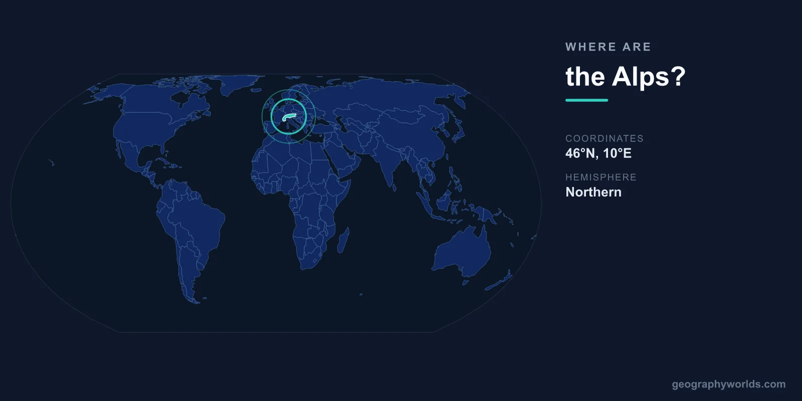
The Alps are located in central-western Europe, centered at approximately 46°N latitude and 10°E longitude. They stretch roughly 1,200 kilometers in a crescent-shaped arc from the Mediterranean coast of France and Italy to the Pannonian Plain of Austria and Hungary, crossing eight countries.
Introduction
The range spans France, Switzerland, Italy, Austria, Germany, Liechtenstein, Slovenia, and Monaco. Mont Blanc, at 4,808 meters on the France-Italy border, is the highest peak in the Alps and the tallest mountain in Western Europe. The Alps are among the most densely populated mountain regions in the world.
Exact Location & Coordinates
- Center Coordinates: 46°N, 10°E
- Region: Central-western Europe
- Extent: ~1,200 km, crescent-shaped arc
- Mont Blanc: 45°50'N, 6°51'E, 4,808 m
On a world map, the Alps are the prominent mountain chain curving across southern and central Europe. They form an arc from the French Riviera on the Mediterranean coast northeast through Switzerland and Austria. The Alps are easily identified on any European map as the high terrain separating northern and southern Europe.
To find the Alps, locate Switzerland on a map of Europe — the Alps run through the heart of Switzerland and extend outward in both directions. The western Alps are in France and Italy; the central Alps span Switzerland, Austria, and northern Italy; the eastern Alps extend through Austria into Slovenia.
Surrounding Countries & Borders
- Switzerland: Heart of the Alps
- Austria: Largest Alpine country by area
- France: Western Alps, including Mont Blanc
- Italy: Southern Alps, Dolomites
- Germany: Bavarian Alps (southern edge)
- Slovenia, Liechtenstein, Monaco: Eastern and small sections
Switzerland and Austria are the most Alpine countries, with the mountains defining their national identity, economy, and culture. Switzerland's highest peak is the Dufourspitze (4,634 m) in the Monte Rosa massif, while Austria's highest is the Grossglockner (3,798 m). Both nations have economies deeply tied to Alpine tourism and winter sports.
France's Alps include the dramatic Mont Blanc massif and the famous ski resorts of Chamonix, Courchevel, and Val d'Isere. Italy's Alps include the spectacular Dolomites in the northeast, a UNESCO World Heritage Site known for their pale limestone towers. Germany has a narrow strip of Alps in Bavaria, including the popular resort town of Garmisch-Partenkirchen.
Geographic Context
- Tectonic Origin: African plate collision with Eurasian plate
- Major Passes: Brenner, St. Gotthard, Simplon, Mont Cenis
- Rivers: Source of Rhine, Rhone, Po, Danube tributaries
The Alps formed from the collision of the African and Eurasian tectonic plates, beginning roughly 65 million years ago. The compression folded, faulted, and uplifted ancient seabed rocks to create the complex mountain architecture visible today. Alpine geology is among the most studied and best understood of any mountain range.
The Alps have been a critical transportation barrier and corridor throughout European history. Mountain passes like the Brenner (Austria-Italy), St. Gotthard (Switzerland), and Simplon have been used for trade and military campaigns since Roman times. Today, major tunnels including the Gotthard Base Tunnel (57 km, the world's longest railway tunnel) carry traffic beneath the mountains.
Physical Characteristics
- Highest Peak: Mont Blanc, 4,808 m
- Peaks Above 4,000m: 82
- Major Glaciers: ~3,000 (shrinking rapidly)
- Total Area: ~200,000 km²
The Alps contain 82 peaks above 4,000 meters, concentrated primarily in the western Alps around the Mont Blanc, Monte Rosa, and Matterhorn massifs. The Matterhorn (4,478 m), straddling the Swiss-Italian border, is one of the most iconic mountain profiles in the world and a symbol of Switzerland.
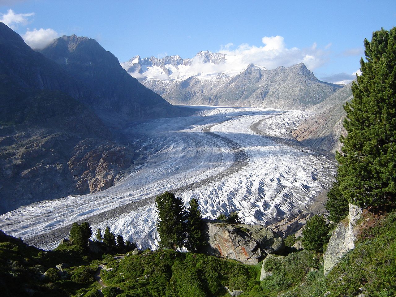
Alpine glaciers are retreating dramatically due to climate change. Since 1850, the Alps have lost roughly half their glacier ice volume, and the rate of loss is accelerating. Scientists estimate that most Alpine glaciers below 3,500 meters could disappear by 2100, with significant implications for water supply, hydropower, and tourism across the region.
Why It Matters
- Tourism: ~120 million visitors per year
- Water Source: Major rivers of Europe originate here
- Winter Sports: Birthplace of modern skiing and alpinism
The Alps are the birthplace of modern mountaineering and winter sports. The first ascent of Mont Blanc in 1786 launched the sport of alpinism. Today, Alpine ski resorts in France, Switzerland, Austria, and Italy attract roughly 120 million visitors annually, making the Alps the world's premier winter sports destination.
As Europe's "water tower," the Alps feed the Rhine, Rhone, Po, and many tributaries of the Danube. These rivers supply drinking water, irrigation, and hydroelectric power to millions of people across the continent. Alpine hydropower provides a significant share of Switzerland's, Austria's, and northern Italy's electricity.
Key Facts
- The Alps are centered at approximately 46°N, 10°E across central-western Europe.
- They stretch ~1,200 km through 8 countries: France, Switzerland, Italy, Austria, Germany, Liechtenstein, Slovenia, Monaco.
- Mont Blanc at 4,808 m is the highest peak in the Alps and Western Europe.
- The range contains 82 peaks above 4,000 m and roughly 3,000 glaciers.
- About 120 million people visit the Alps annually for tourism and winter sports.
Fun Facts
- The Gotthard Base Tunnel through the Alps is the world's longest railway tunnel at 57 km.
- Hannibal famously crossed the Alps with war elephants in 218 BCE to attack Rome.
- The Matterhorn appears on Toblerone chocolate packaging and is one of the most photographed mountains in the world.
- The Alps have lost roughly half their glacier ice volume since 1850.
Final Thoughts
The Alps arc across central-western Europe at approximately 46°N, 10°E, spanning 1,200 kilometers through eight countries. Home to Mont Blanc, the Matterhorn, and the world's premier ski resorts, they are Europe's most iconic mountain range. As the continent's water tower, winter sports capital, and a landscape that has shaped European history from Hannibal to modern tourism, the Alps are an essential feature on any world map.
Test Your Knowledge!
Think you know where things are on the map? Test your skills!
Play Geography Games →