
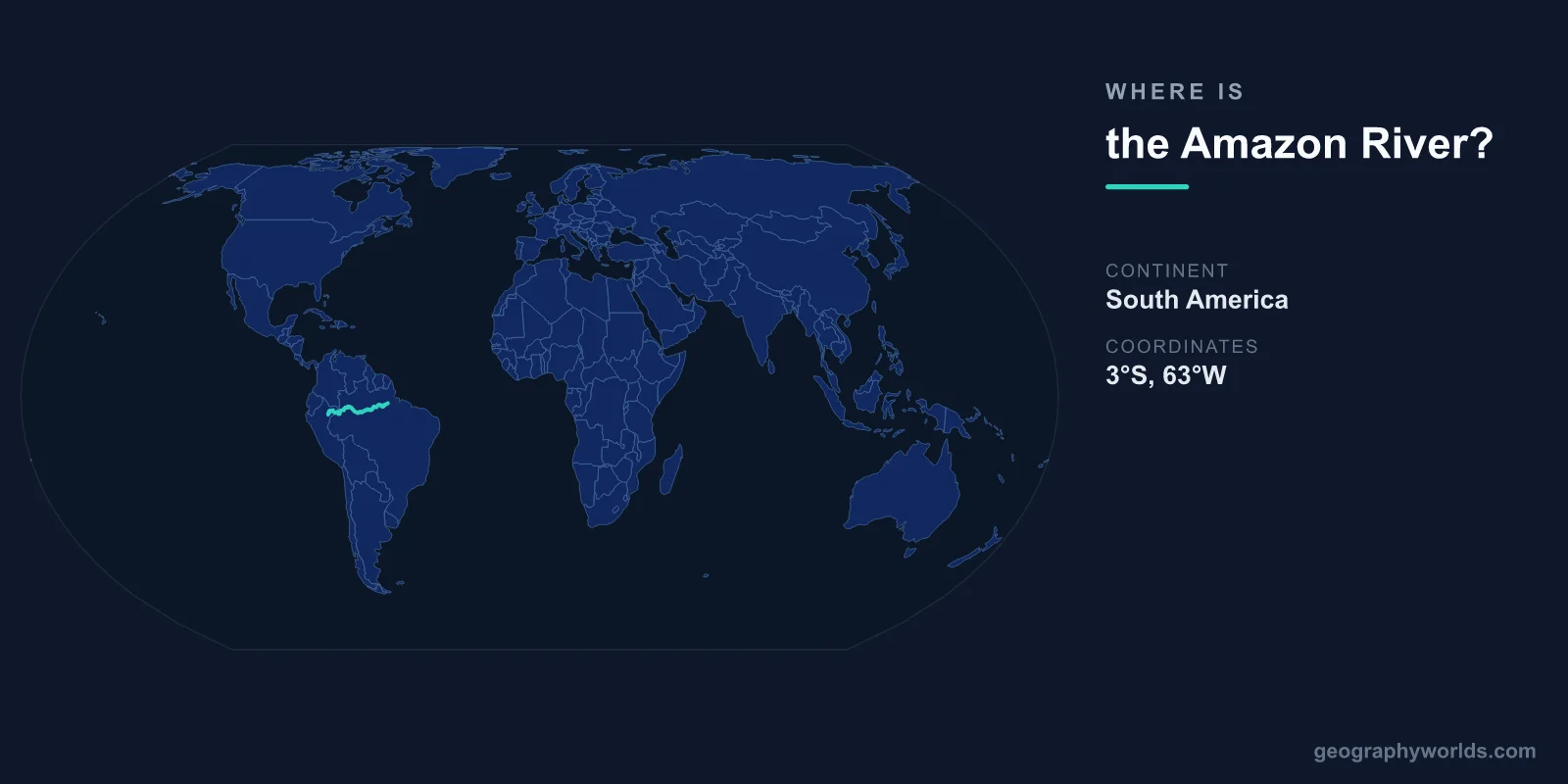
The Amazon River is located in South America, flowing generally from west to east across the northern part of the continent. Its source is in the Andes Mountains of Peru at approximately 15°S, 71°W, and its mouth empties into the Atlantic Ocean near Belem, Brazil, at approximately 0°, 49°W.
Introduction
The Amazon is the world's largest river by discharge volume, releasing roughly 209,000 cubic meters of water per second into the Atlantic — about 20 percent of all freshwater entering the world's oceans. It drains an area of approximately 7 million square kilometers, the largest drainage basin on Earth, covering about 40 percent of South America.
Exact Location & Coordinates
- Source: ~15°S, 71°W (Andes, Peru)
- Mouth: ~0°, 49°W (Atlantic Ocean, Brazil)
- Flow Direction: West to east across northern South America
- Length: ~6,400 km
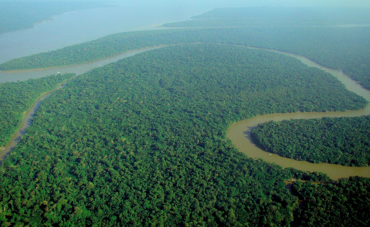
On a world map, the Amazon is the enormous river system draining the green equatorial heart of South America. Find Brazil on a map, then locate the equator crossing through its northern section — the Amazon flows roughly along the equator from the Andes to the Atlantic. Its course is visible on satellite imagery as a winding channel through the vast green Amazon rainforest.
The river's source is a stream called the Apurimac in the Peruvian Andes, high in the mountains near the city of Arequipa. From there it flows north and then east, joining with tributaries to become progressively larger until it reaches the Atlantic as the mightiest river on Earth.
Surrounding Countries & Borders
- Brazil: Largest share of the Amazon basin
- Peru: Source and upper Amazon
- Colombia: Northern tributaries
- Bolivia, Ecuador, Venezuela, Guyana, Suriname: Parts of the drainage basin
Brazil contains roughly 60 percent of the Amazon basin and the river's lower course, including its mouth. The Brazilian Amazon includes the cities of Manaus (where the Rio Negro meets the Amazon) and Belem near the mouth. Peru contains the upper Amazon, where it is called the Ucayali and Maranon before merging.
The Amazon basin touches nine countries in total, making it a truly continental-scale river system. Colombia's Caqueta and Putumayo rivers are major northern tributaries. Bolivia's Madeira River, flowing from the Bolivian Andes, is the Amazon's largest tributary by volume.
Geographic Context
- Drainage Basin: ~7 million km² (40% of South America)
- Tributaries: Over 1,100, including 17 longer than 1,600 km
- Rainforest: The Amazon basin contains the world's largest tropical rainforest
The Amazon basin is synonymous with the Amazon Rainforest, which covers approximately 5.5 million square kilometers. This forest produces roughly 6 percent of the world's oxygen and is home to an estimated 10 percent of all species on Earth. The river and its forest form the planet's most biodiverse ecosystem.
The Amazon has over 1,100 tributaries, 17 of which are longer than 1,600 kilometers — each would be a major river in its own right on any other continent. The Rio Negro, the Amazon's largest left-bank tributary, carries so much dissolved organic matter that its waters appear black, creating the famous "Meeting of the Waters" at Manaus where black and brown waters flow side by side for kilometers.
Physical Characteristics
- Length: ~6,400 km (rivals the Nile as world's longest)
- Discharge: ~209,000 m³/s (world's largest)
- Width at Mouth: ~330 km (including Para River)
- Depth: Up to 100 m in places
The Amazon's discharge is so enormous that it pushes freshwater up to 400 kilometers out into the Atlantic Ocean. The river's plume of freshwater and sediment is visible from space. At its mouth, the river is so wide that Marajo Island, which sits in the estuary, is roughly the size of Switzerland.
During the wet season, the Amazon floods vast areas of forest, creating a seasonally inundated ecosystem called varzea that can extend 50 kilometers or more from the main channel. The river's level fluctuates by 10-15 meters between wet and dry seasons, dramatically changing the landscape twice a year.
Why It Matters
- Biodiversity: Most biodiverse river system on Earth
- Climate: Amazon rainforest is critical for global climate regulation
- Indigenous Peoples: Home to hundreds of indigenous groups
The Amazon River system contains more species of fish than any other river — over 3,000 known species, more than the entire Atlantic Ocean. These include the arapaima (one of the largest freshwater fish), the piranha, the Amazon river dolphin (pink dolphin), and the anaconda. New species are discovered regularly.
Deforestation of the Amazon rainforest is a critical global environmental issue. The forest acts as a massive carbon sink, storing an estimated 150-200 billion tons of carbon. Its destruction releases this carbon as CO2 while reducing the forest's ability to generate its own rainfall through transpiration, potentially pushing the ecosystem toward a tipping point.
Key Facts
- The Amazon flows from ~15°S, 71°W in Peru to ~0°, 49°W in Brazil.
- At ~6,400 km, it rivals the Nile as the world's longest river.
- It carries ~20% of all freshwater entering the world's oceans.
- Its drainage basin covers ~7 million km², about 40% of South America.
- Over 3,000 fish species live in the Amazon — more than in the entire Atlantic Ocean.
Fun Facts
- The Amazon pushes freshwater up to 400 km out into the Atlantic Ocean.
- Marajo Island at the Amazon's mouth is roughly the size of Switzerland.
- The Amazon has no bridges — not a single bridge crosses it along its entire length.
- The "Meeting of the Waters" near Manaus shows black and brown rivers flowing side by side for 6 km.
Final Thoughts
The Amazon River flows across northern South America from the Peruvian Andes (~15°S, 71°W) to the Brazilian Atlantic coast (~0°, 49°W), carrying more water than any other river on Earth. Its 7-million-square-kilometer basin supports the world's largest rainforest and most biodiverse ecosystem. As a climate regulator, biodiversity stronghold, and continental-scale waterway, the Amazon is one of the most consequential features on the world map.
Test Your Knowledge!
Think you know where things are on the map? Test your skills!
Play Geography Games →