
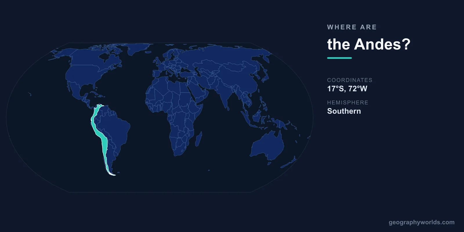
The Andes are located along the western coast of South America, centered at approximately 15°S latitude and 70°W longitude. They extend roughly 7,000 kilometers from Venezuela and Colombia in the north to Tierra del Fuego at the southern tip of the continent, making them the longest continental mountain range on Earth.
Introduction
The range passes through seven countries: Venezuela, Colombia, Ecuador, Peru, Bolivia, Chile, and Argentina. Its highest peak, Aconcagua in Argentina, reaches 6,961 meters — the tallest mountain outside of Asia. The Andes have shaped South American civilization for millennia, from the Inca Empire to modern nations.

Exact Location & Coordinates
- Center Coordinates: 15°S, 70°W
- Region: Western South America
- Extent: ~7,000 km from north to south
- Aconcagua: 32°39'S, 70°00'W, 6,961 m
On a world map, the Andes appear as the continuous mountain spine running along South America's entire western edge. They are easily identified by following the Pacific coastline of the continent — the Andes run parallel to and very close to the coast for thousands of kilometers.
The range starts in Venezuela near the Caribbean coast, runs south through Colombia, Ecuador, Peru, and Bolivia, and forms the long border between Chile and Argentina before terminating in Tierra del Fuego. At their widest, in Bolivia, the Andes spread to about 700 kilometers across, enclosing the high Altiplano plateau.
Surrounding Countries & Borders
- Chile: Entire western slope for 4,300 km
- Argentina: Eastern slope in the southern Andes
- Peru: Central Andes, including the Altiplano
- Bolivia: Widest section with the Altiplano
- Colombia: Northern Andes, splitting into 3 cordilleras
- Ecuador & Venezuela: Northernmost sections
Chile and Argentina share the longest section of the Andes, which forms their mutual border for roughly 5,000 kilometers. Peru and Bolivia contain the wide central Andes, including the Altiplano, a vast high plateau averaging 3,750 meters in elevation. Lake Titicaca, the world's highest navigable lake, sits on the Peru-Bolivia border at 3,812 meters.
In Colombia, the Andes split into three distinct cordilleras (ranges) separated by deep river valleys. Ecuador's short but dramatic section includes Cotopaxi, one of the world's highest active volcanoes at 5,897 meters. Venezuela's Andes are the northernmost extension, reaching the Caribbean coast.
Geographic Context
- Tectonic Origin: Nazca plate subducting under South American plate
- Pacific Ring of Fire: Part of the circum-Pacific volcanic belt
- Altiplano: World's second-highest plateau (after Tibet)
The Andes formed through the subduction of the Nazca oceanic plate beneath the South American continental plate, a process ongoing for roughly 200 million years. This subduction also creates the Peru-Chile Trench, one of the deepest oceanic trenches in the Pacific, running parallel to the Andes just offshore.
The range is part of the Pacific Ring of Fire and contains many active volcanoes. Ojos del Salado on the Chile-Argentina border (6,893 m) is the world's highest active volcano. The Andes also experience frequent earthquakes, with devastating events in Chile (1960, magnitude 9.5 — the strongest ever recorded) and Peru.
Physical Characteristics
- Highest Peak: Aconcagua, Argentina, 6,961 m
- Active Volcanoes: ~200+
- Average Width: 200-700 km
- Glaciers: Tropical glaciers in Ecuador, Peru, Bolivia
The Andes are not a single chain but a complex system of parallel ranges, intermontane valleys, and high plateaus. In the central section, the Western Cordillera and Eastern Cordillera enclose the Altiplano, a plateau second in elevation only to the Tibetan Plateau. In the south, the range narrows and is heavily glaciated, with spectacular ice fields in Patagonia.
The Andes contain the world's only tropical glaciers, found in Ecuador, Peru, and Bolivia. These glaciers are retreating rapidly due to climate change, threatening water supplies for millions of people in Andean cities. The Quelccaya Ice Cap in Peru is the largest tropical ice mass and a critical archive of past climate.
Why It Matters
- Inca Empire: The Andes were the heartland of the largest pre-Columbian empire
- Biodiversity: Among the most biodiverse mountain regions on Earth
- Mining: Major source of copper, lithium, silver, gold
The Andes were the cradle of the Inca Empire, which at its peak in the 15th century stretched 4,000 kilometers from Colombia to Chile. Machu Picchu, the iconic Inca citadel built at 2,430 meters in Peru, is one of the world's most visited archaeological sites. The Inca road system, over 30,000 kilometers long, crossed some of the most challenging mountain terrain on Earth.
The Andes are critical for global mineral resources. Chile produces roughly 25 percent of the world's copper. The "lithium triangle" of Chile, Bolivia, and Argentina holds over half of the world's lithium reserves, essential for electric vehicle batteries. Peru is a major gold and silver producer. These mineral riches have shaped Andean economies for centuries.
Key Facts
- The Andes are centered at approximately 15°S, 70°W along western South America.
- They stretch ~7,000 km through 7 countries — the world's longest continental mountain range.
- Aconcagua in Argentina at 6,961 m is the highest peak outside Asia.
- The Altiplano between the Andean ranges is the world's second-highest plateau.
- Chile, Bolivia, and Argentina hold over half the world's lithium reserves in the Andes.
Fun Facts
- The Andes contain the world's highest capital city — La Paz, Bolivia, at 3,640 m.
- The 1960 Chilean earthquake (magnitude 9.5) is the strongest ever recorded, caused by Andean subduction.
- Andean condors have the largest wingspan of any land bird, reaching 3.3 meters.
- Lake Titicaca on the Peru-Bolivia border is the highest navigable lake in the world at 3,812 m.
Final Thoughts
The Andes run along the entire western coast of South America at approximately 15°S, 70°W, stretching 7,000 kilometers through seven nations. As the world's longest continental mountain range, they contain the highest peak outside Asia, the second-highest plateau on Earth, and critical mineral resources. From the Inca Empire to modern lithium mining, the Andes have shaped and continue to shape civilizations across the continent.
Test Your Knowledge!
Think you know where things are on the map? Test your skills!
Play Geography Games →