
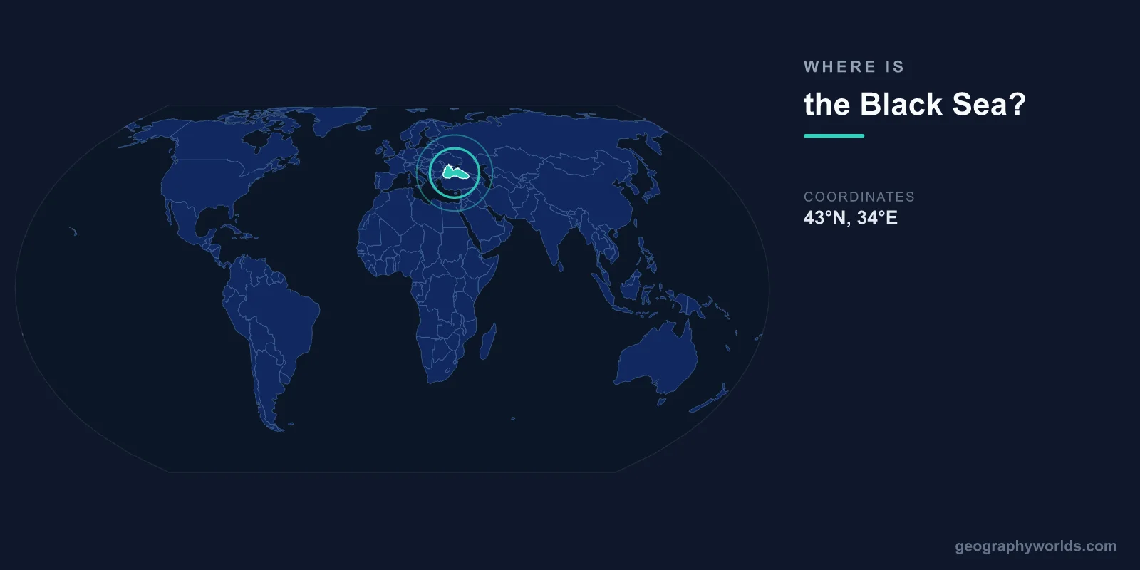
The Black Sea is located between southeastern Europe and western Asia, centered at approximately 43°N latitude and 34°E longitude. It is bordered by six countries: Turkey to the south, Bulgaria and Romania to the west, Ukraine to the north, Russia to the northeast, and Georgia to the east.
Introduction
Covering approximately 436,400 square kilometers, the Black Sea is one of the world's largest inland bodies of water. It connects to the Mediterranean Sea through the narrow Bosporus Strait, the Sea of Marmara, and the Dardanelles, making it a crucial waterway linking Eastern Europe to global maritime routes.

Exact Location & Coordinates
- Center Coordinates: 43°N, 34°E
- Region: Between southeastern Europe and western Asia
- Connected To: Mediterranean Sea via Bosporus Strait
On a world map, the Black Sea is located directly north of Turkey and south of Ukraine. It sits east of the Balkan Peninsula and west of the Caucasus Mountains. The sea occupies a deep basin between two major tectonic plates, which accounts for its remarkable depth.
The easiest way to find the Black Sea on a map is to locate Turkey first, then look at its northern coastline. The entire southern shore of the Black Sea is Turkish territory, stretching roughly 1,700 kilometers from the Bosporus to the Georgian border.
Surrounding Countries & Borders
- Turkey: Southern shore, ~1,700 km coastline
- Ukraine: Northern shore, including Crimean Peninsula
- Russia: Northeastern shore, including Sochi
- Georgia: Eastern shore, including Batumi
- Bulgaria: Western shore, including Varna
- Romania: Western shore, including Constanta
Six nations share the Black Sea coastline, each with significant port cities. Turkey's coast includes Trabzon, Samsun, and the strategic city of Istanbul at the Bosporus entrance. Ukraine's coast features the major port of Odessa and the disputed Crimean Peninsula, which juts into the sea from the north.
Romania and Bulgaria share the western shore, with major ports at Constanta and Varna respectively. Georgia's coastline includes the resort city of Batumi, while Russia's short Black Sea coast features Sochi, host of the 2014 Winter Olympics, and the naval base at Novorossiysk.
Geographic Context
- Distance to Mediterranean: ~320 km via Turkish Straits
- Nearest Ocean: Atlantic Ocean (via Mediterranean)
- Major Inflows: Danube, Dnieper, Don rivers
The Black Sea is essentially a large enclosed basin connected to the world ocean only through the Turkish Straits system. The Bosporus, at just 700 meters wide at its narrowest point, is the sole natural outlet. This restricted connection means the Black Sea has very limited tidal movement and unique water chemistry.
Three of Europe's great rivers empty into the Black Sea. The Danube, Europe's second-longest river, enters from the west through Romania. The Dnieper flows in from Ukraine to the north, and the Don River reaches it indirectly via the Sea of Azov, a shallow northeastern arm of the Black Sea connected by the Kerch Strait.
Physical Characteristics
- Area: 436,400 km²
- Maximum Depth: 2,212 m
- Average Depth: 1,253 m
- Salinity: ~18 ppt (about half of ocean water)
The Black Sea reaches a maximum depth of 2,212 meters in its central basin, making it one of the deepest enclosed seas. Its waters below about 150 meters are almost entirely devoid of oxygen, creating the world's largest meromictic basin. This anoxic layer preserves ancient shipwrecks in remarkable condition.
The sea's salinity is roughly 18 parts per thousand, about half that of typical ocean water. This is because the massive freshwater inflow from the Danube, Dnieper, and other rivers dilutes the saltwater. The low salinity creates a distinct layered structure, with lighter freshwater sitting atop denser saltwater from the Mediterranean.
Why It Matters
- Trade Route: Links Eastern Europe to global shipping
- Naval Significance: Strategic importance for Russia, Turkey, NATO
- Ecology: Unique anoxic deep waters
The Black Sea has been a vital trade route for thousands of years. Ancient Greek colonies dotted its shores, and the Silk Road's maritime branches passed through its waters. Today, major ports like Odessa, Constanta, and Novorossiysk handle millions of tons of cargo annually, including a significant portion of the world's grain exports.
Geopolitically, the Black Sea remains one of the most strategically significant bodies of water on Earth. Russia's access to warm-water ports and its naval presence, combined with NATO member states Turkey, Romania, and Bulgaria on its shores, make it a focal point of international security concerns.
Key Facts
- The Black Sea is centered at approximately 43°N, 34°E, between southeastern Europe and western Asia.
- Six countries border it: Turkey, Ukraine, Russia, Georgia, Bulgaria, and Romania.
- It covers 436,400 km² with a maximum depth of 2,212 meters.
- The Bosporus Strait, only 700 m wide at its narrowest, is its sole outlet to the Mediterranean.
- Its deep waters below 150 m are almost entirely devoid of oxygen.
Fun Facts
- Ancient Greeks called it the "Euxine Sea," meaning "hospitable" — possibly an ironic name given its storms.
- The Black Sea contains so little oxygen at depth that wooden shipwrecks from over 2,000 years ago are found intact.
- The sea gets its name from the dark appearance of its waters during winter storms.
- The Danube River contributes about 40% of all freshwater flowing into the Black Sea.
Final Thoughts
The Black Sea occupies a unique geographic position at the meeting point of Europe and Asia. Located between 41°N and 46°N latitude, bordered by six nations and connected to the Mediterranean by the narrow Bosporus, it has served as a crossroads of civilizations for millennia. Its distinctive deep anoxic waters, strategic importance, and role as a major trade route make it one of the most significant bodies of water on the world map.
Test Your Knowledge!
Think you know where things are on the map? Test your skills!
Play Geography Games →