
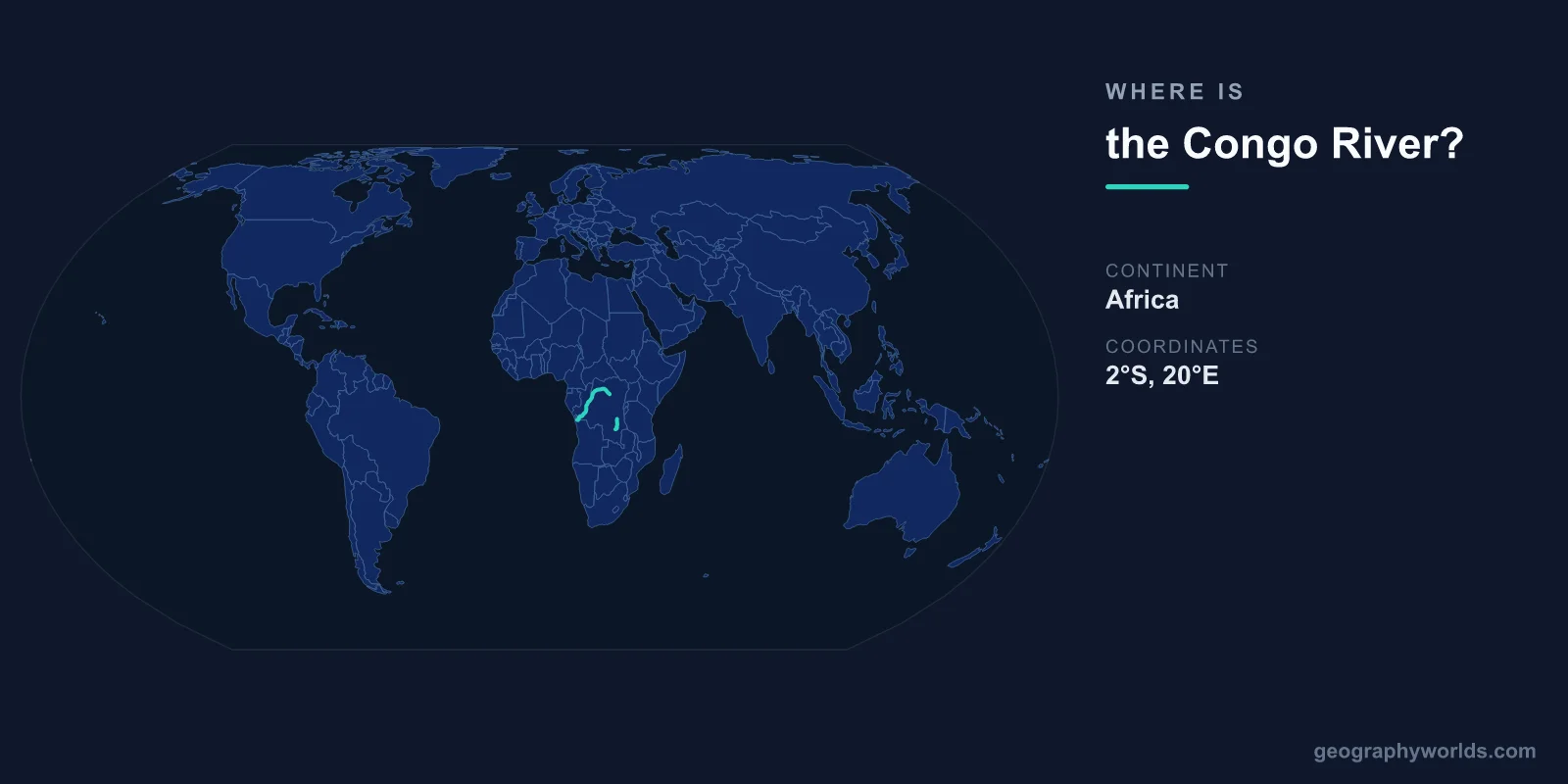
The Congo River is located in central Africa, flowing in a great arc from its source in southeastern DR Congo at approximately 11°S, 29°E to its mouth on the Atlantic Ocean at approximately 6°S, 12°E. At roughly 4,700 kilometers, it is Africa's second-longest river and the world's deepest, with measured depths exceeding 220 meters.
Introduction
The Congo is the world's second-largest river by discharge volume after the Amazon, releasing roughly 41,000 cubic meters of water per second into the Atlantic. Its drainage basin of approximately 3.7 million square kilometers covers a vast swath of equatorial Africa and contains the world's second-largest tropical rainforest.

Exact Location & Coordinates
- Source: ~11°S, 29°E (southeastern DR Congo)
- Mouth: ~6°S, 12°E (Atlantic Ocean)
- Flow Pattern: South, then north, then west (great arc)
- Length: ~4,700 km
On a world map, the Congo River traces a distinctive arc through equatorial Africa. It begins in southeastern DR Congo near the Zambian border, flows northward across the equator, then curves westward and southwestward to reach the Atlantic. This great arc is visible on any map of Africa as a major river system in the continent's center.
The mouth of the Congo is marked by a deep submarine canyon that extends far into the Atlantic, carved by the river's powerful outflow. The river's freshwater plume extends over 100 kilometers into the Atlantic, creating a distinct lens of fresh water over the salty ocean.
Surrounding Countries & Borders
- DR Congo: Main course (the river gives the country its name)
- Republic of Congo: Forms part of the western border with DR Congo
- Other Basin Countries: Central African Republic, Cameroon, Angola, Zambia, Tanzania
The Democratic Republic of the Congo (DRC) contains the majority of the river's course and basin, and the country takes its name from the river. Kinshasa, the DRC's capital, and Brazzaville, the Republic of Congo's capital, face each other across the river — the only place in the world where two national capitals directly face each other across a river.
The Congo basin extends into several other countries. The Central African Republic contributes tributaries from the north, while Angola, Zambia, and Tanzania contribute from the south. The Republic of Congo (Congo-Brazzaville) shares the western river section with the DRC.
Geographic Context
- Drainage Basin: ~3.7 million km² (2nd largest in the world)
- Crosses Equator: Twice (unique among major rivers)
- Rainforest: Congo Basin rainforest is world's 2nd largest
The Congo is unique among the world's major rivers in that it crosses the equator twice — once flowing northward and again flowing southward on its great arc. This means that water from tributaries in both hemispheres feeds the river throughout the year, giving it a remarkably steady flow with no single dominant flood season.
The Congo Basin rainforest, covering roughly 2 million square kilometers, is the second-largest tropical forest after the Amazon. This forest stores an estimated 25-30 billion tons of carbon and contains thousands of species, including forest elephants, gorillas, bonobos, and okapi. The forest's peat bogs alone store roughly 30 billion tons of carbon.
Physical Characteristics
- Length: ~4,700 km
- Maximum Depth: >220 m (world's deepest river)
- Discharge: ~41,000 m³/s (2nd highest globally)
- Drainage Basin: ~3.7 million km²
The Congo's extreme depth — over 220 meters in the lower section — is caused by the river squeezing through narrow gorges in its lower course. These depths have created isolated aquatic environments where unique, cave-adapted fish species have evolved in the dark, deep waters, including several species that are blind.
The river's consistent high flow makes it one of the world's greatest potential sources of hydroelectric power. The Inga Falls area in the lower Congo, where the river drops 96 meters over 15 kilometers, has an estimated hydroelectric potential of 40,000+ megawatts — enough to power much of sub-Saharan Africa. The Grand Inga Dam project, if completed, would be the world's largest hydroelectric facility.
Why It Matters
- Hydroelectric Potential: Could power much of sub-Saharan Africa
- Biodiversity: Second-largest tropical rainforest, critical for global climate
- Transportation: Major waterway for landlocked central African regions
The Congo River serves as the primary transportation network for a vast region with limited road and rail infrastructure. River boats carry passengers and cargo across thousands of kilometers, connecting remote communities to cities like Kinshasa and Kisangani. For many Congolese, the river is the only reliable transportation link to the outside world.
The Congo Basin's ecological importance rivals the Amazon's. Its forests are critical for global climate regulation, absorbing massive amounts of CO2 and recycling moisture that generates rainfall across the continent. Deforestation, mining, and expanding agriculture threaten this ecosystem, but large areas remain among the most intact tropical forests on Earth.
Key Facts
- The Congo River flows from ~11°S, 29°E to ~6°S, 12°E across central Africa.
- At ~4,700 km, it is Africa's second-longest river and the world's deepest (>220 m).
- Its discharge of ~41,000 m³/s is the second highest of any river on Earth.
- It crosses the equator twice — unique among major world rivers.
- Kinshasa and Brazzaville, two national capitals, face each other across the Congo.
Fun Facts
- The Congo is the only major river in the world that crosses the equator twice.
- Blind fish have evolved in the Congo's deep, dark lower stretches.
- The Grand Inga Dam project could generate over 40,000 MW — the world's largest hydroelectric facility.
- The Congo's submarine canyon extends roughly 200 km into the Atlantic Ocean floor.
Final Thoughts
The Congo River arcs through central Africa from approximately 11°S, 29°E to 6°S, 12°E, carrying the world's second-largest river discharge through equatorial forests. As the deepest river on Earth, a twice-equator-crosser, and the lifeline of central Africa, the Congo is one of the most remarkable rivers on the world map. Its enormous hydroelectric potential and ecological significance make it critical to both Africa's future and global climate.
Test Your Knowledge!
Think you know where things are on the map? Test your skills!
Play Geography Games →