
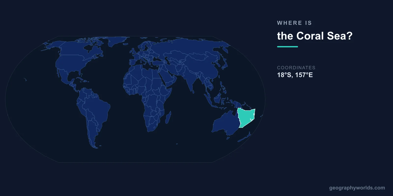
The Coral Sea is located in the southwestern Pacific Ocean, centered at approximately 15°S latitude and 155°E longitude. It lies off the northeast coast of Australia, bounded by Queensland to the west, Papua New Guinea and the Solomon Islands to the north, Vanuatu and New Caledonia to the east, and merging with the Tasman Sea to the south.
Introduction
Covering approximately 4,791,000 square kilometers, the Coral Sea is one of the largest marginal seas in the world. It is best known for containing the Great Barrier Reef, the largest coral reef system on Earth, and for the historic World War II Battle of the Coral Sea in 1942.

Exact Location & Coordinates
- Center Coordinates: 15°S, 155°E
- Region: Southwestern Pacific Ocean
- Connected To: Pacific Ocean, Tasman Sea, Solomon Sea
On a world map, the Coral Sea is the body of water immediately northeast of Australia. If you locate Queensland on Australia's east coast, the Coral Sea stretches from the Great Barrier Reef eastward toward the islands of Melanesia. It sits entirely within the Southern Hemisphere, spanning roughly from 10°S to 24°S latitude.
The sea is bounded by natural and political features rather than clear geographic barriers. The Torres Strait separates it from the Arafura Sea to the northwest, while the Louisiade Archipelago of Papua New Guinea marks its approximate northern boundary.
Surrounding Countries & Borders
- Australia: Western boundary (Queensland coast)
- Papua New Guinea: Northern boundary
- Solomon Islands: Northeastern boundary
- Vanuatu: Eastern boundary
- New Caledonia (France): Southeastern boundary
Australia has the most significant presence in the Coral Sea, as the Great Barrier Reef stretches along virtually the entire Queensland coastline. The Coral Sea Islands Territory, an Australian external territory, includes scattered cays, islets, and reefs across the sea's central and eastern waters.
Papua New Guinea's southeastern coast and island chains form the northern boundary. The Solomon Islands, Vanuatu, and the French territory of New Caledonia define the sea's eastern limits. These Melanesian island nations are surrounded by some of the most biodiverse marine environments on the planet.
Geographic Context
- Part Of: Southwestern Pacific Ocean
- Major Feature: Great Barrier Reef (2,300 km long)
- Island Groups: Coral Sea Islands, Louisiade Archipelago, numerous atolls
The Coral Sea's most famous feature is the Great Barrier Reef, which runs for roughly 2,300 kilometers along Australia's Queensland coast. This massive reef system is the largest living structure on Earth, visible from space, and home to over 1,500 species of fish and 400 types of coral.
The sea contains numerous submerged reefs, atolls, and seamounts, many of which rise steeply from deep ocean floors. The Coral Sea Basin in the central portion reaches abyssal depths, while shallow reef platforms dot the margins. Warm tropical currents flow southward through the sea, feeding into the East Australian Current.
Physical Characteristics
- Area: 4,791,000 km²
- Maximum Depth: ~9,140 m (near New Hebrides Trench)
- Average Depth: 2,394 m
- Water Temperature: 24-28°C at surface
The Coral Sea is remarkably deep in places, particularly near the New Hebrides Trench along its eastern margin, where depths approach 9,140 meters. The central basin averages over 4,000 meters deep, while the continental shelf area near Australia is relatively shallow.
Warm, clear tropical waters characterize the Coral Sea. Surface temperatures remain between 24°C and 28°C year-round, providing ideal conditions for coral growth. The East Australian Current, which flows southward through the Coral Sea, is one of the strongest western boundary currents in the Southern Hemisphere.
Why It Matters
- Great Barrier Reef: UNESCO World Heritage Site
- Biodiversity: Among the most biodiverse marine regions on Earth
- History: Site of pivotal 1942 WWII naval battle
The Coral Sea contains some of the most pristine and biodiverse marine ecosystems remaining on Earth. The Great Barrier Reef alone supports over 9,000 known species. In 2009, Australia established the Coral Sea Commonwealth Marine Reserve, one of the world's largest marine protected areas, covering nearly 990,000 square kilometers.
The Battle of the Coral Sea in May 1942 was the first naval battle in history where the opposing ships never sighted each other, with all attacks carried out by aircraft. This strategic Allied victory helped prevent Japan from invading Australia and marked a turning point in the Pacific War.
Key Facts
- The Coral Sea is centered at approximately 15°S, 155°E in the southwestern Pacific.
- It covers about 4,791,000 km², making it one of the world's largest marginal seas.
- The Great Barrier Reef, the world's largest coral reef system, lies along its western margin.
- It is bounded by Australia, Papua New Guinea, the Solomon Islands, Vanuatu, and New Caledonia.
- Maximum depths near the New Hebrides Trench approach 9,140 meters.
Fun Facts
- The Battle of the Coral Sea in 1942 was the first naval battle fought entirely by aircraft — the ships never saw each other.
- The Great Barrier Reef is so large it can be seen from space.
- The East Australian Current flowing through the Coral Sea was made famous in the film Finding Nemo.
- Australia's Coral Sea Marine Reserve is larger than the combined area of France and Germany.
Final Thoughts
The Coral Sea lies off Australia's northeast coast at approximately 15°S, 155°E, forming a vast tropical expanse in the southwestern Pacific. Home to the Great Barrier Reef and surrounded by the island nations of Melanesia, it contains some of the richest marine biodiversity on Earth. Its combination of ecological importance, strategic history, and sheer scale makes it a landmark feature on any world map.
Test Your Knowledge!
Think you know where things are on the map? Test your skills!
Play Geography Games →