
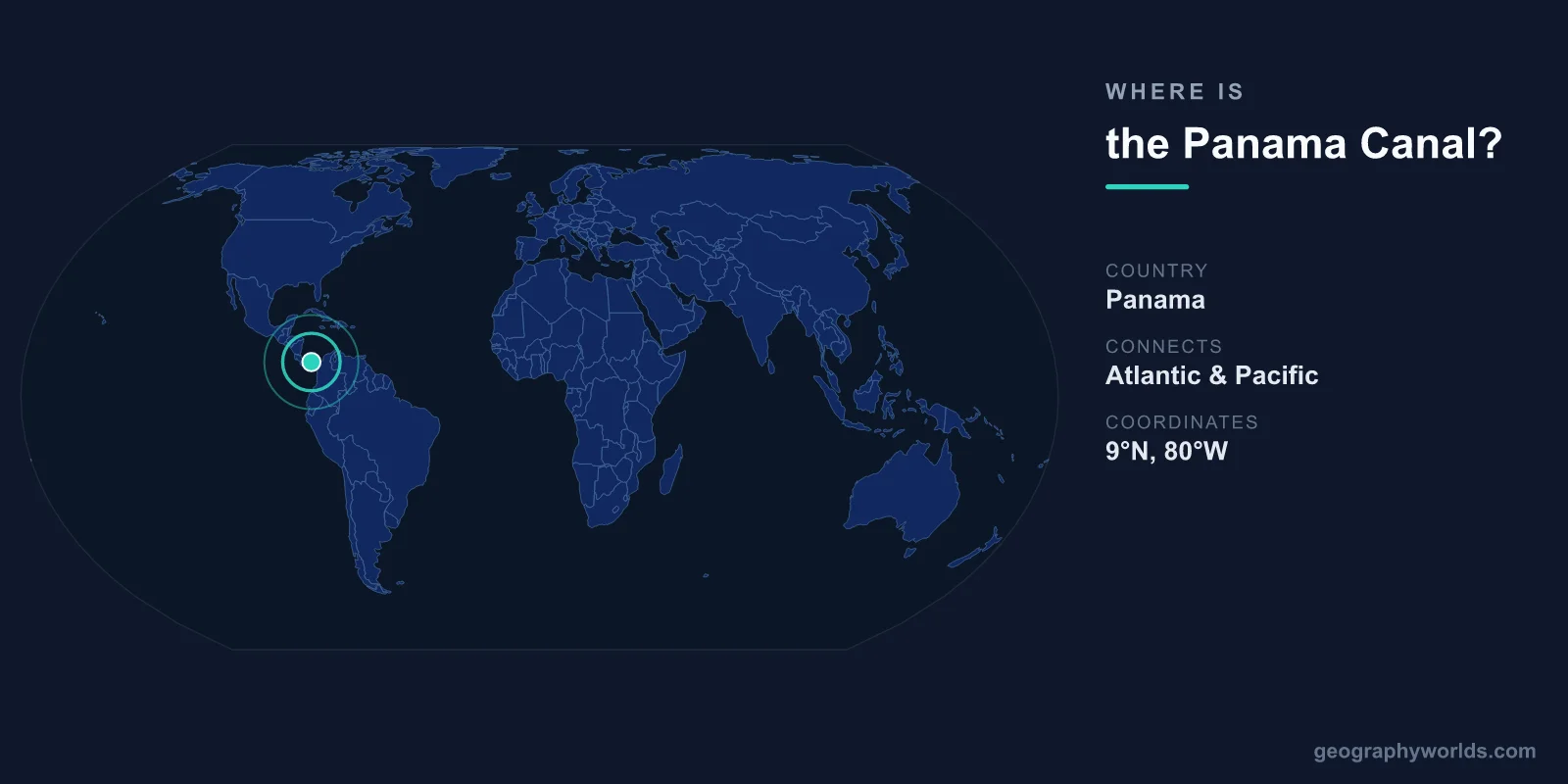
The Panama Canal is located in the Republic of Panama at approximately 9°N latitude and 79.7°W longitude, crossing the narrow Isthmus of Panama to connect the Caribbean Sea (Atlantic Ocean) to the Pacific Ocean. The canal is approximately 82 kilometers long from deep water in the Atlantic to deep water in the Pacific.
Introduction
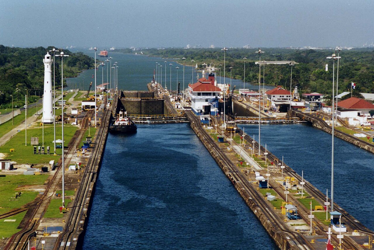
Unlike the sea-level Suez Canal, the Panama Canal uses a lock system to raise ships 26 meters to the level of artificial Gatun Lake in the canal's center, then lower them back to sea level on the other side. This engineering solution was necessary because the Isthmus of Panama, though narrow, is hilly terrain that would have required impossibly deep excavation for a sea-level canal.
Exact Location & Coordinates
- Atlantic Entrance: Colon, 9.36°N, 79.92°W
- Pacific Entrance: Panama City/Balboa, 8.95°N, 79.57°W
- Length: ~82 km (from deep water to deep water)
- Country: Panama
On a world map, the Panama Canal appears as a thin line crossing the narrow isthmus connecting North and South America. Counterintuitively, the Pacific entrance is east of the Atlantic entrance — this is because the isthmus curves, and the canal runs roughly northwest to southeast rather than east to west.
To find the Panama Canal on a map, locate Central America and look for the narrowest point between the Caribbean Sea and the Pacific Ocean. The canal is at the very southern end of Central America, with Colombia to the southeast and Costa Rica to the northwest.
Surrounding Countries & Borders
- Panama: Canal runs entirely through Panamanian territory
- Colombia: South/east of Panama, shares land border
- Costa Rica: Northwest of Panama, shares land border
- Canal Zone: Former US-controlled territory (1903-1999), now returned to Panama
The Panama Canal is entirely within Panamanian territory, operated by the Panama Canal Authority (ACP) since December 31, 1999, when the United States transferred control under the 1977 Torrijos-Carter Treaties. Before this, the US controlled a 16-kilometer-wide Canal Zone across the isthmus.
The canal's construction was one of the largest and most complex engineering projects in history. The French attempted to build a sea-level canal in the 1880s but failed due to engineering challenges, disease (malaria and yellow fever killed over 22,000 workers), and financial problems. The United States completed the lock-based canal between 1904 and 1914.
Geographic Context
- Gatun Lake: Artificial lake at 26 m elevation, central to the canal's operation
- Lock System: Three sets of locks raise/lower ships 26 m
- Continental Divide: Canal crosses the Continental Divide of the Americas at the Culebra Cut
- Neopanamax Locks: New larger locks opened in 2016 to accommodate bigger ships
The canal works by lifting ships from sea level to Gatun Lake through the Gatun Locks on the Atlantic side (a three-step lift of 26 meters), then carrying them across the lake (which makes up a significant portion of the canal's length), and lowering them back to sea level through the Pedro Miguel and Miraflores locks on the Pacific side.
Each lock chamber uses gravity-fed water from Gatun Lake — no pumps are needed. However, each transit uses roughly 197 million liters of fresh water, which flows from the lock chambers into the sea. During drought years, water shortages in Gatun Lake have forced the canal to restrict ship size and number, highlighting the canal's dependence on rainfall.
Physical Characteristics
- Length: ~82 km
- Locks: 3 sets (Gatun, Pedro Miguel, Miraflores) + Neopanamax locks
- Gatun Lake Elevation: 26 m above sea level
- Transit Time: 8-10 hours
- Water per Transit: ~197 million liters
The 2016 expansion added a third set of larger locks (Neopanamax) that accommodate ships carrying up to 14,000 twenty-foot equivalent units (TEUs) of containers, compared to 5,000 TEUs for the original locks. This expansion cost $5.25 billion and took 9 years to complete.
The canal operates 24 hours a day, handling roughly 14,000 ships per year — about 40 per day. Ships are charged tolls based on their size and cargo. The highest toll ever paid was over $1.2 million by a large container ship. The lowest toll on record was 36 cents, paid by Richard Halliburton when he swam the canal in 1928.
Why It Matters
- Global Trade: ~5% of world trade passes through the Panama Canal
- Shipping Distance: Saves 12,600 km vs sailing around South America (Cape Horn)
- Revenue: Over $3.3 billion/year in tolls for Panama
- Drought Risk: Climate change threatens water supply for lock operations
The Panama Canal saves ships traveling between the US East Coast and Asia approximately 12,600 kilometers compared to the alternative route around Cape Horn at the tip of South America. This translates to roughly 2-3 weeks of sailing time and significant fuel costs. The canal is particularly important for trade between the US East Coast and East Asia.
Climate change poses a significant threat to the canal's operations. The lock system depends on rainfall to maintain Gatun Lake at sufficient levels. Extended dry seasons, exacerbated by El Nino events and climate change, have forced the canal to impose draft restrictions (limiting how deep ships can sit in the water) and reduce daily transits. The 2023 drought forced restrictions that reduced daily transits from 38 to 22, causing significant shipping delays.
Key Facts
- The Panama Canal is at ~9°N, 79.7°W, crossing 82 km of the Isthmus of Panama.
- Ships are raised 26 m to Gatun Lake via locks, then lowered back to sea level.
- The canal handles ~5% of global trade, saving 12,600 km vs sailing around South America.
- Each transit uses ~197 million liters of fresh water from Gatun Lake.
- The 2016 expansion added Neopanamax locks for ships carrying up to 14,000 TEUs.
Fun Facts
- The Pacific entrance to the Panama Canal is east of the Atlantic entrance — the isthmus curves counterintuitively.
- Over 22,000 workers died during the French attempt to build the canal, mostly from disease.
- The lowest toll ever paid was 36 cents by a man who swam the canal in 1928.
- The 2023 drought forced the canal to reduce daily transits from 38 to 22, disrupting global shipping.
Final Thoughts
The Panama Canal at approximately 9°N, 79.7°W is one of the most important waterways ever constructed, connecting the Atlantic and Pacific Oceans across 82 kilometers of Central American isthmus. Its lock system, raising ships 26 meters to cross the Continental Divide, remains one of engineering's greatest achievements. As climate change threatens its water supply, the canal's future operations — and the 5 percent of global trade that depends on it — face unprecedented challenges.
Test Your Knowledge!
Think you know where things are on the map? Test your skills!
Play Geography Games →