
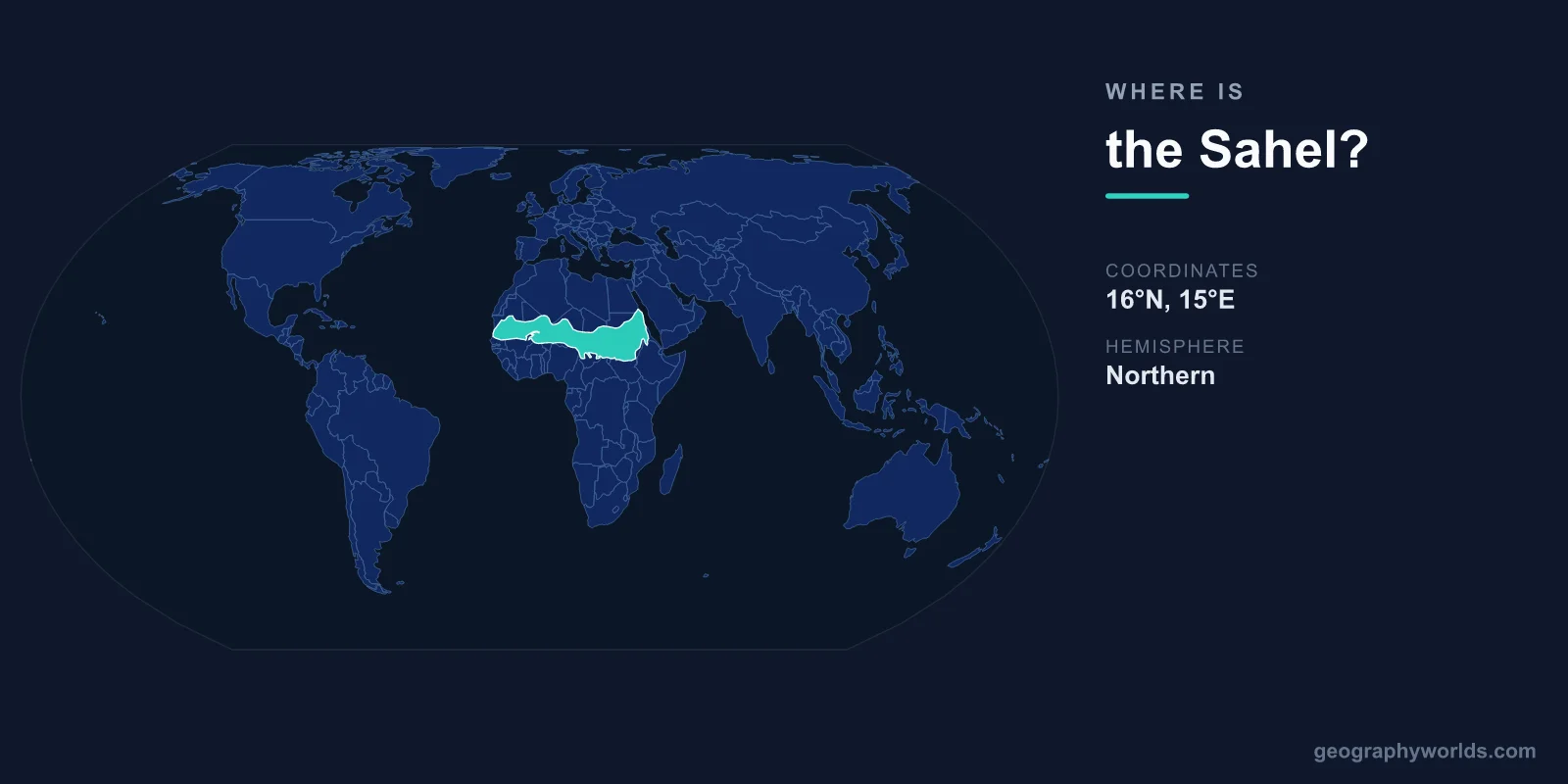
The Sahel is located across central-northern Africa, stretching approximately 5,400 kilometers from the Atlantic Ocean to the Red Sea, roughly between 12°N and 20°N latitude, centered at approximately 15°N, 5°E. It is the semi-arid ecological transition zone between the Sahara Desert to the north and the wetter savannas and forests of sub-Saharan Africa to the south.
Introduction
The name "Sahel" comes from the Arabic word meaning "shore" or "coast" — metaphorically the shore of the Saharan sand sea. The Sahel passes through or touches roughly a dozen countries and is home to over 300 million people. It is one of the most climate-vulnerable and geopolitically significant regions on Earth.

Exact Location & Coordinates
- Center Coordinates: ~15°N, 5°E
- Region: Central-northern Africa, coast to coast
- Extent: ~5,400 km east-west, 500-1,000 km north-south
- Rainfall Range: 200-600 mm per year
On a world map, the Sahel is the broad band of tan-to-light-green terrain immediately south of the Sahara's yellow expanse. It stretches from Senegal and Mauritania on the Atlantic coast eastward through Mali, Burkina Faso, Niger, Nigeria, Chad, and Sudan to Eritrea on the Red Sea coast.
The Sahel is defined by rainfall rather than political borders. The northern boundary receives roughly 200 mm of rainfall per year (the southern edge of the Sahara), while the southern boundary receives roughly 600 mm (where savanna woodlands begin). This 400-mm gradient across 500-1,000 kilometers defines the zone.
Surrounding Countries & Borders
- Senegal: Western Sahel, Atlantic coast
- Mali: Central Sahel (Timbuktu is at the Sahel-Sahara border)
- Niger: Central Sahel (Niamey)
- Chad: Central-eastern Sahel (N'Djamena)
- Burkina Faso: Southern edge of Sahel
- Sudan: Eastern Sahel, Red Sea area
- Other Countries: Mauritania, Nigeria (northern), Cameroon (northern), Eritrea
The Sahel's core countries — Senegal, Mauritania, Mali, Burkina Faso, Niger, Nigeria (northern), Chad, and Sudan — face shared challenges of desertification, food insecurity, and political instability. The "G5 Sahel" grouping (Mauritania, Mali, Burkina Faso, Niger, Chad) was formed to address security threats, particularly from jihadist groups.
Nigeria's northern states, northern Cameroon, and Eritrea represent the Sahel's extensions at its widest definition. The Lake Chad basin in the central Sahel, shared by Chad, Nigeria, Niger, and Cameroon, has shrunk by 90 percent since the 1960s due to drought and irrigation — a stark symbol of the region's environmental crisis.
Geographic Context
- Transition Zone: Between Sahara Desert (north) and savanna (south)
- Desertification: The Sahel is expanding southward in many areas
- Lake Chad: Has shrunk 90% since the 1960s
The Sahel is one of the world's most dynamic ecological boundaries, shifting north and south with decades-long rainfall cycles. During the devastating Sahel droughts of the 1970s-1980s, which killed hundreds of thousands and displaced millions, the desert advanced southward. Some areas have since re-greened, but the overall trend remains concerning.
The Great Green Wall initiative, launched by the African Union, aims to grow an 8,000-kilometer belt of trees and vegetation across the Sahel from Senegal to Djibouti. This ambitious project seeks to combat desertification, restore degraded land, and provide food security and employment for millions of Sahelian people.
Physical Characteristics
- Area: ~3 million km²
- Population: ~300+ million
- Rainfall: 200-600 mm/year, single rainy season
- Vegetation: Grassland, scattered trees, thorny scrub
The Sahel's landscape is characterized by grasslands with scattered drought-resistant trees like acacia, balanites, and baobab. During the brief rainy season (July-September in the western Sahel), the landscape transforms from brown to green within weeks. This single rainy season determines the year's agricultural output and food security.
Pastoralism and rain-fed agriculture are the primary livelihoods. The Fulani, Tuareg, and other pastoral peoples move their herds seasonally across the Sahel following rainfall and grazing patterns. Conflicts between pastoralists and sedentary farmers over shrinking land and water resources are a growing source of violence across the region.
Why It Matters
- Climate Change Frontline: One of the most climate-vulnerable regions on Earth
- Security: Jihadist insurgencies, political instability
- Migration: Major source and corridor for migration toward Europe
The Sahel is ground zero for the human consequences of climate change. Rising temperatures, erratic rainfall, desertification, and population growth are creating a "perfect storm" of food insecurity, poverty, and conflict. The region's population is projected to double by 2050, intensifying pressure on already-stressed resources.
The Sahel has become one of the world's most active conflict zones, with jihadist groups (including affiliates of al-Qaeda and ISIS) operating across Mali, Burkina Faso, Niger, and Nigeria. Political instability, including military coups in Mali, Burkina Faso, and Niger in recent years, has compounded the region's challenges. The Sahel is also a major corridor for migration toward North Africa and Europe.
Key Facts
- The Sahel is centered at approximately 15°N, 5°E across central-northern Africa.
- It stretches ~5,400 km from the Atlantic to the Red Sea.
- Rainfall of 200-600 mm/year defines this transition zone between Sahara and savanna.
- Over 300 million people live in the Sahel region.
- Lake Chad has shrunk by 90% since the 1960s due to drought and overuse.
Fun Facts
- The word "Sahel" comes from Arabic meaning "shore" — the shore of the Saharan sand sea.
- The Great Green Wall project aims to grow an 8,000 km belt of vegetation across the entire Sahel.
- The Sahel's brief rainy season (July-September) determines food security for hundreds of millions of people.
- The Fulani people of the Sahel are the world's largest nomadic pastoral group.
Final Thoughts
The Sahel stretches across Africa at approximately 15°N, 5°E, a 5,400-kilometer semi-arid band between the Sahara and the tropical south. Home to over 300 million people and facing the converging pressures of climate change, population growth, and conflict, the Sahel is one of the most consequential regions on the world map. Understanding its location and challenges is essential for grasping some of the 21st century's most pressing global issues.
Test Your Knowledge!
Think you know where things are on the map? Test your skills!
Play Geography Games →