
Glaciers and ice sheets are massive bodies of ice that form where snow accumulates faster than it melts, compacting over centuries into flowing ice. Together they store roughly 69% of Earth's fresh water. A glacier is a river of ice confined by terrain; an ice sheet is a continent-scale dome of ice — and only two ice sheets exist today, covering Antarctica and Greenland.
These frozen giants are among the most powerful forces in geography. They carved the fjords of Norway, the Great Lakes of North America, and the alpine valleys of Europe. They feed rivers that supply water to well over a billion people. And because they respond directly to temperature, they have become the most visible measure of a warming climate. This guide explains how they form, how they move, where they are found, and why their fate matters to everyone.
How Ice Becomes a Glacier
A glacier begins with snow that survives the summer. Year after year, new snowfall buries and compresses the old. Air is squeezed out, delicate snowflakes recrystallize into granular ice called firn, and after decades to centuries of compaction the firn fuses into dense glacial ice with its characteristic deep blue tint. Once the ice mass grows thick enough — typically around 50 meters — its own weight makes it flow. Movement is what officially turns a patch of perennial ice into a glacier.
Glaciers flow in two ways: the ice itself deforms and creeps downhill like extremely slow-moving putty, and many glaciers also slide on a thin film of meltwater at their base. Most move a few centimeters to a few meters per day, though fast outlet glaciers in Greenland have been clocked at over 40 meters per day.
Every glacier has a budget. Snow accumulates in its upper reaches (the accumulation zone) and melts or evaporates at its lower end (the ablation zone). When accumulation outpaces loss, the glacier thickens and its snout advances; when melt wins, the glacier thins and retreats — even though the ice inside never stops flowing downhill. This mass balance is what glaciologists measure each year to take a glacier's temperature, figuratively and literally.
Glacier vs. Ice Sheet: What's the Difference?
- Mountain (alpine) glaciers occupy valleys and cirques in high ranges — the Alps, Himalayas, Andes, and Alaska. They flow downhill, confined by the surrounding rock, like the Aletsch Glacier, the largest in the Alps.
- Ice caps are dome-shaped ice masses covering less than 50,000 km² — Iceland's Vatnajökull is a classic example.
- Ice sheets exceed 50,000 km² and bury entire landscapes, flowing outward in all directions from thick central domes. Earth has exactly two: the Antarctic Ice Sheet and the Greenland Ice Sheet.
- Ice shelves are floating extensions of ice sheets over the ocean, and icebergs are the chunks that break ("calve") off their edges.
The Two Ice Sheets: Antarctica and Greenland
The numbers are difficult to grasp:
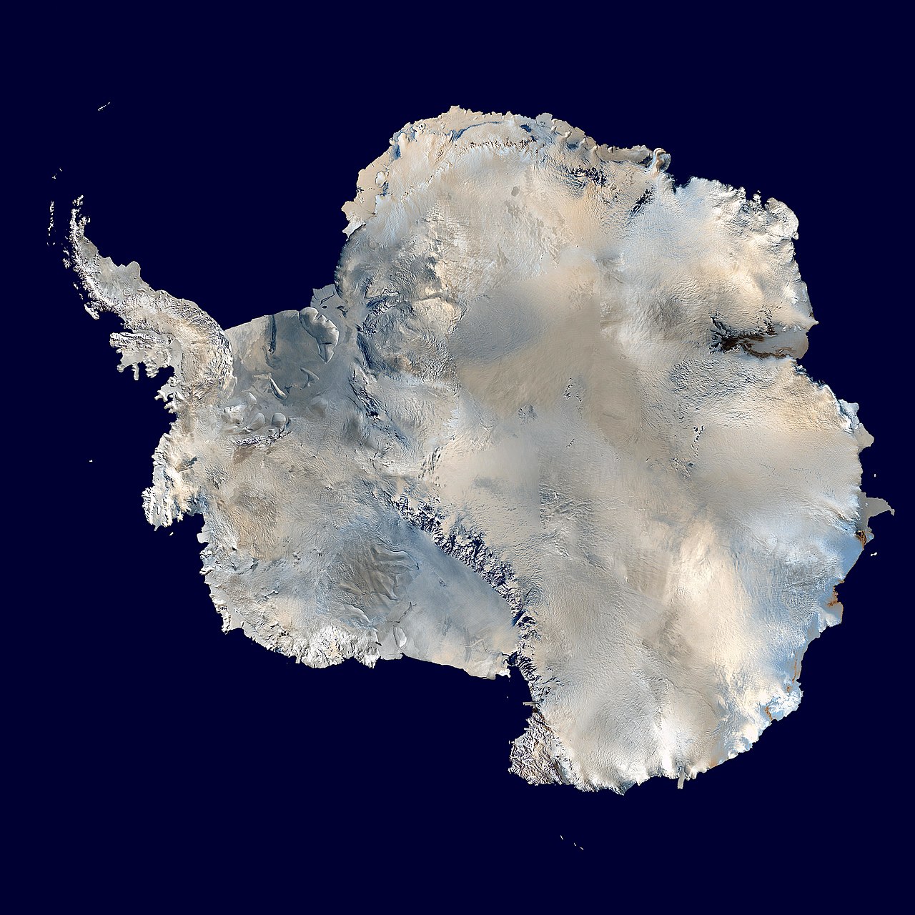
- Antarctica spans about 14 million km² — larger than the United States — with ice averaging over 2 km thick and reaching nearly 4.9 km at its deepest. It holds about 90% of the world's ice; if it all melted, global sea level would rise roughly 58 meters. Explore it further in our Antarctica geography guide.
- Greenland's ice sheet covers about 1.7 million km² — roughly 80% of the island — and contains enough ice to raise sea level about 7 meters. Its ice locally exceeds 3 km in thickness.
The two behave differently under warming, too. Greenland loses ice largely through surface melting in summer, while Antarctica — too cold for much surface melt — loses it where warm ocean water eats at the floating edges of its glaciers, particularly in West Antarctica.
Both are archives as well as reservoirs: ice cores drilled from their depths trap ancient air bubbles, giving scientists a direct record of Earth's atmosphere and temperature stretching back some 800,000 years in Antarctica.
Outside the two ice sheets, glaciers cluster wherever mountains reach high enough or latitudes climb far enough: Alaska and Arctic Canada, the Himalayas and Karakoram (sometimes called the "Third Pole" for holding the most ice outside the polar regions), the Andes, the Alps, Scandinavia, New Zealand's Southern Alps — and even equatorial Africa, where shrinking remnant glaciers still cling to Kilimanjaro and Mount Kenya.
How Glaciers Sculpt the Landscape
Ice is a patient but unstoppable sculptor. Flowing glaciers pluck rock from the ground and drag it along, sandpapering everything beneath them. The results define whole regions:
- U-shaped valleys and fjords: Rivers cut V-shaped valleys; glaciers bulldoze them into broad U-shapes. Where such valleys flooded with seawater, they became fjords like Norway's or New Zealand's.
- Cirques, arêtes, and horns: Bowl-shaped hollows, knife-edge ridges, and pyramid peaks like the Matterhorn are all products of ice erosion.
- Moraines and drumlins: The rock debris a glacier carries is dumped at its edges and snout as ridges called moraines, mapping where the ice once stood.
- Lakes: The Great Lakes, the Finger Lakes, and tens of thousands of lakes across Canada, Scandinavia, and Finland sit in basins gouged by the ice-age ice sheets that covered much of North America and Europe until about 11,700 years ago.
Glaciers vs. Rivers: A Comparison of Nature's Two Great Carvers
Rivers and glaciers both move water downhill and reshape the land, but they work very differently. A river moves fast — meters per second — but carves narrowly, cutting V-shaped valleys and canyons along its channel. A glacier moves perhaps a million times slower, yet erodes across its entire width and depth simultaneously, excavating whole valleys at once. Rivers deliver their sediment continuously to deltas and floodplains; glaciers hoard debris for centuries, then abandon it in moraines when they retreat. And while a river's flow responds to last week's rain, a glacier integrates decades of climate — which is precisely why glaciers are such reliable climate indicators while rivers are not.
Why Glaciers Matter to People
- Water towers: Mountain glaciers act as natural reservoirs, storing winter snow and releasing meltwater through hot, dry summers. Rivers rising in the Himalayas and Karakoram — the Indus, Ganges, and Brahmaputra among them — support well over a billion people downstream.
- Sea level: Melting land ice is a leading driver of global sea-level rise, which threatens coastal cities and low-lying island nations.
- Hydropower and agriculture: Norway, Switzerland, and the Andean nations depend heavily on glacier-fed rivers for electricity and irrigation.
- Tourism and science: From Glacier National Park to the glaciers of Patagonia, ice draws millions of visitors — and ice cores remain one of science's best windows into past climate.
Frozen Giants in Retreat
Nearly all of the world's roughly 200,000 glaciers are shrinking. Alpine glaciers have lost a large share of their volume since the late 1800s; Glacier National Park has far fewer glaciers than the ~150 present when it was established in 1910. Greenland and Antarctica are both losing hundreds of billions of tonnes of ice per year on average, with losses accelerating since the 1990s. The consequences unfold on two timescales: in coming decades, communities that depend on glacial meltwater face first floods, then scarcity as the ice runs out; over centuries, ice-sheet loss will redraw coastlines worldwide.
Not every glacial change is slow, either. Ice shelves can disintegrate in weeks once meltwater wedges their crevasses open, as Antarctica's Larsen B shelf did in 2002, and glacial lakes dammed by unstable moraines can burst without warning — outburst floods are a growing hazard for mountain communities from Nepal to Peru.
Glaciers connect the poles to the tropics, the ice ages to the present, and mountain snowfields to the kitchen taps of distant cities. To see which nations hold the most ice today, browse our list of countries with the most glaciers — then test your knowledge of Earth's coldest places with our world geography quiz.