
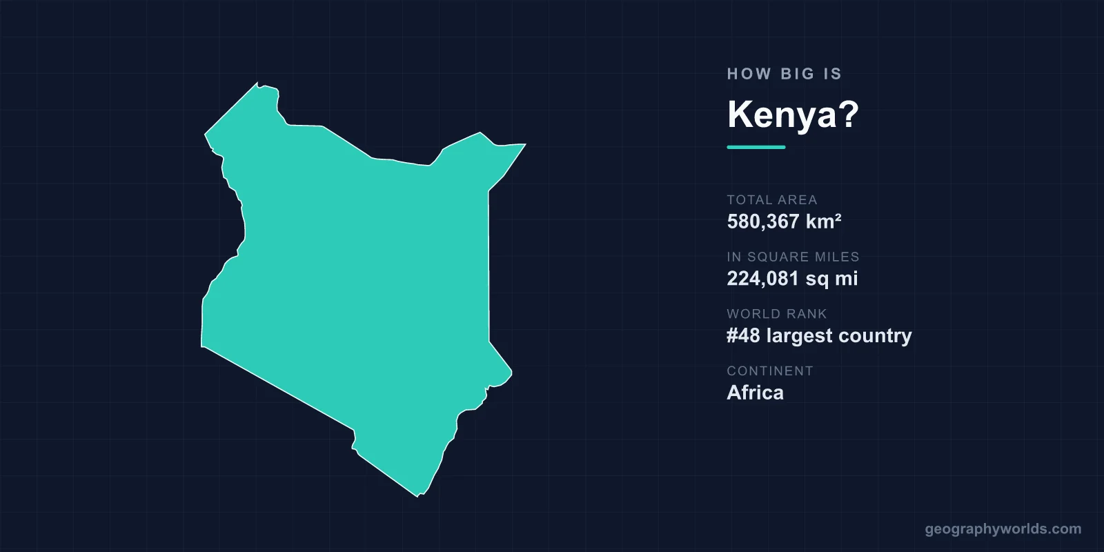
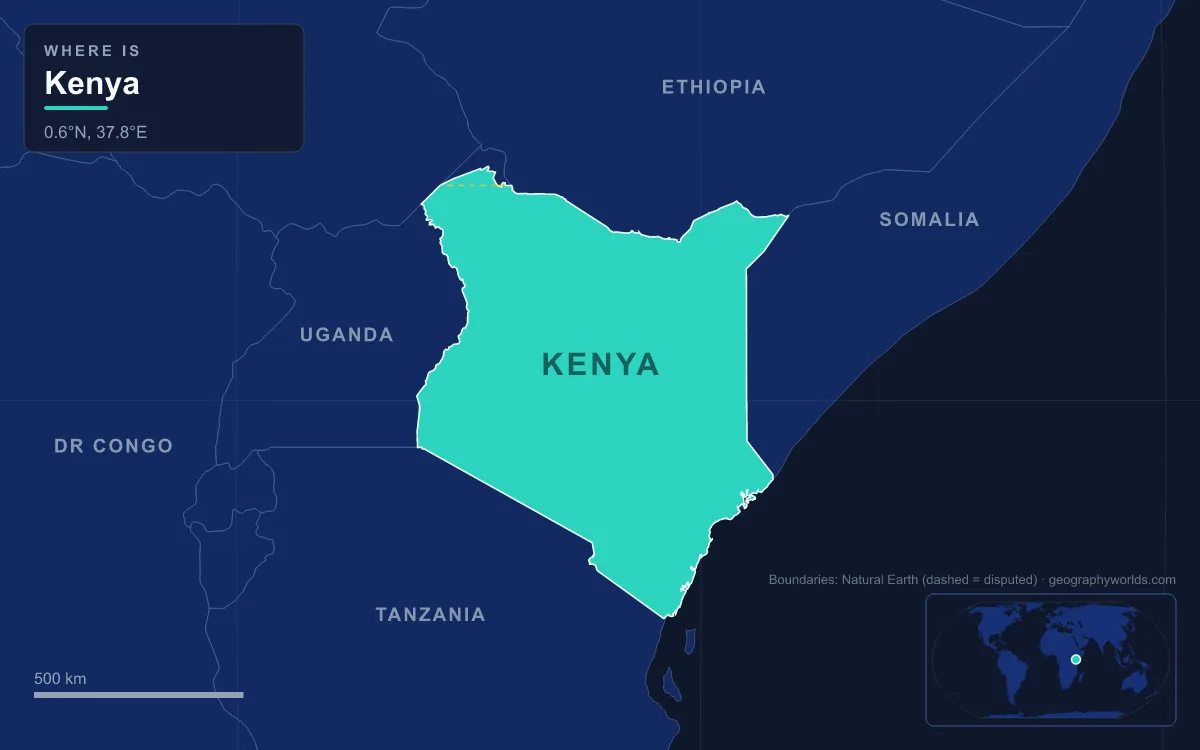
Kenya covers 580,367 km² (224,081 sq mi), which ranks it 48th among the world's countries by total area, a fraction behind Botswana and just ahead of Thailand. That makes it slightly larger than European France (about 551,500 km²) and about four-fifths the size of Texas. The equator cuts straight across the middle of the country, passing just north of Mount Kenya at the town of Nanyuki, and Kenyan territory runs from about 5° north to 5° south of it: from the dry lava fields and desert around Lake Turkana in the north to the Tanzanian border below Kilimanjaro, and from the Kenyan shore of Lake Victoria in the west to roughly 500 km of Indian Ocean coast in the east.
Zero Degrees at Nanyuki
Nanyuki, a market town in Laikipia County on the A2 road north of Nairobi, sits just north of the equator at 0° 01' N, and the road into town passes a roadside sign marking the line. To the south-east of the town rises Mount Kenya, whose summit lies only about 16.5 km south of the equator. Its highest peak, Batian, reaches 5,199 m (17,057 ft), making it the second-highest mountain in Africa after Kilimanjaro. The country takes its name from the mountain, and the massif has been a national park since 1949 and a UNESCO World Heritage Site since 1997.

From that line, Kenya extends roughly five degrees of latitude in each direction, between about 5°N and 5°S, and across about eight degrees of longitude, between 34°E and 42°E. Ten degrees of latitude works out at something over 1,100 km from north to south. Because the country is so close to the equator, its climate is set far more by height than by distance from the line: Nairobi, at 1,798 m, usually ranges between about 9 and 27 °C, while Mombasa on the coast stays warm all year.
580,367 km² and a Near Tie With Botswana
The total of 580,367 km² breaks down into about 569,140 km² of land and 11,227 km² of inland water, so lakes and rivers make up roughly 1.9% of the country. In the ranking used by Wikipedia's list of countries by area, Kenya is 48th, sandwiched between Botswana (582,000 km²) and Thailand (513,120 km²). The margin over Botswana is so thin, about 1,600 km², that some sources swap the two and give Kenya as the 47th-largest country.
Kenya's area also comes with a caveat at its north-western corner. The Ilemi Triangle, an area of about 11,000 km² beyond Lake Turkana, is claimed by both Kenya and South Sudan. Kenya has de facto control of the territory up to a 1950 Sudanese patrol line, and the dispute traces back to a straight-line boundary drawn in 1914 that ignored the seasonal grazing of the Turkana people.
With 47,564,296 people counted in the 2019 census, Kenya averaged roughly 82 people per km² that year, but the figure hides a sharp split. Nairobi County packs about 4.4 million people into roughly 696 km², while the vast northern counties have only a few people per square kilometre.
Kenya Against France, Texas and Its Neighbours
Kenya is the same order of size as France, and which one is bigger depends on what you count. European France covers about 551,500 km², so Kenya is roughly 5% larger. France including its five overseas regions covers 643,801 km², and on that basis Kenya is about 90% of France. Against Texas, which covers about 696,200 km², Kenya comes in at roughly 83%: if Kenya were laid over the Lone Star State, a strip about 116,000 km² of Texas would still show around it.
Other European comparisons are less close. Kenya is about 96% the size of Ukraine (603,550 km²), about 1.6 times the size of Germany (357,581 km²), almost twice the size of Italy (302,068 km²) and nearly two and a half times the size of the United Kingdom (244,376 km²).
In East Africa, Kenya is a middle-sized country. Ethiopia to the north (1,104,300 km²) is nearly twice its size, and Tanzania to the south (947,303 km²) is about 63% larger. South Sudan and Somalia are each roughly 10% larger than Kenya, while Uganda, at 241,550 km², is well under half its size. Kenya shares about 3,457 km of land border with these five neighbours, the longest stretch being the 867 km frontier with Ethiopia. Our guide to the countries that border Kenya follows each of those lines in turn.
Turkana, Marsabit and Wajir: The Arid Half
Most of Kenya's area is not the green highland country around Nairobi and Mount Kenya but the dry north and north-east. Kenya is divided into 47 counties, and six of them, Turkana, Marsabit, Wajir, Garissa, Mandera and Isiolo, together cover roughly 297,000 km², or just over half of the country. Turkana County alone, in the north-west between the Ugandan border and Lake Turkana, covers about 77,600 km² by the figure in its own Wikipedia article (other tables give more), making it the largest county and larger than the Republic of Ireland (70,273 km²). Marsabit County, on the opposite shore of the lake, covers about 66,900 km², and Wajir about 55,800 km².
This is the land of the Chalbi Desert, an ancient lake bed between Mount Marsabit and Lake Turkana whose name means "bare, salty area" in the language of the Gabra people. Farmland is scarce by comparison. Only about 9.8% of Kenya's land is classed as arable, and most of it lies in the highlands on either side of the Rift Valley and in the Lake Victoria basin. At the other extreme of the county list, Mombasa County on the coast covers just 229.7 km² of land, so Turkana is more than 300 times its size.
The Rift Valley Highlands Around Mount Kenya
The smaller, wetter share of Kenya is where most Kenyans live and farm. From the coast, low plains rise westward into the central highlands, which the Great Rift Valley splits down the middle, with fertile plateaus on either side running towards Lake Victoria and towards Mount Kenya. These Kenyan Highlands are the country's main farming region, and they also hold its tallest ground: Mount Kenya at 5,199 m in the east, and Mount Elgon, an extinct shield volcano straddling the Ugandan border north of Kisumu, in the west. Elgon's highest point, Wagagai, lies on the Ugandan side.
The highlands also hold Kenya's largest forests. The Mau Forest complex on the Mau Escarpment covers about 273,300 hectares, or roughly 2,733 km², making it the largest indigenous montane forest in East Africa; rivers rising there, including the Mara and the Sondu, feed Lake Victoria and Lake Nakuru. Further west, the Kakamega Forest in Kakamega, Vihiga and Nandi counties is Kenya's only tropical rainforest, a remnant of the Guineo-Congolian forest that once spread across the continent. Down the floor of the Rift, a chain of lakes including Naivasha, a freshwater lake north-west of Nairobi, links the highland heart of the country to the desert lake in the north.
Lake Turkana and Kenya's 6% of Lake Victoria
Kenya's 11,227 km² of inland water is dominated by two very different lakes. Lake Turkana, in the Rift Valley of the far north, covers about 6,405 km². It is a long, thin lake: around 290 km end to end, yet no more than about 32 km across at its widest. Almost all of it lies in Kenya; only the far northern end, where the Omo River flows in, crosses into Ethiopia. It is the world's largest permanent desert lake and the largest alkaline lake, with no outlet, so it loses water only by evaporation. Sibiloi National Park on its eastern shore and the volcanic Central and South Islands form the Lake Turkana National Parks, a UNESCO World Heritage Site listed in 1997 and extended in 2001.

Lake Victoria in the far west is more than nine times larger, at about 59,947 km², but Kenya holds only a small slice. Tanzania has 49% of the lake and Uganda 45%, leaving Kenya about 6%, or roughly 4,100 km², including the shallow Winam Gulf, with the port of Kisumu on its north-eastern shore and Homa Bay to the south. Rivers such as the Nzoia, Yala and Sondu Miriu drain Kenya's western highlands into it. For more on the northern lake, read our full guide to Lake Turkana's geography.
Roughly 500 km of Indian Ocean Shore
Kenya's coastline is short for a country of its size. Figures vary with how the shore is measured: Wikipedia's geography summary gives 536 km, while the CIA World Factbook figure quoted in the same article is 490 km. Either way, it is only about a seventh of the length of the land border. The coast runs from the Tanzanian border south of Mombasa, past Malindi, to the Lamu archipelago near Somalia, and its waters give Kenya an exclusive economic zone of about 116,942 km².
Kenya's two longest rivers reach the sea along this stretch. The Tana, at about 1,000 km the longest river in the country, rises in the Mount Kenya region, where it is known as the Sagana, and flows for some 700 km through semi-arid plains before reaching the ocean. The Athi-Galana-Sabaki, at about 390 km, rises in the Gatamaiyo Forest, picks up the Nairobi River and the Tsavo River from the slopes of Kilimanjaro, and enters the ocean as the Galana. The low coastal strip rises inland to the central highlands, the Rift Valley and Mount Kenya, so a journey from Mombasa to the equator at Nanyuki climbs from sea level, past Nairobi at 1,798 m, into the highlands. To see how Kenya measures up against its larger southern neighbour, read our comparison of Kenya and Tanzania.