

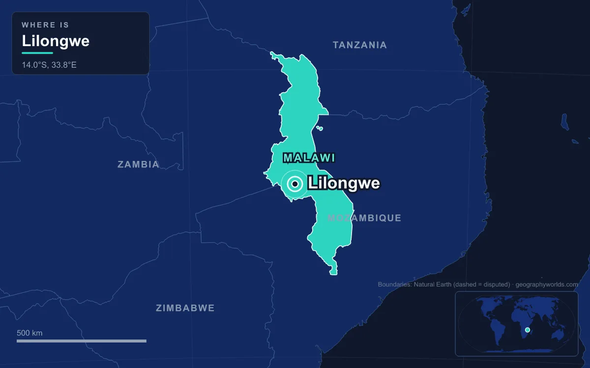
Lilongwe, home to 989,318 people at the 2018 census, is the capital and largest city of Malawi. It lies on a plateau in the Central Region, about 1,050 metres above sea level on the Lilongwe River, not far from the borders with Zambia and Mozambique. It was a colonial district post and farming market until 1975, when President Hastings Kamuzu Banda made it the capital in place of Zomba. The move was planned from 1965, and it turned a town of fewer than 20,000 people into a city that has now overtaken Blantyre, the country's old commercial centre. Lilongwe is easiest to understand by comparing it: with its rival, with the capital it replaced, with itself over time, and with the rest of Malawi.
19,425 People in 1966, Nearly a Million by 2018
The first number to know is how fast Lilongwe grew. The census of 1966, two years after independence, counted 19,425 people. By 1977 there were 98,718, by 1987 223,318, and by 1998 440,471. The 2008 census recorded 674,448 and the 2018 census 989,318, fifty times the 1966 figure in just over half a century. Growth has recently been running at about 4.3 percent a year, and one estimate put the population at 1,122,000 in 2020.
That growth started from a modest base. Lilongwe began around 1902 as a boma, a small administrative post, set up by a local leader named Njewa, and it became a district centre in 1904. In the 1920s its position at the junction of several roads made it a market for the tobacco and maize farms of the Central Region plateau, and it was formally recognised as a town in 1947. Nothing about it looked like a future capital until the 1960s.
Lilongwe Against Blantyre, the Old Commercial Capital
Malawi's second city is a very different place. Blantyre was founded in 1876 as a Church of Scotland mission and named after the Scottish birthplace of David Livingstone. It became a British consular station in 1883 and a municipality by 1895, making it the oldest municipality in the country. Blantyre grew rich on colonial trade and became the home of Malawi's manufacturing and finance. The Malawi Stock Exchange opened there in November 1996, and the city is still often called the commercial capital, as opposed to the political one.
For decades Blantyre was simply bigger. The census figures show how Lilongwe closed the gap and then passed it:
In 1977 Blantyre had more than twice Lilongwe's population. By 2008 the capital had edged ahead by about 13,000 people, and by 2018 the lead was nearly 190,000. The two cities also have different populations. In Lilongwe the Chewa are the largest group, at 42 percent in the 2018 census, followed by the Ngoni at 17 percent. In Blantyre the Lomwe lead with nearly 40 percent, and the Chewa make up only about 9 percent. Mzuzu, the third city with 221,272 people, is different again: 80 percent of its residents are Tumbuka.
Why Zomba Lost the Capital in 1975
Before Lilongwe, the capital was Zomba, a small town at the foot of the Zomba Plateau in the southern Shire Highlands. It had been the seat of government for British Central Africa and then the Nyasaland Protectorate, and it stayed the capital of independent Malawi from 1964 until 1975. Its colonial buildings, botanical garden and university college made it a pleasant administrative town, but it sat in the far south of a long, narrow country.
The case for moving was set out in 1965. The government wanted all of its ministries in one city, to work more efficiently, and it wanted a growth point in the centre of the country to pull development into the Central and Northern regions, away from the south that Blantyre and Zomba dominated. Lilongwe, on a fertile plateau roughly in the middle of Malawi, fitted both aims. The move was gradual. Lilongwe became the capital in 1975, but Parliament stayed in Zomba until 1994, and the last government offices did not move until 2005.
The two towns also differ in setting. Zomba lies in the Shire Highlands, a plateau mostly between 600 and 1,100 metres high, at the foot of the Zomba Plateau, whose highest point is 2,087 metres. This was the part of Malawi that David Livingstone had marked out as suitable for European settlement after he reached Lake Malawi in 1859, and the missions, planters and colonial offices followed him there. Lilongwe, at 1,050 metres on the open central plateau, had no comparable colonial core. Its planners were starting almost from scratch, which is why the capital's layout looks so different from the older southern towns.
Old Town Against Capital Hill: A City Built in Separate Pieces
Lilongwe was planned to be spread out on purpose. After the 1968 Master Plan, the 1969 Outline Zoning Plan set out a linear city with four separate centres, so that no single downtown would jam up. The Old Town grew from the existing commercial centres in Area 2 and Area 3. A new City Centre was built to serve Capital Hill. Kanengo, in Area 25, was set aside for heavy industry, and Lumbadzi, in Area 53, grew near the new airport. Parkland was left between the sectors.

The result is still a split city. The new side holds ministries, embassies, hotels and offices. The Old Town has the markets, bus stations, cafés and walled market streets. By 1986 the Old Town sector was nearly full, while Capital Hill was about half built and Kanengo and Lumbadzi only about a quarter. Kamuzu International Airport was built at Lumbadzi between 1977 and 1982 and opened in 1983. Rail lines were extended east to Salima and west to the Zambian border.
Official Lilongwe keeps adding monuments on the same wide avenues. Banda died on 25 November 1997, and the marble-and-granite Kamuzu Mausoleum that holds his remains, completed in 2006, stands on Presidential Way beside the Parliament building and the new Chinese-funded National Parliament Complex. Bingu National Stadium, with 41,100 seats, opened in 2017 at a cost of about US$70 million.

393 Square Kilometres and the Numbered Areas
Lilongwe's streets make more sense once you know that the city is divided into numbered "Areas" rather than named districts, and its plans assign each one a role. Area 20 is Capital Hill, Area 30 holds the police headquarters, and Area 35 is reserved for the military. The State House grounds in Area 44 alone cover about 555 hectares. Low-density housing fills places such as Area 12, while Areas 7, 18 and 21 are among the densest.
The city council's jurisdiction, including Area 58, which was added at the time of the 2008 census, covers about 393 square kilometres. The 1986 zoning scheme that guided growth was meant to last until 2000, but it was not updated after that for lack of money and staff. Meanwhile unplanned settlements spread across the city, some of them on land set aside for industry or public use. A new start came through Japan's aid agency, JICA. Its team and Malawian counterparts studied the city from June 2009 to September 2010, the Minister of Lands approved the resulting urban master plan on 20 July 2011, and since November 2012 JICA experts have helped Lilongwe City Council revise its structure plan. The plan adds a "high-rise commercial" zone to concentrate taller buildings in the city centre, a sharp change from the low, spread-out capital of the 1970s.
869 Millimetres of Rain, Almost All Between November and March
Lilongwe's altitude gives it a milder climate than its latitude would suggest. Average daily highs run from about 22.5°C in July to 29.5°C in October, and the coolest month has a mean temperature of about 15°C. The real contrast is between the seasons. Almost all of the year's rain arrives in five months, then the sky shuts off:
December to March brings 737 millimetres, about 85 percent of the annual total. June to September together bring about 2 millimetres. Blantyre, at a similar altitude of 1,039 metres, receives slightly more, about 897 millimetres a year.
One Capital Among 17.5 Million Malawians
The last comparison is with the country as a whole. Malawi's 2018 census counted 17,563,749 people, so the capital held only about 5.6 percent of them. Even adding Blantyre, Mzuzu and Zomba, most Malawians live in the countryside. The national population has since passed 22 million by a 2025 estimate.
Religion in the capital is mixed. At the 2018 census the Church of Central Africa Presbyterian was the largest denomination in Lilongwe at about 23 percent, followed by Catholics at about 17 percent and Muslims at about 11 percent. Geography sets the capital apart most clearly. Lilongwe is an inland plateau city, away from the country's defining feature, Lake Malawi, which stretches roughly 560 to 580 kilometres along the eastern side of the country; our guide to Lake Malawi covers its rift-valley basin and shoreline in detail. The lake forms more than three-quarters of Malawi's eastern boundary. The rest of the frontier is shared with Zambia to the west, Tanzania to the north and north-east, and Mozambique, which wraps around the south. The capital's position near two frontiers is clearer on the map in our article on the countries that border Malawi, and the national story it now anchors is told in our Malawi country guide.
Quick Facts About Lilongwe
- Country: Malawi
- Continent: Africa (East Africa)
- Country population: approximately 22.8 million
- Capital city status: Lilongwe is the capital of Malawi, the seat of national government, and the location of foreign embassies, parliament, and the head of state's official residence.
Frequently Asked Questions
What is the capital of Malawi?
The capital of Malawi is Lilongwe. Lilongwe is the seat of national government, hosts most foreign embassies and consulates, and is typically where the head of state and parliament are located.
What continent is Lilongwe in?
Lilongwe, the capital of Malawi, is located in Africa, in the East Africa region. As Malawi's capital, Lilongwe serves as the country's primary connection to the broader African political, economic, and cultural sphere.
Why is Lilongwe the capital of Malawi?
Lilongwe was chosen as the capital of Malawi for reasons that typically combine geography, history, and politics. Capital city selections often reflect a desire for centrality (being accessible from across the country), historical importance (being a longstanding seat of government or culture), or neutrality (being acceptable to multiple regions or ethnic groups within the country). The specific reasons for Lilongwe's designation are detailed in the city's history above.
What is Lilongwe known for?
As the capital of Malawi, Lilongwe is best known for housing the country's central government institutions — parliament, presidential or royal residences, supreme court, and key ministries. It is also typically a major cultural and economic center within Malawi, hosting national museums, embassies, and signature monuments. The introduction and history sections above provide detailed coverage of the city's specific notable institutions and landmarks.
Related Pages
- Malawi Country Guide — full geography, climate, economy, and culture overview
- Flag of Malawi — meaning, history, and design of Malawi's national flag