

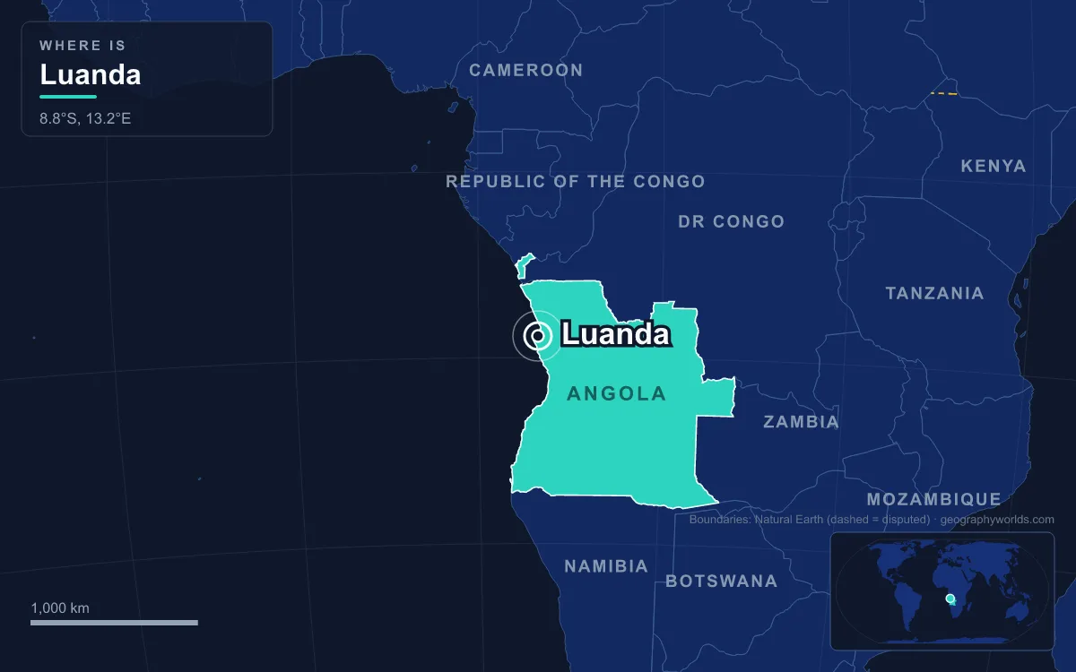
Luanda became Angola’s capital twice over: first as the Portuguese foothold founded in 1576 on a sheltered bay of the northern Atlantic coast, and then on 11 November 1975, when the movement that had fought its way to control of the city declared independence there. Today it is the capital and largest city of Angola, its main port and the seat of Luanda Province, with a metropolitan population of more than 8.8 million in 2024, roughly a third of all Angolans. That makes it the most populous Portuguese-speaking capital in the world. Its position has never rested on being central; it rests on the harbour, the island that shelters it and the fact that whoever held Luanda held the state.
Why the Portuguese Chose the Bay and the Ilha in 1576
The site was chosen for the sea, not the land. Paulo Dias de Novais, grandson of the navigator Bartolomeu Dias, received a royal charter from King Sebastian in 1575 and reached the Angolan coast on 11 February that year. He was drawn by stories of silver mines at Cambambe, up the Kwanza River, but the place he fortified was a bay protected by a long, low sandbar now called the Ilha de Luanda. The island was home to the Axi-lwanda, a group of Ambundu people paying tribute to the Kingdom of Kongo, and it mattered for a very specific reason: its shallows yielded the small sea-snail shells called nzimbu, the currency of Kongo and much of Central Africa. By settling there, the Portuguese sat on top of the region’s money supply. They then crossed to the mainland opposite and, on 25 January 1576, founded São Paulo da Assunção de Loanda with about a hundred settler families and four hundred soldiers. The name of the island people became the name of the town.
Luanda was not the only candidate for a headquarters in these early decades. Portugal’s ambitions lay inland, and in 1582 it built the fort of Massangano on the Kwanza as its base for operations in the interior, which it remained until the late 17th century; Dias de Novais himself was buried there in 1589. But a colony that lived by shipping needed a port, and Luanda kept winning on that score. Fortifications grew with it: São Pedro da Barra was built to guard the harbour mouth in 1618, and in 1627 the Fortress of São Miguel on the headland above the bay became the colony’s administrative centre. São Miguel, the best preserved of them, now houses the Museum of the Armed Forces.

Slaves, the Dutch and Brazil: Holding the Capital, 1641–1836
What the port was used for explains why rivals fought over it. From its first decades until 1836, Luanda was the centre of the slave trade to Brazil, supplied through alliances and wars with African states inland such as Ndongo and later with Imbangala traders who competed with the Mbundu. By 1751 between 5,000 and 10,000 captives a year were being sold through the city, and Brazilian ships were the most numerous in its harbour. Historians describe Angola in this period as being, in practice, almost a colony of Brazil, and Brazilian influence in Luanda stayed strong until Brazil’s own independence in 1822.
That traffic made Luanda a target. In 1641 the Dutch, who had seized sugar-growing north-eastern Brazil and needed enslaved labour for it, captured Luanda and held it from 1641 to 1648 as Fort Aardenburgh. The city was retaken by a fleet sent from Brazil under Salvador Correia de Sá, a veteran of the fight against the Dutch in Bahia, who then became governor of Angola himself. The episode showed the pattern that would repeat in 1975: the colony could survive without its capital for a while, but whoever controlled Luanda’s harbour controlled Angola’s link to the outside world.
The end of the slave trade in 1836 forced the city to reinvent itself. In 1844 Angola’s ports were opened to foreign shipping, and by 1850 Luanda was one of the largest cities of the Portuguese empire outside Portugal, exporting palm and peanut oil, wax, copal, timber, ivory, cotton, coffee and cocoa. Water had always been the weak point of a city on the edge of a semi-desert, and in 1889 Governor Brito Capelo opened an aqueduct that finally gave it a reliable supply, laying the ground for the growth that followed.
Quifangondo and 11 November 1975: Why Luanda Stayed the Capital
By the 20th century no one seriously questioned Luanda’s status. Under Portugal’s Estado Novo dictatorship it grew from a town of 61,208 in 1940, of whom 14.6 per cent were white, to 475,328 in 1970, including 124,814 Europeans. The colonial war that began in 1961 was fought mostly in the countryside, and the capital boomed through it. Then the Carnation Revolution in Lisbon on 25 April 1974 ended the dictatorship, and Portugal prepared to leave. The Alvor Agreement of January 1975, signed by Portugal and the three liberation movements, the MPLA, the FNLA and UNITA, set independence for 11 November 1975 and called for general elections. It collapsed within months. By the middle of the year the three movements were fighting one another for control of Luanda itself.
Because independence would be handed over in the capital, the capital became the prize. The MPLA, whose leadership was predominantly Ambundu and which had courted public-sector workers in Luanda, forced the FNLA out of the city in July 1975, while UNITA withdrew to its strongholds in the south. On 10 November 1975, the last day of Portuguese rule, the FNLA made its final serious attempt to take Luanda at the Battle of Quifangondo, just north of the city, aiming to seize the waterworks and the bridge over the Bengo River that supplied the capital. FNLA forces, backed by Zairean and South African artillery crews, were beaten by MPLA troops supported by Cuban advisers. Hours later Agostinho Neto proclaimed the People’s Republic of Angola in Luanda.
The rival claim shows that the choice of capital was not automatic. UNITA and the FNLA answered Neto’s proclamation with a rival Democratic People’s Republic of Angola, whose capital was Huambo, the highland railway city the Portuguese had renamed Nova Lisboa. It did not last: MPLA and Cuban forces took Huambo on 8 February 1976. The civil war went on until 2002, but Luanda, holding the port, the oil refinery, the ministries and international recognition, was not again in real doubt as the seat of government. Most white Portuguese residents left as refugees in 1975, and skilled Cuban technicians helped keep basic services running.
What Being Capital Means for Luanda in the 2020s
The war’s biggest effect on the capital was demographic. Luanda was the safest place in the country, so displaced people poured in for 27 years. The informal neighbourhoods called musseques, which had existed on the city’s edge for decades, spread for kilometres beyond the colonial limits while water, power and roads were barely extended. The 2014 census counted 6,945,386 people in Luanda Province, and by 2024 the metropolitan population had passed 8.8 million. About one Angolan in three now lives in the capital, and more than half of its residents live in poverty.
Peace in 2002 and high oil prices turned Luanda into a building site. The old city splits into the Baixa, the low town of narrow streets and colonial buildings by the port, and the Cidade Alta on the heights above. Along the bay, the Marginal waterfront was rebuilt and glass towers went up behind it, while the Boavista slum on the bay was cleared in 2001 to make way for luxury housing. A large Chinese firm was contracted to build most of the replacement housing for slum residents, and new estates such as Kilamba rose on the city’s southern edge.

Being capital of an oil state has also made Luanda one of the most expensive cities on earth for foreigners. Mercer’s cost-of-living index has ranked it first in the world, above Seoul, Geneva and Shanghai. After new import tariffs in March 2014, a half-litre tub of vanilla ice cream was reported to cost US$31, in a country where the average salary in 2010 was about US$260 a month and oil-industry pay averaged over US$5,400. The city refines offshore oil, runs Angola’s largest port and exports coffee, cotton, sugar, diamonds and iron. A new international airport, named after Agostinho Neto and sited near Viana south-east of the city, finally opened in November 2023 after years of delay, taking over from Quatro de Fevereiro Airport.
The state has also kept redrawing the capital’s map. In 2011 Luanda Province absorbed Icolo e Bengo and Quiçama from neighbouring Bengo; in 2024 the province was reorganised into 17 municipalities, the old Luanda municipality was dissolved, and Icolo e Bengo became a province of its own. Nature sets the other limits. The cold Benguela Current offshore keeps the city unusually dry for the tropics, with about 405 millimetres of rain in an average year, but totals swing wildly, from 55 millimetres in 1958 to 851 millimetres in 1916. The IPCC lists Luanda among 12 major African cities most exposed to sea-level rise, a real concern for a capital whose reason for existing is its waterfront. How Luanda compares with the country’s next-largest centres, including Lubango and Huambo, is covered in our list of the largest cities in Angola, and the wider national story is in our Angola country guide.
Quick Facts About Luanda
- Country: Angola
- Continent: Africa (Southern Africa)
- Country population: approximately 40.2 million
- Capital city status: Luanda is the capital of Angola, the seat of national government, and the location of foreign embassies, parliament, and the head of state's official residence.
Frequently Asked Questions
What is the capital of Angola?
The capital of Angola is Luanda. Luanda is the seat of national government, hosts most foreign embassies and consulates, and is typically where the head of state and parliament are located.
What continent is Luanda in?
Luanda, the capital of Angola, is located in Africa, in the Southern Africa region. As Angola's capital, Luanda serves as the country's primary connection to the broader African political, economic, and cultural sphere.
Why is Luanda the capital of Angola?
Luanda was chosen as the capital of Angola for reasons that typically combine geography, history, and politics. Capital city selections often reflect a desire for centrality (being accessible from across the country), historical importance (being a longstanding seat of government or culture), or neutrality (being acceptable to multiple regions or ethnic groups within the country). The specific reasons for Luanda's designation are detailed in the city's history above.
What is Luanda known for?
As the capital of Angola, Luanda is best known for housing the country's central government institutions — parliament, presidential or royal residences, supreme court, and key ministries. It is also typically a major cultural and economic center within Angola, hosting national museums, embassies, and signature monuments. The introduction and history sections above provide detailed coverage of the city's specific notable institutions and landmarks.
Related Pages
- Angola Country Guide — full geography, climate, economy, and culture overview
- Flag of Angola — meaning, history, and design of Angola's national flag