
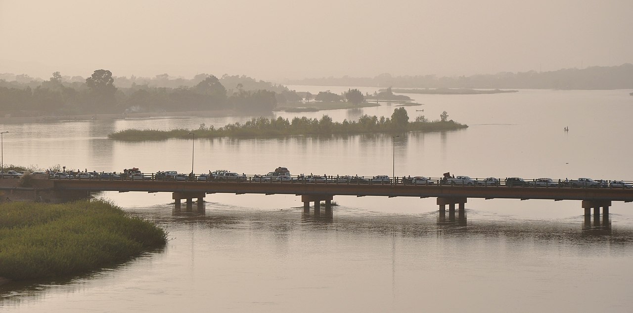
Niamey is the capital and largest city of Niger, set in the far west of the country on the Niger River, mostly on a sandy plateau along the river's left (east) bank. It had an estimated 1,407,635 residents in 2022 and in 2015 Oxford Economics named it the world's fastest-growing city. Its defining feature is the river: the Niger is the city's only permanent watercourse, its sole source of piped water, its main flood risk and the reason the French put a post here in 1901. Niamey is also one of the hottest major cities in the world, with average April highs of about 41°C.
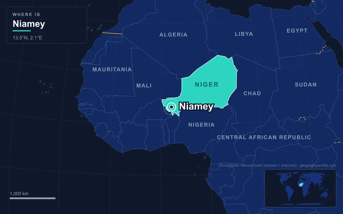
A Laterite Plateau Above a Bend in the Niger
To understand Niamey, start with its ground. The city covered 552 square kilometres in 2022, of which about 297 were built up. Most of it sits on the left-bank plateau at between 190 and 230 metres above sea level, while the right bank is a low alluvial plain at 180 to 185 metres. The highest point, Trois Sœurs, reaches just 250 metres. The plateau is made of sand and laterite, the hard, iron-rich red crust that city quarries still dig for building material, laid over the ancient rock of the West African Craton beneath the city centre. That hard plateau pushes the river into a straight channel past the city, and the French chose a site above a bend in it.
The river arrives here after a long journey. The Niger rises in the Guinea Highlands, runs about 4,180 kilometres in a great crescent through Mali, Niger and Nigeria, and ends in a delta on the Gulf of Guinea. By the time it reaches Niamey it has crossed the Inner Niger Delta in Mali, and far upstream in Mali the Sélingué Dam helps regulate its level, which has kept the city from losing its water in drought years. Upstream towards Karma the channel is dotted with sandy islands, the largest being Boubon, Kanazi and Néni Goungou.
On top of the plateau the natural cover is tiger bush, bands of scrub separated by bare ground, with millet fields and savanna in the valleys between. The city has been clearing it fast: woodland and shrubland covered 35 percent of the area in 1968 and only 7 percent by 2009. A greenbelt of about 2,500 hectares was planted in the 1960s, mainly with introduced species such as neem, although much of it is no longer forested. Residents keep mango and neem trees in their compounds for shade and fruit, and urban market gardens covered about 54 hectares in 2007.

Goudel, Gamkalé and Gaweye: Villages Before the City
Before the colonial era this stretch of river was a buffer zone between the Sahelian kingdoms that fought over the region, and it was not urbanised. In the sixteenth century the villages of Goudel and Gamkalé were founded on the left bank, and the future city grew up between them around the gully of Gounti Yéna. By the early nineteenth century more villages lined both banks: the Hausa village of Maourey, the Zarma village of Kalley and the Songhai village of Gaweye on the left, and the Fula villages of Lamordé, Nogaré and Kirkissoye on the right. Their peoples, Zarma and Songhai refugees from the Moroccan invasion of the Songhai Empire, Maouri hunters from the Dogondoutchi area and the regionally dominant Fula, are still the core of the city's population.
The origin of the name is disputed, and each group tells it differently. Maouri tradition says the founders settled beside a landmark tree called Gna, giving "Gna-mé". Zarma tradition credits a chief named Kouri Mali and an exclamation meaning "settle here". Songhai tradition speaks of two fishermen from Gao who were given the river island of Yama Gungu by local Fula herders before moving to the left bank. Several of those village names survive as city neighbourhoods.
Captain Salaman's Post and the Zinder Rivalry, 1901–1926
French missions reached the villages in the 1890s; the Voulet–Chanoine Mission set fire to Niamey in 1899. In 1901 Captain Henri Salaman, who oversaw the Niger–Chad road, set up the first French post, and the choice was all about geography. The site above the river bend could serve as a port between Zinder in the east and Timbuktu upstream, and it helped the French secure the interior. Salaman built on an empty stretch of the left-bank plateau, today the quarter called Terminus, and was the first to call the whole cluster of villages Niamey. Locals called it "garin captin Salma", Captain Salaman's town.
For 25 years the capital went back and forth between the river and the east. Niamey replaced Zinder in 1903, after a Tuareg revolt weakened the eastern territory, but it had only about 1,800 inhabitants in 1904, and the capital returned to Zinder in 1911. The final decision came after the Colony of Niger was created in 1922. Zinder lay close to British Nigeria and far from French ports, and the official reason given for the move was that Zinder lacked enough drinking water. Niamey, by contrast, had the river, which officials saw as the only place suitable for farming, a more comfortable climate and easier links to French Dahomey. Governor Jules Brévié declared Niamey the capital on 28 December 1926, when it had 3,142 people; the governor's palace was built largely with forced labour.
The river bank then became contested ground. The 1930 plan put an indigenous quarter near the water and a European quarter further inland, separated by a zone sanitaire. After a fire destroyed many straw houses in 1935, riverside residents were forcibly moved onto the plateau. The dividing line faded as the city grew into the buffer zone, and by 1955 the European and African towns had merged.
Kennedy Bridge and the Crossing to the Right Bank
Independence in 1960 found a city of 33,816 still almost entirely on one side of the river. That changed in 1970 with the opening of the Kennedy Bridge, named for the American president, which linked the left bank to the far emptier right bank and let the city spread west across the floodplain. The timing mattered. A uranium boom in the 1970s and 1980s paid for new public buildings in a revived Sudanese style, while the droughts of 1972–73 and 1983–84 drove herders and farmers towards the river; the second drought alone brought about 150,000 migrants. The city limits grew from 1,367 hectares in 1970 to 4,400 hectares by 1977, absorbing surrounding villages.
The bridge also became the city's most political landmark. On 9 February 1990 security forces fired on student protesters from the University of Niamey on the bridge. The killings fed a wave of strikes and protests, including a general strike by about 100,000 people in Niamey that November, which helped push Niger towards multiparty democracy. Today the city is split into five communes, Niamey I to IV on the plateau side and Niamey V across the water on the right bank.

Roads, not the river, now carry the city's trade. Boats rarely use this stretch of the Niger, and freight on it has amounted to only a few thousand tonnes a year. Cargo arrives mostly by road from Cotonou in Benin, the nearest seaport, while the RN1 highway runs east across the whole country. A railway to Benin was planned from the 1970s; Niamey's station opened in April 2014 and track reached Dosso in 2016, but the line was never completed and dismantling began in 2024.
Red Flood, Guinean Flood and the Water Niamey Drinks
Living beside a Sahel river means living with two floods a year. The first, the "red flood", comes from monsoon rain on right-bank tributaries such as the Gorouol, Dargol and Sirba, usually between August and October. The second, the "Guinean flood", is rain that fell months earlier in Guinea's Fouta Djallon highlands and has crept slowly through the Inner Niger Delta, reaching the city around January to March. River levels in the region have risen even as rainfall fell, a pattern scientists call the Niamey paradox, and in the 2000s and 2010s the red flood grew stronger as cleared land shed more runoff. Poor drainage turned the red flood into disaster in 2010, 2012 and 2013.
The climate squeezes the city from the other side. Niamey receives roughly 500 to 750 millimetres of rain a year, almost all between June and early September, and practically none from October to April. Monthly highs range from about 32°C in January to 41°C in April, and hot-season days can approach 45°C. Annual minimum temperatures rose by 1.4°C between 1965 and 2013. The driest years on record were 1972, 1982 and 1984, the same period as the droughts that pushed people towards the city.
All of the city's piped water still comes from the Niger. Official figures from 2008 said pipes served about 65 percent of residents; the rest rely on public standpipes, water towers and boreholes. Much of the drinking water reaching homes is carried by ga'ruwa, licensed water deliverers who fill 25-litre jugs at standpipes and push them door to door on handcarts, and who supply more than half of the city's drinking water. In a city growing by several percent a year, that single river is carrying more people every season.
The river that drew Salaman's post to this bend still sets the terms of life in Niamey, from where people build to what they drink. Follow it further in our complete guide to the Niger River, see how the capital compares with Zinder, Maradi and the rest in the largest cities in Niger, or read about the Sahel belt whose rains and droughts have shaped the city's growth.
Quick Facts About Niamey
- Country: Niger
- Continent: Africa (West Africa)
- Country population: approximately 28.8 million
- Capital city status: Niamey is the capital of Niger, the seat of national government, and the location of foreign embassies, parliament, and the head of state's official residence.
Frequently Asked Questions
What is the capital of Niger?
The capital of Niger is Niamey. Niamey is the seat of national government, hosts most foreign embassies and consulates, and is typically where the head of state and parliament are located.
What continent is Niamey in?
Niamey, the capital of Niger, is located in Africa, in the West Africa region. As Niger's capital, Niamey serves as the country's primary connection to the broader African political, economic, and cultural sphere.
Why is Niamey the capital of Niger?
Niamey was chosen as the capital of Niger for reasons that typically combine geography, history, and politics. Capital city selections often reflect a desire for centrality (being accessible from across the country), historical importance (being a longstanding seat of government or culture), or neutrality (being acceptable to multiple regions or ethnic groups within the country). The specific reasons for Niamey's designation are detailed in the city's history above.
What is Niamey known for?
As the capital of Niger, Niamey is best known for housing the country's central government institutions — parliament, presidential or royal residences, supreme court, and key ministries. It is also typically a major cultural and economic center within Niger, hosting national museums, embassies, and signature monuments. The introduction and history sections above provide detailed coverage of the city's specific notable institutions and landmarks.
Related Pages
- Niger Country Guide — full geography, climate, economy, and culture overview
- Flag of Niger — meaning, history, and design of Niger's national flag