
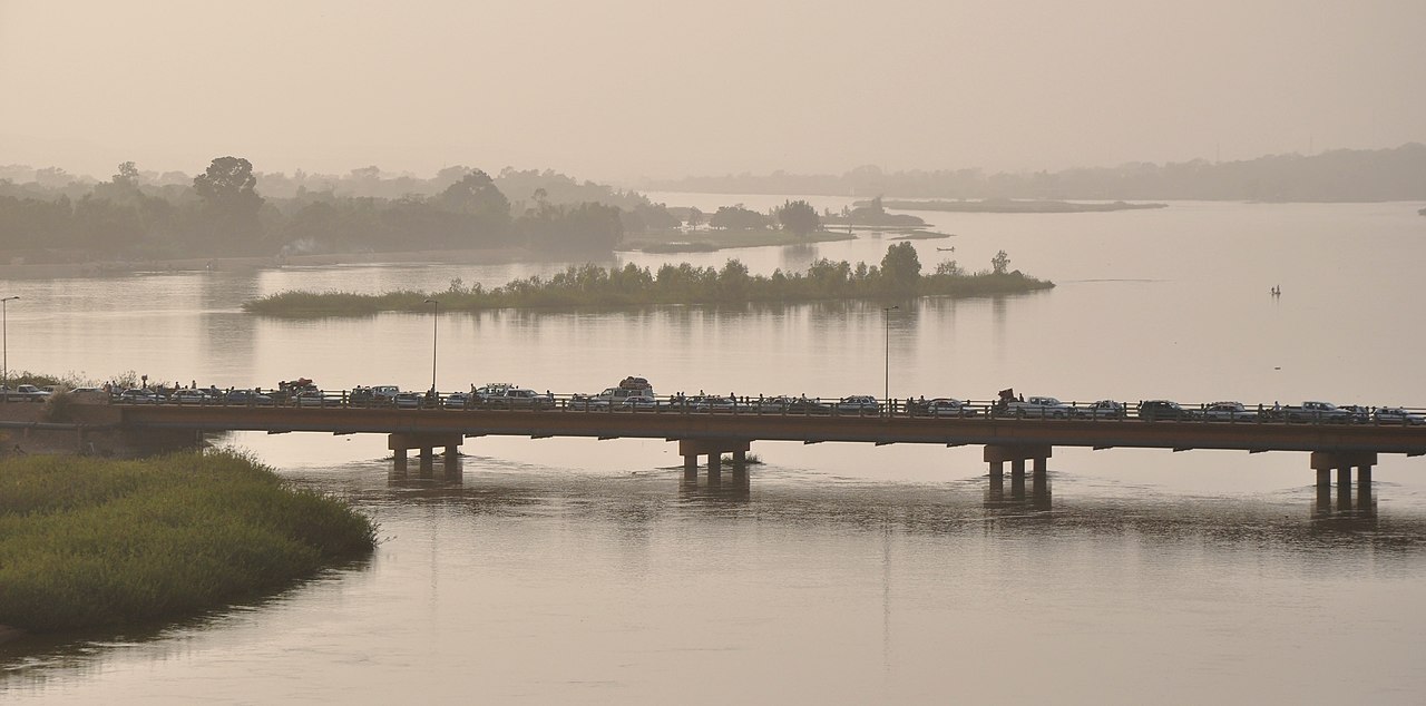
The Niger is West Africa's principal river and the third-longest in Africa, running roughly 4,200 km (2,600 miles) from the Guinea Highlands to the Gulf of Guinea. Its defining feature is its shape: instead of taking the short route to the nearby Atlantic, it flows inland to the edge of the Sahara before curving back south — a great boomerang that puzzled geographers for centuries.
The river that runs the wrong way
The Niger rises in the Guinea Highlands, in the Fouta Djallon massif of south-eastern Guinea, no more than about 240 km from the Atlantic coast. A river in that position might reasonably be expected to run straight to the sea. The Niger does the opposite. It turns north-east, away from the ocean, and heads inland across Mali, passing Bamako and pushing towards the southern margin of the Sahara.
Near Timbuktu it reaches its northernmost point, then bends decisively to the south-east — the elbow of the boomerang. From there it crosses into Niger, flowing past Niamey, runs along the Benin border, and enters Nigeria. At Lokoja it receives the Benue, its greatest tributary, and finally turns south to reach the Atlantic through the vast Niger Delta.
This course baffled European geographers for a very long time. Some believed the river was a tributary of the Nile; others thought it drained into an inland lake or vanished into the desert. The direction of flow was not settled to European satisfaction until the Scottish explorer Mungo Park reached the river at Ségou in 1796 and reported that it flowed eastward. Park died on a second expedition in 1805 without following it to its mouth, and the connection between the upper river and the Niger Delta was not confirmed until the 1830s.
Why the shape exists
The accepted explanation is that the modern Niger is two ancient rivers joined together. The upper Niger once terminated in a lake in what is now the Sahara, in a period when the region was far wetter than today. A separate lower river, draining to the Gulf of Guinea, cut backwards through erosion at its head until it tapped into that basin and captured the upper river's flow. The elbow near Timbuktu marks the seam. It is a textbook case of river capture, and it explains why a river that begins so close to the Atlantic takes such an extraordinarily long way round to reach it.
Course, basin and the inland delta
The Niger's drainage basin covers roughly 2.1 million square kilometres, with the active basin spread across nine countries and the wider catchment touching several more. The river is conventionally divided into an upper, middle and lower course, each with a distinct character.
- Upper Niger: from the Guinea Highlands through Mali to Ségou — a well-watered zone fed by reliable rainfall, where most of the river's total flow is generated.
- Middle Niger: the stretch through Mali's interior, including the Inner Niger Delta and the great northward arc past Timbuktu and Gao, then on into Niger.
- Lower Niger: from the Nigerian border to the sea, augmented enormously by the Benue and ending in the coastal delta.
The Inner Niger Delta
Perhaps the river's most remarkable feature is not at its mouth but in the middle of Mali. Here the Niger loses gradient and spreads across a nearly flat basin into a maze of channels, lakes, swamps and seasonally flooded plains — the Inner Niger Delta, an inland delta rather than a coastal one. At the height of the flood it can inundate an area on the order of 20,000 square kilometres, shrinking dramatically in the dry season.
This wetland is one of the most important in Africa. It supports very large populations of resident and migratory waterbirds, including species that winter there after breeding in Europe, and it is central to the livelihoods of the region — Bozo fishing communities, Fulani herders bringing cattle to the receding floodplain pastures, and rice farmers working the flooded margins. It is also the reason the Niger's lower course runs relatively clear: the inland delta acts as an enormous settling basin, trapping sediment and, through evaporation, consuming a substantial share of the river's water before it continues.
The Niger Delta
At the ocean, the Niger builds one of the world's largest river deltas, covering some 70,000 square kilometres of southern Nigeria. It is a dense network of creeks, distributaries and one of Africa's largest mangrove forests, and it is also the heart of Nigeria's petroleum industry. That combination has made it a byword for environmental conflict, with decades of oil spills, gas flaring, mangrove destruction and disputes over the distribution of revenue.
Climate, flow and hydrology
The Niger's regime is governed by the West African monsoon. Rains fall in the Guinean headwaters chiefly between June and September, and the resulting flood wave travels downstream slowly, taking months to work through the Inner Delta. The consequence is a striking mismatch: the flood arrives in the Sahelian middle reaches during the dry season, months after the rain that produced it fell hundreds of kilometres upstream.
The river passes through several climate zones on its way — humid tropical at the source, savanna through the middle course, genuinely semi-arid Sahel at the northern arc where the surrounding land receives very little rain, and back to humid tropical in the delta. Along the Saharan margin the Niger loses water to evaporation rather than gaining it, functioning as an exotic river sustained by rainfall far away.
Several dams now regulate the flow, among them the Markala and Sélingué dams in Mali and the Kainji Dam in Nigeria, completed in 1968, which supplies hydroelectric power and created a large reservoir. These structures support irrigation and electricity generation but alter the flood pulse that the Inner Delta's ecology and economy depend on — a tension that recurs throughout the basin. The Niger Basin Authority, which brings the riparian states together, exists to coordinate these competing demands.
The Niger compared with the Nile
Africa's two great rivers invite comparison, and the contrasts are more instructive than the similarities.
Length and rank. The Nile is far longer, at roughly 6,650 km, and competes with the Amazon for the title of world's longest river. The Congo is second in Africa and carries vastly more water than either. The Niger is third by length in Africa and first in West Africa.
Shape. The Nile runs broadly straight, south to north, for its entire length. The Niger's boomerang is the exact opposite — a river that appears to set off in the wrong direction and doubles back.
Sediment and clarity. The Nile historically carried immense volumes of silt out of the Ethiopian highlands, and its annual deposition made Egyptian agriculture possible for millennia. The Niger drops most of its sediment in the Inner Delta long before reaching the sea, and consequently runs comparatively clear through its lower course.
Delta type. Both end in large deltas, but the Niger is unusual in having two: the coastal delta in Nigeria and the inland one in Mali. The Nile has no equivalent to the latter.
Historical role. Both were civilisational arteries. The Nile sustained ancient Egypt in a narrow, tightly bounded corridor. The Niger sustained a succession of West African empires along a much broader inland trade network, linking the forest zone to the trans-Saharan caravan routes.
People, empires and cities of the river
The Niger has been the organising feature of West African civilisation for well over a thousand years. The empires of Ghana, Mali and Songhai rose in its basin, each drawing wealth from control of the gold, salt and trans-Saharan trade that moved along and across the river.
Its cities reflect that history. Djenné, on an island in the Inner Delta, is famous for the Great Mosque, the largest mud-brick structure in the world, rebuilt in its present form in 1907 and resurfaced communally each year. Nearby Djenné-Djenno is among the oldest known urban sites in sub-Saharan Africa, with occupation dating back well over two thousand years. Timbuktu, near the northern bend, became a celebrated centre of Islamic scholarship, with manuscript libraries that survive to this day. Gao served as the capital of the Songhai Empire. Mansa Musa, the fourteenth-century Malian ruler whose pilgrimage to Mecca made him a legend for his distribution of gold, ruled from this basin.
The river remains a working artery. It supports fisheries, floodplain rice cultivation and seasonal cargo and passenger navigation on stretches of the middle course, though low water in the dry season restricts through-traffic. Its wildlife includes hippopotamuses, Nile crocodiles and the West African manatee, an elusive and threatened species, along with enormous concentrations of waterbirds in the Inner Delta.
The pressures on it are considerable: Sahelian drought and rainfall variability, upstream abstraction for irrigation, dam construction, the spread of invasive water hyacinth choking channels, deforestation and sedimentation in the headwaters, and oil pollution in the coastal delta. For a basin supporting well over 100 million people, these are not abstract concerns.
A note on the name
The name is often assumed to come from the Latin niger, meaning black. That is generally regarded as a coincidence and a folk etymology. The likelier derivation is from a Tuareg phrase along the lines of egerew n-igerewen, meaning something like "river of rivers" — a name that suits it. Two modern countries, Niger and Nigeria, take their names from the river rather than the other way round.
Key facts
- Length: approximately 4,200 km (2,600 miles) — third-longest in Africa
- Source: Guinea Highlands (Fouta Djallon), south-eastern Guinea, about 240 km from the Atlantic
- Mouth: the Niger Delta, Gulf of Guinea, Nigeria
- Basin area: roughly 2.1 million km²
- Main countries on the river: Guinea, Mali, Niger, Benin, Nigeria
- Principal tributary: the Benue, joining at Lokoja
- Distinctive features: the boomerang course, the Inner Niger Delta, and one of the world's largest coastal deltas
Want to test your knowledge of Africa's rivers and countries? Try our world geography quiz, or explore more geography games.