
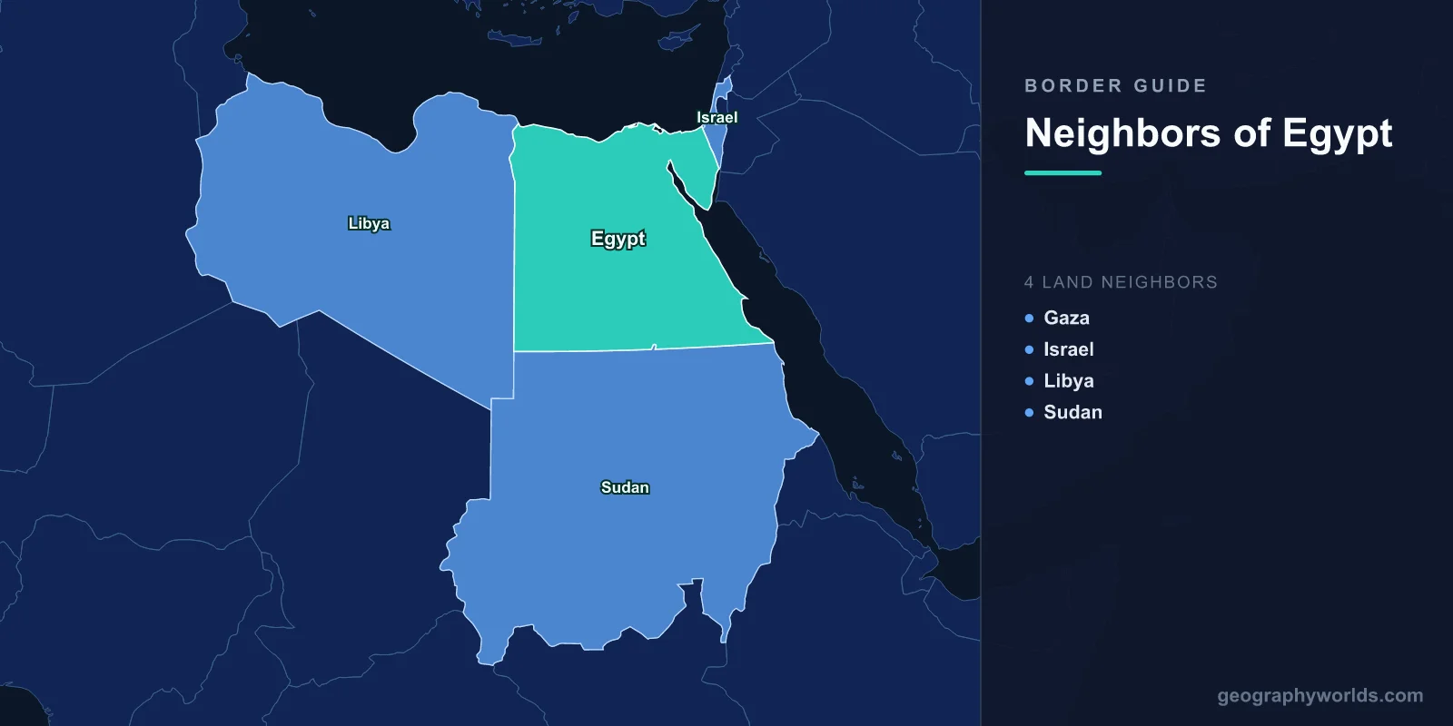
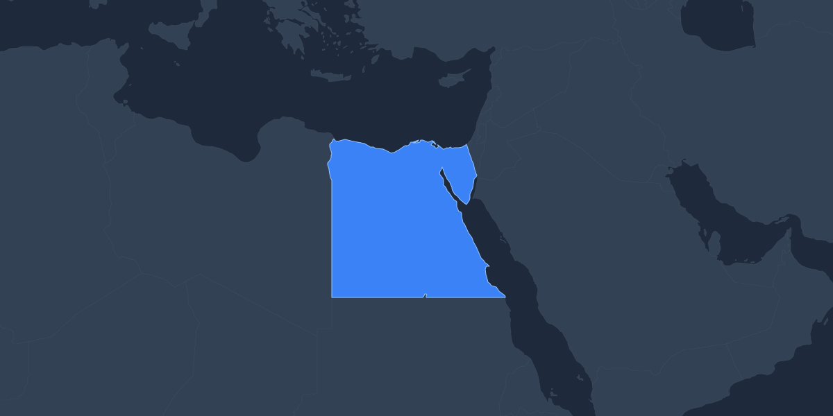
Egypt shares land borders with three sovereign countries and one Palestinian territory: Libya to the west, Sudan to the south, Israel to the northeast, and the Gaza Strip in the far northeast. Together these frontiers stretch roughly 2,612 kilometres. To the north Egypt is bounded by the Mediterranean Sea and to the east by the Red Sea, giving the country one of the most strategically positioned locations on the African continent.
Egypt sits at the meeting point of Africa and Asia, with the Sinai Peninsula forming a land bridge between the two continents. That unusual geography means its neighbors lie in two regions at once, and the Suez Canal slicing through Egyptian territory turns the country into a global crossroads for trade between Europe, Asia, and the wider Mediterranean world. For more background, see our Egypt country guide.
Egypt's Borders at a Glance
Before exploring each frontier in detail, it helps to see how Egypt's neighbors compare. Two of its borders are among the longest in North Africa, while another is one of the shortest international land boundaries anywhere in the world.
- Sudan — south, longest overall border (~1,276 km), linked by the Nile
- Libya — west, longest desert frontier (~1,115 km)
- Israel — northeast, across the Sinai Peninsula (~208 km)
- Gaza Strip — northeast, shortest border (~13 km)
Libya: The Western Frontier
Libya runs along Egypt's entire western edge, sharing a border of around 1,115 kilometres that makes it Egypt's second-longest land boundary. The frontier cuts through the Libyan Desert, an exceptionally arid stretch of the Sahara with very few permanent settlements. Unlike borders that trace rivers or mountain ranges, this line is largely a straight, surveyed boundary inherited from the colonial era. The Siwa Oasis, lying near the border on the Egyptian side, has long served as a meeting point for desert caravans and is famous for its connection to the ancient Oracle of Amun, which Alexander the Great is said to have visited. Today the western desert is also a focus of oil and gas activity, and the remote frontier is monitored to manage cross-border movement.
Sudan: The Southern Neighbor
Sudan borders Egypt to the south along roughly 1,276 kilometres, the country's longest international border of all. Much of this line follows the 22nd parallel, drawn as a straight latitude line in 1899 during the Anglo-Egyptian administration of Sudan. A complication arises at the Hala'ib Triangle near the Red Sea coast, an area both countries claim, and the Bir Tawil region, which uniquely neither country claims. The two nations are bound together by the Nile River, which flows north out of Sudan into Egypt, and by the vast Lake Nasser reservoir created behind the Aswan High Dam, which straddles the border region. This shared dependence on the Nile makes water management a central, sometimes sensitive, part of the relationship between the two states.
Israel and the Sinai Border
Israel shares a border of about 208 kilometres with Egypt, running across the Sinai Peninsula from the Mediterranean coast near Rafah down to the Gulf of Aqaba at the resort town of Taba. This border was formalised by the 1979 Egypt–Israel Peace Treaty, which followed the return of the Sinai Peninsula to Egyptian control after the wars of the preceding decades. The treaty made Egypt the first Arab state to recognise Israel and remains a cornerstone of regional diplomacy. Today the border zone is closely managed, with monitored crossings and demilitarised provisions written into the original agreement. Because the Sinai lies in Asia, this is also one of Egypt's two transcontinental land borders.
The Gaza Strip: Egypt's Shortest Border
Egypt's shortest frontier is with the Gaza Strip, a Palestinian territory, measuring only about 13 kilometres. The sole crossing point is at Rafah, which serves as the main gateway between Gaza and the outside world that does not pass through Israeli-controlled territory. Because of this, the Rafah crossing carries outsized humanitarian and political importance, and its opening and closing are closely watched internationally. The short border belies its significance in Middle Eastern affairs, and it sits in the same northeastern corner of the Sinai as the Israeli frontier.
Maritime Neighbors and Sea Routes
Beyond its land borders, Egypt faces several countries across the water. To the north, across the Mediterranean, lie Cyprus, Greece, and Turkey, with whom Egypt negotiates maritime boundaries and offshore gas exploration zones. To the east, the Red Sea and the Gulf of Aqaba place Egypt opposite Saudi Arabia and Jordan. These maritime relationships are vital: the Suez Canal, opened in 1869, links the Mediterranean and Red seas and handles a large share of global shipping, making Egypt's coastlines as economically important as its land frontiers.
Why Egypt's Borders Matter
Few countries occupy a more pivotal position than Egypt. Its land borders connect Africa to Asia, while its two coastlines and the Suez Canal connect Europe to the Indian Ocean and beyond. This crossroads status has shaped Egyptian history for millennia, from ancient trade routes and pilgrimages to modern energy pipelines and container shipping. Each neighbor brings a distinct relationship: Sudan and the shared Nile, Libya and the open desert, Israel and a landmark peace treaty, and Gaza and a single, heavily scrutinised crossing. Understanding these frontiers is key to understanding Egypt's role in both African and Middle Eastern affairs.
Key Facts
- Number of land neighbors: 4 (Libya, Sudan, Israel, and the Gaza Strip)
- Sovereign-state neighbors: 3 (Libya, Sudan, Israel)
- Total land border length: roughly 2,612 km
- Longest border: Sudan, about 1,276 km
- Shortest border: Gaza Strip, about 13 km
- Seas bordering Egypt: Mediterranean Sea (north) and Red Sea (east)
- Continents spanned: Africa and Asia, divided by the Suez Canal
Frequently Asked Questions
How many countries border Egypt?
Egypt borders four entities by land: Libya, Sudan, Israel, and the Gaza Strip. Of these, Libya, Sudan, and Israel are sovereign states, while the Gaza Strip is a Palestinian territory rather than an independent country.
Which country has the longest border with Egypt?
Sudan has the longest international border with Egypt at roughly 1,276 kilometres, running largely along the 22nd parallel in the south. Libya's western border is a close second at around 1,115 kilometres.
Does Egypt border any countries in Asia?
Yes. Because the Sinai Peninsula lies in Asia, Egypt's borders with Israel and the Gaza Strip are on the Asian side of the Suez Canal, making Egypt a transcontinental country spanning both Africa and Asia.
What seas surround Egypt?
Egypt is bordered by the Mediterranean Sea to the north and the Red Sea to the east. The Suez Canal connects these two seas through Egyptian territory, creating one of the world's busiest maritime trade routes.
