
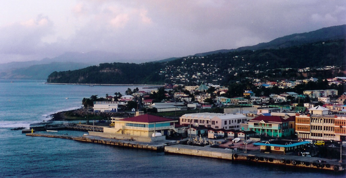
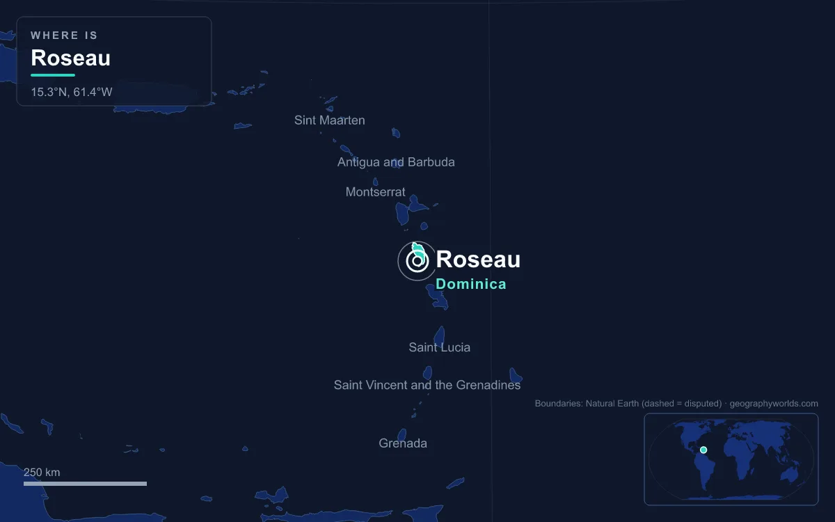
Roseau is the capital and largest city of Dominica, a compact town of 14,725 people at the 2011 census, set on the island’s sheltered west (leeward) coast in Saint George parish. Its site explains almost everything about it: the city sits on a flat alluvial fan built up by the Roseau River where it meets the Caribbean Sea, boxed in by the river to the north, the steep slope of Morne Bruce to the east and the sea to the west. That small wedge of level ground, rare on one of the most mountainous islands in the Lesser Antilles, is why a village stood here long before Europeans arrived, and why the capital returned here after British planners briefly chose swampy, fever-ridden Portsmouth in the north.
The Alluvial Fan Between the Roseau River and Morne Bruce
Dominica is a volcanic island whose interior rises to 1,447 metres at Morne Diablotins, and most of its coast drops straight from ridge to sea. The Roseau River is the exception on the southwest shore. It rises south of the island’s centre, runs about 13.6 kilometres to the coast and drains a basin of some 33 square kilometres. Over centuries it swung back and forth across its mouth, shifting from roughly where the Newtown district now stands to its present channel, and in doing so it spread a low fan of gravel and silt into the sea. The historic core of Roseau is built on that fan.
The fan gave three things a settlement needs on a steep island: flat land to build on, a reliable river for fresh water and an anchorage on the calm leeward side, away from the Atlantic swell that pounds the east coast. It also set hard limits. The river caps the town to the north, Morne Bruce rises abruptly behind it, and the sea closes the western edge. Roseau could only grow by squeezing more onto the fan or by spilling north and south along the coast, and it has done both.

From Sairi to the Roseaux: Who Settled the River Mouth
Amerindian peoples moving up the island chain settled beside the river over roughly the last 2,000 years, and the Island Carib (Kalinago) village of Sairi stood on the site of the present city. When French settlers established themselves here in the 17th century, they named the place after the reeds, roseaux in French, that grew thickly along the riverbanks. In Dominican Creole the name is still pronounced Wozo.
The French laid out their settlement the way many towns in France were planned, with streets running outward from a central open space. That space survives as the Old Market Plaza, and the slightly crooked lanes that leave it are the oldest part of the street pattern. The best surviving examples of French colonial architecture are concentrated along King George V Street, while the British left their mark in street names, large town houses and government buildings.
Fort Young and the Garrison on Morne Bruce
The same features that made the fan easy to settle made it easy to attack from the sea, and Roseau spent the 18th century as a prize between France and Britain. The French built a fort to protect the town in 1699. After Britain gained the island, Governor William Young ordered a new fortress on the same seafront site, and Fort Young was built in 1770. It did not hold: in 1778 a French force invaded Dominica, took Fort Young and Roseau, and controlled the island until it was handed back to Britain in 1784 under the Treaty of Paris.
The British answer was to use the hill behind the town. From the 1770s until 1854 a military garrison occupied Morne Bruce, the ridge that closes Roseau’s eastern side, and remains of its barracks and officers’ quarters still stand, along with one old cannon. The hill takes its name from James Bruce, a captain of the Royal Engineers who designed many of Dominica’s forts in the 1700s. A large cross was raised on the summit in the 1920s, and today the hill is reached by road or by Jack’s Walk, a footpath that climbs from the Botanic Gardens.

Fort Young itself lost its military role in the 19th century and served as the headquarters of the Dominican police. In 1964 it became the Fort Young Hotel, which kept the old flagstone walkways and cannons in its courtyard and now has 71 rooms on the quayside, next to the Dominica Museum and the public library.
Eighty Blocks in Thirty Hectares: Roseau’s Crowded Grid
From the late 18th century British planners overlaid the French core with a grid of streets, government buildings and new blocks to the north and south, the districts now called Potter’s Ville and Newtown. Because the fan is so small, the grid is small too. Central Roseau packs about 80 blocks into roughly 30 hectares, so the average block covers only about a third of a hectare. For comparison, the central grids of Kingstown in Saint Vincent and Castries, capital of Saint Lucia, fit around 50 and 60 blocks into areas of more than 40 hectares each.
The result is one of the densest and least legible town centres in the region. There is very little open space inside the grid, and many old courtyards have been built over for offices. Instead, the green space sits around the edges, set by the geography: the sea and the river on two sides, and the Botanic Gardens and the Government House gardens on the landward side. Few Caribbean capitals have a botanical garden so close to their centre, and the Roseau River is among the largest rivers to flow through any capital in the region.
The gardens themselves occupy 16 hectares of a former sugar plantation within the Bath Estate, which the owner, William Davies, sold to the colonial government in 1891. Planting started in 1890, and the gardens were meant to supply farmers with properly propagated seedlings and encourage new crops. They now also house the Parrot Conservation and Research Centre, which works on Dominica’s two endemic and endangered parrots, the Sisserou and the Jaco.
Two landmarks show the town’s two colonial layers. The Roman Catholic cathedral is built in a Gothic and Romanesque revival style, while the Anglican church on Victoria Street is Georgian. Because the centre is so cramped, most residents now live outside it, in suburbs such as Goodwill (laid out in the 1950s), Bath Estate (early 1980s), Stock Farm, Castle Comfort and Wall House, and in older villages such as Fond Cole and Canefield that have been absorbed into the urban area. Traffic pours into the old grid every morning along streets that, as older residents put it, were once just the space between buildings.
When the Valley Floods: Hurricane David, Erika and Maria
A river fan is flat because floods built it, and Roseau has learned that the process has not stopped. Its climate is tropical monsoon, with highs of about 28 to 31 °C and nearly 1,800 millimetres of rain a year, but the real danger comes from the mountains behind the town, which receive far more rain and funnel it straight down the Roseau Valley.
Hurricane David struck in 1979 and destroyed much of what remained of Fort Young, along with many of the oldest trees in the Botanic Gardens. One of them, a huge African baobab, fell onto an empty school bus, and the tree and crushed bus are still in the gardens as a reminder.
In August 2015 Tropical Storm Erika passed well north of the island as a weak storm but dropped torrential rain, more than 200 millimetres everywhere on Dominica in under 48 hours and 321 millimetres at Canefield Airport, just north of Roseau. Landslides dammed rivers that then burst, and the island recorded 30 deaths and 574 people left homeless, its worst natural disaster since David.
Two years later, on the night of 18 September 2017, Hurricane Maria made landfall as a Category 5 storm with sustained winds of 165 mph (266 km/h), the strongest ever to hit the island. Early radio reports from Roseau described half the city under water. Nearly every power pole and line came down, the public library lost its roof panels and a Baptist church was reduced to a single wall. South of the capital, riverside flooding and landslides destroyed about 80 percent of the buildings in Pointe Michel. The physics behind storms like these are explained in our guide to how hurricanes form.
Roseau Valley to the Boiling Lake: The Capital’s Volcanic Backyard
Follow the river upstream and the city gives way within minutes to some of the most active volcanic ground in the Caribbean. The Roseau Valley leads into Morne Trois Pitons National Park, established in July 1975 as Dominica’s first national park and listed as a UNESCO World Heritage Site in 1997. It covers about 7,000 hectares, and all the major rivers of the island’s southern half, the Roseau among them, rise within it.
The park’s best-known feature is the Boiling Lake, about 10.5 kilometres east of Roseau. It is a flooded fumarole roughly 60 to 75 metres across, the second-largest hot lake in the world after Frying Pan Lake in New Zealand, with water measured at 82 to 92 °C along its edges. There is no road to it; the trail passes through the Valley of Desolation, an area of steaming vents and boiling mud pools. There are no settlements inside the park, but the state electricity company holds rights there for hydropower and geothermal energy, so the uplands that feed Roseau’s river also feed its grid.
Back on the coast, Roseau remains Dominica’s main port for foreign trade, shipping bananas, bay oil, vegetables, citrus and cocoa, with the Woodbridge Bay deepwater port on its northern edge. Nearby Canefield Airport handles small aircraft on regional hops, ferries link Roseau with Guadeloupe, Martinique and Saint Lucia, and Windsor Park, a cricket and football stadium completed in 2007 with EC$33 million from China, stands on the edge of the grid. The novelist Jean Rhys was born in Roseau on 24 August 1890. For the wider picture of the island’s parishes, rainforest and people beyond the capital, see our guide to Dominica.
Quick Facts About Roseau
- Country: Dominica
- Continent: North America (Caribbean)
- Country population: approximately 66 thousand
- Capital city status: Roseau is the capital of Dominica, the seat of national government, and the location of foreign embassies, parliament, and the head of state's official residence.
Frequently Asked Questions
What is the capital of Dominica?
The capital of Dominica is Roseau. Roseau is the seat of national government, hosts most foreign embassies and consulates, and is typically where the head of state and parliament are located.
What continent is Roseau in?
Roseau, the capital of Dominica, is located in North America, in the Caribbean region. As Dominica's capital, Roseau serves as the country's primary connection to the broader North American political, economic, and cultural sphere.
Why is Roseau the capital of Dominica?
Roseau was chosen as the capital of Dominica for reasons that typically combine geography, history, and politics. Capital city selections often reflect a desire for centrality (being accessible from across the country), historical importance (being a longstanding seat of government or culture), or neutrality (being acceptable to multiple regions or ethnic groups within the country). The specific reasons for Roseau's designation are detailed in the city's history above.
What is Roseau known for?
As the capital of Dominica, Roseau is best known for housing the country's central government institutions — parliament, presidential or royal residences, supreme court, and key ministries. It is also typically a major cultural and economic center within Dominica, hosting national museums, embassies, and signature monuments. The introduction and history sections above provide detailed coverage of the city's specific notable institutions and landmarks.
Related Pages
- Dominica Country Guide — full geography, climate, economy, and culture overview
- Flag of Dominica — meaning, history, and design of Dominica's national flag