
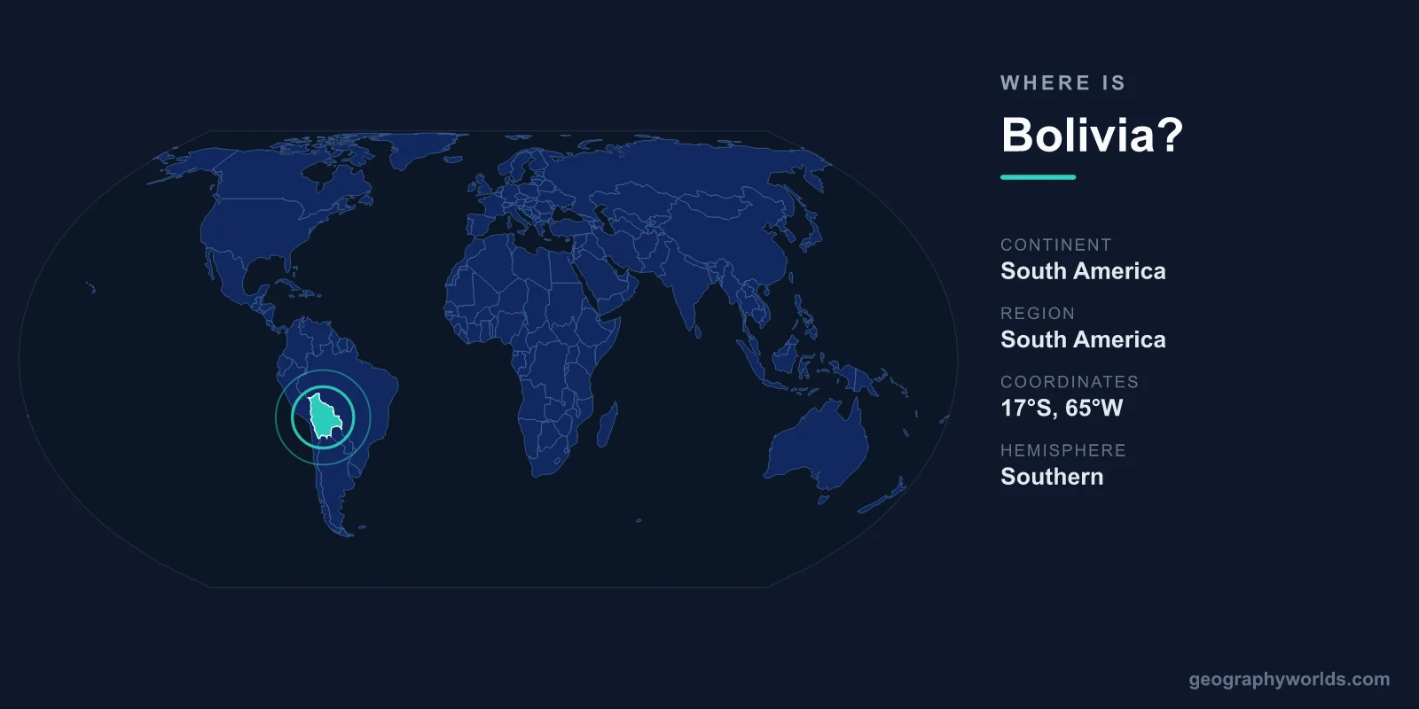
Bolivia is a landlocked country in central South America, lying between roughly 10°S and 23°S latitude and 57°W and 70°W longitude, with the Andes Mountains rising in the west and Amazon lowlands stretching across the east. It sits squarely in both the Southern and Western Hemispheres and covers about 1,098,581 km², making it the fifth-largest nation in South America and roughly twice the size of France.
Where Exactly Is Bolivia on the Map?
To find Bolivia, look at the heart of South America, just south of the Equator and slightly west of the continent's center. It is one of only two landlocked countries on the continent (the other being Paraguay), meaning it has no coastline of its own. Despite this, Bolivia's position links the high Andean spine of the west coast with the vast tropical interior that drains toward the Atlantic.
The country's geographic spread is enormous. From its high-altitude western plateau to its eastern jungle frontier, Bolivia crosses several climate zones, which is why you can experience freezing alpine conditions and steamy rainforest within the same nation. If you would like to learn more, see our bolivia country guide.
Which Countries Border Bolivia?
Bolivia shares land borders with five neighboring countries, placing it at a genuine crossroads of the continent. These borders have shaped centuries of trade, migration, and cultural exchange between Andean and lowland peoples.
- Brazil – to the north and east, Bolivia's longest border
- Paraguay – to the southeast, across the dry Gran Chaco
- Argentina – to the south
- Chile – to the southwest, along the high Andes
- Peru – to the west and northwest, sharing Lake Titicaca
Bolivia famously lost its Pacific coastline to Chile in the War of the Pacific (1879–1884), and the question of access to the sea remains a defining theme in Bolivian national identity and diplomacy to this day.
A Country of Two Capitals
Bolivia is unusual in having two capital cities. Sucre is the constitutional and historical capital, home to the Supreme Court and the place where the country declared independence in 1825. La Paz, however, serves as the seat of government, hosting the executive and legislative branches. At roughly 3,640 meters above sea level, La Paz is the highest administrative capital in the world, with its sister city El Alto perched even higher on the surrounding plateau.
This split reflects historic rivalries between regions and means that, depending on the context, either city may be referred to as Bolivia's capital. For geographic and constitutional purposes, Sucre holds the formal title.
Landscapes from the High Andes to the Amazon
Bolivia's terrain is among the most varied of any landlocked nation. Geographers usually divide it into three broad regions:
- The Altiplano – a vast, windswept high plateau in the west, sitting around 3,500–4,000 meters above sea level between two ranges of the Andes. This is where you find Lake Titicaca, the highest navigable lake in the world, shared with Peru.
- The Yungas and valleys – a transitional zone of fertile, semi-tropical slopes that step down from the highlands toward the lowlands.
- The Oriente lowlands – tropical plains and Amazon rainforest covering more than half the country in the north and east, including the city of Santa Cruz, Bolivia's largest and most economically dynamic urban center.
The country's single most famous landmark is the Salar de Uyuni, the largest salt flat on Earth at over 10,000 km². During the rainy season a thin layer of water turns its surface into a vast natural mirror, and it holds a significant share of the world's lithium reserves.
People, Language, and Identity
Bolivia is home to roughly 12 million people and is one of the most indigenous nations in the Americas. While Spanish is the most widely spoken language, the constitution recognizes dozens of official languages, with Quechua and Aymara being the most prominent indigenous tongues. The dominant religion is Roman Catholic Christianity, often blended with Andean spiritual traditions such as reverence for Pachamama, or Mother Earth.
The country operates as a presidential republic, and its national currency is the boliviano (BOB). This fusion of high-altitude Andean heritage and lowland tropical culture gives Bolivia an identity unlike anywhere else on the continent.
Frequently Asked Questions
Is Bolivia in North or South America?
Bolivia is in South America, located in the central part of the continent. It lies in both the Southern and Western Hemispheres, just south of the Equator.
Does Bolivia have a coastline?
No. Bolivia is landlocked and has no access to the sea. It lost its Pacific coast to Chile in the War of the Pacific in the late 19th century, and the issue of maritime access remains an important national cause.
What is the capital of Bolivia?
Bolivia has two capitals. Sucre is the constitutional capital, while La Paz is the seat of government and the world's highest administrative capital at about 3,640 meters above sea level.
What countries border Bolivia?
Bolivia borders five countries: Brazil, Paraguay, Argentina, Chile, and Peru. Brazil shares its longest border, and Peru shares Lake Titicaca with Bolivia.