
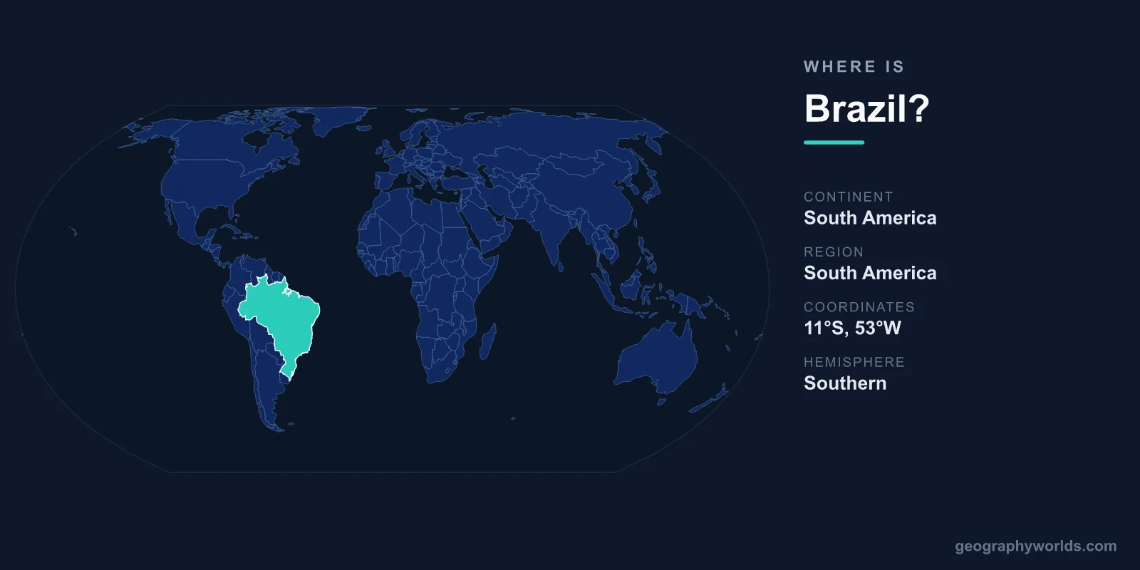
Brazil is located in eastern South America, occupying nearly half the continent and bordered by the Atlantic Ocean to the east. Its capital is Brasília, and the country sprawls across roughly 8,515,767 km², stretching from the equatorial Amazon Basin in the north to the temperate grasslands of the south. Brazil sits in both the Southern and Western Hemispheres, making it one of the most geographically expansive nations on Earth.
Where Exactly Is Brazil on the Map?
Brazil dominates the eastern and central portions of South America. Most of the country lies south of the equator, though its northern reaches cross into the Northern Hemisphere near the states of Roraima and Amapá. To the east, more than 7,000 kilometres of coastline meet the Atlantic Ocean, while the interior pushes deep into the heart of the continent. The equator runs through the north near the mouth of the Amazon River, and the Tropic of Capricorn cuts across the south near São Paulo, placing most of Brazil firmly within the tropics.
Geographically, Brazil is the fifth-largest country in the world by land area and by far the largest in South America. It is comparable in size to the continental United States and covers about 47 percent of South America's total landmass. Brazil's easternmost point, Ponta do Seixas near João Pessoa, is also the easternmost tip of the entire Americas. If you want to test your sense of where it falls relative to its neighbours, try locating it in our geography games.
Which Countries Border Brazil?
Brazil shares land borders with every South American nation except Chile and Ecuador — a remarkable total of nine neighbouring countries. This places it at the geographic and economic centre of the continent, and only Russia and China share borders with more nations.
- Argentina, Paraguay and Uruguay – to the south and southwest
- Bolivia and Peru – to the west
- Colombia – to the northwest
- Venezuela, Guyana and Suriname – to the north
The southern borders with Argentina and Paraguay sit near the famous Iguaçu Falls, while the western and northern frontiers run through dense Amazon rainforest where boundaries are defined more by rivers and forest than by roads or fences. These long, often remote frontiers have historically made Brazil a crossroads for trade, migration and cultural exchange across the continent.
Brazil's Regions and Landscapes
Brazil's enormous size means it spans several distinct natural zones, organised into five official regions. The north is dominated by the Amazon Basin, home to the world's largest tropical rainforest and the Amazon River, which carries more water than any other river on the planet. The central-west features the cerrado savanna and the Pantanal, one of the planet's largest tropical wetlands.
The southeast — including São Paulo and Rio de Janeiro — is the most populous and economically powerful region, marked by coastal mountains and landmarks like Christ the Redeemer overlooking Guanabara Bay. The south brings cooler, subtropical climates with rolling grasslands and European-influenced towns, while the northeast offers warm beaches and the semi-arid backlands known as the sertão. Much of the interior rises into the Brazilian Highlands, a broad plateau, though Brazil has no peaks rivalling the Andes just across its western border.
Why Brazil's Location Matters
Brazil's position gives it both equatorial and subtropical climates, allowing it to grow everything from coffee and soybeans to sugarcane and tropical fruits. Its long Atlantic coastline supports major ports such as Santos and Rio de Janeiro, anchoring trade between the Americas, Europe and Africa. Because the country lies south of the equator, its seasons are reversed compared with the Northern Hemisphere: summer falls between December and February, and winter between June and August.
The capital, Brasília, was deliberately built inland and inaugurated in 1960 to draw development away from the crowded coast and toward the country's interior, replacing Rio de Janeiro as the seat of government. Brazil spans several time zones from east to west, so the sun rises on its Atlantic edge well before it reaches the far western Amazon. Today the country is home to roughly 215 million people — the most populous nation in South America and the largest Portuguese-speaking country in the world. For a deeper look at its culture, economy and travel highlights, see our brazil country guide.
Frequently Asked Questions
What continent is Brazil in?
Brazil is in South America, where it is the largest country and occupies the eastern and central part of the continent along the Atlantic coast.
Is Brazil in the Northern or Southern Hemisphere?
Brazil lies mostly in the Southern Hemisphere, but its northern states cross the equator into the Northern Hemisphere. It is entirely within the Western Hemisphere.
What is the capital of Brazil and where is it located?
The capital is Brasília, located in the central-western interior of the country in the Federal District. It was purpose-built and inaugurated in 1960, replacing Rio de Janeiro as the seat of government.
How big is Brazil?
Brazil covers about 8,515,767 km², making it the fifth-largest country in the world by area and roughly half the size of the entire South American continent.