
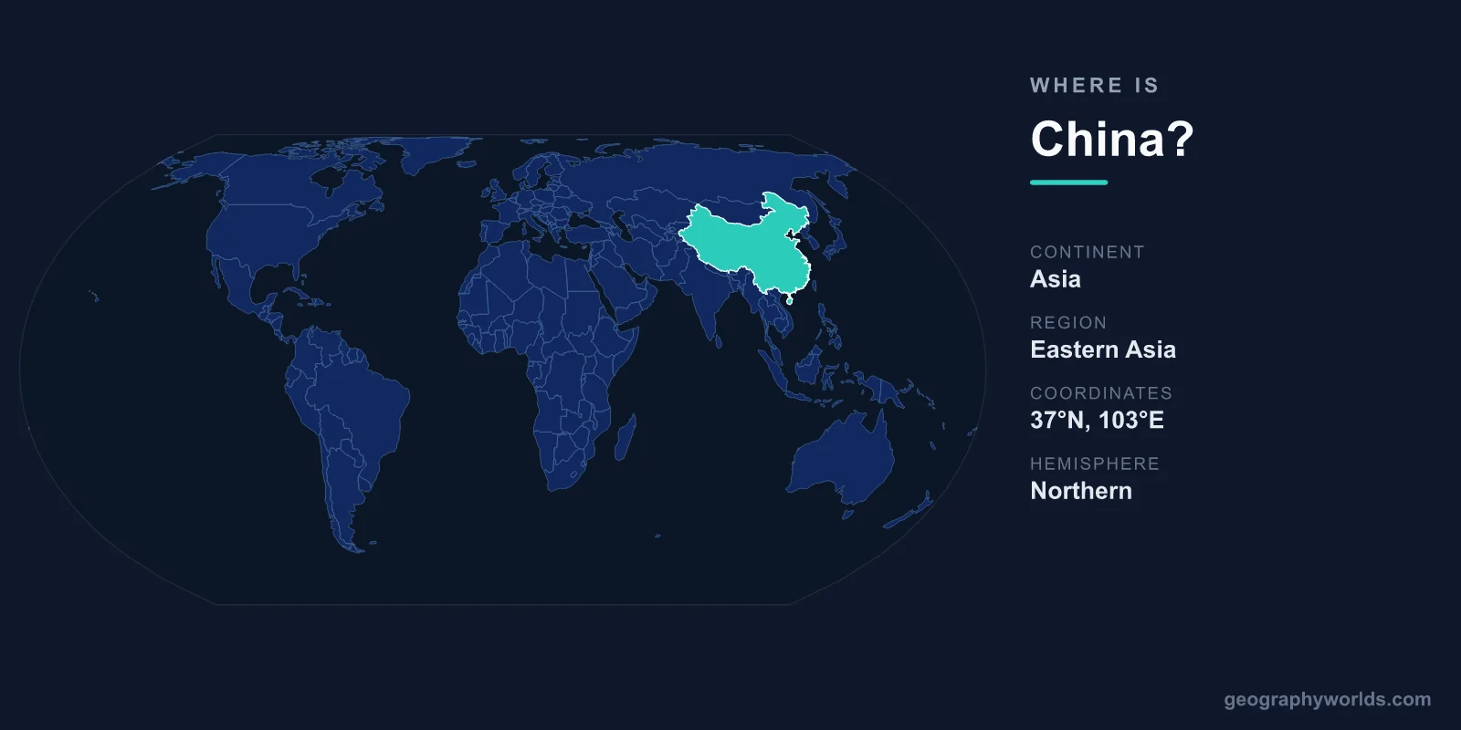
China is located in East Asia, occupying the eastern part of the Asian continent along the western shore of the Pacific Ocean. It covers about 9,596,961 km², ranking among the largest countries on Earth, with its capital at Beijing. Positioned in both the Northern and Eastern Hemispheres, China stretches from the coastal plains facing the Pacific all the way west to the soaring Himalayan plateau.
Where Is China on the World Map?
China sits in the East Asia region, bordered to the east by the Pacific Ocean and its marginal seas, the Yellow Sea, the East China Sea, and the South China Sea. To find it on a globe, look for the broad landmass north of Southeast Asia, east of Central Asia, and south of Russia and Mongolia. Its approximate geographic center lies near the city of Lanzhou, while Beijing, the capital, sits in the northeast at roughly 39.9° N latitude and 116.4° E longitude.
Because the country spans more than 60 degrees of longitude from west to east, the sun rises on its eastern coast hours before it reaches the far western deserts. Despite this width, all of mainland China officially uses a single time zone, China Standard Time (UTC+8).
What Countries Border China?
China shares land borders with 14 countries, more than almost any other nation. Its neighbors wrap around it on the north, west, and south, leaving the eastern flank open to the sea.
- North and northeast: Russia, Mongolia, and North Korea
- West and northwest: Kazakhstan, Kyrgyzstan, Tajikistan, and Afghanistan
- Southwest (Himalayan frontier): Pakistan, India, Nepal, and Bhutan
- South: Myanmar, Laos, and Vietnam
These long frontiers have made China a historic crossroads for trade and culture, most famously along the ancient Silk Road that connected it to Central Asia and beyond.
What Are China's Main Geographic Regions?
China's terrain steps downward from west to east like a staircase. The high Tibetan Plateau in the southwest, often called the "Roof of the World," holds the country's tallest peaks, including its share of Mount Everest on the Nepal border. From there the land descends through the Yunnan-Guizhou highlands and the basins of central China before flattening into the fertile lowland plains of the east, where most of the population lives.
Two of Asia's greatest rivers, the Yangtze and the Yellow River, rise on the western highlands and flow east to the sea, watering the densely farmed heartlands. To the north and northwest lie the arid Gobi and Taklamakan deserts, while the southeast enjoys a warm, humid subtropical climate. This range gives China nearly every climate zone, from polar conditions on the plateau to tropical weather on Hainan Island.
How Big Is China and Who Lives There?
At roughly 9.6 million km², China is comparable in size to the entire continent of Europe or to the United States. It is home to around 1.4 billion people, making it one of the two most populous countries in the world. The vast majority live in the eastern third of the country, where cities such as Shanghai, Beijing, and Guangzhou form some of the densest urban clusters on the planet.
Mandarin Chinese is the official language, and the national currency is the Chinese Yuan Renminbi (CNY). For more detail on regions, landmarks, and travel, see our china country guide.
Frequently Asked Questions
What continent is China in?
China is in Asia, specifically the East Asia region. It lies in the Northern and Eastern Hemispheres along the western edge of the Pacific Ocean.
What is the capital of China?
The capital is Beijing, located in the northeast of the country. It serves as China's political and administrative center and is one of its largest cities.
How many countries border China?
China shares land borders with 14 countries, including Russia, India, Mongolia, Vietnam, Pakistan, and North Korea, tying it for the most land neighbors of any nation.