
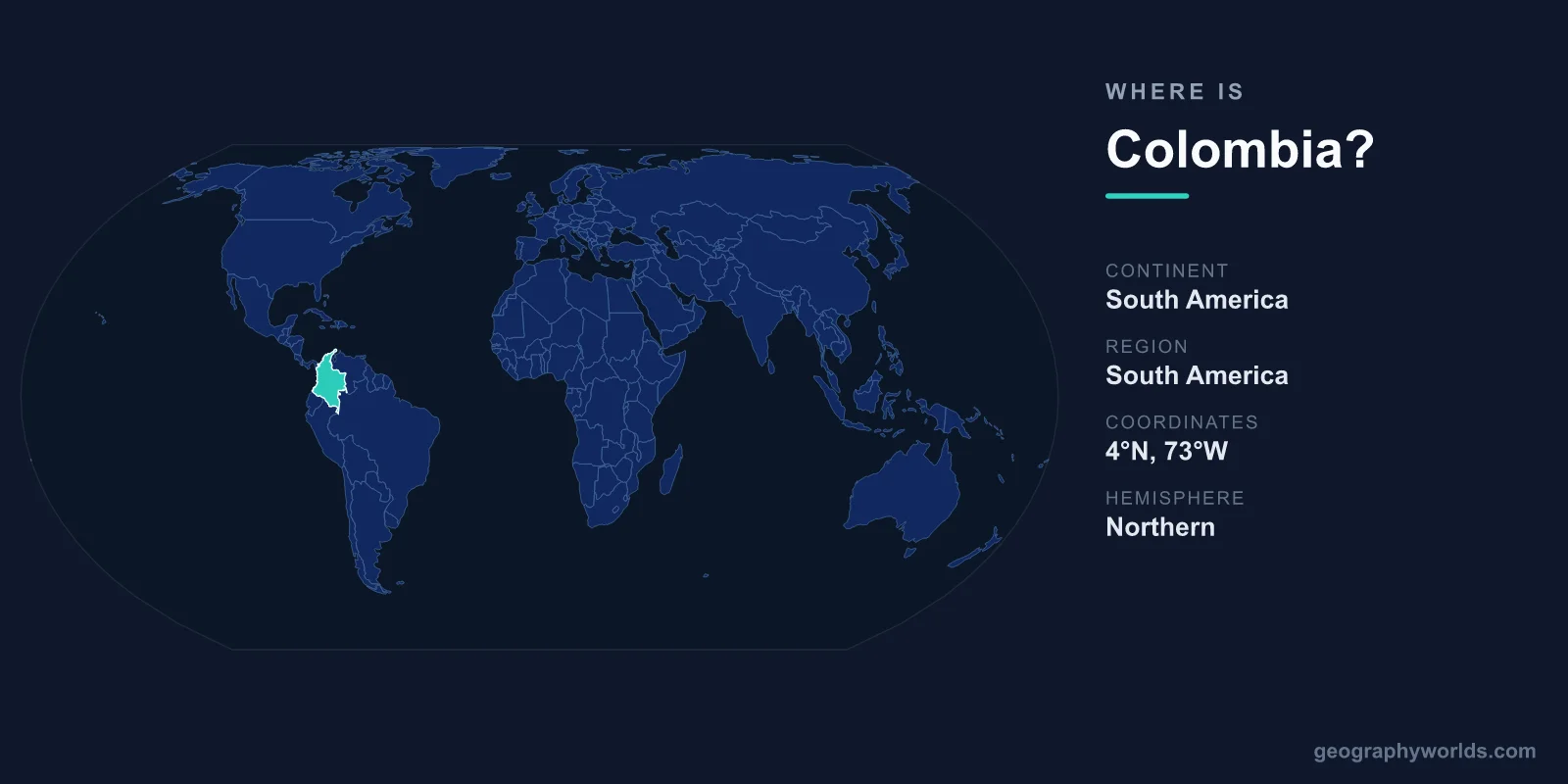
Colombia is located in the northwest corner of South America, the only country on the continent with coastlines on both the Caribbean Sea and the Pacific Ocean. It sits at the meeting point between Central and South America, with its capital Bogotá perched high in the Andes Mountains and the country straddling the equator across roughly 1,141,748 square kilometres.
Where Exactly Is Colombia on the Map?
Colombia occupies the northwestern shoulder of South America, bridging the isthmus that connects the continent to Central America. The country lies mostly in the Northern Hemisphere but extends just south of the equator, so it sits in both the Northern and Southern Hemispheres while remaining firmly in the Western Hemisphere. In coordinate terms, the mainland spans roughly from 12°N near the Caribbean coast down to about 4°S in the Amazon, and from around 67°W to 79°W.
This position gives Colombia a rare distinction: it is the only South American nation with frontage on two oceans. Its Caribbean coastline stretches across the north, while its Pacific shoreline runs down the west. Far out in the Caribbean, the islands of San Andrés and Providencia push Colombian territory north toward Central America, hundreds of kilometres from the mainland.
Which Countries Border Colombia?
Colombia shares land borders with five countries, placing it at a strategic crossroads between Central America, the Andes, and the Amazon basin. Those neighbours are:
- Venezuela – to the east and northeast, along Colombia's longest land border.
- Brazil – to the southeast, where the two nations meet deep in the Amazon rainforest.
- Peru – to the south, including the Amazon River frontier near the town of Leticia.
- Ecuador – to the southwest, across the Andean highlands.
- Panama – to the northwest, the only land link between South and Central America.
The Colombia–Panama frontier is dominated by the Darién Gap, a roadless stretch of dense jungle and swamp so impassable that the Pan-American Highway breaks here, leaving no continuous road route between the two continents. Colombia also shares maritime boundaries with Caribbean neighbours such as Jamaica, Nicaragua, Costa Rica, and the Dominican Republic.
The Landscapes Within Colombia
Colombia's geography is remarkably varied for a single country. The Andes Mountains split into three parallel ranges — the Cordillera Occidental, Central, and Oriental — as they enter from the south, creating the highland valleys and plateaus that cradle most of Colombia's major cities. Bogotá itself sits at roughly 2,640 metres above sea level, making it one of the highest capital cities in the world. Between the ranges flow the great rivers, the Magdalena and the Cauca.
Beyond the Andes, the country opens into strikingly different regions. To the east stretch the Llanos, vast tropical grasslands shared with Venezuela, while the far southeast dissolves into Amazon rainforest. The Caribbean coast features beaches, the historic walled city of Cartagena, and the Sierra Nevada de Santa Marta — an isolated mountain massif whose snow-capped peaks rise dramatically near the sea, ranking among the highest coastal mountains on Earth.
Because Colombia sits on the equator yet ranges from sea level to glacier-topped peaks, it contains nearly every climate zone, from steamy lowland jungle to cool highland páramo. This extraordinary spread of habitats helps make Colombia one of the most biodiverse countries on the planet.
People, Cities, and Culture
Colombia is home to roughly 52 million people, making it the second-most populous country in South America after Brazil. Spanish is the official language, and Roman Catholic Christianity remains the dominant religious tradition, shaping festivals and daily life. The official currency is the Colombian peso (COP).
The population clusters mainly in the Andean interior and along the Caribbean coast. Bogotá is the largest city and the political heart of the country, followed by Medellín, known for its spring-like climate, and Cali, a centre of salsa music. The Caribbean port of Barranquilla hosts one of Latin America's most famous carnivals, while Cartagena's walled Old City is a UNESCO World Heritage Site. For a deeper look at the nation's regions, history, and travel highlights, see our colombia country guide.
How Big Is Colombia?
At about 1,141,748 square kilometres, Colombia is the fourth-largest country in South America and roughly twice the size of France. It is comparable in area to Peru and noticeably larger than Texas and California combined. Its coastline totals more than 3,000 kilometres across the two oceans, and its territory includes both the mainland and several island groups in the Caribbean and Pacific.
Frequently Asked Questions
What continent is Colombia on?
Colombia is in South America, occupying the continent's northwestern corner. It borders Panama, which forms the land bridge to Central America, but Colombia itself is fully a South American nation.
Is Colombia in North or South America?
Colombia is in South America. Some confusion arises because it sits just south of Central America and shares a border with Panama, but it is firmly part of the South American continent.
What is the capital of Colombia and where is it?
The capital is Bogotá, located high in the eastern Andes at about 2,640 metres above sea level near the centre of the country. It is Colombia's largest city and its political and economic hub.
Does Colombia touch two oceans?
Yes. Colombia is the only South American country with coastlines on both the Caribbean Sea to the north and the Pacific Ocean to the west, giving it access to two major maritime regions.